
The depopulated village of Dayr Tarif / District of Ramla
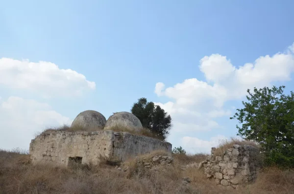
Dayr Tarif
About the depopulated village of Dayr Tarif
- District
- Ramla
- Date Dayr Tarif was occupied
- 13 July 1948
- Population in 1948
- 2,030
- Military operation
- Operation Dani
- Brigade that carried it out
- First capture (9 July): Armored Brigade units and a Kiryati battalion; then the Ninth Commando Battalion (11 July); the unit of the final occupation is not named
- Who defended the village
- Jordanian Army
- Distance from the governorate centre
- 10 km northeast of Ramla
- Elevation above sea level
- 75 m
- Cause of displacement
- Direct military assault by Israeli occupation forces – according to Benny Morris as cited by Khalidi, the inhabitants were evacuated due to an Israeli attack on 10 July 1948
- Extent of destruction
- Dayr Tarif was mostly destroyed with the exception of its school.
- Ethnic cleansing
- Dayr Tarif inhabitants were completely ethnically cleansed.
- Settlements built on the built-up area of Dayr Tarif after 1948
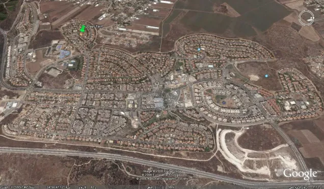
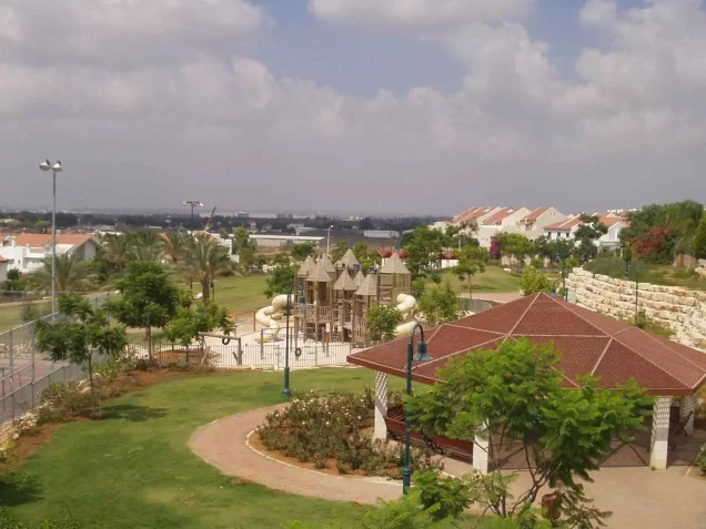
- Beyt 'Arif, established in 1949 on the ruins of the village
Hover a dot to read the village name, or click to open its card.
Borders of the depopulated village of Dayr Tarif
Dayr Tarif: A Depopulated Palestinian Village in the Ramla District
Dayr Tarif was a Palestinian village in the Ramla District, situated at the edge of the coastal plain approximately 10 kilometres northeast of al-Ramla, at an average elevation of about 75 metres above sea level. Its population reached 1,750 in the 1944/1945 statistics. The village was subjected to an air raid in April 1948 and later became the scene of intense fighting during Operation Dani in July. Control changed hands before Israeli forces finally secured the village by 13 July 1948, and its Palestinian inhabitants were displaced during the Nakba and the occupation of Palestine in 1948.
- Subdistrict
- Ramla
- Distance from district center
- 10 km northeast of Ramla
- Average Elevation
- 75 m above sea level
- Population in 1931
- 1,246
- Number of Houses in 1931
- 291
- Population in 1944/1945
- 1,750
- Estimated Population in 1948
- About 2,030 – a later demographic estimate, not an official census
- Total Land Area in 1945
- 8,756 dunams
- Attack and Depopulation
- Zionist forces bombed the village from an airplane on 14 April 1948, wounding five villagers according to the newspaper Filastin; it was then occupied twice in the course of Operation Dani: first on 9 July, before an Arab Legion counter-attack forced the attacking force to withdraw, and finally by 13 July 1948. Benny Morris, as cited by Khalidi, indicates that the inhabitants were evacuated due to an Israeli attack on 10 July.
- Final Israeli Control
- By 13 July 1948, after a stiff fight around the village and neighbouring Bayt Nabala; it had been temporarily occupied on 9 July, and the New York Times, as cited by Khalidi, reported it occupied on 10 July.
- Military Operation
- Operation Dani
- Military Unit
- Units of the Armored Brigade (Eighth Brigade) and an infantry battalion of the Kiryati Brigade in the first capture (9 July), then the Armored Brigade's Ninth Commando Battalion (11 July); the sources do not name the unit that completed the final occupation
- Cause of Depopulation
- Direct military assault by Israeli occupation forces – according to Benny Morris as cited by Khalidi, the inhabitants were evacuated due to an Israeli attack on 10 July 1948
- Settlements Documented on Village Lands
- Beyt 'Arif, established in 1949 on the ruins of the village
Location
Dayr Tarif stood on uneven terrain at the eastern edge of the coastal plain, approximately 10 kilometres northeast of al-Ramla and about 7 kilometres from Lydda.
The village had an average elevation of approximately 75 metres above sea level and was about 3 kilometres east of Lydda airport.
A network of roads connected Dayr Tarif with Lydda, al-Ramla, al-'Abbasiyya, Jaffa, and the surrounding villages. It was also located close to a main road leading north toward Tulkarm.
A nearby railway running from northeast to southwest further improved the village's connections with surrounding urban areas.
Bayt Nabala lay to the east, al-Haditha to the south, al-Safiriyya to the west, and al-Tira to the north.
Dayr Tarif Through History
The site of Dayr Tarif has been identified with the Roman-period settlement of Bethariph.
In 1596, Dayr Tarif was a village in the nahiya of Ramla in the Gaza district, with an estimated population of approximately 270.
The inhabitants paid taxes on wheat, barley, sesame, fruit, goats, beehives, vineyards, and other forms of agricultural production.
In the late nineteenth century, Dayr Tarif was described as a small settlement at the edge of a plain.
Architecture
Dayr Tarif had an approximately trapezoidal layout and was divided into eastern and western sections separated by vacant land.
Most houses were built of adobe brick. Construction accelerated during the final years of the British Mandate, particularly in the eastern half of the village.
Dayr Tarif contained a mosque, several shops, and an elementary school.
The built-up area covered approximately 51 dunams in the 1944/1945 statistics.
Population
Dayr Tarif had 836 inhabitants in the 1922 census.
By the 1931 census, the population had increased to 1,246 people living in 291 houses.
According to the 1944/1945 statistics, the village population reached 1,750 Arabs.
The estimates of approximately 2,030 inhabitants in 1948 and 12,466 refugees and descendants in 1998 published by Palestine Remembered are later estimates rather than official British Mandate census figures.
Population of Dayr Tarif
- 1596About 270Historical estimate based on Ottoman records
- 1922836Official census
- 19311,246Official census
- 1944/19451,750Government of Palestine statistics
- 1948About 2,030Later estimate
- 199812,466Estimate of refugees and their descendants
Number of Houses
The 1931 census recorded 291 houses in Dayr Tarif.
The estimate of approximately 474 houses for 1948 is a later figure rather than an official census count.
Education
Dayr Tarif's elementary school was established in 1920.
By 1947, the school had an enrollment of 171 pupils.
Local sources provide additional figures concerning teachers, the school library, and literacy in the village, but these details are not documented to the same degree in the principal Walid Khalidi and PalQuest account and are therefore not treated here as established official statistics.
Land of Dayr Tarif
According to the 1944/1945 statistics, Dayr Tarif had a total land area of 8,756 dunams.
Arab ownership amounted to 8,338 dunams, while 418 dunams were classified as public land. No Jewish-owned land was recorded within the village's statistical unit.
The entire 418 dunams of public land should not be described simply as roads and wadis, since the official statistics classify the category more broadly as public land.
Land Ownership in Dayr Tarif in 1944/1945
- Arab ownership8,338 dunums95%
- Jewish ownership0 dunums0%
- Public land418 dunums5%
Agriculture and Economic Life
The inhabitants of Dayr Tarif practised both rain-fed and irrigated agriculture. Irrigation water was drawn from a number of artesian wells drilled on the southern and northwestern sides of the village.
Citrus fruits and bananas were important crops, alongside cereals, orchards, and olives.
According to the 1944/1945 statistics, 1,410 dunams were devoted to citrus and bananas, while 486 dunams were irrigated or used for plantations.
Cereal cultivation covered 5,989 dunams in total, including 5,981 Arab-owned dunams and 8 dunams of public land.
Palestine Remembered records approximately 714 dunams planted with olive trees. This represents a crop category within cultivated land and should not be added separately to the overall land-use totals.
Land Use in Dayr Tarif in 1944/1945, in Dunams
- Arab
- Public
- Citrus and bananas1,410 dunums
- Irrigated and plantation land486 dunums
- Cereals5,989 dunums
- Built-up area51 dunums
- Uncultivable land820 dunums
Archaeology
Dayr Tarif was built on a mound covering a Roman-period site traditionally identified as Bethariph.
Remains of earlier buildings and fragments of ancient artifacts were found at the site.
Local sources provide additional descriptions of presses, cisterns, tombs, caves, and architectural fragments, but the principal reference material reviewed does not provide detailed dating for all of these remains. They should therefore not all be assigned to a single historical period without further archaeological evidence.
The April 1948 Air Raid
The first documented attack on Dayr Tarif took place on 14 April 1948.
According to the Palestinian newspaper Filastin, as transmitted by Walid Khalidi and PalQuest, Zionist forces used an aircraft to bomb the village.
The raid wounded five villagers, including a two-year-old child.
Operation Dani
Operation Dani began on 9 July 1948 and continued until 18 July. It was one of the largest Zionist offensives conducted during the ten days between the two truces.
Its first phase, from 9 to 12 July, aimed to capture Lydda and al-Ramla and the Palestinian villages surrounding them.
Forces from the Harel, Yiftach, Eighth Armored, Kiryati, and Alexandroni brigades participated in this phase, while the second phase extended toward the Jerusalem corridor and al-Latrun.
Dayr Tarif was among the Palestinian villages directly affected by Operation Dani.
The Battle and Occupation of Dayr Tarif
Dayr Tarif experienced several stages of fighting and changes of control during Operation Dani, and its occupation cannot accurately be reduced to a single date without explanation.
First Capture on 9 July
On 9 July 1948, units of the Eighth Armored Brigade and an infantry battalion of the Kiryati Brigade entered and captured Dayr Tarif at the beginning of Operation Dani.
The Transjordanian Arab Legion then launched a strong counterattack that forced the Israeli forces to withdraw.
Fighting on 10–11 July
The accounts transmitted by Walid Khalidi and PalQuest indicate that the villagers were displaced as a result of the Israeli attack around 10 July.
On 11 July, the Ninth Commando Battalion of the Eighth Armored Brigade captured positions around Dayr Tarif and pushed Arab Legion defenders toward the village of Budrus, although complete control of Dayr Tarif was not yet secured at that moment.
Final Control
Fighting continued around Dayr Tarif as the offensive against Lydda and al-Ramla developed.
By 13 July 1948, Dayr Tarif had finally fallen under Israeli control after intense fighting around the village and neighbouring Bayt Nabala.
Palestine Remembered's summary table gives 10 July as the occupation date, while the detailed narrative shows that Israeli forces first entered on 9 July, were driven out, and did not secure final control until 13 July.
Israeli military accounts are cited here only as transmitted through Walid Khalidi and PalQuest and not through direct reliance on the original Israeli sources.
Occupation and Depopulation Chronology
- 14 April 1948
First attack on the village
The newspaper Filastin reported that Zionist forces used an airplane to bomb Dayr Tarif, wounding five villagers, including a two-year-old child. According to Khalidi, this is the first recorded attack on the village.
- 9 July 1948
Temporary occupation
At the beginning of Operation Dani, units of the Armored Brigade (Eighth Brigade) and an infantry battalion of the Kiryati Brigade captured the village, but were forced to withdraw soon after entering it as a result of a “powerful counter-attack” by the Transjordanian Arab Legion, according to the History of the War of Independence as cited by Khalidi.
- 10 July 1948
Depopulation of the village
Benny Morris, as cited by Khalidi, indicates that the villagers were evacuated due to an Israeli attack on this day; this agrees with a New York Times report that the village was occupied late in the afternoon of 10 July, after Israeli occupation forces fended off an Arab effort to recapture Wilhelma.
- 11 July 1948
Ground assault
The Armored Brigade's Ninth Commando Battalion occupied positions surrounding Dayr Tarif and pushed its Arab Legion defenders back towards the village of Budrus, so that the village was temporarily bypassed, according to the History of the War of Independence as cited by Khalidi.
- 13 July 1948
Final occupation
Dayr Tarif finally fell to Israeli occupation forces by 13 July, after a stiff fight that raged around it and neighbouring Bayt Nabala. Khalidi considers it probable that it was reoccupied soon after 11 July, in preparation for the assault on Lydda and Ramla.
- 1949
Settlement on village lands
Israel established the settlement of Beyt 'Arif on the ruins of the village.
Displacement of the Population
The fighting during Operation Dani resulted in the displacement of Dayr Tarif's Palestinian inhabitants.
The account transmitted by Walid Khalidi associates the villagers' departure with the Israeli assault around 10 July 1948.
Once Israeli forces consolidated control by 13 July, the inhabitants were unable to re-establish their community at the village site, and most of the built environment was subsequently destroyed.
Israeli Settlements on the Lands of Dayr Tarif
Beyt 'Arif
Beyt 'Arif was established in 1949 on the ruins of Dayr Tarif.
Kefar Truman
Kefar Truman lies southwest of the Dayr Tarif village site but, according to Walid Khalidi and PalQuest, it was not established on Dayr Tarif's lands.
- 1949Beyt 'Arif
Established on the ruins of Dayr Tarif
- 1949Kefar Truman
Located southwest of the site but not on Dayr Tarif's lands
Dayr Tarif After the Nakba
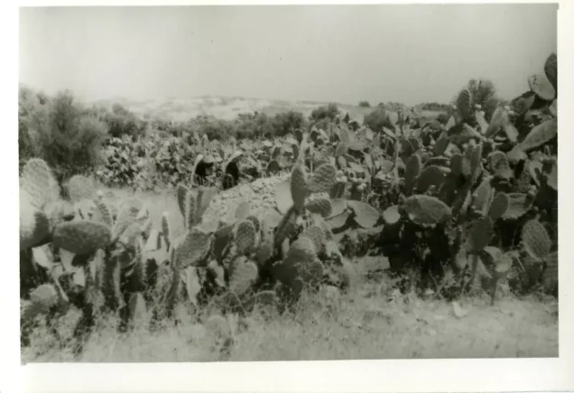
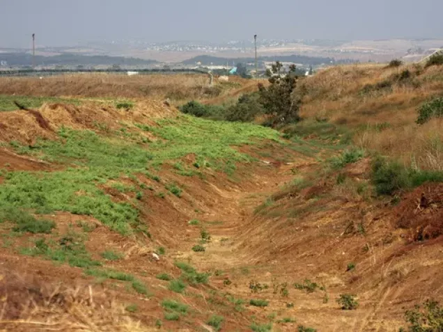
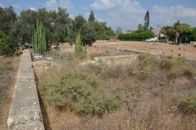
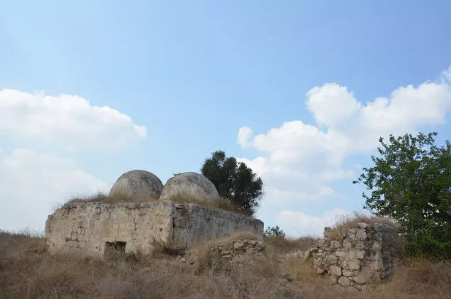
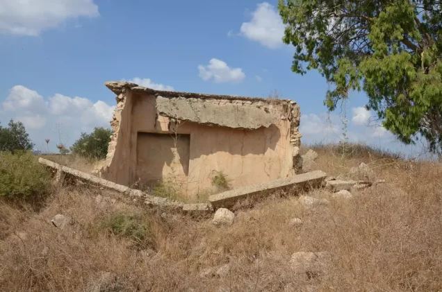
According to the field documentation relied upon by Walid Khalidi, rubble and debris from destroyed houses were scattered throughout the Dayr Tarif village site, which had become overgrown with thorns and other wild vegetation.
Several old olive and cypress trees remained standing.
The village school building also survived and was being used as a stable at the time of documentation.
The surrounding lands were cultivated with cotton and citrus fruits.
This description reflects the condition of the site during the field documentation relied upon by Walid Khalidi and should not necessarily be interpreted as a comprehensive survey updated to 2026.
Sources
- PalQuest – Interactive Encyclopedia of the Palestine Question: Dayr Tarif.
- PalQuest: Dayr Tarif.
- PalQuest: Operation Dani.
- Palestine Remembered: Dayr Tarif, Ramla District.
- Walid Khalidi, All That Remains, entry on Dayr Tarif.
- Filastin, 15 April 1948, as transmitted by Walid Khalidi and PalQuest.
- Fawzi al-Qawuqji, Arab Liberation Army reports concerning fighting in the area.
- Government of Palestine, censuses of 1922 and 1931.
- Government of Palestine, Department of Statistics, Village Statistics, 1945.
Photo gallery
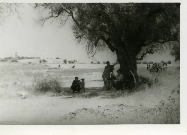
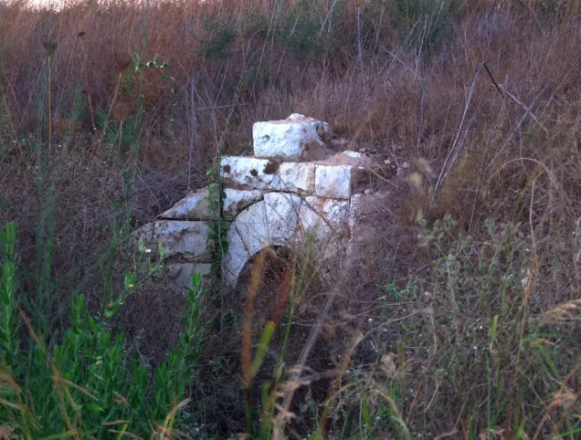
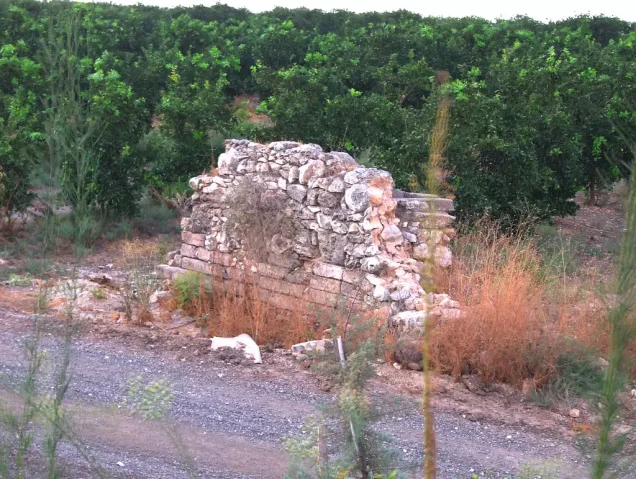
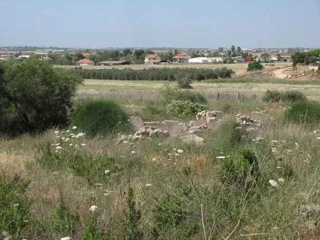
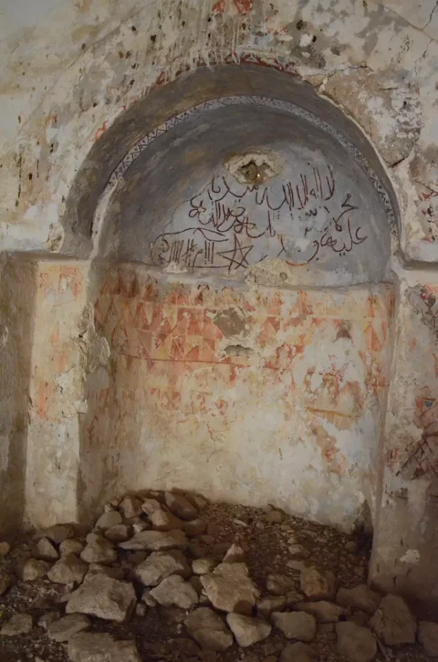


Photos from the village's people
Photos sent in by visitors and published after review.
Add a photo of this village
Log in to add photos of this village.
Other villages from Ramla
More from the archive



 Download Our Palestine App
The whole archive in the palm of your hand: depopulated villages, the Nakba, the massacres and Al-Aqsa — free, with no ads to erase the story.
Download Our Palestine App
The whole archive in the palm of your hand: depopulated villages, the Nakba, the massacres and Al-Aqsa — free, with no ads to erase the story.



Comments
No comments yet — be the first to write one.
Add your comment
Name and email are optional. Comments appear after review.