
The depopulated village of Wadi Qabbani / District of Tulkarm

Wadi Qabbani
About the depopulated village of Wadi Qabbani
- District
- Tulkarm
- Date Wadi Qabbani was occupied
- 01 March 1948
- Population in 1948
- 370
- Military operation
- Coastal Clearing
- Brigade that carried it out
- Haganah
- Distance from the governorate centre
- 12 (km) Northwest of Tulkarm
- Elevation above sea level
- 25 m
- Cause of displacement
- Expulsion by Zionist troops
- Extent of destruction
- Wadi Qabbani was completely obliterated.
- Ethnic cleansing
- Wadi Qabbani inhabitants were completely ethnically cleansed.
- Settlements built on the land of Wadi Qabbani before 1948
- HaOgen
Hover a dot to read the village name, or click to open its card.
Borders of the depopulated village of Wadi Qabbani
Wadi Qabbani – Tulkarm Subdistrict
Wadi Qabbani, also rendered Wadi al-Qabbani, was a depopulated Palestinian village in the Tulkarm subdistrict. It lay approximately 12 km northwest of Tulkarm at an average elevation of about 25 meters. The village stood roughly 1.5 km east of the main coastal highway and was connected to it by a secondary road passing through the settlement.
Wadi Qabbani occupied the elevated archaeological site of Khirbat al-Shaykh Husayn in an otherwise low-lying coastal environment, with marshland bordering the site to the west and south. The official April 1945 population statistics recorded 320 Muslims. Its registered lands totaled 9,812 dunums.
The exact date of occupation and depopulation is not known. Walid Khalidi considers it likely that Wadi Qabbani was occupied during the early months of 1948, when the Haganah pursued a policy of removing Palestinian rural communities along the coast north of Tel Aviv. Between 8 and 10 April, the Haganah General Staff issued orders to evacuate, or expel if necessary, Arab rural communities along the Tel Aviv–Hadera axis, and Khalidi considers it probable that Wadi Qabbani fell within the scope of those orders.
Location of Wadi Qabbani
The village lay in the coastal plain approximately 12 km northwest of Tulkarm and stood about 25 meters above sea level.
It was situated approximately 1.5 km east of the main coastal highway and was linked to it by a secondary road that ran through the village, connecting the community with the surrounding coastal region.
The settlement occupied the elevated site of Khirbat al-Shaykh Husayn, while marshland extended along its western and southern sides.
Neighboring Villages and Areas
Palestinian maps and community documentation place Qaqun, Wadi al-Hawarith, Khirbat Zalafa, al-Jalama, and Umm Khalid among the localities in the geographical surroundings of Wadi Qabbani, with the coastal road and the Netanya area to the west.
The directional layout in some digitized village diagrams becomes distorted when converted into text. These surrounding names should therefore not be transformed into precise eight-direction cadastral boundaries without consulting original land-demarcation maps.
The Name Wadi Qabbani
The village was named after the Lebanese Qabbani family, which had owned most of the area's lands during an earlier period.
Sources also document continued Palestinian residence, cultivation, tenancy, and agricultural activity in the wadi. The principal sources reviewed, however, do not provide a complete parcel-by-parcel history of every change in land ownership.
Khirbat al-Shaykh Husayn and Archaeological Remains
Wadi Qabbani was built on the archaeological site of Khirbat al-Shaykh Husayn. Khalidi records artifacts at the site that may date to the Roman period.
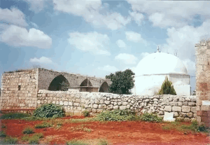
Later Palestinian community documentation also associates the locality with a shrine of Shaykh Husayn al-Harithi. This information derives from local memory and should not by itself be treated as archaeological proof of the shrine's age or identification.
Population of Wadi Qabbani
| Year | Population | Nature of figure / Notes |
|---|---|---|
| 1922 | No verified separate figure | No independent figure was established from the principal sources reviewed |
| 1931 | No verified separate figure | The principal village sources reviewed do not provide an independent population count |
| 1945 | 320 | Official Government of Palestine statistics; all were recorded as Muslims |
| 1948 | 371 | Later demographic estimate published by Palestine Remembered; not an official census |
| 1998 | 2,282 refugees and descendants | Later estimate published by Palestine Remembered |
| 1998 – different local source | 2,828 | Different later estimate published by the Palestinian Villages Encyclopedia |
The original April 1945 population table records 320 Muslims in Wadi Qabbani. The figure of 210 that appears on some secondary internet pages conflicts with the official table and has therefore not been used.
Houses and Built Environment
The reviewed core sources do not provide an official separate house count for Wadi Qabbani in the 1931 census.
Khalidi states that on the eve of the war the village contained three houses built of brick. This should not be converted into a claim that the entire population lived in only three dwellings: the wording identifies brick-built houses but does not provide a census of every form of residence in the settlement.
Local documentation linking a number of residents with Wadi al-Hawarith and other rural and semi-Bedouin communities also cautions against assuming that Wadi Qabbani had the same tightly clustered architectural pattern as a large sedentary village.
Land Ownership
The registered lands of Wadi Qabbani totaled 9,812 dunums in 1944/45. Palestine Remembered presents its simplified ownership categories as follows:
- Palestinian427 dunums4%
- Transferred to Zionists9,276 dunums95%
- Communal/Public109 dunums1%
PalQuest retains the original official categories, recording 427 dunums as Arab, 9,276 as Jewish, and 109 as Public.
Thus, by 1945 most of the registered land was categorized as Jewish-owned, while a Palestinian community continued to live in Wadi Qabbani and cultivate part of the land.
Land Use in 1944/45
- Arab
- Jewish
- Public
- Citrus and bananas46 dunums
- Cereals8,465 dunums
- Non-cultivable land1,301 dunums
The figures balance exactly with the official land-ownership totals.
Palestine Remembered's simplified display requires correction in the non-arable category. Its Palestinian column shows 128 dunums, but the official breakdown demonstrates that this consists of only 19 Arab dunums plus 109 dunums of Public land. The entire 128 dunums should therefore not be classified as privately Palestinian-held land.
The available official table does not provide a separate built-up-area figure for the village, and none has been inferred from another category.
Economic Life in Wadi Qabbani
Agriculture was a principal source of livelihood for the Palestinian residents. In 1944/45, 408 dunums in the Arab ownership category were devoted to cereals.
Later Palestinian community documentation also records livestock raising, particularly water buffalo, which was well suited to the wet and marshy environment surrounding parts of the village.
This local account is consistent with the documented marshland west and south of the village, although no official source reviewed provides a numerical count of buffalo or the scale of pastoral activity.
Water
Marshland was a major environmental feature around Wadi Qabbani, particularly west and south of Khirbat al-Shaykh Husayn.
Palestinian community documentation records three springs used for drinking and irrigation. One was remembered as 'Ayn al-Jawamis, also known as 'Ayn Abu Maryam.
Local memory connects the spring's name with the watering of buffalo raised by village families. These details are preserved as community and oral-history evidence rather than as a complete official inventory of the village's water resources.
Families and the Connection with Wadi al-Hawarith
Palestinian local documentation associates a number of Wadi Qabbani families with Wadi al-Hawarith and records other connections with Qaqun and neighboring communities.
Names appearing repeatedly in community records include Abu Maryam, Abu Khalifa, and Abu 'Ajaj, among others. Published family documents include tax receipts, agricultural guarantees, and other Mandate-era records showing individual families living and working in the area.
Wadi Qabbani nevertheless appears as a separate locality from Wadi al-Hawarith North and South in the 1945 statistics and in Khalidi's work. Their population and land figures should therefore not be merged.
Education
The principal sources reviewed do not provide securely documented information about a formal school operating independently in Wadi Qabbani.
Nor is there sufficient verified evidence to identify the school attended by village children elsewhere. No school building, founding date, or enrollment total has therefore been inferred.
Religious Life
The official 1945 population table records all 320 residents of Wadi Qabbani as Muslims.
Khalidi's village entry does not provide sufficient evidence for a separately documented mosque. Later local material refers to a shrine of Shaykh Husayn al-Harithi near Khirbat al-Shaykh Husayn, but the shrine's history and identification are not independently established in the principal source.
Wadi Qabbani before the Nakba
Wadi Qabbani lay in a coastal region that had experienced extensive Zionist land acquisition and settlement before 1948. This is reflected clearly in the official 1945 land statistics.
By that year, 9,276 of the village unit's 9,812 dunums were registered in the Jewish ownership category, compared with 427 Arab dunums and 109 Public dunums.
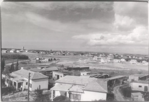
In 1947, Kibbutz ha-'Ogen was established on the village site according to Khalidi, before the Palestinian population was finally displaced in 1948.
The case therefore requires a clear distinction between changes in legal land ownership before the Nakba and the continuing physical presence of Palestinian residents in the locality until 1948.
Occupation and Depopulation of Wadi Qabbani
The exact date of Wadi Qabbani's occupation and depopulation is not known.
Palestine Remembered lists 1 March 1948 in its page header, and several Palestinian local compilations repeat this date. Khalidi, however, does not document a specific military event in Wadi Qabbani on that day.
Instead, he states that the village was probably occupied during the early months of the war, judging from events in neighboring coastal communities.
During March and April 1948, the Haganah pursued a general policy of uprooting Palestinian Arab coastal settlements north of Tel Aviv. Between 8 and 10 April, the Haganah General Staff issued orders to evacuate, or expel if necessary, the Arab rural communities along the axis between Tel Aviv and Hadera.
Because Wadi Qabbani lay approximately midway along that corridor, Khalidi considers it probable that the village came under the scope of these orders, as happened at neighboring 'Arab al-Nufay'at, whose residents were ordered to leave on 10 April.
This evidence does not justify converting 8–10 April into an exact occupation date for Wadi Qabbani itself. The most accurate conclusion is that the village was probably occupied and depopulated during March or April 1948 in the context of the Haganah's coastal clearing policy, while the precise date remains unknown.
“Coastal Clearing” and Military Unit
Palestine Remembered uses the label “Coastal Clearing” for the military context of Wadi Qabbani.
Khalidi's detailed account, however, does not present this as a formally named military operation with a defined beginning, end, and village-specific attacking unit. Instead, it describes a Haganah policy and orders to remove Arab rural communities along the coastal corridor between Tel Aviv and Hadera.
This article therefore treats “coastal clearing” as a description of the campaign or policy rather than as a formal operation equivalent to Operation Yiftach or Operation Dani.
The Haganah can be identified as the responsible military organization at the general level. The principal village entry does not identify a specific brigade or battalion as the unit that entered Wadi Qabbani, and none has therefore been assigned.
Occupation Chronology
- 1947
Pre-1948 settlement on the site
Kibbutz ha-'Ogen was established on the site of Wadi Qabbani before the final displacement of the Palestinian community.
- 1 March 1948
Different date listed by Palestine Remembered
The date appears in the site's summary data and in later local compilations, but Khalidi does not document a specific occupation event in Wadi Qabbani on this day.
- March–April 1948
Haganah coastal removal policy
The Haganah pursued a general policy of uprooting Palestinian Arab communities along the coast north of Tel Aviv.
- 8–10 April 1948
Haganah General Staff orders
Units were ordered to evacuate, or expel if necessary, Arab rural communities along the Tel Aviv–Hadera corridor.
- 10 April 1948
Expulsion of neighboring 'Arab al-Nufay'at
PalQuest documents the order for neighboring 'Arab al-Nufay'at to leave. Khalidi uses the surrounding pattern as evidence for interpreting Wadi Qabbani, not as proof that both villages had identical dates.
- Exact date unknown; probably during the early months of 1948
Occupation and depopulation of Wadi Qabbani
Khalidi considers it probable that the village came under the coastal expulsion orders, but no detailed village-specific occupation date is established.
- Later; exact destruction date not documented
Disappearance of the village buildings
The houses subsequently disappeared, but the principal source does not establish a single date for their demolition.
Refugees from Wadi Qabbani
Palestine Remembered estimates the village population in 1948 at approximately 371. This is a later demographic estimate rather than an official Mandate census figure.
Later Palestinian online sources differ over the number of refugees and descendants in 1998. Palestine Remembered gives 2,282, while the Palestinian Villages Encyclopedia gives 2,828.
Neither figure should be presented as an official census result without an independent demographic source resolving the discrepancy.
Community documentation places families originating from Wadi Qabbani in refugee camps including Tulkarm, Nur Shams, and Balata, as well as in Jordan, but this is local documentation rather than a comprehensive refugee census.
Israeli Settlements on Wadi Qabbani Village Lands
| Settlement | Established | Relationship to Wadi Qabbani |
|---|---|---|
| ha-'Ogen | 1947 | Khalidi records it as having been established on the village site before the Nakba |
Palestinian local sources also associate Mishmar HaSharon, Kefar Hayyim, Beit HaLevi, and Kefar Monash with Wadi Qabbani lands or with the wider overlapping lands of surrounding villages.
Khalidi does not independently list all of these settlements as having been founded specifically on Wadi Qabbani's land. Without additional cadastral verification they are therefore not placed in the same category as ha-'Ogen, whose relationship to the village site is directly documented.
Wadi Qabbani Today
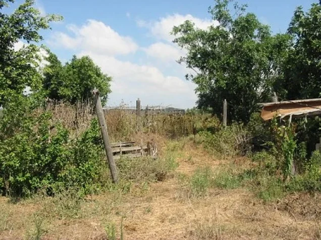
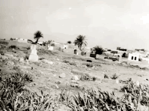
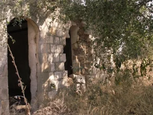
In Walid Khalidi's field description, the village houses had disappeared and no structural remains were visible.
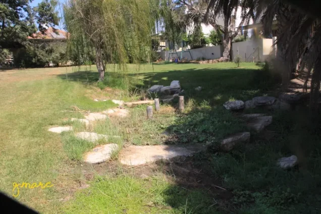
Two Christ's-thorn trees grew near the former village cemetery. The cemetery site had been converted into a children's playground belonging to the kibbutz, and no visible traces of the graves could be distinguished at the time of the survey.
This description is not a direct field verification of conditions in 2026. Field research for All That Remains was conducted between 1987 and 1990, before the book's publication in 1992.
Palestine Remembered also contains later community documentation from 2020–2023 concerning 'Ayn al-Jawamis / 'Ayn Abu Maryam and visits to the former village area. Such material helps preserve knowledge of the village's water sources and landscape, but it does not constitute an independent, comprehensive contemporary survey of all former village lands.
Sources
- PalQuestPalQuest – Wadi Qabbani
- Palestine RememberedPalestine Remembered – Wadi Qabbani, Tulkarm District
- Palestine RememberedPalestine Remembered – Wadi Qabbani entry from Walid Khalidi's All That Remains
- Institute for Palestine StudiesInstitute for Palestine Studies – Walid Khalidi, All That Remains
- users.cecs.anu.edu.auGovernment of Palestine Village Statistics, April 1945 – Official Population Tables
- palqura.comPalestinian Villages Encyclopedia – Wadi Qabbani; supplementary local documentation
- Palestine RememberedPalestine Remembered – Local documentation on Wadi Qabbani, water springs, and buffalo raising
- Palestine RememberedPalestine Remembered – Community documentation on families of Wadi al-Hawarith and Wadi Qabbani
- PalQuestPalQuest – All That Remains: Methodology and Field Research
Photo gallery



Photos from the village's people
Photos sent in by visitors and published after review.
Add a photo of this village
Log in to add photos of this village.
Other villages from Tulkarm
More from the archive
 Download Our Palestine App
The whole archive in the palm of your hand: depopulated villages, the Nakba, the massacres and Al-Aqsa — free, with no ads to erase the story.
Download Our Palestine App
The whole archive in the palm of your hand: depopulated villages, the Nakba, the massacres and Al-Aqsa — free, with no ads to erase the story.



Comments
No comments yet — be the first to write one.
Add your comment
Name and email are optional. Comments appear after review.