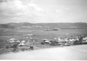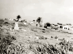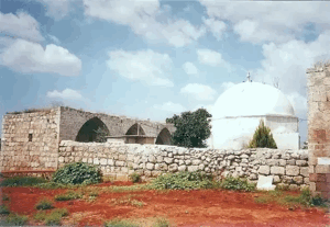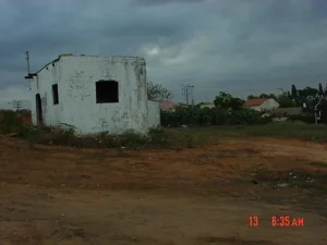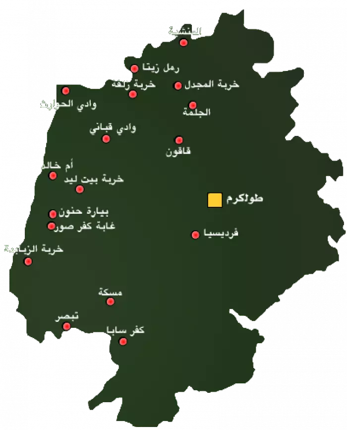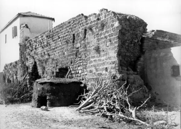
Umm Khalid was a Palestinian village in the Tulkarm Subdistrict during the British Mandate. It stood approximately 15 kilometres west of Tulkarm and less than two kilometres east of the Mediterranean coast. The village was depopulated in March 1948, and its site and much of its land were subsequently absorbed into the expanding city of Netanya.
| Field | Information |
|---|---|
| Subdistrict | Tulkarm |
| Distance from Tulkarm | Approximately 15 km west of the city |
| Average Elevation | Approximately 25 meters above sea level |
| Population in 1931 | 586 inhabitants – the figure includes Arab al-Balawina |
| Number of Houses in 1931 | 131 inhabited houses – the figure includes Arab al-Balawina |
| Population in 1944/1945 | 970 inhabitants |
| Estimated Population in 1948 | Approximately 1,125 inhabitants – a later demographic estimate, not an official census |
| Total Land Area in 1945 | 2,894 dunams |
| Attack and Depopulation | 20 March 1948; the village was completely evacuated amid fear generated by military operations and attacks in the surrounding area. The principal source does not establish a specific direct ground assault on Umm Khalid on that date |
| Final Israeli Control | 20 March 1948; the sources indicate that Zionist forces took control of the village after its inhabitants had left |
| Military Operation | “Coastal Clearing” according to Palestine Remembered's classification; the principal source does not identify a specific named military operation directly responsible for the evacuation of Umm Khalid |
| Military Unit | The available principal sources do not identify a specific brigade or battalion; the Haganah is referenced in general terms |
| Cause of Depopulation | Fear of attack and military operations amid escalating attacks on Palestinian villages in the coastal region |
| Settlements Documented on the Village Lands | Netanya – established in 1929 and later expanded over much of Umm Khalid's land; Gan Hefer – 1940; Nira – 1941. Gan Hefer and Nira were merged in 1953 to form Sha'ar Hefer, which covers part of the village lands |
Population of Umm Khalid
The inhabitants were predominantly Muslim. Many had moved to Umm Khalid from other villages in the Tulkarm Subdistrict in search of agricultural work. The 1931 census recorded 586 residents—580 Muslims and 6 Christians—living in 131 houses; these figures included Arab al-Balawina. The official 1944/45 statistics recorded 970 residents, comprising 960 Muslims and 10 Christians.
Population and Depopulation
Umm Khalid had 970 inhabitants in the official 1944/45 statistics. Its 1948 population is commonly estimated at 1,125; the figure is an estimate rather than a census count. An Israeli military intelligence report cited by historians dates the village’s evacuation to 20 March 1948. Netanya had been founded nearby in 1929, west of Umm Khalid, and its later urban expansion absorbed most of the village lands. Parts of the lands were also incorporated into Sha'ar Hefer.
Built Environment
The village had a rectangular layout extending from north to south. Its closely clustered houses were constructed of stone and mud and separated by narrow alleys. At the centre of the village stood a mosque, an elementary school for boys, and four shops selling groceries and textiles.
Economic Life
Agriculture formed the mainstay of the village economy. The inhabitants cultivated watermelons, citrus fruit, vegetables, and cereals. In 1944/45, 47 dunams were devoted to citrus and bananas, while 1,830 dunams of Palestinian-owned land were planted with cereals. The villagers also raised livestock and produced dairy products, including milk and cheese.
Land Ownership in Umm Khalid
- Palestinian ownership1,923 dunums66%
- Jewish ownership882 dunums30%
- Public land89 dunums3%
* One dunam equals approximately 1,000 square metres.
Land Use in 1944/45
- Palestinian ownership (dunams)
- Jewish ownership (dunams)
- Public land (dunams)
- Citrus and bananas47 dunums
- Cereal cultivation2,712 dunums
- Built-up area23 dunums
- Cultivable land2,759 dunums
- Uncultivated land112 dunums
* One dunam equals approximately 1,000 square metres. Cultivable and uncultivated totals are aggregate categories and should not be added again to their component uses.
Population of Umm Khalid
- 1922307British Mandate census
- 1931586British Mandate census; includes Arab al-Balawina
- 1944/45970Official village statistics
- 19481,125Estimate
- Estimated refugees in 19986,910Demographic estimate
Archaeological Remains
Archaeological finds in and around the village included the remains of towers and fortifications, as well as wells, reservoirs, cisterns, and pottery. Flint tools found near the site suggest possible habitation from prehistoric times. The site also contained the remains of the Crusader-period Lombard Castle of Roger.
Location of Umm Khalid
The village stood on a sandstone hill less than two kilometres east of the Mediterranean shore. The Tulkarm–Netanya road passed to its south, while the Haifa–Jaffa road ran to the east. Umm Khalid occupied a relatively elevated position on the Palestinian coastal plain, approximately 25 metres above sea level, which offered some protection from flooding.
Its fertile lands benefited from abundant groundwater. Wadi al-Hawarith lay to the north, Khirbat Bayt Lid to the east, and Netanya to the west and south. Jewish settlements established in the wider surrounding area before 1948 included Kfar Haim and Beit Yitzhak.
Area of Umm Khalid
The village lands covered a total of 2,894 dunams. Of this total, 1,923 dunams were under Palestinian ownership, 882 dunams under Jewish ownership, and 89 dunams were classified as public land, including roads and wadis. The soil was fertile, and groundwater was readily available.
* One dunam equals approximately 1,000 square metres.
Occupation and Depopulation Chronology
- Weeks preceding 20 March 1948
Escalating Military Pressure in the Coastal Region
The surrounding coastal area experienced increasing military operations and attacks, contributing to growing fear among the inhabitants of a number of Palestinian villages.
- 20 March 1948
Evacuation of Umm Khalid
All inhabitants of Umm Khalid left the village. The sources link the evacuation to fear caused by the military situation and the village's location amid Jewish settlements.
- 20 March 1948
Destination of the Displaced Population
The sources indicate that the inhabitants moved toward Tulkarm after leaving Umm Khalid.
- 20 March 1948
Military Control of the Village
Umm Khalid came under the control of Zionist forces after the village had been emptied of its inhabitants.
- March 1948
Military Operation or Operational Context
Palestine Remembered classifies the depopulation of Umm Khalid under “Coastal Clearing,” while the principal source does not identify a separate named military operation specifically for the occupation of the village.
- 20 March 1948
Military Unit
The available principal sources do not identify a specific brigade or battalion; the Haganah is referenced in general terms.
- From 20 March 1948 onward
Final Control
The consulted sources do not document a subsequent Palestinian recovery of the village. Its site later became incorporated into the urban expansion of Netanya.
Occupation and Depopulation
According to an Israeli military intelligence report, Umm Khalid was evacuated on 20 March 1948 amid a general climate of fear. Historian Benny Morris notes that several villages north of Tel Aviv underwent similar processes as attacks intensified during the early weeks of the war. The coastal area contained a dense concentration of Jewish settlements and was regarded by the Zionist leadership as central to the territory of the proposed Jewish state. In that context, the removal of Arab residents before 15 May was considered desirable by that leadership. The consulted academic reference does not identify a specific assault on Umm Khalid, a named military unit, or a discrete military operation as the direct cause of its depopulation.
Umm Khalid Today
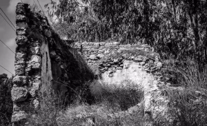
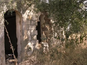
The village site is now part of Netanya. Some village houses have survived and have been used as residences or for commercial purposes, including warehouses operated by Israeli companies. Nearby land has been planted with citrus trees.
Netanya, founded in 1929 approximately one kilometre west of the village, later expanded across most of Umm Khalid’s lands. Gan Hefer, founded in 1940, and Nira, founded in 1941, were merged in 1953 to form Sha'ar Hefer, which covers part of the village lands.
Neighbouring Localities
Wadi al-Hawarith and Kfar Haim lay to the north; Beit Yitzhak and Khirbat Bayt Lid lay to the east; and the lands of Netanya extended to the south and west.