
The depopulated village of Nitaf / District of Al-Quds (Jerusalem)
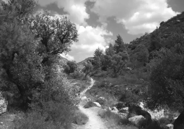
About the depopulated village of Nitaf
- District
- Al-Quds (Jerusalem)
- Date Nitaf was occupied
- 15 April 1948
- Population in 1948
- 50
- Military operation
- Operation Dani
- Distance from the governorate centre
- 17 (km) West of Jerusalem
- Elevation above sea level
- 400 m
- Extent of destruction
- Nitaf was mostly destroyed with the exception of ONE deserted house.
- Ethnic cleansing
- Nitaf inhabitants were completely ethnically cleansed.
- Settlements built on the built-up area of Nitaf after 1948
- Nataf
Hover a dot to read the village name, or click to open its card.
Borders of the depopulated village of Nitaf
Nitaf – Depopulated Palestinian Village of the Jerusalem Subdistrict
Nitaf, also rendered Nataf, was a Palestinian village in the Jerusalem Subdistrict. It stood approximately 17 km west of Jerusalem at an average elevation of about 400 metres above sea level.
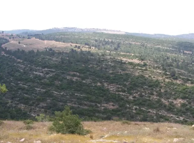
The village occupied a steep west-facing slope overlooking a deep, winding wadi running from east to west. Secondary roads and dirt tracks connected Nitaf with surrounding Palestinian villages and eventually with major routes such as the Jerusalem–Jaffa highway.
Nitaf was one of the smallest villages in the Jerusalem Subdistrict. Its official population was 40 in 1944/45, while its registered lands covered 1,401 dunums, all recorded in the Arab ownership category.
Name of Nitaf
The village appears in Palestinian sources as Nitaf, with Nataf as an alternative rendering.
The principal Khalidi/PalQuest account does not provide a sufficiently documented linguistic or historical explanation of the place-name, so no speculative etymology is presented as established fact.
Location
Nitaf lay approximately 17 km west of Jerusalem at an average elevation of about 400 metres above sea level.
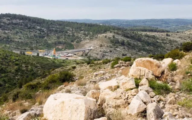
It stood on a steep west-facing mountain slope overlooking a deep, winding valley extending from east to west.
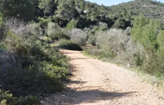
Dirt tracks and secondary roads linked the village with neighboring communities and ultimately with the Jerusalem–Jaffa highway.
Nearby Palestinian localities included Bayt Thul to the south, al-Qubayba to the east, Bayt I'nan to the northeast, Bayt Liqya to the north, Bayt Nuba to the northwest, Yalu to the west, and Bayt Mahsir to the southwest.
Village Layout
Nitaf's houses were built of stone and tightly clustered within a small area on the mountainside without a regular planning pattern.
The 1944/45 statistics do not provide a separate built-up-area figure, so none is inferred.
The inhabitants were Muslims, and a shrine dedicated to Shaykh Mas'ud stood east of the village.
Population of Nitaf
| Year | Population | Nature of Figure / Notes |
|---|---|---|
| 1922 | 16 | Official census; all inhabitants were Muslims. |
| 1931 | Not independently available | Nitaf appears in the official census table without separate population or house figures and was statistically associated with Qatanna during this period. |
| 1944/45 | 40 | Independent official Government of Palestine figure. |
| 1948 | 46 | Later Palestine Remembered estimate, not an official census. |
| 1998 | 285 refugees | Later estimate of refugees originating from the village and their descendants. |
Later Palestinian statistical publications also use 46 as an estimate of Nitaf's 1948 population. It is a projected figure rather than the result of an official census conducted during the Nakba.
Number of Houses
No independent official house count is available for Nitaf in the 1931 census.
The official table lists Nitaf without separate numerical values, while Qatanna carries the population and house totals used for that statistical grouping. Those figures should not be presented as an independent Nitaf house count.
Land Ownership in Nitaf
Nitaf's registered lands totalled 1,401 dunums in 1944/45.
Using the ownership terminology employed by Palestine Remembered:
- Palestinian1,401 dunums100%
- Transferred to Zionists0 dunums0%
- Communal0 dunums0%
In the official Mandate classification, all 1,401 dunums were recorded as Arab land, with no Jewish or Public land listed.
Land Use in 1944/45
- Cereals158 dunums11%
- Plantations and Irrigable Land166 dunums12%
- Non-Cultivable Land1,077 dunums77%
Cultivated or cultivable land totalled 324 dunums, approximately 23 percent of the village area, while 1,077 dunums, about 77 percent, were classified as non-cultivable.
Within the 166 dunums of plantations and irrigable land, 77 dunums were planted with olives. This is a subset of the plantation category and should not be added again to the land-use total.
No separate built-up-area figure is provided in the published official table.
Economic Life in Nitaf
The inhabitants depended on agriculture and livestock grazing.
They cultivated cereals, fruit trees, olives, and grapevines, while parts of the village lands were used as pasture.
In 1944/45, 158 dunums were devoted to cereals and 166 dunums to plantations and irrigable cultivation, including 77 dunums of olives.
The relatively limited cultivated acreage reflects the steep and rugged mountainous terrain surrounding the village.
Water Resources
The villagers obtained domestic water from a spring located west of the village.
Agriculture depended primarily on rainfall, despite part of the land being statistically classified as plantations and irrigable land.
Later Palestinian community documentation refers to 'Ayn Nitaf or 'Ayn al-Balad, but Khalidi's principal village description identifies it simply as a spring west of the village.
Education and Public Services
The principal Khalidi/PalQuest entry does not securely document a formal school in Nitaf before the Nakba.
It likewise does not establish a separate mosque, and no religious building is inferred solely from the fact that the inhabitants were Muslims.
The religious landmark directly documented by the principal source is the shrine of Shaykh Mas'ud east of the village.
Shrine of Shaykh Mas'ud
A maqam dedicated to Shaykh Mas'ud stood east of Nitaf.
The principal sources do not provide a securely documented biography of the shaykh or a date for the shrine's construction, so no unsupported tradition is added.
Archaeological Remains
Nitaf was built on an archaeological site and was surrounded by several khirbas.
Khalidi does not provide a precise chronology for those remains, so they should not automatically be assigned to the Roman, Byzantine, or Crusader periods without specialized archaeological evidence.
Disagreement Over the Date of Depopulation and Occupation
No single date can be used without qualification as a securely documented military occupation date for Nitaf.
Palestine Remembered lists 15 April 1948 as the occupation date, while a later Palestinian statistical table published by the Institute for Palestine Studies gives 15 April as the displacement date.
Khalidi's detailed village-specific account, however, does not document a military entry into Nitaf on 15 April. Instead, he explicitly notes the lack of reliable village-specific information and reconstructs the probable occupation period from events in the surrounding Jerusalem corridor.
15 April may therefore be retained as a later reported date of population displacement, but it should not automatically be equated with the final military occupation of the village site.
Operation Nachshon and Nitaf
Operation Nachshon ran from 3 to 15 April 1948 and aimed to seize villages and positions along the Tel Aviv–Jerusalem road and secure passage for Zionist convoys.
PalQuest lists Nitaf among the villages affected by the operation, which involved the Har'el and Giv'ati Brigades.
However, inclusion within the operation's affected area does not independently demonstrate that either brigade physically entered Nitaf on 15 April, and the village entry does not identify a village-specific attacking unit.
Military pressure associated with Nachshon may have contributed to population flight even if direct permanent military control of the village site came later.
The Jerusalem Corridor and Al-Latrun Battles
After Operation Nachshon, Haganah forces continued a series of offensives intended to expand their position on the western approaches to Jerusalem and seize the strategically important al-Latrun salient.
Khalidi uses nearby Dayr Ayyub, for which a more detailed military record exists, as the closest documented comparison for understanding Nitaf's fate.
Dayr Ayyub changed hands repeatedly in May and June 1948 during operations following Nachshon, including Operation Makkabi and other attacks around al-Latrun.
Khalidi consequently leaves open the possibility that Nitaf came under Zionist control sometime between mid-April and early June, without establishing a precise village-specific date.
Operation Dani and the Possible Final Occupation
Operation Dani was carried out from 9 to 18 July 1948. Its second stage, from 13 to 18 July, sought to expand Israeli control toward the Ramallah–al-Latrun road and the western approaches to Jerusalem.
Khalidi states that if Nitaf had not already been occupied by early June, it almost certainly fell to Israeli occupation forces during the second stage of Operation Dani.
PalQuest likewise lists Nitaf among the villages affected by Operation Dani.
The combination sometimes found in database fields of “15 April 1948” and “the second stage of Operation Dani” therefore cannot represent a single military event, since the latter did not begin until 13 July.
Military Unit
No village-specific evidence identifies the brigade that finally occupied Nitaf.
The Har'el and Giv'ati Brigades participated in Operation Nachshon, while Operation Dani involved several formations, including Har'el, Yiftach, Kiryati, Alexandroni, and Etziyyoni.
The participation of those brigades in the wider operations does not justify selecting one of them as the Nitaf-specific occupying unit without direct evidence.
The most precise formulation is therefore: population displacement: 15 April 1948 according to later Palestinian compilations, with circumstances uncertain; final military occupation: not precisely dated and may have occurred during the Jerusalem corridor battles through early June or during the second stage of Operation Dani on 13–18 July; village-specific occupying unit: unknown.
Occupation Chronology
- 3 April 1948
Beginning of Operation Nachshon
The Haganah launched a broad offensive to seize villages and positions along the Tel Aviv–Jerusalem route.
- 3–15 April 1948
Nitaf listed among villages affected by Nachshon
PalQuest lists Nitaf among the affected localities, but the detailed village account does not document a village-specific assault.
- 15 April 1948
Later reported displacement date
Used by Palestine Remembered and a later Palestinian statistical table, but not independently established as the date of permanent military occupation in Khalidi's account.
- Mid-April–early June 1948
Jerusalem corridor and al-Latrun battles
Operations following Nachshon widened Zionist-controlled territory on the western approaches to Jerusalem; Nitaf may have been occupied during this period.
- 9–18 July 1948
Operation Dani
Nitaf is listed among the villages affected by the operation.
- 13–18 July 1948
Second stage of Operation Dani
If Nitaf had not already fallen, Khalidi considers it almost certain that Israeli occupation forces captured it during this phase.
- Exact date not documented
Destruction of most village structures
Later field surveys establish that most of the village disappeared, but the principal source does not provide a precise demolition date.
Israeli Settlements on Nitaf Village Lands
According to Walid Khalidi and PalQuest, no Israeli settlement was established on Nitaf village land itself.
The Israeli settlement called Nataf was established in 1982 on land belonging to the Palestinian village of Bayt Thul rather than on Nitaf land.
Nataf lies less than 1 km south of the former Palestinian village site and clearly adopted a name derived from Nitaf.
Its proximity should therefore be distinguished from the cadastral question: the principal source identifies the settlement as having been established on Bayt Thul land.
Nitaf Today
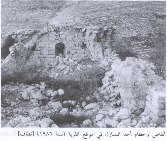
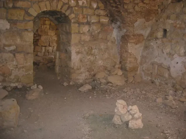
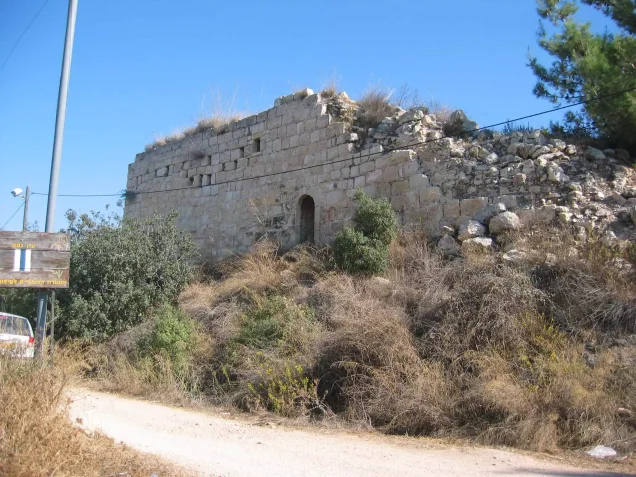
In the field description published by Walid Khalidi in All That Remains, a large deserted stone house remained at Nitaf, surrounded by old agricultural terraces.
The single-storey building had an arched doorway and arched windows.
A second abandoned house stood northwest of the first, near the bottom of a slope.
The detailed Khalidi account therefore documents at least two surviving houses, rather than the single house suggested by some abbreviated database fields.
Most of Nitaf's lands fell within the Demilitarized Zone delineated by the 1949 Jordan–Israel Armistice Agreement.
Palestine Remembered also contains later community photographs and videos documenting ruins, orchards, and the village spring, including material uploaded in 2025. Such material demonstrates continuing community documentation of the site but does not constitute a comprehensive archaeological or field survey of Nitaf's condition in 2026.
Sources
- PalQuest – Nitaf
- PalQuest – Operation Nachshon
- PalQuest – Operation Dani
- PalQuest – Dayr Ayyub, for the Jerusalem corridor and al-Latrun military context
- Palestine Remembered – Nitaf, Jerusalem
- Palestine Remembered – Nitaf entry from Walid Khalidi's All That Remains
- Government of Palestine – Census of Palestine 1922, PCBS digital republication
- Government of Palestine – Census of Palestine 1931, Jerusalem Subdistrict
- Institute for Palestine Studies – Jerusalem Statistical Yearbook: Depopulated Jerusalem Localities
- Institute for Palestine Studies – Walid Khalidi, All That Remains
Photo gallery
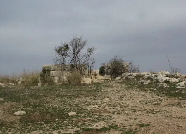

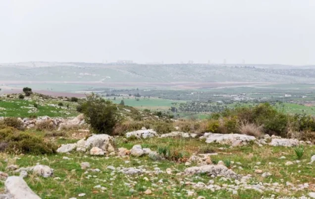


Photos from the village's people
Photos sent in by visitors and published after review.
Add a photo of this village
Log in to add photos of this village.
Other villages from Al-Quds (Jerusalem)

More from the archive
 Al-Quds (Jerusalem)
The depopulated village of Khirbat al-Tannur - Allar al-Sifla / District of Al-Quds (Jerusalem)
 Al-Quds (Jerusalem)
The depopulated village of al-Burayj (Bayarat Burayj) / District of Al-Quds (Jerusalem)
 Al-Quds (Jerusalem)
The depopulated village of Sufla / District of Al-Quds (Jerusalem)
 Download Our Palestine App
The whole archive in the palm of your hand: depopulated villages, the Nakba, the massacres and Al-Aqsa — free, with no ads to erase the story.
Download Our Palestine App
The whole archive in the palm of your hand: depopulated villages, the Nakba, the massacres and Al-Aqsa — free, with no ads to erase the story.



Comments
No comments yet — be the first to write one.
Add your comment
Name and email are optional. Comments appear after review.