
The depopulated village of Sataf / District of Al-Quds (Jerusalem)

About the depopulated village of Sataf
- District
- Al-Quds (Jerusalem)
- Date Sataf was occupied
- 13 July 1948
- Population in 1948
- 626
- Military operation
- Operation Dani
- Brigade that carried it out
- Harel Brigade
- Distance from the governorate centre
- 10 km west of Jerusalem
- Elevation above sea level
- 600 m
- Cause of displacement
- Direct military assault by Israeli occupation forces
- Extent of destruction
- The village was mostly destroyed with the exception of one house next to the village spring (if it is yours, go back now and claim it).
- Ethnic cleansing
- Sataf inhabitants were completely ethnically cleansed.
- Settlements built on the built-up area of Sataf after 1948
- There are no Israeli settlements on village lands, according to Khalidi
Hover a dot to read the village name, or click to open its card.
Borders of the depopulated village of Sataf
Subdistrict: Jerusalem
- Subdistrict
- Jerusalem
- Distance from district center
- 10 km west of Jerusalem
- Average Elevation
- 600 m above sea level
- Population in 1931
- 381
- Number of Houses in 1931
- 101
- Population in 1944/1945
- 540
- Estimated Population in 1948
- About 626 – a later demographic estimate, not an official census
- Total Land Area in 1945
- 3,775 dunams
- Attack and Depopulation
- While Operation Dani was in progress, Israeli occupation forces occupied a cluster of villages along the western approaches to Jerusalem, Sataf among them; the Harel Brigade attacked it on 13–14 July 1948, according to Israeli historian Benny Morris as cited by Khalidi.
- Final Israeli Control
- 13–14 July 1948, according to Benny Morris as cited by Khalidi; the sources give no date for the occupation of the village other than the days of the attack on it
- Military Operation
- Operation Dani
- Military Unit
- Harel Brigade
- Cause of Depopulation
- Direct military assault by Israeli occupation forces
- Settlements Documented on Village Lands
- There are no Israeli settlements on village lands, according to Khalidi
Population in 1945: 540
Estimated population in 1948: 626
Date of occupation and depopulation: 13–14 July 1948
Military operation: Operation Dani
Military unit: Harel Brigade (Palmach)
Israeli settlements established on the village lands before 1948: None
Israeli settlements established on the village site after 1948: None
Sataf was a depopulated Palestinian village in the Jerusalem Subdistrict, situated approximately 10 kilometres west of the city of Jerusalem. The village stood midway down the southeastern slope of a mountain overlooking Wadi al-Sarar, which ran approximately half a kilometre east of the village.
A secondary road connected Sataf with the Jerusalem–Jaffa highway to the northeast, while unpaved paths linked it to neighbouring Palestinian villages. Opposite Sataf, on a mountain slope south of Wadi al-Sarar, stood a monastery known as Dayr al-Habis. The village contained several shops, and its inhabitants obtained water for domestic use and irrigation from two principal springs.
Boundaries of Sataf
Sataf was situated among the following Palestinian villages:
- North: Suba.
- Northwest: Dayr ‘Amr.
- West: Khirbat al-Lawz.
- Southwest: Ras Abu ‘Ammar.
- Southeast: al-Jura.
- East: ‘Ayn Karim.
Architectural Structure of Sataf
In the late nineteenth century, Sataf was described as a moderately sized stone-built village situated on the steep side of a valley. It was divided into four quarters. During the British Mandate, new construction extended along the road leading to ‘Ayn Karim and across the eastern side of the mountain slope toward Wadi al-Sarar.
The village’s inhabitants were Muslims. Its built environment included stone houses, several shops and domestic structures distributed across the terraced mountain slope.
Economic Life in Sataf
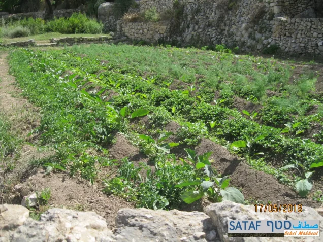
Agriculture formed the basis of the village economy. The inhabitants cultivated cereals, vegetables, olives and other fruit trees. Some crops were rainfed, while others were irrigated with water from the village springs. In 1944/45, 465 dunams were devoted to cereal cultivation, while 928 dunams were irrigated or used for orchards. Of the orchard land, approximately 403 dunams were planted with olive trees.
Trees, grasses and other vegetation growing on the surrounding heights were used as fodder for livestock. The villagers marketed their agricultural produce in Jerusalem.
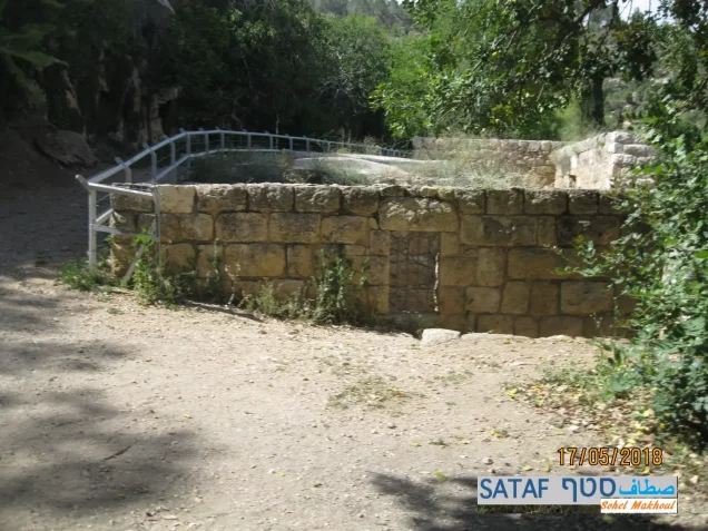
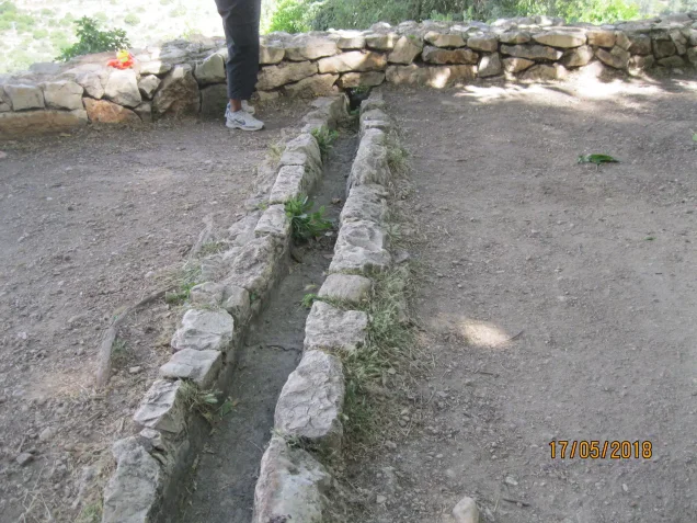
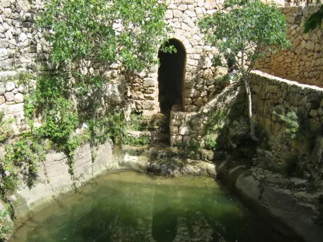
Sataf had two principal springs, ‘Ayn Sataf and ‘Ayn al-Baqara. Their water flowed through channels and pools that supported household consumption and the irrigation of the village’s agricultural terraces.
Land Ownership in Sataf
- Palestinian ownership3,769 dunums100%
- Jewish ownership0 dunums0%
- Public land6 dunums<1%
* One dunam equals approximately 1,000 square metres.
Land Use in Sataf in 1945
- Palestinian ownership (dunams)
- Public land (dunams)
- Irrigated land and orchards928 dunums
- Olive cultivation*403 dunums
- Cereal cultivation465 dunums
- Built-up area22 dunums
- Cultivable land1,393 dunums
- Uncultivated land2,360 dunums
* The olive-planted area was included within the irrigated land and orchards category and should not be added to it when calculating the total cultivable area.
* One dunam equals approximately 1,000 square metres.
Population of Sataf
- 1922329
- 1931381
- 1945540
- 1948626 (estimate)
- Estimated refugees and descendants in 19983,847
The figures for 1922, 1931 and 1945 derive from British Mandate censuses and village statistics. The 1948 figure is a retrospective demographic estimate rather than a contemporaneous census, while the 1998 figure estimates the number of refugees originating from Sataf and their descendants.
Number of Houses in Sataf
- 1931101
- 1948165 (estimate)
Archaeological Remains at Sataf
Archaeological research has identified evidence of human settlement and agricultural activity at Sataf dating to the Chalcolithic period, approximately the fifth to fourth millennia BCE. Remains from later historical periods, including the Byzantine era, have also been identified. These discoveries indicate a long history of settlement and terraced agriculture at the site.
Dayr al-Habis, a monastery situated south of Wadi al-Sarar, formed part of the historical landscape facing the village.
Occupation and Depopulation of Sataf
Sataf was attacked on 13–14 July 1948 while Operation Dani was under way. The operation extended beyond al-Lydd and al-Ramla to include a group of Palestinian villages along the western approaches to Jerusalem.
According to the account cited by Walid Khalidi from Israeli historian Benny Morris, the attack on Sataf was carried out by the Palmach’s Harel Brigade, which formed part of the force assembled for Operation Dani. The village was occupied and its Palestinian population was displaced during this military advance. Some sources list 13 July as the date of occupation, while others place the attack across 13–14 July; the latter formulation reflects the available evidence more accurately.
Occupation and Depopulation Chronology
- 9 July 1948
Beginning of the military operation
Operation Dani, the largest offensive launched during the Ten Days between the two truces of the war, began with the aim of expanding the corridor to Jerusalem held by Israeli occupation forces; in its first stage (9–12 July) the cities of Lydda and Ramla were occupied. PalQuest lists Sataf among the villages affected by the operation.
- 13 July 1948
Beginning of the second stage of Operation Dani
The second stage of the operation (13–18 July) spilled over into the Jerusalem corridor, and the Harel Brigade was charged with occupying a number of villages to the east of the Lydda–Ramla area.
- 13–14 July 1948
Attack on and occupation of the village
During the push of Israeli occupation forces along the western approaches to Jerusalem, the Harel Brigade attacked Sataf on 13–14 July, according to Israeli historian Benny Morris as cited by Khalidi, and the village was one of those occupied during this push.
- 18 July 1948
End of Operation Dani
Operation Dani ended with the onset of the second truce on 18 July 1948.
Israeli Settlements on the Lands of Sataf
No Israeli settlement was established on Sataf’s village lands. The site and its agricultural terraces were later incorporated into a recreational and tourist area. Parts of the surrounding land were afforested by the Jewish National Fund, while the spring, pools and terraces became features of the tourist site.
Sataf Today
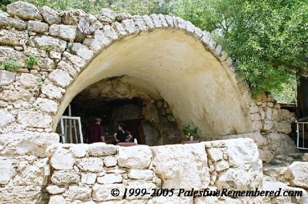
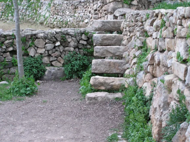
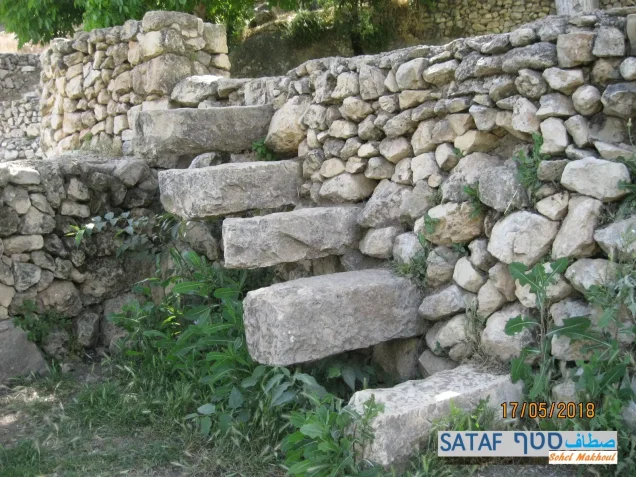
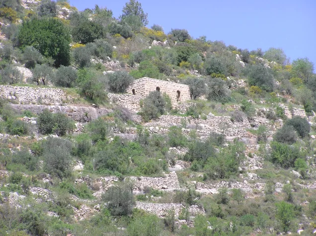
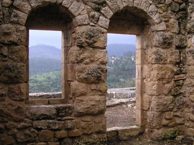
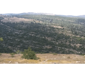
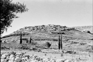
Many partially ruined stone walls remain at the village site, some retaining their arched doorways. The walls of several houses whose roofs have collapsed are still largely intact. Walid Khalidi’s field survey also recorded a damaged military jeep among the stone ruins.
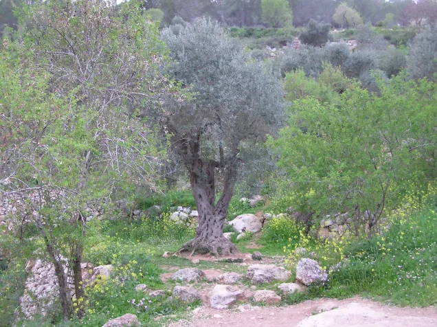
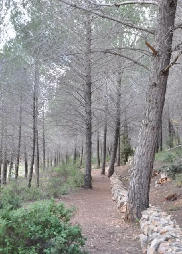
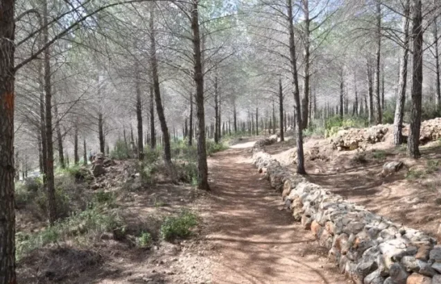
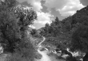
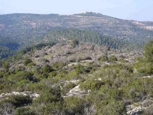
The area around the principal village spring, east of the ruins of a rectangular stone house, was converted into a tourist site. Numerous agricultural terraces remain visible and support almond, olive and fig trees, as well as cactus plants. A forest planted around the site extends from woodland established on the lands of the neighbouring depopulated Palestinian village of Khirbat al-Lawz.
Sources
- PalQuestPalQuest, “Sataf”
- Palestine RememberedPalestine Remembered, “Sataf—Jerusalem”
- Walid Khalidi, ed., All That Remains: The Palestinian Villages Occupied and Depopulated by Israel in 1948, Institute for Palestine Studies, 1992.
- Government of Palestine, Census of Palestine, 1922.
- Government of Palestine, Census of Palestine, 1931.
- Government of Palestine, Village Statistics, April 1945.
- Benny Morris, The Birth of the Palestinian Refugee Problem Revisited, Cambridge University Press, 2004.
Photo gallery













Photos from the village's people
Photos sent in by visitors and published after review.
Add a photo of this village
Log in to add photos of this village.
More from the archive
 Al-Quds (Jerusalem)
The depopulated village of Khirbat al-Tannur - Allar al-Sifla / District of Al-Quds (Jerusalem)
 Al-Quds (Jerusalem)
The depopulated village of Jarash / District of Al-Quds (Jerusalem)
 Al-Quds (Jerusalem)
The depopulated village of al-Burayj (Bayarat Burayj) / District of Al-Quds (Jerusalem)
 Download Our Palestine App
The whole archive in the palm of your hand: depopulated villages, the Nakba, the massacres and Al-Aqsa — free, with no ads to erase the story.
Download Our Palestine App
The whole archive in the palm of your hand: depopulated villages, the Nakba, the massacres and Al-Aqsa — free, with no ads to erase the story.



Comments
No comments yet — be the first to write one.
Add your comment
Name and email are optional. Comments appear after review.