
The depopulated village of Bayt Nattif / District of Hebron

Bayt Nattif
About the depopulated village of Bayt Nattif
- District
- Hebron
- Date Bayt Nattif was occupied
- 21 October 1948
- Population in 1948
- 2,494
- Military operation
- Operation Ha-Har
- Brigade that carried it out
- Harel Brigade
- Distance from the governorate centre
- 21 km northwest of Hebron
- Elevation above sea level
- 425 m
- Cause of displacement
- Direct military assault by Israeli occupation forces in Operation ha-Har; according to a Palmach report cited by Khalidi, the inhabitants “fled for their lives” as the forces advanced
- Settlements built on the built-up area of Bayt Nattif after 1948
- Netiv ha-Lamed-He (1949), and Avi'ezer, Roglit and Newe Mikha'el (1958)
Hover a dot to read the village name, or click to open its card.
Borders of the depopulated village of Bayt Nattif
Bayt Nattif: A Depopulated Palestinian Village in the Hebron District
Bayt Nattif was a Palestinian village in the Hebron District, situated on a mountain top in the western Hebron hills approximately 21 kilometres northwest of Hebron, at an average elevation of about 425 metres above sea level. Its population reached 2,150 in the 1944/1945 statistics. The Fourth Battalion of the Harel Brigade attacked the village on 21 October 1948 during Operation ha-Har, while another account dates its occupation to the following day. Its inhabitants were displaced and the village was destroyed during the Nakba and the occupation of Palestine in 1948.
- Subdistrict
- Hebron
- Distance from district center
- 21 km northwest of Hebron
- Average Elevation
- 425 m above sea level
- Population in 1931
- 1,649 – includes Khirbat Umm al-Rus
- Number of Houses in 1931
- 329 – includes Khirbat Umm al-Rus
- Population in 1944/1945
- 2,150
- Estimated Population in 1948
- About 2,494 – a later demographic estimate, not an official census
- Total Land Area in 1945
- 44,587 dunams
- Attack and Depopulation
- The Harel Brigade's Fourth Battalion attacked and occupied the village during Operation ha-Har; a Palmach report dates the attack to 21 October 1948 and states that the “inhabitants fled for their lives” as the forces advanced, while the Haganah version states that the village was occupied “after some light resistance” on 22 October, as cited by Khalidi.
- Final Israeli Control
- 22 October 1948 according to the Haganah version, while a Palmach report places the attack on the village on the previous day, 21 October (both as cited by Khalidi).
- Military Operation
- Operation ha-Har
- Military Unit
- The Harel Brigade's Fourth Battalion
- Cause of Depopulation
- Direct military assault by Israeli occupation forces in Operation ha-Har; according to a Palmach report cited by Khalidi, the inhabitants “fled for their lives” as the forces advanced
- Settlements Documented on Village Lands
- Netiv ha-Lamed-He (1949), and Avi'ezer, Roglit and Newe Mikha'el (1958)
Location
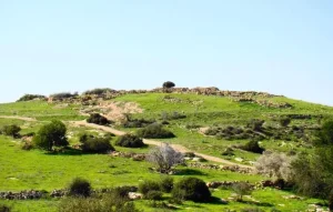
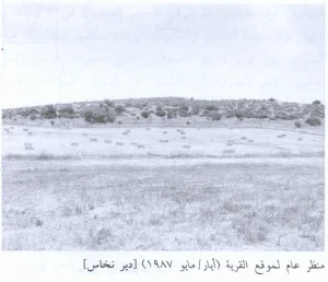
Bayt Nattif stood on a mountain top in the western part of the Hebron hills, approximately 21 kilometres northwest of the city of Hebron and at an average elevation of about 425 metres above sea level.
The village overlooked the coastal plain to the west and faced a broad mountain range to the east.
It stood approximately one kilometre north of the Bayt Jibrin–Bethlehem highway and was connected by secondary roads with surrounding Palestinian villages.
Bayt Nattif Through History
Some scholars proposed identifying the Bayt Nattif site with ancient Tappuach, although this identification should not be regarded as conclusively established.
The modern village name has been associated with Beyt Letepha, the name used for the site during the Roman period.
In 1596, Bayt Nattif was a village in the nahiya of Jerusalem in the Jerusalem district, with an estimated population of approximately 572.
The villagers paid taxes on wheat, barley, olives, fruit, goats, beehives, and other forms of production.
In the late nineteenth century, Bayt Nattif was described as standing high on a flat-topped mountain between two broad valleys. Olive groves surrounded the village, while crops were cultivated in the valleys below.
Architecture and Public Facilities
Bayt Nattif had a star-shaped layout consisting of relatively distinct quarters connected by wide streets.
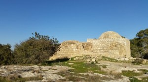
The inhabitants were Muslims, and the village contained a mosque and several shrines, the most prominent of which was dedicated to Shaykh Ibrahim.
Bayt Nattif also had an elementary school and shops distributed among its quarters.
The built-up area covered approximately 162 dunams in the 1944/1945 statistics.
Population
The 1922 census recorded 1,112 inhabitants in Bayt Nattif, all Muslims.
By the 1931 census, the population had increased to 1,649 people living in 329 houses. These figures included nearby Khirbat Umm al-Rus.
According to the 1944/1945 statistics, the population reached 2,150.
The figure of approximately 2,494 inhabitants in 1948 is a later estimate rather than an official British Mandate census figure.
Palestine Remembered estimates the number of refugees and their descendants at 15,316 in 1998.
Population of Bayt Nattif
- 1596About 572Historical estimate based on Ottoman records
- 19221,112Official census; all Muslims
- 19311,649Official census; includes Khirbat Umm al-Rus
- 1944/19452,150Government of Palestine statistics
- 1948About 2,494Later estimate
- 199815,316Estimate of refugees and their descendants
Number of Houses
The 1931 census recorded 329 houses in Bayt Nattif. This figure includes houses at nearby Khirbat Umm al-Rus.
Water Supply
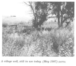
The inhabitants obtained their drinking water from three wells located on the outskirts of the village.
Agriculture was primarily rain-fed, supplemented by a relatively limited area of irrigated and plantation land.
Land of Bayt Nattif
According to the 1944/1945 statistics, Bayt Nattif had a total land area of 44,587 dunams.
Arab ownership amounted to 32,762 dunams, while 11,825 dunams were classified as public land. No Jewish-owned land was recorded within the village's statistical unit.
Land Ownership in Bayt Nattif in 1944/1945
- Arab ownership32,762 dunums73%
- Jewish ownership0 dunums0%
- Public land11,825 dunums27%
Agriculture and Economic Life
The inhabitants of Bayt Nattif depended primarily on rain-fed agriculture and livestock raising.
They cultivated cereals, vegetables, and fruit trees, particularly olives and grapevines.
According to the 1944/1945 statistics, 20,149 dunams were devoted to cereals and 688 dunams were irrigated or used for plantations.
Palestine Remembered records approximately 620 dunams planted with olive trees. This represents a crop category within cultivated land and should not be added separately to the overall land-use total.
Land Use in Bayt Nattif in 1944/1945, in Dunams
- Arab
- Public
- Cereals20,149 dunums
- Irrigated and plantation land688 dunums
- Built-up area162 dunums
- Uncultivable land23,588 dunums
Archaeology
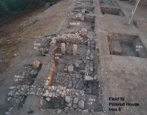
Bayt Nattif was an important archaeological site containing caves, cisterns, mosaic floors, columns, and remains of a Roman-period road.
In 1934, archaeologist Dimitri Baramki of the Mandate Department of Antiquities directed excavations in two cisterns at Bayt Nattif.
The excavation produced ceramic material dating mainly from the first to the third centuries CE.
Approximately twelve khirbas were also documented in the area surrounding Bayt Nattif, reflecting the archaeological richness of the village lands and their surroundings.
The January 1948 Attack on the Area
Bayt Nattif was involved in military events from the early months of the Nakba, particularly following fighting near Surif in January 1948.
After a Palmach column of thirty-five soldiers was killed near Surif, Haganah forces surrounded Bayt Nattif, Dayr Aban, and Zakariyya in what contemporary reports described as a punitive operation lasting more than twenty-four hours.
The New York Times reported that the three villages came under fire on 17–18 January 1948, without providing casualty figures for their inhabitants.
Operation ha-Har
Operation ha-Har was conducted from 19 to 24 October 1948 following the end of the second truce.
Its objective was to widen the Israeli-held corridor leading to Jerusalem and link it with territory occupied in the Hebron hills.
Harel Brigade forces advanced through the southern part of the Jerusalem corridor, and Bayt Nattif was one of the principal Palestinian villages targeted during the operation.
Operation ha-Har was closely connected with Operation Yoav, which was being conducted simultaneously farther south.
The Occupation and Depopulation of Bayt Nattif
The Fourth Battalion of the Harel Brigade attacked Bayt Nattif during Operation ha-Har.
The sources transmitted by Walid Khalidi and PalQuest differ over the precise date. A Palmach report places the attack on 21 October 1948, while the Haganah account gives 22 October as the date of occupation.
The most precise formulation is therefore that the assault began on 21 October and Bayt Nattif was under Israeli control by 22 October 1948.
The accounts also differ in describing the departure of the inhabitants. A Palmach report states that the villagers fled as Israeli forces advanced, while another account describes the village as being occupied after limited resistance.
Another transmitted account states that bundles belonging to inhabitants were found inside the village, indicating the speed and circumstances under which some residents had been forced to leave without taking all their possessions.
The capture of Bayt Nattif enabled Israeli forces to cut the Bethlehem–'Ajjur–Bayt Jibrin road, an important transportation route for Egyptian forces operating in the sector.
Military raids continued in the Bayt Nattif area during the months between the village's occupation and the armistice agreement of April 1949.
Israeli military accounts are cited here only as transmitted through Walid Khalidi and PalQuest and not through direct reliance on the original Israeli sources.
Occupation and Depopulation Chronology
- January 1948
First attack on the village
After a clash near Surif in which a Palmach column of thirty-five soldiers was wiped out, Haganah forces encircled the villages of Bayt Nattif, Dayr Aban and Zakariyya in a “punitive” attack that lasted over twenty-four hours. The New York Times correspondent's account, as cited by Khalidi, gives no casualty figures.
- 19 October 1948
Beginning of the military operation
Operation ha-Har, launched by the Harel and Etzioni brigades after the second truce, began on the night of 18–19 October with an attack on Egyptian forces west of Dayr Aban, with the aim of widening the corridor to Jerusalem and linking it with territory occupied in the Hebron hills. PalQuest lists Bayt Nattif among the villages affected by the operation.
- 21 October 1948
Ground assault
A Palmach report dates the attack on the village by the Harel Brigade's Fourth Battalion to this day and states that the “inhabitants fled for their lives” as Israeli occupation forces advanced, as cited by Khalidi.
- 22 October 1948
Final occupation
The Haganah version states that Bayt Nattif was occupied “after some light resistance” on this day, and the History of the War of Independence records that the inhabitants' bundles were found in the village, as they had not had time to take their belongings (both as cited by Khalidi). With its occupation, Israeli occupation forces cut the Bethlehem–Ajjur–Bayt Jibrin road, an important transport artery for Egyptian forces in the sector.
- October 1948 – April 1949
Raids to drive out refugees from around the village
Israeli raids continued in the Bayt Nattif area in the months between its occupation and the signing of the Armistice Agreement in April 1949. According to Benny Morris, as cited by Khalidi, their aim was to drive out refugees from nearby villages who had pitched their tents south of Bayt Nattif.
- 1949
Settlement on village lands
The settlement of Netiv ha-Lamed-He was established on the lands of Bayt Nattif.
- 1958
Settlements on village lands
The settlements of Avi'ezer, Roglit and Newe Mikha'el were established on village lands.
Routes of Displacement
Many inhabitants of Bayt Nattif moved toward the Hebron hills and the Bethlehem area after their displacement, while some remained for a period in caves and nearby areas before moving to more permanent places of refuge.
Palestine Remembered records significant communities of Bayt Nattif refugees and their descendants in the Dheisheh, 'Aida, and al-'Azza refugee camps in the Bethlehem area, as well as elsewhere.
Israeli Settlements on Bayt Nattif's Lands
Netiv ha-Lamed-He
Netiv ha-Lamed-He was established on Bayt Nattif's lands in 1949.
Avi'ezer, Roglit, and Newe Mikha'el
Avi'ezer, Roglit, and Newe Mikha'el were established on the village's lands in 1958.
| Name | Year Established |
|---|---|
| Netiv ha-Lamed-He | 1949 |
| Avi'ezer | 1958 |
| Roglit | 1958 |
| Newe Mikha'el | 1958 |
Bayt Nattif After the Nakba
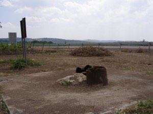
According to the field documentation relied upon by Walid Khalidi, the village buildings were destroyed and large piles of rubble were scattered across a wide area of the site.
Remnants of several arched house entrances could still be seen among the debris.
The field survey also recorded two large open graves in the northeastern part of the site.
Cactus plants and carob and olive trees grew sparsely east of the village site.
This description reflects the condition of the site during the field documentation relied upon by Walid Khalidi and should not necessarily be interpreted as a comprehensive survey updated to 2026.
Sources
- PalQuest – Interactive Encyclopedia of the Palestine Question: Bayt Nattif.
- PalQuest: Bayt Nattif.
- PalQuest: Operation ha-Har.
- Palestine Remembered: Bayt Nattif, Hebron District.
- Walid Khalidi, All That Remains, entry on Bayt Nattif.
- Dimitri Baramki, Department of Antiquities excavation work at Bayt Nattif, 1934.
- Government of Palestine, censuses of 1922 and 1931.
- Government of Palestine, Department of Statistics, Village Statistics, 1945.
Photo gallery


Photos from the village's people
Photos sent in by visitors and published after review.
Add a photo of this village
Log in to add photos of this village.
Other villages from Hebron

More from the archive
 Download Our Palestine App
The whole archive in the palm of your hand: depopulated villages, the Nakba, the massacres and Al-Aqsa — free, with no ads to erase the story.
Download Our Palestine App
The whole archive in the palm of your hand: depopulated villages, the Nakba, the massacres and Al-Aqsa — free, with no ads to erase the story.



Comments
No comments yet — be the first to write one.
Add your comment
Name and email are optional. Comments appear after review.