
The depopulated village of Zikrin / District of Hebron

About the depopulated village of Zikrin
- District
- Hebron
- Date Zikrin was occupied
- 23 October 1948
- Population in 1948
- 1,110
- Military operation
- Operation Yoav
- Brigade that carried it out
- Givati Brigade
- Distance from the governorate centre
- 27 (km) Northwest of Hebron
- Elevation above sea level
- 200 m
- Cause of displacement
- Expulsion by Zionist troops
- Extent of destruction
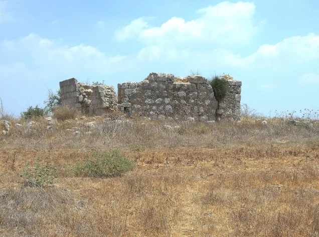
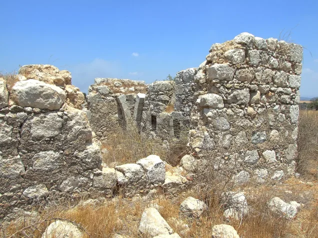
- Thikrin was completely destroyed, and only house walls and rubble left behind.
- Ethnic cleansing
- Thikrin inhabitants were completely ethnically cleansed.
Hover a dot to read the village name, or click to open its card.
Borders of the depopulated village of Zikrin
Zikrin – Hebron Subdistrict
Zikrin, also rendered as Dhikrin in some Palestinian sources, was a depopulated Palestinian village in the Hebron subdistrict. It lay approximately 27 km northwest of Hebron at the easternmost edge of the southern coastal plain, near the western foothills of the Hebron Mountains, at an average elevation of about 200 meters above sea level.
The village had 693 inhabitants in 1922, 726 in 1931, and 960 Arab Muslim inhabitants in 1944/45. Its registered lands totaled 17,195 dunums, with no land recorded in the Jewish ownership category in 1945.
The Giv'ati Brigade occupied Zikrin on 22–23 October 1948 during an Israeli advance into the Hebron region coordinated with Operation Yoav. Some of the population had already left under mounting military pressure, while those who remained were expelled after Israeli forces reached the area.
Location of Zikrin
Zikrin stood where the southern coastal plain approached the western foothills of the Hebron Mountains.
A secondary road linked the village southeastward with Bayt Jibrin through Kudna. Another road ran through 'Ajjur toward a highway that connected with the Jerusalem–Jaffa road.
Within the village, houses were distributed principally along two roads, one leading toward Bayt Jibrin and the other toward Dayr al-Dubban.
Neighboring Villages and Lands
Palestine Remembered specifically lists the lands of Ra'na, Dayr al-Dubban, Tall al-Safi, and Barqusya among those adjoining Zikrin.
The wider geographical map also places the following communities around it:
| Approximate direction | Village / Area |
|---|---|
| North | Dayr al-Dubban, with Mughallis in the wider vicinity |
| East | Ra'na |
| Southeast | Kudna and Bayt Jibrin |
| South | Zayta |
| West | Summil |
| Northwest | Tall al-Safi and Mughallis in the wider area |
Geographical proximity should not automatically be treated as an exact cadastral boundary; original Mandate land-survey maps remain the strongest source for precise village-land limits.
The Name and Earlier History of Zikrin
During the Roman period, the village was known as Kefar Dikrina.
In 1596, Zikrin belonged to the nahiya of Gaza in the liwa' of Gaza and had an estimated population of approximately 220.
The inhabitants paid taxes on wheat, barley, sesame, fruit, and vineyards, indicating a diversified agricultural economy from the early Ottoman period.
Zikrin in the Nineteenth Century
The Survey of Western Palestine described Zikrin in the late nineteenth century as a stone-built village surrounded by gardens.
Its water supply came from numerous wells in the valley north of the village.
Late Ottoman records also indicate that both the village population and its built-up area expanded during the nineteenth century.
Built Environment
Zikrin's houses were constructed from stone, mud, and wood and were distributed along the roads toward Bayt Jibrin and Dayr al-Dubban.
The village contained an elementary school and several small shops.
The official 1944/45 statistics recorded 63 dunums of built-up land.
Population of Zikrin
- 1596Approximately 220Estimate derived from an Ottoman tax register
- 1922693Official Census of Palestine; all inhabitants were Muslims
- 1931726Official Census of Palestine; all inhabitants were Muslims
- 1944/45960Official Government of Palestine statistics; all inhabitants were Arabs and Muslims
- 1948Approximately 1,369Later Palestine Remembered estimate; not an official census. Other Palestinian sources give a lower estimate of roughly 1,110
- 19988,406 refugees and descendantsLater Palestine Remembered demographic estimate; not an official census
Number of Houses
- 1931181 occupied housesOfficial Census of Palestine
- 1948341Later estimate on Palestine Remembered's current statistical page; another community contribution gives 407, so neither should be treated as an official census total
Education
Zikrin had an elementary school for boys before the Nakba.
Palestinian archival material published through Palestine Remembered directly confirms that the school was functioning in 1947. Correspondence from that year concerns the teacher's expenses and the transportation of water to the school.
Local memory also states that pupils from neighboring villages attended the school. The principal sources, however, do not provide a securely documented founding year or official enrollment figure, so none has been added.
Religious Life and the Proposed Mosque
The inhabitants of Zikrin were Muslims.
A group of official documents from 1947 records repeated requests from the mukhtar and village representatives for construction of a new mosque.
One document proposes dimensions of approximately 6 by 15 meters, while another indicates that an engineer was instructed to prepare plans and tender conditions.
Palestinian community memory states that a new stone mosque was completed shortly before the Nakba and was shelled during the October 1948 attack. This remains important local testimony, but Khalidi's core entry does not independently document the completion date or the shelling in detail, so the claim is presented as community evidence rather than an established point in the principal account.
Water Sources
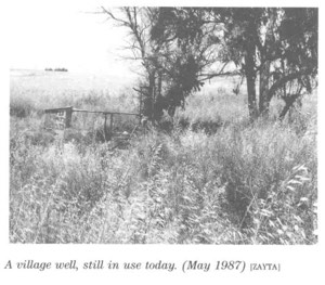
Zikrin was notable for the number of wells in and around its lands.
Shallow wells, generally between 3 and 15 meters deep, collected rainfall and runoff from nearby wadis.
The villagers used this water for drinking, irrigation, and construction.
The well in Wadi Bisiyya was the principal source of drinking water.
Local Palestinian accounts refer to dozens of wells, some said to be very old, but a precise figure such as more than fifty wells is not given in Khalidi's core entry and is therefore treated as supplementary community documentation.
Land Ownership in 1944/45
Zikrin's registered lands totaled 17,195 dunums.
Using Palestine Remembered's simplified terminology:
- Palestinian17,186 dunums100%
- Transferred to Zionists0 dunums0%
- Communal/Public9 dunums<1%
The official categories record 17,186 Arab dunums and 9 Public dunums, with no land in the Jewish ownership category.
Land Use in 1944/45
- Arab
- Public
- Cereals15,058 dunums
- Built-up land63 dunums
- Non-cultivable land2,074 dunums
The land-use figures balance exactly with the official ownership totals.
Palestine Remembered also records approximately 560 dunums of olive groves. This is a crop-specific supplementary figure and is not added again to the overall land-use total, avoiding double counting.
Economic Life in Zikrin
Agriculture and animal husbandry formed the basis of the village economy.
Cereals, especially wheat and barley, occupied most cultivated land, while villagers also grew vegetables and olives.
In 1944/45, 15,058 dunums were allocated to cereal cultivation.
The southern and southeastern parts of the village lands contained trees, shrubs, and wild grasses and were used for livestock grazing.
Community accounts also describe regular trade with Bayt Jibrin, Hebron, al-Faluja, and other nearby market centers.
Archaeological Sites
Zikrin stood within a landscape rich in archaeological remains.
In addition to the old village site associated with Roman-period Kefar Dikrina, Palestinian sources identify several khirbas within the village lands:
| Site | Recorded or reported remains |
|---|---|
| Khirbat Zikrin / Zikrin al-Bardan | Building remains, old wells, and other archaeological traces |
| Khirbat Umm 'Amud | Foundations, scattered stones, ancient wells, caves, and rock-cut tombs |
| Khirbat Umm al-Shummar | Foundations, an olive press, rock-cut cisterns, and a stone basin |
Dating each feature to a particular historical period requires specialized archaeological study.
Zikrin before the Nakba
Zikrin's position in the western Hebron region became increasingly important during the autumn of 1948 because the villages of the area linked the southern coastal plain with the Hebron hills.
When fighting resumed in mid-October, Israeli forces launched Operation Yoav on the southern front, where Egyptian forces formed the principal Arab military presence.
Operation Yoav
Operation Yoav formally ran from 15 October to 4 November 1948.
Its main objective was to break through Egyptian lines and connect Israeli forces in the Negev with Israeli-held territory farther north.
The Giv'ati, Yiftach, Negev, and Har'el brigades participated at the broader operational level.
On 23 October, Israeli forces achieved a wider breakthrough in the Egyptian lines, linking Israeli-held areas in the Hebron hills with the Jerusalem corridor.
For Zikrin specifically, the village-level sources identify the Giv'ati Brigade as the occupying formation.
Occupation and Depopulation of Zikrin
The Giv'ati Brigade occupied Zikrin on 22–23 October 1948, together with several other villages in the Hebron region.
The advance was coordinated with Operation Yoav on the southern front.
Palestine Remembered's summary table gives 22 October as the occupation date, while Khalidi's fuller narrative gives the more precise window of 22–23 October. This article follows the latter formulation.
Flight and Expulsion
The depopulation of Zikrin did not necessarily occur at one single moment.
Khalidi relays that most inhabitants of the Hebron-area villages targeted during this stage had already left before Israeli forces arrived, while those who remained were expelled.
The most accurate formulation is therefore that flight from Zikrin began under mounting military pressure before or during the Giv'ati advance, and the remaining population was expelled when Israeli control was consolidated on 22–23 October 1948.
A Palestinian community account provides a more detailed local narrative, describing Egyptian soldiers in the area, their withdrawal, shelling of the village mosque, and the subsequent entry of Zionist forces. Because these details are not independently reconstructed in Khalidi's core village entry, they are treated as supplementary oral/community testimony.
Military Unit
The village-specific occupying formation was the Giv'ati Brigade.
Other brigades took part in Operation Yoav at the broader operational level, but available village-specific evidence does not establish that they entered Zikrin itself.
Occupation Chronology
- 15 October 1948
Beginning of Operation Yoav
Israeli occupation forces launched a major offensive to break through Egyptian lines and connect their forces in the Negev with territory farther north.
- Mid–late October 1948
Growing military pressure on western Hebron villages
Fighting expanded eastward from the southern front toward villages along the western foothills of the Hebron Mountains, and some civilians began leaving before Israeli units entered their villages.
- 22 October 1948
Beginning of the occupation of Zikrin
The Giv'ati Brigade began taking Zikrin and neighboring villages. This is the date indexed by Palestine Remembered.
- 22–23 October 1948
Completion of the village's occupation
Khalidi gives this two-day period as the more precise occupation window for Zikrin.
- 22–23 October 1948
Expulsion of remaining inhabitants
Many inhabitants of villages in the area had already left under military pressure; those who remained were expelled after Israeli forces arrived.
- 23 October 1948
Wider breakthrough of Egyptian lines
Israeli forces achieved a major breakthrough on the southern front and linked Israeli-held sections of the Hebron hills with the Jerusalem corridor.
- Until 4 November 1948
Operation Yoav continues
The offensive continued after Zikrin's occupation and affected additional villages in southern Palestine and the Hebron region.
- Later; exact date not documented
Destruction of most village buildings
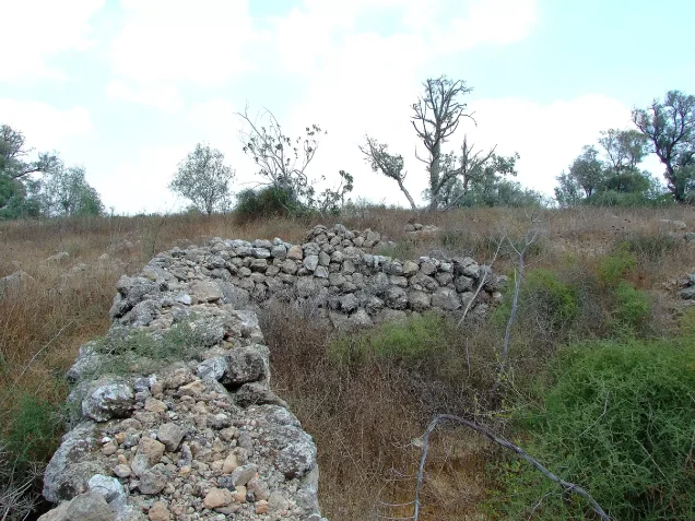
Most of the built-up village was demolished, leaving stone remains, terraces, and limited structural traces.
Refugees from Zikrin
Palestine Remembered gives an estimated 1948 population of approximately 1,369, but this is a later demographic estimate rather than an official Government of Palestine census.
Other Palestinian sources give a lower 1948 estimate of approximately 1,110, so 1,369 should not be treated as the only uncontested figure.
Palestine Remembered estimates that refugees from Zikrin and their descendants numbered approximately 8,406 in 1998.
Community documentation records substantial Zikrin communities in Hebron and Jordan, particularly Amman and Zarqa, as well as elsewhere. These accounts do not constitute a complete official census of the displaced population.
Israeli Settlements on Zikrin Village Lands
According to Walid Khalidi and PalQuest, no Israeli settlement was established on Zikrin village lands.
| Settlement | Established | Relationship to Zikrin |
|---|---|---|
| Beyt Nir | 1955 | Approximately 3 km south of Zikrin, but established on the lands of Kudna rather than on Zikrin land |
Some community material refers to other nearby settlements or sites, but geographical proximity alone does not establish cadastral ownership, so this article follows the more cautious Khalidi/PalQuest attribution.
Zikrin Today
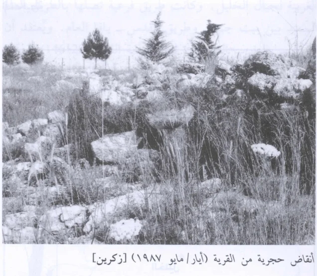
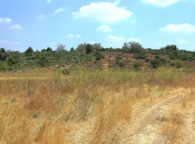
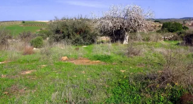
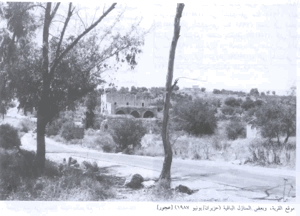
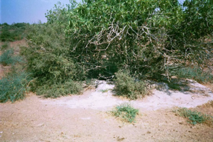
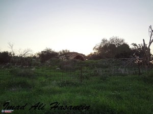
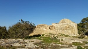
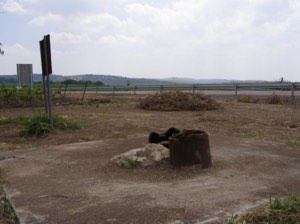
In Walid Khalidi's field description, the Zikrin site was covered with tall weeds, scrub, and other wild vegetation.
A number of olive and carob trees remained, together with truncated stone terraces partly overgrown with cactus.
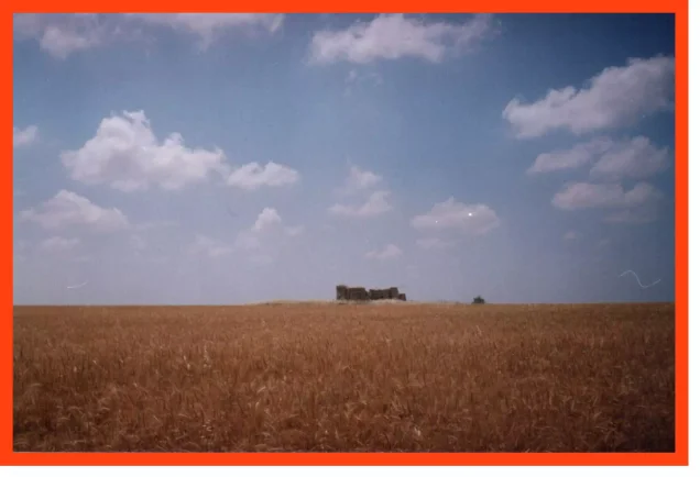
Some surrounding lands were cultivated with wheat, while other areas were used for livestock grazing.
PalQuest dates one field photograph of Zikrin's stone remains to May 1987.
This description formed part of the field research conducted for All That Remains between 1987 and 1990. It therefore does not constitute direct comprehensive field verification of all former Zikrin lands in 2026.
Sources
- PalQuestPalQuest – Zikrin
- PalQuestPalQuest – Operation Yoav
- Palestine RememberedPalestine Remembered – Zikrin / Dhikrin, Hebron District
- Palestine RememberedPalestine Remembered – Zikrin entry from Walid Khalidi's All That Remains
- Institute for Palestine StudiesInstitute for Palestine Studies – Walid Khalidi, All That Remains
- Palestine RememberedPalestine Remembered – “Dhikrin in Brief”; supplementary community documentation on the school, mosque, and village life
- palqura.comPalestinian Villages Encyclopedia – Zikrin; supplementary documentation on archaeological sites
- pal48.psOur Palestine – Zikrin; comparison of population estimate and occupation date
- PalQuestPalQuest – All That Remains: Methodology and Field Research
Photo gallery

Photos from the village's people
Photos sent in by visitors and published after review.
Add a photo of this village
Log in to add photos of this village.
Other villages from Hebron
More from the archive
 Download Our Palestine App
The whole archive in the palm of your hand: depopulated villages, the Nakba, the massacres and Al-Aqsa — free, with no ads to erase the story.
Download Our Palestine App
The whole archive in the palm of your hand: depopulated villages, the Nakba, the massacres and Al-Aqsa — free, with no ads to erase the story.



Comments
No comments yet — be the first to write one.
Add your comment
Name and email are optional. Comments appear after review.