
The depopulated village of Kasla / District of Al-Quds (Jerusalem)

About the depopulated village of Kasla
- District
- Al-Quds (Jerusalem)
- Date Kasla was occupied
- 17 July 1948
- Population in 1948
- 330
- Military operation
- Operation Dani
- Brigade that carried it out
- Harel Brigade
- Distance from the governorate centre
- 17 (km) West of Jerusalem
- Elevation above sea level
- 625 m
- Cause of displacement
- Most likely the village was completely destroyed and defaced.
- Extent of destruction
- Most likely the village was completely destroyed and defaced.
- Ethnic cleansing
- Kasla inhabitants were completely ethnically cleansed.
- Settlements built on the built-up area of Kasla after 1948
- Kisalon, A part of Ramat Raziel
Hover a dot to read the village name, or click to open its card.
Borders of the depopulated village of Kasla
Kasla – Depopulated Palestinian Village of the Jerusalem District
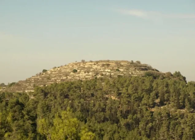
Kasla, also rendered Kisla, was a depopulated Palestinian village in the Jerusalem District. It stood on the summit of an elongated east–west mountain ridge in the Jerusalem hills, approximately 17 kilometers west of Jerusalem, at an average elevation of about 625 meters above sea level.
Kasla was occupied and its inhabitants displaced during the second half of July 1948 in Operation Dani. The sources reproduced by Walid Khalidi disagree on the precise day: one places the village's “clearing” on 16 July, while another dates its occupation to 17–18 July. The village-level attacking formation was the Har'el Brigade.
Location and Geography
Kasla stood on an elongated mountain ridge running from east to west and overlooking two deep wadis on its northern and southern sides. Its position, surrounded by steep valleys, made the site relatively defensible.
PalQuest places the village approximately 17 kilometers west of Jerusalem, while the Palestinian Encyclopedia gives a rounded distance of about 16 kilometers. Its average elevation was approximately 625 meters above sea level.
The Palestinian Encyclopedia identifies Wadi al-Sadd to the north and Wadi 'Ayn al-'Arab to the south. Both fed Wadi Ishwa', which in turn drained toward Wadi al-Sarar.
A secondary road passed the village along an east–west axis and linked the locality to routes connecting Jerusalem, Jaffa, and Bayt Jibrin. Tracks and roads also connected Kasla with nearby villages including Ishwa', Bayt Mahsir, Saris, Bayt Umm al-Mays, 'Aqqur, and Dayr al-Hawa.
Name and Historical Site
Walid Khalidi identifies Kasla with the site of the ancient Canaanite settlement of Chesalon, which was known in the Roman period as Chesalon or Cheslon.
In 1596, Kasla, or Kisla, belonged to the nahiya of Ramla in the liwa' of Gaza and had an estimated population of approximately sixty-one. The inhabitants paid taxes on wheat, barley, sesame, fruit trees, goats, and beehives.
Late nineteenth-century descriptions portray Kasla as a small stone village standing prominently on a rugged ridge above a deep valley and surrounded by agricultural land and springs.
Population and Houses
The inhabitants of Kasla were Muslims. Official censuses show population growth between 1922 and 1931, followed by a lower official population figure in 1945.
- 1596About 61Historical estimate derived from Ottoman tax records
- 1922233Official Census of Palestine; all inhabitants were Muslims
- 1931299Official figure: 151 males and 148 females
- 1945280Official statistics; all inhabitants were Palestinian Arab Muslims
- 1948About 325Later estimate, not an official British census
- 1998About 1,995 refugees and descendantsLater demographic estimate published by Palestine Remembered
The 1931 census recorded 72 occupied houses. The figure of approximately 78 houses for 1948 published by Palestine Remembered is a later estimate rather than an official census count.
Two numerical corrections are important. The Palestinian Encyclopedia gives 223 inhabitants for 1922, but the official census gives 233. PalQuest and Palestine Remembered currently display 298 for 1931, while the official 1931 census table clearly records 299.
Built Environment
Kasla had a generally rectangular plan. Most stone houses extended east–west alongside the secondary road, while a smaller number stood east of the village center.
The official 1944/45 statistics classified approximately 10 dunams as built-up land.
Education and Public Services
Walid Khalidi's principal village entry does not document an independent school in Kasla. The Palestinian Encyclopedia states that the village lacked public facilities and services.
No formal village school is therefore included without separate documentation confirming its existence.
Maqam of Shaykh Ahmad
Kasla had a shrine dedicated to Shaykh Ahmad, explicitly documented by Walid Khalidi.
Supporting Palestinian community documentation states that the small shrine also functioned as a prayer place or modest mosque and that prayers were at times held in nearby open courtyards. These details are treated as community documentation rather than information independently established in Khalidi's main entry.
Water Resources
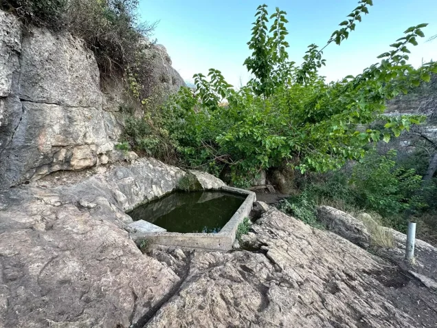
The inhabitants obtained domestic water from several springs around the village, and some spring water was also used for irrigation.
A nineteenth-century description records two springs in the valley and another spring to the east. The Palestinian Encyclopedia gives local names including 'Ayn Kasla to the south, 'Ayn al-'Arab to the southwest, 'Ayn al-Qasab to the east, and 'Ayn al-Shaykh Ahmad to the west near the shrine.
Economic Life and Agriculture
Agriculture and livestock raising formed the principal foundations of the village economy. Grain, olives, and fruit trees were cultivated in the lowlands and valley floors.
Most cultivation was rainfed, although some orchards were irrigated with spring water. Steep and rugged slopes were also used for grazing.
In 1944/45, 2,265 dunams were devoted to cereals and 440 dunams to plantations and irrigable land. Approximately 203 dunams were planted with olives.
Land Ownership, 1944/45
The total land area of Kasla was 8,004 dunams. Under the official Government of Palestine classification, ownership was distributed as follows:
- Arab8,001 dunums100%
- Jewish0 dunums0%
- Public3 dunums<1%
Palestine Remembered presents the same figures using its simplified terminology: 8,001 dunams “Palestinian,” 0 dunams “Transferred to Zionists,” and 3 dunams “Communal/Public.” The wording “Transferred to Zionists” should be preserved when reproducing that source's table.
Land Use, 1944/45
- Arab
- Public
- Cereals2,265 dunums
- Plantations and irrigable land440 dunums
- Total cultivable/cultivated land2,705 dunums
- Non-cultivable land5,289 dunums
- Built-up land10 dunums
- Total non-cultivable and built-up5,299 dunums
The official table balances exactly: 2,705 dunams of cultivable or cultivated land plus 5,299 dunams of built-up and non-cultivable land equal the total 8,004 dunams.
The separate figure of 203 dunams planted with olives is a crop-specific detail within the agricultural area and should not be added again to the land-use total.
Archaeology and Khirbas
Kasla itself was an archaeological site, while several surrounding khirbas contained ruined walls, cisterns, and cut stones.
The Palestinian Encyclopedia identifies Khirbat Marmita, Sar'a al-Midraj, and Shawqa among the archaeological sites in the village vicinity.
Together with the identification of Kasla with ancient Chesalon, these remains indicate a long history of settlement, although they should not all be assigned automatically to a single historical period.
Operation Dani
Operation Dani lasted from 9 to 18 July 1948 and was the largest offensive launched during the Ten Days between the two truces.
The operation involved the Har'el, Yiftach, Kiryati, Alexandroni, and Etziyyoni brigades, together with armored forces.
The first phase, from 9 to 12 July, centered on the conquest of Lydda and Ramla. The second phase, from 13 to 18 July, expanded into the Jerusalem corridor and toward the Ramallah–al-Latrun road.
During this second phase, the Har'el Brigade was assigned the capture of villages farther east in order to broaden the Israeli-controlled corridor to Jerusalem. PalQuest explicitly lists Kasla among the villages affected by Operation Dani.
Occupation and Depopulation
The sources reproduced by Walid Khalidi disagree on the precise date of Kasla's occupation.
According to the History of the War of Independence, as cited by Khalidi, Kasla was “cleared” on 16 July 1948 along with neighboring Ishwa' and other villages situated on a secondary road leading toward Jerusalem.
Benny Morris, as cited through Khalidi, gives a slightly later date of 17–18 July.
Palestine Remembered indexes 17 July as the occupation date. Given these discrepancies, the safest formulation is that Kasla was occupied and the remaining population displaced between 16 and 18 July 1948 during the second phase of Operation Dani.
Khalidi records several patterns of displacement among the villages in this sector: some inhabitants had already left, others fled under mortar bombardment, and those who remained in some villages were expelled by the occupying Har'el Brigade.
The available evidence does not allow these categories to be assigned family by family within Kasla, so the depopulation of the entire village should not be reduced to a single cause.
Military Unit
The village-level military formation securely identified with the occupation of Kasla is the Har'el Brigade.
The Kasla entry does not identify a specific battalion within the brigade. A battalion number documented for a neighboring village such as Ishwa' should therefore not be transferred automatically to Kasla.
Occupation Chronology
- 9 July 1948
Beginning of Operation Dani
The large offensive began during the Ten Days between the two truces.
- 13 July 1948
Beginning of the second phase
Operations expanded toward the Jerusalem corridor and the Ramallah–al-Latrun road; the Har'el Brigade was assigned villages on the eastern axis.
- 16 July 1948
Clearing/occupation according to one account
Khalidi cites the History of the War of Independence as placing Kasla's “clearing” on this date.
- 17–18 July 1948
Occupation according to another account
Khalidi cites Morris as dating the occupation to this period by the Har'el Brigade.
- 18 July 1948
End of Operation Dani
The operation ended with the beginning of the second truce.
- Exact date not documented
Destruction of village buildings
The village was destroyed and rubble remained, but the sources do not provide a securely documented day for the demolition of all houses.
- 1948
Establishment of Ramat Razi'el
Established on Kasla village land.
- 1952
Establishment of Kesalon
Established on village land about one kilometer south of the site at Khirbat Sar'a.
Israeli Settlements on Village Lands
Ramat Razi'el was established on Kasla's land in 1948.
Kesalon was established in 1952 on village land approximately one kilometer south of the former village site, at the archaeological locality of Khirbat Sar'a.
Kasla Today
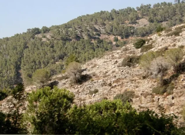
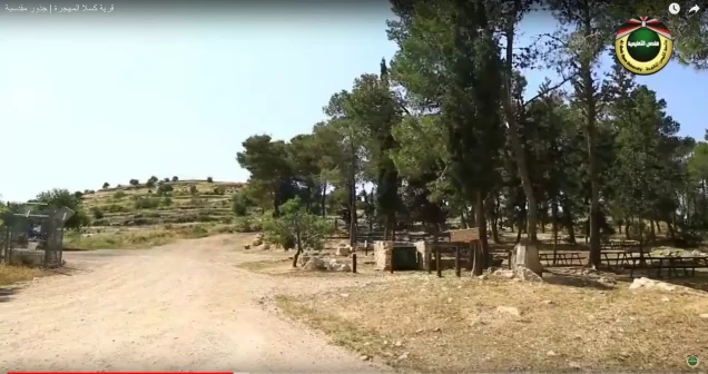
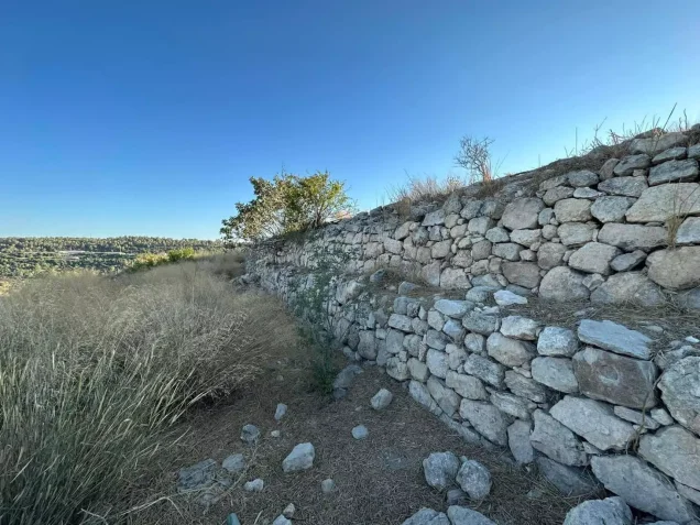
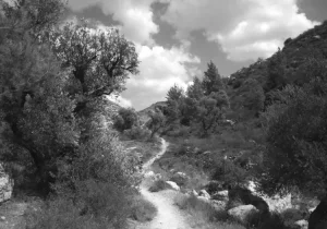
According to the field description published in Walid Khalidi's All That Remains, wild grass covered much of the village site and grew among the rubble of stone houses, which was sometimes difficult to distinguish from the ruins of collapsed agricultural terraces.
Almond trees grew on the mountain summit, while cactuses spread across the southern slopes. To the northeast, two carob trees stood amid the remains of a vineyard, and several agricultural terraces remained intact on the slopes.
This description should not be treated as a field verification of conditions in 2026. Fieldwork for All That Remains was conducted between 1987 and 1990, so it records the condition of the site during that survey period rather than providing a comprehensive contemporary assessment.
Sources
- PalQuest – Interactive Encyclopedia of the Palestine Question: Kasla
- PalQuest – Operation Dani
- Palestine Remembered – Kasla, Jerusalem District
- Palestinian Encyclopedia – Kasla
- Census of Palestine 1922 – official table recording Kasla with 233 inhabitants
- Census of Palestine 1931 – Jerusalem Sub-District: Kasla, 299 inhabitants and 72 houses
- Palestinian Villages Encyclopedia – Kasla; supporting community documentation
- Institute for Palestine Studies – Walid Khalidi, All That Remains
- PalQuest – All That Remains: Methodology
Photo gallery





Photos from the village's people
Photos sent in by visitors and published after review.
Add a photo of this village
Log in to add photos of this village.
Other villages from Al-Quds (Jerusalem)
More from the archive
 Al-Quds (Jerusalem)
The depopulated village of Khirbat al-Tannur - Allar al-Sifla / District of Al-Quds (Jerusalem)
 Al-Quds (Jerusalem)
The depopulated village of Jarash / District of Al-Quds (Jerusalem)
 Al-Quds (Jerusalem)
The depopulated village of al-Burayj (Bayarat Burayj) / District of Al-Quds (Jerusalem)
 Download Our Palestine App
The whole archive in the palm of your hand: depopulated villages, the Nakba, the massacres and Al-Aqsa — free, with no ads to erase the story.
Download Our Palestine App
The whole archive in the palm of your hand: depopulated villages, the Nakba, the massacres and Al-Aqsa — free, with no ads to erase the story.



Comments
No comments yet — be the first to write one.
Add your comment
Name and email are optional. Comments appear after review.