
The depopulated village of Sar'a / District of Al-Quds (Jerusalem)
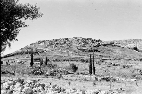
About the depopulated village of Sar'a
- District
- Al-Quds (Jerusalem)
- Date Sar'a was occupied
- 18 July 1948
- Population in 1948
- 390
- Military operation
- Operation Nachshon
- Brigade that carried it out
- Harel Brigade
- Who defended the village
- Egyptian Muslim Brotherhoods, some Arab Liberation Army volunteers, and some local Palestinian militia.
- Distance from the governorate centre
- 25 (km) West of Jerusalem
- Elevation above sea level
- 350 m
- Cause of displacement
- Military assault by Zionist troops
- Extent of destruction
- Sar'a was destroyed some time in 1949 to make room for the settlement of Tzor'a. Currently, the village site has been completely defaced.
- Ethnic cleansing
- Sar'a inhabitants were completely ethnically cleansed.
- Settlements built on the built-up area of Sar'a after 1948
- Tarum
Hover a dot to read the village name, or click to open its card.
Borders of the depopulated village of Sar'a
Sar'a – Jerusalem Subdistrict
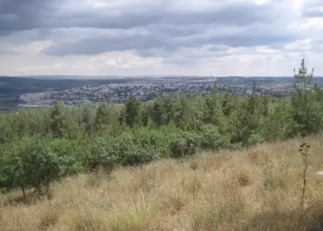
Sar'a was a depopulated Palestinian village in the Jerusalem subdistrict, located approximately 25 km west of Jerusalem at an average elevation of about 350 meters. The village stood on a prominent hill on the western slope of a mountain, overlooking the transitional zone between the Jerusalem hills and the coastal plain.
Sar'a had 271 inhabitants in the official 1931 Census of Palestine and 340 in the 1944/45 statistics. Its registered lands covered 4,967 dunums. Israeli occupation forces captured the village during Operation Dani on 13–14 July 1948; the village-specific force identified by Walid Khalidi was the Fourth Battalion of the Har'el Brigade.
Location of Sar'a
Sar'a stood on a prominent hill on the western slope of the Jerusalem highlands. A short secondary road, approximately 2 km long, linked the village with a main road running northeast of Bayt Jibrin and connecting with the Jerusalem–Jaffa highway.
Its elevated location overlooked lower terrain west of the Jerusalem hills. Sar'a also formed part of the cluster of Palestinian villages traditionally known as the 'Arqub area.
Palestine Remembered identifies the lands of 'Islin, Dayr Rafat, Dayr Aban, and Ishwa' among the areas adjoining Sar'a. Palestinian local sources also place Bayt Susin, Kafr 'Uriya, and other localities in its wider surroundings. Geographical proximity, however, should not automatically be treated as a precise cadastral boundary without consulting original land maps.
Name and Early History
Walid Khalidi considers it possible that Sar'a occupied the site of the ancient town known as Zorah or Sur'a and notes that the locality was known as Sarea during the Roman period. This identification should be treated as a historical and archaeological possibility rather than as an unquestionable demonstration of continuous settlement.
In 1596, Sar'a was a village in the nahiya of Ramla in the liwa' of Gaza, with an estimated population of approximately 94. The inhabitants paid taxes on wheat, barley, olives, goats, beehives, and other agricultural production.
The biblical scholar Edward Robinson passed near Sar'a in 1841 after leaving al-Latrun. In 1875, the village population was estimated at around 400. This was a contemporary estimate rather than an official census and should therefore be kept distinct from later Mandate-era population figures.
Sar'a in the Late Nineteenth Century
The Survey of Western Palestine described Sar'a as a village situated on a low, bare hill of white Eocene chalk. South of the village stood the maqam of al-Nabi Samat.
Some traditions associated the shrine with the biblical figure Samson. Such an identification is best understood as a religious or local tradition rather than as archaeological proof of the identity of the person buried there.
Built Environment
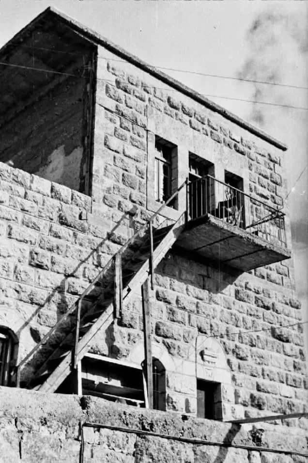
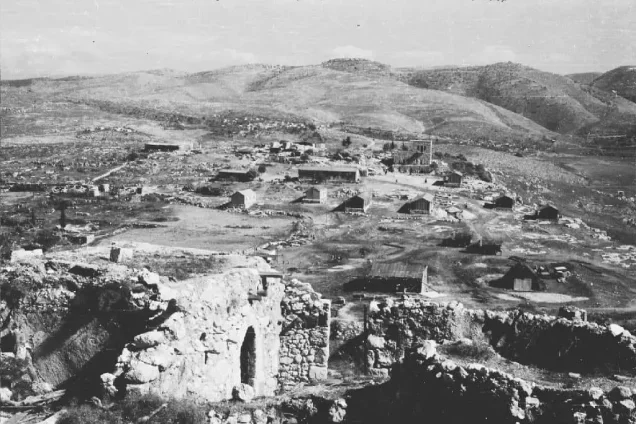
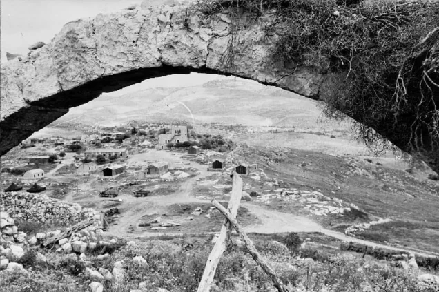
Sar'a was divided into three quarters. Houses of mud and stone were closely clustered within each quarter and separated by narrow, winding alleys.
Construction in the southern quarter extended uphill toward the summit, while the northern quarter expanded along the northeastern slope. Several small shops were located near the center of each quarter.
The village's built-up area covered approximately 16 dunums in the 1944/45 statistics.
Population of Sar'a
- 159694Estimate derived from an Ottoman tax register; not a modern census
- 1875About 400Contemporary historical estimate rather than an official census
- 1922205Official Census of Palestine; all inhabitants were Muslims
- 1931271Official Census of Palestine; all inhabitants were Muslims
- 1944/45340Official British Mandate-era statistics
- 1948394Later estimate published by Palestine Remembered; not an official census
- 19982,422 refugees and descendantsLater estimate published by Palestine Remembered
Number of Houses
- 193165Official Census of Palestine
- 194894Later estimate published by Palestine Remembered; not an official census figure
Land Ownership
Sar'a's registered land area totaled 4,967 dunums in the 1944/45 statistics. Palestine Remembered presents the simplified ownership categories as follows:
- Palestinian4,964 dunums100%
- Transferred to Zionists0 dunums0%
- Communal/Public3 dunums<1%
PalQuest preserves the official categories, recording 4,964 dunums as Arab land and 3 dunums as Public land. No area is recorded under Jewish ownership.
Land Use in 1944/45
- Arab
- Public
- Cereals2,979 dunums
- Plantations and irrigable land194 dunums
- Built-up land16 dunums
- Non-cultivable land1,778 dunums
The land-use figures therefore balance exactly with the village's total registered area.
Khalidi also records approximately 115 dunums of olive groves concentrated in the eastern part of the village lands. This is a crop-specific figure within the agricultural area and should not be added again to the overall land-use total.
Economic Life in Sar'a
Agriculture was the principal livelihood of the villagers. Cultivation depended on rainfall as well as irrigation water brought from springs in the valley floors.
The inhabitants cultivated cereals, olives, and fruit trees, including figs, apricots, and grapevines. Olive groves were concentrated in the eastern fields, while fruit trees were planted mainly to the north.
In 1944/45, 2,979 dunums were devoted to cereals and 194 dunums were irrigated or used for plantations. Forests and natural vegetation covered parts of the western and eastern slopes.
Several small shops served the village's three quarters, although the core sources reviewed do not provide enough evidence to document substantial additional craft or industrial activity.
Water
Agriculture at Sar'a was principally rain-fed, with spring water from the valley floors also used for irrigation.
The principal sources reviewed do not provide a fully verified list of the names of individual springs or wells, so unsupported local names have not been added.
Education in Sar'a
Khalidi's village entry does not identify a separate government school within Sar'a. Palestinian local documentation based on the history of neighboring Ishwa', however, records that the Ishwa' Government School also served children from Sar'a, 'Islin, and 'Artuf.
In 1944, a school building was established at a location roughly central to the participating villages, and instruction had developed through the seventh elementary grade.
The more accurate conclusion is therefore that children from Sar'a had access to a shared government school during the later Mandate period, rather than that a separately registered government school necessarily operated inside the village itself.
Shrines and Religious Life
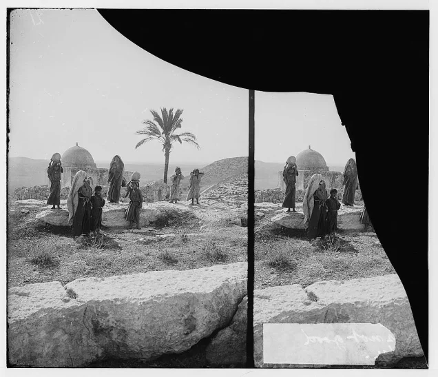
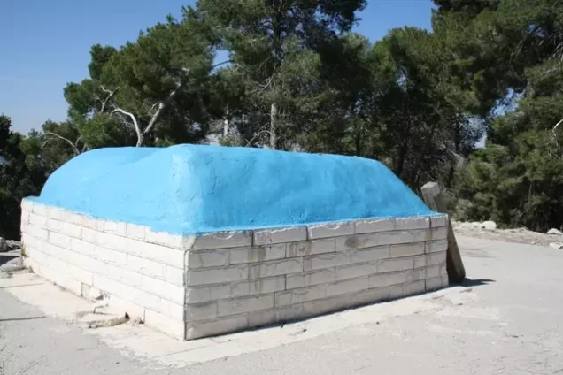
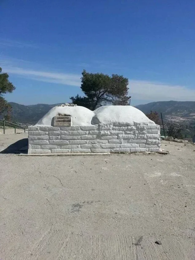
The population of Sar'a was entirely Muslim in the Mandate-era censuses. One of its principal religious landmarks was the maqam of al-Nabi Samat, also remembered locally as al-Nabi Samit, south of the village.
Palestine Remembered's summary records two shrines in Sar'a. Khalidi's later field survey also describes a surviving shrine on the western edge of the site containing the tombs of two local religious figures.
The association between the shrine of al-Nabi Samat and Samson belongs to religious and local tradition and should not be presented as a definitive archaeological identification.
Archaeological Remains
Sar'a was an archaeological site containing caves, tombs, rock-cut cisterns, and a press, all of which indicate earlier occupation of the locality.
Southeast of the village stood Khirbat al-Tahuna, where the remains included a building of squared masonry and foundations of older structures.
These remains attest to the antiquity of the site but are insufficient by themselves to establish the date or function of every archaeological feature.
Sar'a before Its Occupation in 1948
Sar'a's location in the highlands west of Jerusalem and near routes leading into the Jerusalem corridor gave it growing military significance during the fighting of 1948.
Following the end of the first truce, Israeli forces launched Operation Dani during the renewed period of fighting in July. It was the largest offensive of the interval between the two truces and aimed to expand the Israeli-controlled corridor leading toward Jerusalem.
Operation Dani
Operation Dani began on 9 July 1948 and ended on 18 July. It was conducted in two major stages. The first, between 9 and 12 July, concentrated on Lydda, Ramla, and their surrounding areas. The second, beginning on 13 July, extended eastward toward al-Latrun and the approaches to Jerusalem.
Several brigades participated in Operation Dani as a whole, including Har'el, Yiftach, Kiryati, Alexandroni, and Etziyyoni. In the specific case of Sar'a, however, the village entry identifies the Fourth Battalion of the Har'el Brigade as the force that captured the village.
Occupation and Depopulation of Sar'a
Walid Khalidi dates the occupation of Sar'a to 13–14 July 1948 during Operation Dani, as Israeli occupation forces advanced in the eastern sector of the operation.
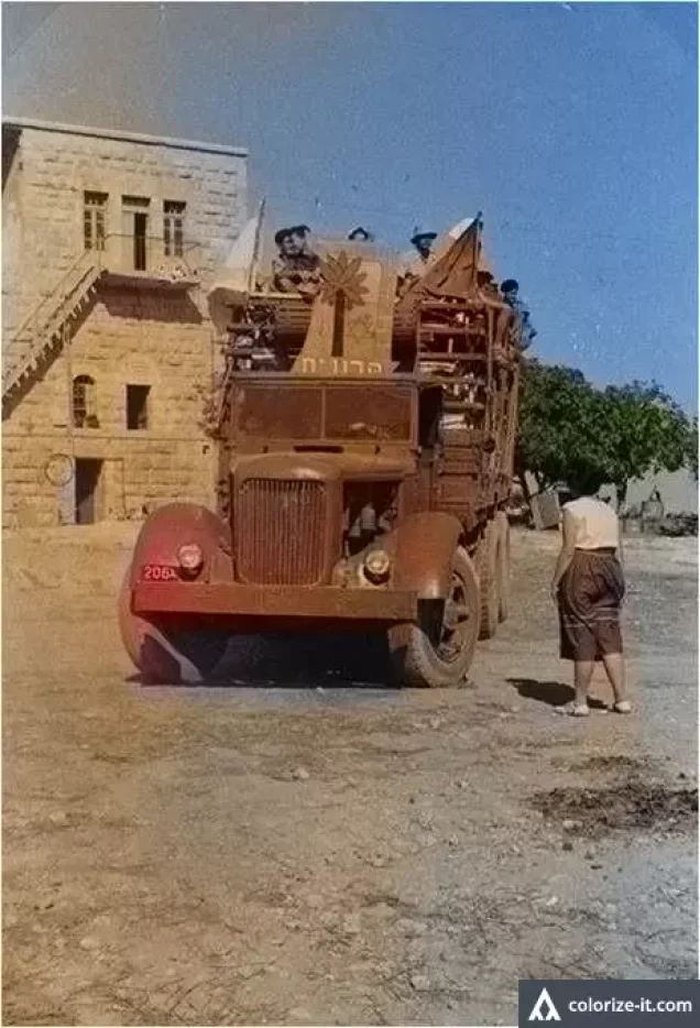
Egyptian forces were defending Sar'a when it was attacked. The Fourth Battalion of the Har'el Brigade captured the village in preparation for an assault on neighboring 'Artuf.
Palestine Remembered gives 18 July 1948 in the statistical header of its Sar'a page as the occupation date. Its detailed narrative, however, reproduces Khalidi's account dating the capture to 13–14 July.
Because of this internal discrepancy, 13–14 July 1948 is used here as the better-supported date of Sar'a's capture, while 18 July is retained only as the differing date appearing in Palestine Remembered's summary data.
Palestine Remembered classifies the cause of depopulation as a direct military assault. Khalidi's village-specific account establishes the attack and occupation but does not provide a separate precise date for the departure of every civilian resident. The villagers' displacement is therefore described in connection with the military assault without inventing an unsupported independent date.
Military Unit that Captured Sar'a
In the case of Sar'a, the village-specific attacking formation can be identified with greater precision than in many other village histories: the village was captured by the Fourth Battalion of the Har'el Brigade during Operation Dani.
This is more specific than merely noting that the Har'el Brigade participated in Operation Dani. Khalidi directly identifies the Fourth Battalion as the unit that took Sar'a in preparation for the subsequent attack on 'Artuf.
Occupation Chronology
- 9 July 1948
Beginning of Operation Dani
The largest Israeli offensive between the two truces began, with the objective of expanding the controlled corridor toward Jerusalem.
- 9–12 July 1948
First stage of Operation Dani
The offensive concentrated primarily on Lydda, Ramla, and their surrounding villages.
- 13 July 1948
Beginning of the second stage
Operations shifted eastward toward the al-Latrun area and the approaches to Jerusalem, with the Har'el Brigade active in this sector.
- 13–14 July 1948
Assault and occupation of Sar'a
The Fourth Battalion of the Har'el Brigade captured Sar'a, which was defended by Egyptian forces, in preparation for an attack on neighboring 'Artuf.
- In the context of the July assault and occupation
Depopulation
Palestine Remembered classifies direct military assault as the cause of the villagers' departure; the core village narrative does not provide a separate exact date for the departure of all residents.
- 18 July 1948
Different date in Palestine Remembered's summary
This appears in the site's statistical header but conflicts with the detailed Khalidi narrative and is therefore not used as the primary occupation date.
- After the occupation; exact date not established by the principal source
Destruction of the village
The built-up village was subsequently destroyed, leaving rubble and some religious and archaeological remains. Khalidi does not establish one exact date for the demolition of all houses.
Refugees from Sar'a
Palestine Remembered estimates Sar'a's population in 1948 at approximately 394. This is a later estimate rather than an official British Mandate census figure.
The same source estimates that refugees from Sar'a and their descendants numbered approximately 2,422 in 1998. This should likewise be understood as a later demographic estimate.
Israeli Settlements on or near Sar'a Village Lands
| Settlement | Established | Relationship to Sar'a |
|---|---|---|
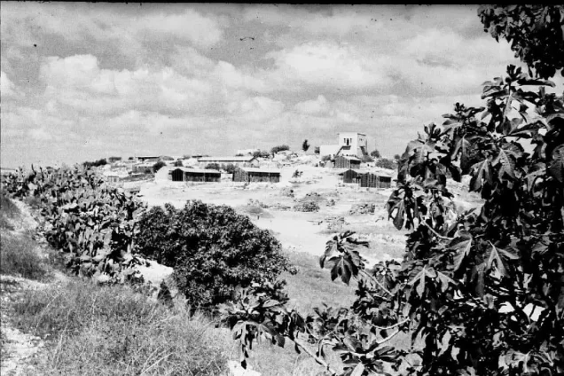
| Tarum | 1950 | Established on Sar'a village land on the northeastern side of the site |
| Tzor'a | 1949 | Established approximately 2 km southwest of Sar'a, but on land belonging to the Palestinian village of Dayr Aban rather than Sar'a |
This distinction is important because a settlement's proximity to a depopulated Palestinian village does not establish that it was built on that village's land. Khalidi's detailed entry clearly places Tarum on Sar'a's lands and Tzor'a on Dayr Aban's lands.
Sar'a Today
In the field description published by Walid Khalidi, stone rubble and iron girders from the village houses were scattered among trees at the site.
A flat stone surrounded by rubble carried Qur'anic inscriptions and the date A.H. 1355, approximately 1936. On the western edge of the site stood a shrine containing the tombs of two local religious figures.
A valley northeast of the village site was covered with fig, almond, and cypress trees.
This description does not constitute a direct field verification of conditions at Sar'a in 2026. The methodology of All That Remains states that field surveys of village sites were conducted between 1987 and 1990, before the book was published in 1992.
Later Palestinian community documentation also records visits to the site and changes affecting the village's shrines, cemetery, and landscape. Such material is useful for tracing the memory and transformation of the site but should not by itself be treated as a comprehensive contemporary archaeological or cadastral survey.
Sources
- PalQuestPalQuest – Sar'a
- PalQuestPalQuest – Operation Dani
- Palestine RememberedPalestine Remembered – Sar'a, Jerusalem District
- Palestine RememberedPalestine Remembered – Sar'a entry from Walid Khalidi's All That Remains
- Institute for Palestine StudiesInstitute for Palestine Studies – Walid Khalidi, All That Remains
- PalQuestPalQuest – All That Remains: Methodology and Field Research
- palqura.comPalestinian Villages Encyclopedia – Ishwa' Government School and its service to Sar'a and neighboring villages
Photo gallery

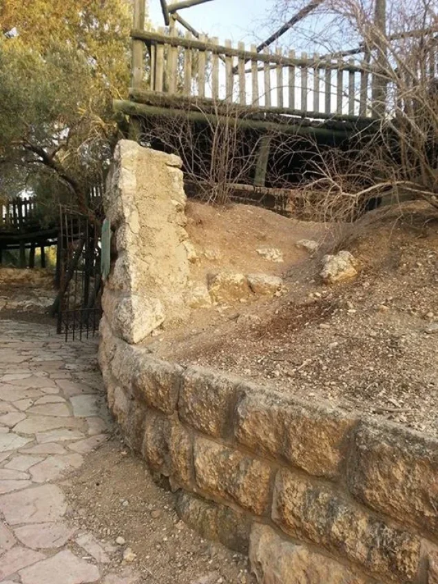
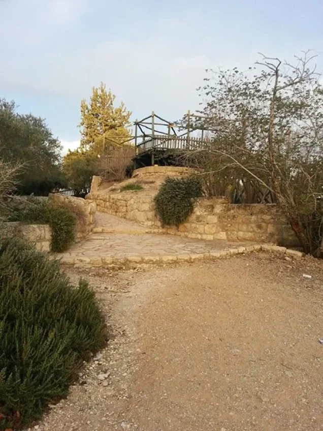

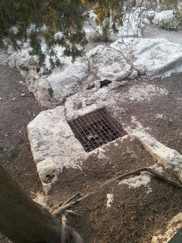
Photos from the village's people
Photos sent in by visitors and published after review.
Add a photo of this village
Log in to add photos of this village.
Other villages from Al-Quds (Jerusalem)
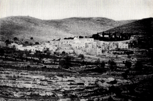
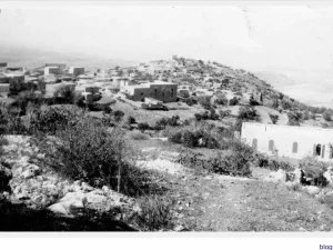
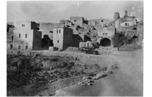
More from the archive
 Al-Quds (Jerusalem)
The depopulated village of Khirbat al-Tannur - Allar al-Sifla / District of Al-Quds (Jerusalem)
 Al-Quds (Jerusalem)
The depopulated village of Jarash / District of Al-Quds (Jerusalem)
 Al-Quds (Jerusalem)
The depopulated village of al-Burayj (Bayarat Burayj) / District of Al-Quds (Jerusalem)
 Download Our Palestine App
The whole archive in the palm of your hand: depopulated villages, the Nakba, the massacres and Al-Aqsa — free, with no ads to erase the story.
Download Our Palestine App
The whole archive in the palm of your hand: depopulated villages, the Nakba, the massacres and Al-Aqsa — free, with no ads to erase the story.



Comments
No comments yet — be the first to write one.
Add your comment
Name and email are optional. Comments appear after review.