
The depopulated village of Al-Jura (Jerusalem) / District of Al-Quds (Jerusalem)
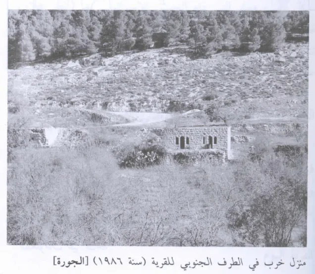
Al-Jura (Jerusalem)
About the depopulated village of Al-Jura (Jerusalem)
- District
- Al-Quds (Jerusalem)
- Date Al-Jura (Jerusalem) was occupied
- 11 July 1948
- Population in 1948
- 487
- Military operation
- Operation Dani
- Brigade that carried it out
- Not identified in the sources, which refer only to Israeli units operating in the southern part of the Jerusalem corridor
- Who defended the village
- Egyptian Army
- Distance from the governorate centre
- 8.5 km from Jerusalem
- Elevation above sea level
- 800 m
- Cause of displacement
- Military assault by Israeli occupation forces during Operation Dani; the available sources do not detail how the inhabitants left
- Extent of destruction
- The village was mostly destroyed with the exception of a single house.
- Ethnic cleansing
- al-Jura inhabitants were completely ethnically cleansed.
- Settlements built on the built-up area of Al-Jura (Jerusalem) after 1948
- Ora, established by Israel in 1950 on village land, about 0.5 km east of the village site
Hover a dot to read the village name, or click to open its card.
Borders of the depopulated village of Al-Jura (Jerusalem)
al-Jura: A Depopulated Palestinian Village in the Jerusalem District
Al-Jura was a depopulated Palestinian village in the Jerusalem District, located approximately 8.5 kilometers west of Jerusalem on a steep mountainside facing west and overlooking deep valleys. PalQuest gives the village an average elevation of approximately 800 meters above sea level.
- Subdistrict
- Jerusalem
- Distance from district center
- 8.5 km from Jerusalem
- Average Elevation
- 800 m above sea level
- Population in 1931
- 329
- Number of Houses in 1931
- 63
- Population in 1944/1945
- 420
- Estimated Population in 1948
- About 487 – a later demographic estimate, not an official census
- Total Land Area in 1945
- 4,158 dunams
- Attack and Depopulation
- Circumstantial evidence indicates that Israeli occupation forces first captured al-Jura in the course of Operation Dani, probably on 11 July 1948, when Israeli units operating in the southern part of the Jerusalem corridor captured two hilltops in the immediate vicinity of the village overlooking 'Ayn Karim, according to the History of the War of Independence as cited by Khalidi. The available sources give no details of how its inhabitants were displaced.
- Final Israeli Control
- Probably 11 July 1948, during Operation Dani; the date is inferred from the capture of two hilltops beside the village on that day, and the available sources give no later date for its occupation
- Military Operation
- Operation Dani
- Military Unit
- No specific unit is identified in the available sources; the History of the War of Independence, as cited by Khalidi, refers to Israeli units operating in the southern part of the Jerusalem corridor
- Cause of Depopulation
- Military assault by Israeli occupation forces during Operation Dani; the available sources do not detail how the inhabitants left
- Settlements Documented on Village Lands
- Ora, established by Israel in 1950 on village land, about 0.5 km east of the village site
The Government of Palestine's 1944/1945 statistics recorded 420 inhabitants and a total land area of 4,158 dunums. During the Nakba and the occupation of Palestine in 1948, al-Jura was probably first captured on 11 July during Operation Dani, when Israeli forces seized nearby heights overlooking 'Ayn Karim.
Location of al-Jura
- Al-Jura was located approximately 8.5 kilometers west of Jerusalem.
- PalQuest gives its average elevation as approximately 800 meters above sea level.
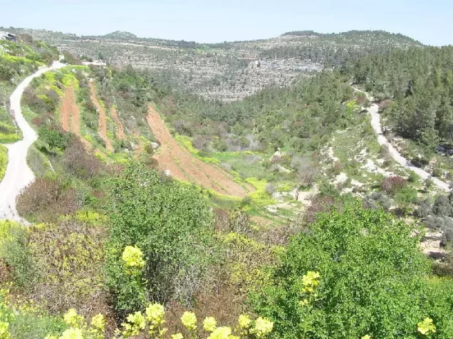
- The village stood on a steep mountainside facing west and overlooking deep valleys.
- A small valley running from east to west bordered the southern edge of the village.
- A secondary road connected al-Jura with the main road to Jerusalem.
- Other roads and tracks linked it with 'Ayn Karim, al-Walaja, Sataf, Khirbat al-Lawz, and neighboring villages.
Neighboring Villages and Localities
Al-Jura stood among several Palestinian communities in the Jerusalem hills, including 'Ayn Karim, al-Maliha, al-Walaja, Khirbat al-Lawz, Sataf, Ra's Abu 'Ammar, and al-Qastal.
A small hill separated al-Jura from 'Ayn Karim. The Palestinian Encyclopedia and Palestinian local documentation identify this area as al-Maskubiyya and record the presence there of the Miss Kerry School and a health resort or convalescent facility.
The Meaning of the Name al-Jura
The Arabic word “jura” refers to a hollow or depression relative to the surrounding terrain.
The Palestinian Encyclopedia describes the village as having developed in a relatively low area among the Jerusalem hills and gives an elevation of approximately 725 meters for this depression, compared with surrounding heights reaching about 851 meters.
PalQuest gives an average village elevation of approximately 800 meters. These figures do not undermine the explanation of the name, since the term refers to the site's position relative to the surrounding mountains rather than to a low elevation above sea level.
The Built Environment of al-Jura
In the late nineteenth century, al-Jura was described as a small hamlet situated on a hillside with olive trees growing below it.
The village originally developed in a roughly rectangular form, but later building expansion gradually changed its overall layout into an arc or crescent shape.
The villagers' houses were constructed of stone. The built-up area covered approximately 27 dunums according to the 1944/1945 statistics.
Population of al-Jura
The 1922 Census of Palestine recorded 234 inhabitants in al-Jura.
In the 1931 census, the population increased to 329 inhabitants living in 63 houses.
The Government of Palestine's 1944/1945 statistics recorded 420 inhabitants.
The figures of 487 inhabitants for 1948 and 2,992 refugees for 1998 published by Palestine Remembered are later estimates and are not official Government of Palestine censuses.
Population of al-Jura
- 1922234Official census under the British Mandate
- 1931329Official census under the British Mandate
- 1944/1945420Government of Palestine statistics
- 1948487Later estimate published by Palestine Remembered
- 19982,992Later refugee-population estimate published by Palestine Remembered
Number of Houses in al-Jura
The 1931 census recorded 63 houses in al-Jura.
The figure of 93 houses for 1948 published by Palestine Remembered is a later estimate rather than an official census conducted in that year.
Number of Houses in al-Jura
- 193163Official census
- 194893Later estimate published by Palestine Remembered
Public Services in al-Jura
Al-Jura had relatively limited public facilities and depended substantially on neighboring 'Ayn Karim and the city of Jerusalem for many services.
Palestine Remembered lists an elementary school in the village, although the principal sources used here do not provide a firmly documented date of establishment or detailed enrollment figures.
Water Sources in al-Jura
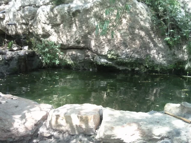
The villagers obtained drinking water from a spring west of al-Jura.
Other springs to the east and southwest were used to irrigate vegetable gardens and orchards.
The availability of springs and agricultural terraces contributed to the cultivation of fruit trees on the mountainous village lands.
Land Ownership in al-Jura
The total land area recorded for al-Jura in the 1944/1945 statistics was 4,158 dunums.
The Arabic Palestine Remembered table uses the categories “Palestinian,” “Transferred to Zionists,” and “Masha'.” These terms are preserved below to reflect the terminology of that source. The Government of Palestine statistics use the official categories “Arab,” “Jewish,” and “Public.”
Land Ownership in al-Jura, 1944/1945, Using the Terminology of Palestine Remembered
- Palestinian3,909 dunums94%
- Transferred to Zionists247 dunums6%
- Masha' (source terminology)2 dunums<1%
Land Use in al-Jura in 1944/1945
A total of 2,060 dunums was cultivated or classified as cultivable, including 1,971 dunums of Arab land and 89 dunums of Jewish land.
Cereals covered 846 dunums of Arab land. Plantations and irrigable land covered another 1,214 dunums, consisting of 1,125 dunums of Arab land and 89 dunums of Jewish land.
Land Use in al-Jura According to the 1944/1945 Statistics
- Arab
- Jewish
- Public
- Plantations and Irrigable Land1,214 dunums
- Cereals846 dunums
- Built-up Area27 dunums
- Non-Cultivable Land2,071 dunums
Palestine Remembered separately records approximately 176 dunums planted with olive trees. This figure does not appear as an independent additive category in the official land-use table and is therefore presented as supplementary agricultural information.
Economic Life in al-Jura
The people of al-Jura depended primarily on agriculture, cultivating cereals, vegetables, and fruit trees with the help of rainfall and the numerous springs found on village lands.
Al-Jura was particularly known for the quality of its fruit, especially grapes, while olive trees and other fruit trees were also cultivated.
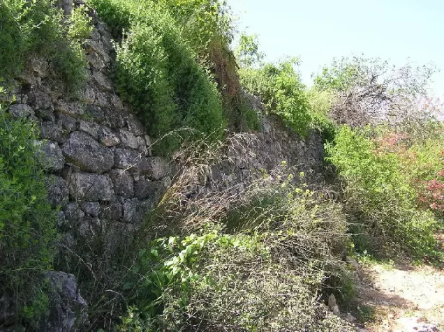
Agricultural terraces covered parts of the surrounding slopes and allowed villagers to make productive use of the mountainous terrain.
Archaeological Sites in al-Jura
Several archaeological sites in and around al-Jura indicated a long history of settlement in the area.
East of the village lay Khirbat Sa'ida and 'Ayn al-Jadida, where evidence of Byzantine and later Crusader occupation was recorded.
Nearby Khirbat al-Qusur has been identified by Walid Khalidi with the village of Qusur known in the sixteenth century.
Palestinian local sources also record ruined buildings, arches and foundations, and a stone lintel bearing a Greek inscription among the archaeological remains in the area.
Operation Dani
The occupation of al-Jura was associated with Operation Dani, a major Israeli military offensive that began on 9 July 1948 and continued until 18 July during the “Ten Days” of fighting between the First and Second Truces.
The operation was intended to widen the Israeli-held corridor toward Jerusalem while capturing Lydda, Ramla, and a number of villages and strategic positions in the Lydda–Ramla plain and the western approaches to Jerusalem.
The Har'el, Yiftach, Eighth Armored, Kiryati, Alexandroni, and Etzioni Brigades participated in Operation Dani. The principal sources dealing specifically with al-Jura, however, do not securely identify which one of these formations entered the village itself.
The Occupation of al-Jura in July 1948
Walid Khalidi and PalQuest conclude that al-Jura was probably first occupied on 11 July 1948 during Operation Dani.
The conclusion is based on an account stating that Israeli units operating in the southern section of the Jerusalem corridor captured two heights on that date immediately beside al-Jura. The heights overlooked 'Ayn Karim, and one was later named Mount Herzl.
After taking the heights, Israeli forces began shelling 'Ayn Karim. Because the positions lay directly along the boundaries of al-Jura, Khalidi concludes that the village probably fell at the same time.
For this reason, 11 July is used as the probable date of al-Jura's occupation, while acknowledging that the evidence is circumstantial rather than a detailed direct account of the village's capture.
The Israeli military-account details are presented here through the Palestinian intermediary source Khalidi/PalQuest rather than through independent reliance on Israeli sources.
al-Jura and 'Ayn Karim
The probable date of al-Jura's occupation should be distinguished from the final occupation of neighboring 'Ayn Karim.
The heights beside al-Jura were captured on 11 July and were then used to bombard 'Ayn Karim. The more detailed chronology indicates that the final assault on 'Ayn Karim began in the early hours of 18 July and that the village fell later that morning.
The probable occupation of al-Jura therefore preceded the final capture of 'Ayn Karim by approximately one week.
The Displacement of al-Jura's Inhabitants
The military assault and Israeli seizure of al-Jura and its surrounding area during Operation Dani resulted in the displacement of the Palestinian inhabitants during the Nakba.
Palestine Remembered classifies Zionist military assault as the immediate cause of depopulation, while Khalidi's village entry does not provide enough independent detail to reconstruct the precise departure of every family or a complete displacement route.
The article therefore does not attribute a specific expulsion order or detailed route of flight to one military unit without additional documentation.
Occupation and Depopulation Chronology
- 9 July 1948
Beginning of the military operation
Operation Dani, the largest offensive launched during the Ten Days between the two truces of the war, began and lasted until 18 July 1948; it was designed to expand the Israeli-held corridor to Jerusalem. PalQuest lists al-Jura among the villages affected by the operation.
- 11 July 1948
Capture of two hilltops beside the village
Israeli units operating in the southern part of the Jerusalem corridor captured two hilltops overlooking 'Ayn Karim (one of which was later renamed Mount Herzl) and began to bombard 'Ayn Karim before occupying it, according to the History of the War of Independence as cited by Khalidi. The two hills were located in the immediate vicinity of al-Jura.
- Probably 11 July 1948
Occupation of the village
Circumstantial evidence indicates that Israeli occupation forces first captured al-Jura in the course of Operation Dani, and Khalidi concludes that it probably fell at the same time as the two hilltops. The available sources give no later date for its occupation and no details of how its inhabitants were displaced.
- 1950
Settlement on village lands
Israel established the settlement of Ora on village land, about 0.5 km east of the village site.
Settlement Established on the Lands of al-Jura
In 1950, the Israeli settlement of Ora was established on the lands of al-Jura.
- Ora: established in 1950 on al-Jura's lands, approximately half a kilometer east of the village site.
Some secondary sources also associate Aminadav with the immediate area, but Palestinian sources concerning neighboring al-Walaja identify Aminadav with al-Walaja's lands. It is therefore not listed here as a settlement established on al-Jura's land.
The Site of al-Jura After the Nakba
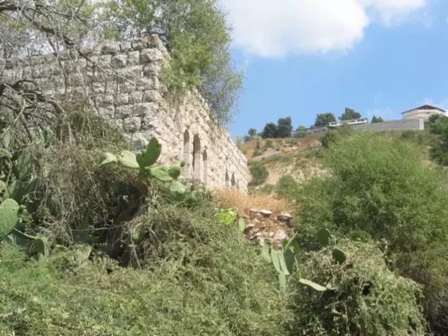
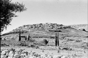
According to Walid Khalidi's field description, two stone houses remained standing on the valley slope at the southern edge of al-Jura.
The larger surviving house was a rectangular two-storey structure. Its upper floor contained two arched doors flanked by arched windows.
Almond groves covered a terrace on the valley slope, while fig, carob, and cypress trees and cactuses grew across the site.
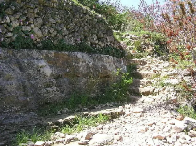
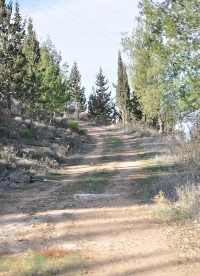
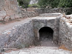
Ruins of village houses, stone stairways, and wells remained visible on adjacent land, and cypress forests surrounded the former village site.
This description is based on fieldwork conducted for Walid Khalidi's All That Remains and should not necessarily be treated as an updated field survey of the site today.
Sources
- PalQuestPalQuest – Interactive Encyclopedia of the Palestine Question: al-Jura, Jerusalem
- PalQuestPalQuest – Interactive Encyclopedia of the Palestine Question: Operation Dani
- PalQuestPalQuest – Interactive Encyclopedia of the Palestine Question: 'Ayn Karim
- Institute for Palestine StudiesInstitute for Palestine Studies: Walid Khalidi, All That Remains
- Palestine RememberedPalestine Remembered: al-Jura – Jerusalem District
- palestinapedia.psPalestinian Encyclopedia: al-Jura – Jerusalem District
- pal48.psFilastunna: al-Jura – Jerusalem District
Photo gallery

Photos from the village's people
Photos sent in by visitors and published after review.
Add a photo of this village
Log in to add photos of this village.
More from the archive
 Al-Quds (Jerusalem)
The depopulated village of Khirbat al-Tannur - Allar al-Sifla / District of Al-Quds (Jerusalem)
 Al-Quds (Jerusalem)
The depopulated village of Jarash / District of Al-Quds (Jerusalem)
 Al-Quds (Jerusalem)
The depopulated village of al-Burayj (Bayarat Burayj) / District of Al-Quds (Jerusalem)
 Download Our Palestine App
The whole archive in the palm of your hand: depopulated villages, the Nakba, the massacres and Al-Aqsa — free, with no ads to erase the story.
Download Our Palestine App
The whole archive in the palm of your hand: depopulated villages, the Nakba, the massacres and Al-Aqsa — free, with no ads to erase the story.



Comments
No comments yet — be the first to write one.
Add your comment
Name and email are optional. Comments appear after review.