
The depopulated village of Jubb Yusuf / District of Safed

Subdistrict: Safad
Population in 1948: Approximately 197
Date of occupation and depopulation: 4 May 1948
Military operation: Operation Yiftach
Attacking force: Palmach units operating under the Haganah
Settlement established on village land before 1948: ‘Ammi‘ad, originally established in 1946 under the name HaHoshlim
Settlements established on the built-up village site after 1948: None
Jubb Yusuf
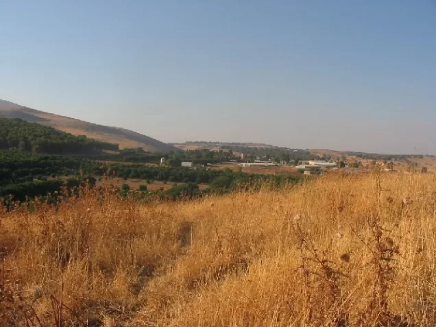
Jubb Yusuf was a Palestinian village in the Safad Subdistrict, situated approximately six kilometres southeast of Safad and northwest of Lake Tiberias. It stood on a level volcanic plain with reddish soil, at an elevation of approximately 250 metres above sea level.
A highway connecting Safad and Tiberias passed a short distance east of the village. Its closely clustered houses were built of mud brick, basalt, and limestone.
The village had a domed mosque. Numerous wells and springs supplied water for domestic use and irrigation. The springs attracted members of the Bedouin ‘Arab al-Suyyad tribe, who settled in the village, cultivated its land, and constituted most of its entirely Muslim population.
Historical Importance of Jubb Yusuf
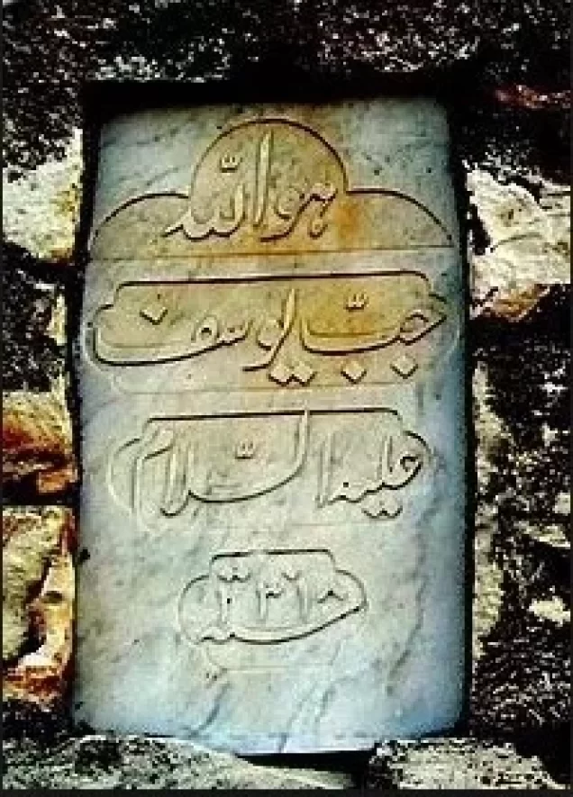
The village took its name from the nearby well known as Jubb Yusuf, or “Joseph’s Well.” According to Muslim tradition, it was associated with the pit into which the prophet Yusuf was cast by his brothers. The site was also known as Khan Jubb Yusuf because it had served for centuries as a stopping place for travellers on the route to Damascus.
The Arab geographer al-Maqdisi described it in 985 as a resting place on the Damascus road. Salah al-Din al-Ayyubi reportedly stopped there while travelling to confront the Crusader forces at the Battle of Hittin in 1187. In the fourteenth century, Ibn Battuta described the well as large and deep and situated in the courtyard of a small mosque.
In the early eighteenth century, the scholar and traveller ‘Abd al-Ghani al-Nabulsi recorded a domed structure over the well, a mosque, and a well-built khan. By the early nineteenth century, the Swiss traveller Johann Ludwig Burckhardt reported that the khan was falling into ruin.
Boundaries of Jubb Yusuf
Jubb Yusuf was bordered by the following villages and localities:
- North: al-Ja‘una.
- Northwest: ‘Akbara.
- West and southwest: al-Qudayriyya.
- South: al-Samakiyya.
- East: al-Zanghariyya, including the locality known as Zihliq.
Economic Life in Jubb Yusuf
The inhabitants depended on agriculture and livestock raising. Their principal crops included wheat, barley, vegetables, fruit, and olives. They also raised goats and maintained beehives.
In 1944/45, a total of 2,477 dunams was devoted to cereal cultivation. The relatively large area classified as uncultivable included rocky and grazing land.
Land Ownership in Jubb Yusuf
| Ownership category | Area (dunams)* |
|---|---|
| Palestinian-owned | 11,230 |
| Jewish-owned | 0 |
| Public land | 95 |
| Total | 11,325 |
* One dunam equals approximately 1,000 square metres.
Land Use in Jubb Yusuf in 1945
| Type of land use | Palestinian land (dunams)* |
|---|---|
| Cereal cultivation | 2,477 |
| Cultivable land | 2,477 |
| Uncultivable land | 8,848 |
* One dunam equals approximately 1,000 square metres.
Population of Jubb Yusuf
Ottoman tax records from 1596 listed Jubb Yusuf as a village in the nahiya of Jira, within the liwa of Safad, with an estimated population of 72. The residents paid taxes on wheat, barley, fruit, goats, and beehives.
The population was recorded as 59 in 1922 and 93 in 1931. By 1945, it had risen to 170. The estimated population at the time of the Nakba was approximately 197.
Population Figures for Jubb Yusuf
| Year | Population* |
|---|---|
| 1596 | 72 |
| 1922 | 59 |
| 1931 | 93 |
| 1945 | 170 |
| 1948 estimate | 197 |
| Estimated number of refugees in 1998 | 1,211 |
* The figures for 1948 and 1998 are demographic estimates rather than contemporary census counts.
Number of Houses in Jubb Yusuf
| Year | Number of houses |
|---|---|
| 1931 | 17 |
| 1948 estimate | 36 |
Occupation and Depopulation of Jubb Yusuf
Units of the Arab Liberation Army clashed with Jewish military convoys south of Jubb Yusuf on at least two occasions during the early weeks of the fighting. According to records attributed to Arab Liberation Army commander Fawzi al-Qawuqji, the confrontations took place on 12 and 26 February 1948. British forces intervened on both occasions to end the fighting.
During the second half of April, the Haganah launched Operation Yiftach in eastern Galilee. In a report submitted to the Haganah General Staff on 22 April, Palmach commander Yigal Allon recommended removing the Bedouin communities encamped between the Jordan River, Jubb Yusuf, and Lake Tiberias.
According to Benny Morris’s reconstruction, the village itself was not attacked until 4 May 1948. He states that its inhabitants were probably expelled at that time. The date should therefore be treated as the best-supported estimate rather than as a fully documented account of the precise sequence of the village’s occupation.
Historical and Religious Remains
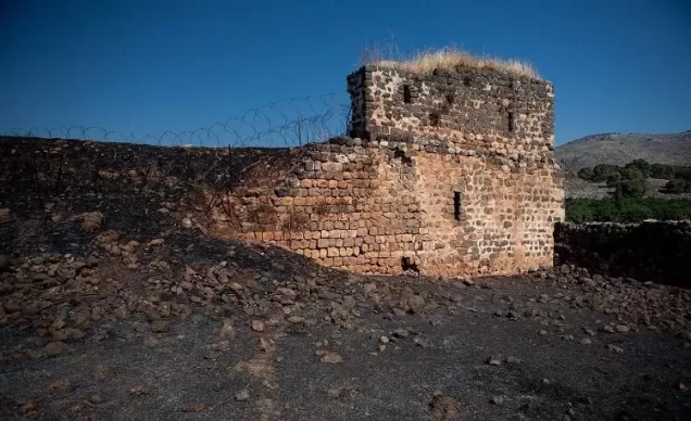
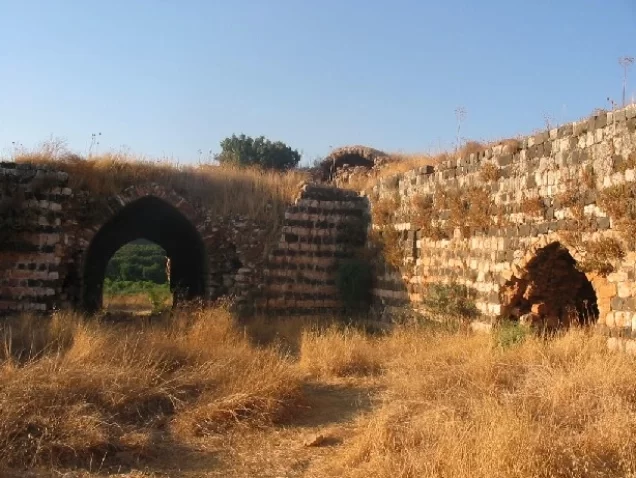
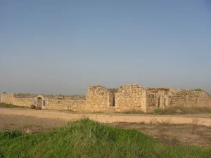
A shrine dedicated to the local religious figure Shaykh ‘Abdallah stood in the village. Several ruined sites were also located east of Jubb Yusuf. The village’s most prominent historical structure was its khan, which formed part of a long-established stopping place on the regional travel route.
The domed structure associated with Joseph’s Well should be distinguished from the domed tomb of Shaykh ‘Abdallah. Published accounts sometimes conflate the well, the mosque, the khan, and the shrine, although they were distinct components of the historical site.
Settlement Established on the Land of Jubb Yusuf
The settlement of ‘Ammi‘ad was established on village land in 1946, north of the Palestinian village site. Its founding group initially occupied an outpost near Jubb Yusuf and later used the name HaHoshlim before adopting the name ‘Ammi‘ad.
Korazim was not established on the land of Jubb Yusuf; it stands on land associated with the depopulated village of al-Samakiyya. Vered HaGalil is likewise not listed by Walid Khalidi among the settlements established on Jubb Yusuf’s land. Accordingly, neither should be presented as occupying the village site without parcel-level cadastral evidence.
Jubb Yusuf Today
The principal surviving remains are the thorn-covered khan and the domed tomb of Shaykh ‘Abdallah. Fig and carob trees grow at the site, while residents of ‘Ammi‘ad cultivate much of the former village land.
Infrastructure belonging to the water-diversion system is located near the village site. It includes facilities connected to the pumping station at al-Tabigha, approximately six kilometres to the south, which draws water from Lake Tiberias.
Sources
- Palestine Remembered: Jubb Yusuf, Safad Subdistrict.
- Institute for Palestine Studies: All That Remains.
- Walid Khalidi, ed., All That Remains, Institute for Palestine Studies, 1992.
- Government of Palestine, Department of Statistics, Village Statistics, April 1945.
- Government of Palestine, Census of Palestine, 1922 and Census of Palestine, 1931.
- Fawzi al-Qawuqji, “Memoirs, 1948,” Journal of Palestine Studies, vol. 1, no. 4.
Photo gallery




Photos from the village's people
Photos sent in by visitors and published after review.
Add a photo of this village
Log in to add photos of this village.
Other villages from Safed


 Download Our Palestine App
The whole archive in the palm of your hand: depopulated villages, the Nakba, the massacres and Al-Aqsa — free, with no ads to erase the story.
Download Our Palestine App
The whole archive in the palm of your hand: depopulated villages, the Nakba, the massacres and Al-Aqsa — free, with no ads to erase the story.



Comments
No comments yet — be the first to write one.
Add your comment
Name and email are optional. Comments appear after review.