
The depopulated village of Bayt 'Affa / District of Gaza
Subdistrict: Gaza
Estimated population of Bayt 'Affa in 1948: 812
Date of occupation and depopulation: The village was first occupied and lost again around 9–11 July 1948; it was probably occupied for the final time in the second half of October during Operation Yoav. The exact final date is uncertain.
Military unit: Giv'ati Brigade during the July battles; the Second Battalion held the village during one phase, while the Fourth Battalion failed to recapture it on 17–18 July
Israeli settlements established on Bayt 'Affa’s lands before 1948: None
Israeli settlements established on the village site or its lands after 1948: None documented in the principal academic source
Bayt 'Affa was a Palestinian village situated approximately 29 kilometres northeast of Gaza, 5 kilometres northwest of al-Faluja, and about 2 kilometres north of the al-Faluja–al-Majdal road.
Name of Bayt 'Affa
Local etymological accounts associate the word 'Affa with proposed Syriac meanings connected either with flowering or with burial, producing interpretations such as “the house of flowers” or “the house of burial.” The latter interpretation has sometimes been linked to the village shrine traditionally attributed to the prophet Salih. These explanations have not been conclusively established by the academic sources consulted and should be treated as local etymological traditions.
Location of Bayt 'Affa
Bayt 'Affa lay between 'Ibdis and 'Iraq Suwaydan, approximately one kilometre from each. Its location was less strategically prominent than that of villages situated directly along the principal roads, such as al-Faluja and 'Iraq Suwaydan.
The village stood on a small hill in a slightly elevated area adjoining the coastal plain. Its average elevation was approximately 100 metres above sea level. Wadi al-Rana ran immediately east of the village.
Boundaries of Bayt 'Affa
Bayt 'Affa was surrounded by the following Palestinian villages:
North: 'Ibdis.
Southwest: 'Iraq Suwaydan.
Southeast: Karatiyya.
East: Hatta.
Bayt 'Affa before 1948
- Secondary roads linked the village to two highways, one to the north and another to the south. These roads provided access to al-Majdal and the coastal highway.
- In the late nineteenth century, Bayt 'Affa was described as a moderately sized village whose houses were constructed mainly of adobe brick. Its inhabitants were Palestinian Muslims.
- The villagers maintained a shrine dedicated to a man they believed to be the prophet Salih.
- Bayt 'Affa depended on the larger neighbouring village of al-Faluja, southeast of the village, for commercial and educational services.
- The village stood on part of a small hill adjoining the coastal plain. The terrain resembled the elevated kurkar formations around 'Iraq Suwaydan.
- The village was constructed over an earlier settlement, and archaeological remains were recorded in and around its lands.
- The fourteenth-century Sufi scholar al-Faluji reportedly lived in Bayt 'Affa after migrating to Palestine from Iraq, before moving to the locality that later became al-Faluja.
Economic Life in Bayt 'Affa
- The inhabitants worked primarily in rainfed agriculture, cultivating cereals and grapes. In 1944/45, 5,657 dunams were devoted to cereal cultivation, while 14 dunams were irrigated or used for orchards.
- Some villagers raised livestock and grazed their animals on the rangelands between Bayt 'Affa and Kawkaba to the southwest.
Education in Bayt 'Affa
Bayt 'Affa did not have an independent village school. Pupils relied on educational services in neighbouring villages. Available local accounts state that some attended the shared school at 'Iraq Suwaydan, while al-Faluja also provided educational services to the village.
Population of Bayt 'Affa
- Ottoman fiscal records from 1596 indicate a population of approximately 143. The British Mandate census recorded 422 inhabitants in 1922 and 462 inhabitants living in 105 houses in 1931.
- The population was officially estimated at 700 in 1945. A later demographic projection estimated that it had reached approximately 812 by 1948.
- The estimated number of Palestinian refugees originating from Bayt 'Affa and their descendants was 4,987 in 1998.
- The inhabitants recorded during the British Mandate were Palestinian Muslims.
Historical Population of Bayt 'Affa
| Year | Population | Type of figure |
|---|---|---|
| 1596 | 143 | Estimate based on Ottoman fiscal records |
| 1922 | 422 | British Mandate census |
| 1931 | 462 | British Mandate census |
| 1945 | 700 | Official population estimate |
| 1948 | 812 | Demographic projection |
| Estimated refugee population in 1998 | 4,987 | Later demographic estimate |
The 1948 population and the 1998 refugee population are demographic estimates rather than contemporary census counts.
Number of Houses in Bayt 'Affa
| Year | Number of houses | Type of figure |
|---|---|---|
| 1931 | 105 | British Mandate census |
| 1948 | 184 | Estimate |
Archaeological Remains in Bayt 'Affa
- Archaeologists recorded a shrine and architectural fragments east of the village in Wadi al-Rana.
- A khirba on the village lands contained the remains of walls constructed from uncut stone, together with a well and ancient columns. Some local accounts identify this site as Khirbat Mamin, although the principal academic source does not record that name.
- The village contained the shrine known as Maqam al-Nabi Salih.
Lands of Bayt 'Affa
Bayt 'Affa’s lands covered 5,808 dunams. In 1944/45, 14 dunams were irrigated or used for orchards, 5,657 dunams were allocated to cereals, and 26 dunams formed the built-up area. Cultivable land totalled 5,671 dunams, while 111 dunams were classified as uncultivated.
Land Ownership in Bayt 'Affa
| Ownership category | Area (dunams)* |
|---|---|
| Palestinian ownership | 5,707 |
| Jewish ownership | 0 |
| Public land | 101 |
| Total | 5,808 |
* One dunam equals approximately 1,000 square metres.
Land Use in Bayt 'Affa in 1944/45
| Land-use category | Palestinian land (dunams)* | Public land (dunams)* | Total (dunams)* |
|---|---|---|---|
| Irrigated land and orchards | 14 | 0 | 14 |
| Cereal cultivation | 5,657 | 0 | 5,657 |
| Built-up area | 26 | 0 | 26 |
| Cultivable land | 5,671 | 0 | 5,671 |
| Uncultivated land | 10 | 101 | 111 |
* One dunam equals approximately 1,000 square metres.
Occupation and Depopulation of Bayt 'Affa
Shortly after midnight on 27 January 1948, a Zionist militia unit entered the outskirts of Bayt 'Affa and attempted to place explosives in several outlying houses. According to a contemporary report in the Palestinian newspaper Filastin, village guards detected the infiltrators and engaged them for approximately two hours, compelling them to withdraw towards the settlement of Negba.
Accounts of the village’s occupation diverge, and the available evidence indicates that Bayt 'Affa changed hands at least twice. Benny Morris states that Giv'ati forces occupied it on 14–15 July 1948 during the period between the first and second truces, as part of an offensive intended to extend the brigade’s area of control southwards towards the approaches to the Naqab.
Other accounts place the first occupation slightly earlier. Egyptian writer Muhammad Abd al-Mun'im states that Israeli forces captured the village during the night of 10–11 July from Palestinian militiamen assigned to defend it, before regular Egyptian forces recaptured it on the morning of 11 July. Contemporary press reporting likewise indicates that Israeli forces briefly seized Bayt 'Affa around 9–10 July and then lost it to Arab forces.
During one phase of the fighting, a platoon of the Giv'ati Brigade’s Second Battalion held the village. On 17–18 July, the brigade’s Fourth Battalion, supported by a naval landing party, attempted unsuccessfully to recapture it.
Bayt 'Affa was probably occupied for the final time during Operation Yoav in the second half of October 1948. Palestine Open Maps gives 15 October as the depopulation date, but Walid Khalidi’s account does not establish a precise date for the final occupation. Estimates therefore vary between sources. The inhabitants were probably displaced during the first occupation in July, several months before final Israeli control was established.
Bayt 'Affa Today
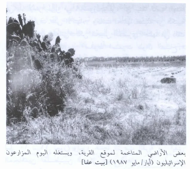
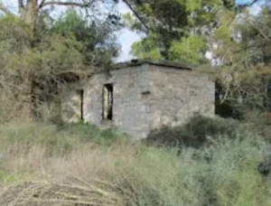
The village was destroyed, and no traces of its houses remained when the site was documented by Walid Khalidi’s research team. Sycamore and carob trees and cactus plants marked the former village site.
The surrounding lands were cultivated with fruit trees, especially citrus, and were irrigated through water channels connected to the Jordan River diversion system.
Settlements near Bayt 'Affa
In 1953, the Israeli settlement of Yad Natan was established near Bayt 'Affa, immediately south of its site. However, Walid Khalidi and PalQuest place Yad Natan on the lands of the neighbouring Palestinian village of 'Iraq Suwaydan, northwest of Bayt 'Affa. It should therefore not be listed as an Israeli settlement established on Bayt 'Affa’s lands.
No Israeli settlement is identified by the principal academic source as having been established directly on the built-up site or registered lands of Bayt 'Affa.
Sources
- Interactive Encyclopedia of the Palestine Question: Bayt 'Affa.
- Walid Khalidi, ed., All That Remains: The Palestinian Villages Occupied and Depopulated by Israel in 1948, Institute for Palestine Studies.
- Institute for Palestine Studies: “Scenes of Everyday Life in Bayt 'Affa”.
- Palestine Remembered: Bayt 'Affa, Gaza Subdistrict.
- Palestine Open Maps: Bayt 'Affa.
- Village Statistics, April 1945, Government of Palestine.
- Benny Morris, The Birth of the Palestinian Refugee Problem, 1947–1949, as cited by Walid Khalidi and PalQuest.
Photo gallery


Photos from the village's people
Photos sent in by visitors and published after review.
Add a photo of this village
Log in to add photos of this village.
Other villages from Gaza
 Download Our Palestine App
The whole archive in the palm of your hand: depopulated villages, the Nakba, the massacres and Al-Aqsa — free, with no ads to erase the story.
Download Our Palestine App
The whole archive in the palm of your hand: depopulated villages, the Nakba, the massacres and Al-Aqsa — free, with no ads to erase the story.



Comments
No comments yet — be the first to write one.
Add your comment
Name and email are optional. Comments appear after review.