
The depopulated village of Indur / District of Nazareth
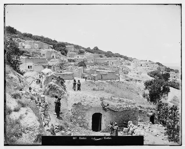
About the depopulated village of Indur
- District
- Nazareth
- Date Indur was occupied
- 24 May 1948
- Population in 1948
- 720
- Military operation
- Operation Gideon
- Brigade that carried it out
- Golani Brigade
- Who defended the village
- Some Palestinian and ALA volunteers, and possibly some Syrian Army.
- Distance from the governorate centre
- 10.5 (km) Southeast of Nazareth
- Elevation above sea level
- 175 m
- Extent of destruction
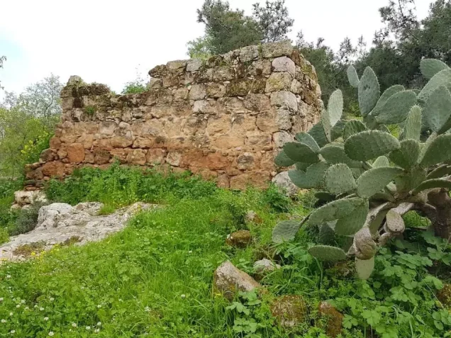
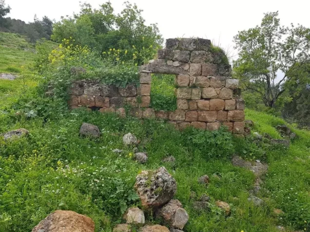
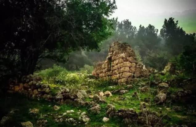
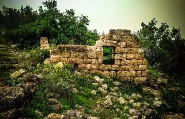
- Indur was completely destroyed, and only house walls and rubble left behind.
- Ethnic cleansing
- Indur inhabitants were completely ethnically cleansed.
Hover a dot to read the village name, or click to open its card.
Borders of the depopulated village of Indur
Indur: A Depopulated Palestinian Village in the Nazareth District
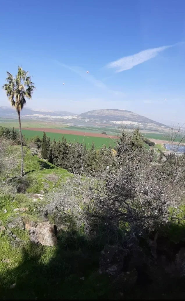
Indur, also associated with the historical name 'Ayn Dur or Endor, was a depopulated Palestinian village in the Nazareth District. It was located approximately 10.5 kilometers southeast of Nazareth on the northeastern slopes of Mount al-Dahi, overlooking the Marj ibn 'Amir plain to the north. Its average elevation was approximately 175 meters above sea level.
The Government of Palestine's 1944/1945 statistics recorded 620 inhabitants, all Muslims, and a total land area of 12,444 dunums. During the Nakba and the occupation of Palestine in 1948, Indur came under the control of the Golani Brigade on 24 May 1948, following the fall of Baysan and during the continuation of Israeli military operations in the Baysan Valley and the southeastern approaches to Lower Galilee.
Key Facts About Indur
- Subdistrict: Nazareth.
- Distance from Nazareth: approximately 10.5 kilometers southeast.
- Average elevation: approximately 175 meters above sea level.
- Population in 1944/1945: 620.
- Estimated population in 1948: 719 according to Palestine Remembered.
- Total land area: 12,444 dunums.
- Date of occupation: 24 May 1948 according to Walid Khalidi/PalQuest.
- Military formation: Golani Brigade.
- Post-1948 Israeli settlements on village land: none.
Location of Indur
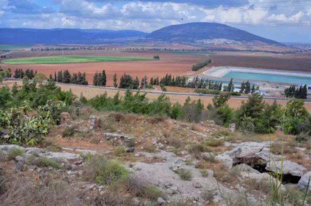
Indur stood on the lower northeastern slopes of Mount al-Dahi, facing north toward the broad Marj ibn 'Amir plain.
The village was several kilometers from a highway connecting the Tiberias and Nazareth areas. The pipeline of the British-owned Iraq Petroleum Company passed approximately half a kilometer north of the village.
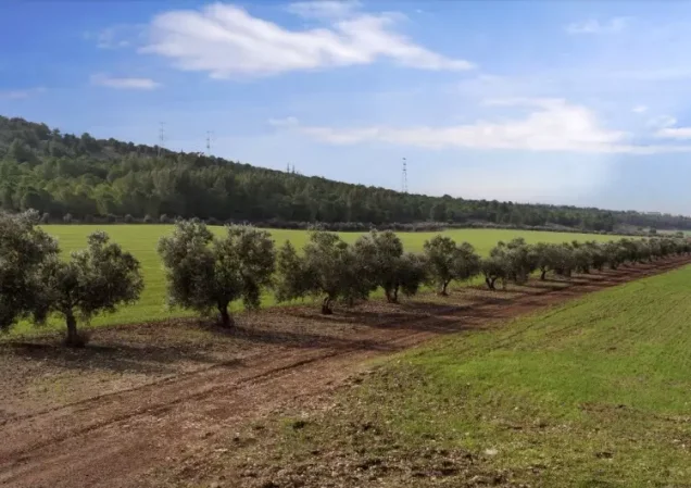
The surrounding landscape combined mountain slopes with flatter agricultural land overlooking the plain.
Neighboring Villages and Localities
Indur lay among a number of Palestinian villages and localities in the Nazareth and Marj ibn 'Amir area, including:
- Dabburiyya to the north.
- Iksal to the northwest.
- Nin to the west.
- al-Dahi to the southwest.
- Na'ura to the south.
- Tamra to the southeast.
- Kafr Misr to the east.
- Mount Tabor to the northeast of the village area.
The Name and Ancient History of Indur
Walid Khalidi suggests that the name Indur probably preserved that of the ancient Canaanite town of 'Ayn Dur, or Endor, a name associated with the meaning “spring of the sanctuary.”
'Ayn Dur appears in the biblical account concerning Saul's consultation with a diviner before his battle with the Philistines.
The precise location of the ancient town has not been conclusively established. Khalidi notes that it may have stood at the site of Indur itself or at nearby Tall al-'Ajjul or Khirbat al-Safsafa.
The locality was known as Endor during the Crusader period.
Indur in the Ottoman Period
In 1596, Indur was recorded in the nahiya of Shafa within the liwa' of Lajjun and had an estimated population of approximately twenty-two.
The inhabitants paid taxes on crops including wheat, barley, and olives, as well as on goats, beehives, and other forms of property and production.
The Built Environment of Indur
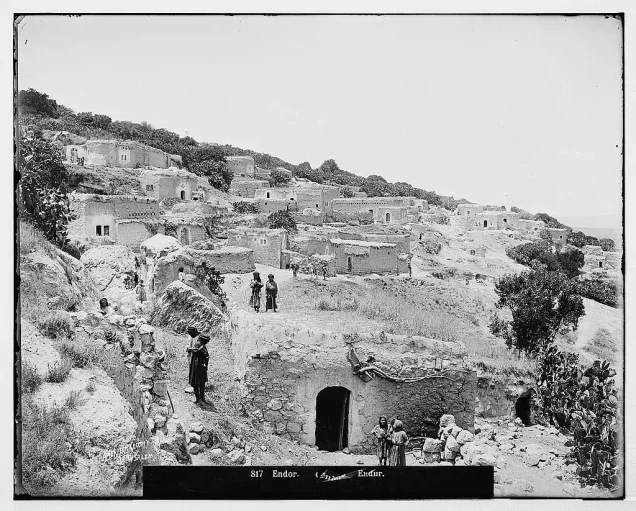
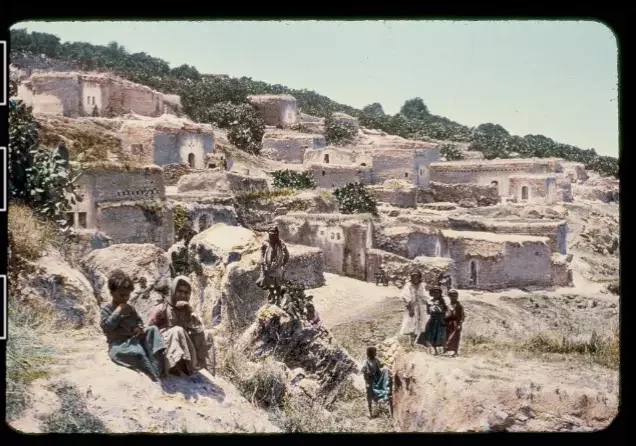
In the late nineteenth century, Indur was described as an adobe-built village situated against a steep hillside, with several small caves in the higher ground nearby.
During the British Mandate, the village consisted of a winding chain of houses whose layout followed the contours of the hillside.
Houses were constructed of stone and cement or stone and mud. The built-up area covered approximately 29 dunums according to the 1944/1945 statistics.
Population of Indur
The 1922 Census of Palestine recorded 311 inhabitants in Indur, including 310 Muslims and one Christian.
By the 1931 census, the population had increased to 445, including 444 Muslims and one Christian, living in 75 houses.
The Government of Palestine's 1944/1945 statistics recorded 620 inhabitants, all classified as Muslims.
The figures of 719 inhabitants for 1948 and 4,417 refugees for 1998 published by Palestine Remembered are later demographic estimates rather than official Government of Palestine censuses.
Population of Indur
- 1596About 22Historical estimate based on Ottoman records
- 1922311Official census: 310 Muslims and one Christian
- 1931445Official census: 444 Muslims and one Christian
- 1944/1945620Government of Palestine statistics; all Muslims
- 1948719Later estimate published by Palestine Remembered
- 19984,417Later refugee-population estimate published by Palestine Remembered
Number of Houses in Indur
The 1931 Census of Palestine recorded 75 houses in Indur.
The figure of 121 houses for 1948 published by Palestine Remembered is a later estimate rather than the result of an official census conducted that year.
Number of Houses in Indur
- 193175Official census
- 1948121Later estimate published by Palestine Remembered
Shaykh Tawfiq Ibrahim and the 1936–1939 Revolt
Shaykh Tawfiq Ibrahim was one of the most prominent people from Indur and took part in Palestinian resistance to British rule.
He was one of the leaders of the 1936–1939 Palestinian Revolt and an associate of Shaykh Izzeddin al-Qassam, whose death while fighting British forces in 1935 was one of the developments preceding the outbreak of the revolt the following year.
Education in Indur
An elementary school was established in Indur during the Ottoman period. Children from neighboring Nin also attended the school.
The British Mandate authorities subsequently closed it.
The principal sources used here do not provide a securely documented founding year or enrollment figure, and no unsupported date is therefore assigned to the school.
Water Sources in Indur
Palestinian local documentation describes Indur as relatively well supplied with natural water sources.
One of the principal sources was 'Ayn al-Dalafa, located inside a cave south of the village and remembered for its clear, fresh water. 'Ayn al-Safsaf was another local water source.
These names are presented as part of the Palestinian local documentation of the village.
Land Ownership in Indur
The Government of Palestine's 1944/1945 statistics recorded a total land area of 12,444 dunums for Indur, with no Jewish land ownership recorded.
The Arabic Palestine Remembered table uses the categories “Palestinian,” “Transferred to Zionists,” and “Masha'.” These terms are retained below as that source's terminology. The official Government of Palestine categories for the same figures were “Arab” and “Public.”
Land Ownership in Indur, 1944/1945, Using Palestine Remembered Terminology
- Palestinian10,414 dunums84%
- Transferred to Zionists0 dunums0%
- Masha' (source terminology)2,030 dunums16%
Land Use in Indur in 1944/1945
A total of 10,479 dunums was cultivated or classified as cultivable, consisting of 10,382 dunums of Arab land and 97 dunums of public land.
Cereals occupied 10,061 dunums, including 9,964 dunums of Arab land and 97 dunums of public land. Plantations and irrigable land covered 394 dunums, while citrus and bananas occupied another 24 dunums.
Non-cultivable land totaled 1,936 dunums, consisting of 3 dunums of Arab land and 1,933 dunums of public land. The built-up area covered 29 dunums of Arab land.
Land Use in Indur According to the 1944/1945 Statistics
- Arab
- Jewish
- Public
- Citrus and Bananas24 dunums
- Plantations and Irrigable Land394 dunums
- Cereals10,061 dunums
- Built-up Area29 dunums
- Non-Cultivable Land1,936 dunums
Approximately 180 dunums within the plantation and irrigable category were planted with olive trees. The olive-grove figure is therefore a subset of the plantation category and should not be added again to the total agricultural area.
Economic Life in Indur
Grain cultivation formed the foundation of Indur's economy, with wheat, barley, and other cereals occupying the overwhelming majority of its cultivated land.
The villagers also grew olives, citrus, fruit trees, and vegetables and engaged in animal husbandry.
Ottoman tax records show that wheat, barley, olives, goats, and beehives formed part of the village economy as early as the sixteenth century.
Archaeological Remains in Indur
The remains in and around Indur indicate a long history of settlement in the area.
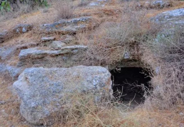
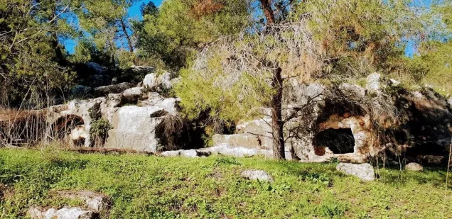
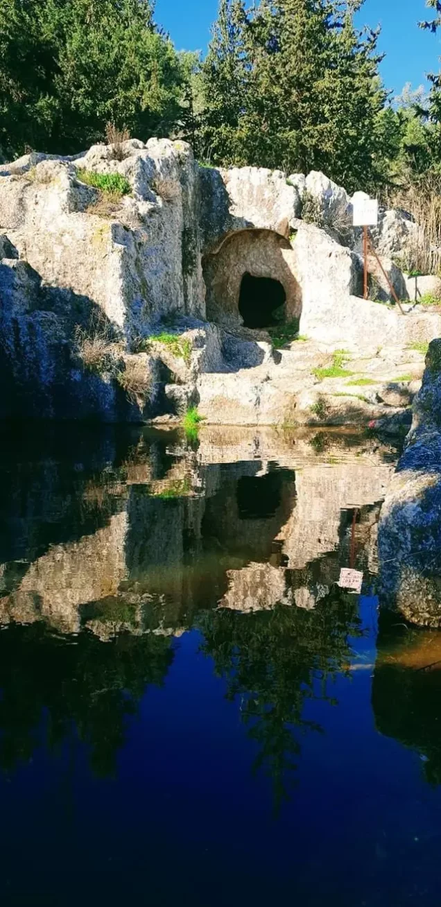
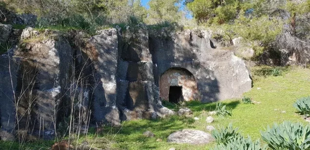
Walid Khalidi records rock-cut cisterns, silos, and tombs, as well as abandoned older houses whose ruins stood close to the inhabited village before the Nakba.
Nearby Khirbat al-Safsafa and Tall al-'Ajjul were also significant archaeological sites, and either one of them or Indur itself may have been associated with the location of ancient 'Ayn Dur.
The Fall of Baysan and the Military Context
The region east and southeast of Indur underwent major military changes in May 1948, particularly with the assault on Baysan and the surrounding Palestinian villages.
The Haganah's Golani Brigade carried out Operation Gideon between 10 and 15 May 1948. The offensive resulted in the occupation of the Baysan Valley and the displacement of inhabitants from numerous Palestinian communities.
Indur itself was not occupied within the formal dates of Operation Gideon. Walid Khalidi and PalQuest date its occupation to 24 May, nine days after the operation ended.
It is therefore more precise to place the capture of Indur within the continuation of Golani military activity following the fall of Baysan rather than categorically describing it as part of Operation Gideon.
Was Indur Occupied During Operation Erez?
Some Palestinian local databases list “Erez” in the military-operation field associated with Indur. However, this attribution does not appear in Walid Khalidi's principal account as presented by PalQuest, and the accompanying local narratives do not explain the basis for the classification.
The principal source used here instead connects Indur's fall with the continuation of Golani Brigade operations following the occupation of the Baysan Valley, without assigning the village's capture to an operation named Erez.
For that reason, this article does not identify Operation Erez as the confirmed military operation responsible for the occupation of Indur.
The Occupation of Indur on 24 May 1948
Walid Khalidi and PalQuest record that Indur came under Israeli control on 24 May 1948.
The source suggests that the inhabitants may have left as a result of a military assault and under the influence of the fall of nearby Baysan and the wider collapse of Palestinian control in the neighboring valley.
Although most of the Baysan Valley had already been occupied by the Haganah before 15 May, the Golani Brigade continued military activity in the area during the second half of May and into early June, described in the Israeli source cited by Khalidi as “cleansing and defending” the area.
Israeli military-account details are presented here through the Palestinian intermediary sources Walid Khalidi and PalQuest rather than through independent reliance on Israeli sources.
The Displacement of Indur's Inhabitants
The principal sources do not provide a single detailed Palestinian account reconstructing every stage of the villagers' departure, but they clearly connect the depopulation of Indur with the military developments in the surrounding region.
An Israeli intelligence report dated 30 June 1948 and published through the PalQuest archive lists Indur under 24 May and associates the villagers' departure with the Baysan–Gesher front. It records the Nazareth area as their destination.
The displacement of Indur can therefore be understood within the combined context of direct military pressure on the village, the earlier fall of Baysan, and the continuation of Golani Brigade operations across the area.
Israeli Settlements and Indur's Lands
According to Walid Khalidi and PalQuest, no new Israeli settlement was established on Indur's village lands after its depopulation.
Davrat lies immediately west of the former village site. It was founded in 1946, before the Nakba, on the boundary between the lands of Indur and those of Dabburiyya.
Davrat is therefore not classified here as a post-1948 settlement established on Indur's lands.
The Site of Indur After the Nakba
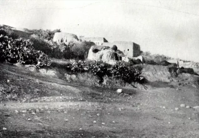
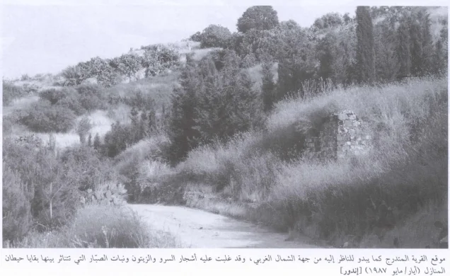
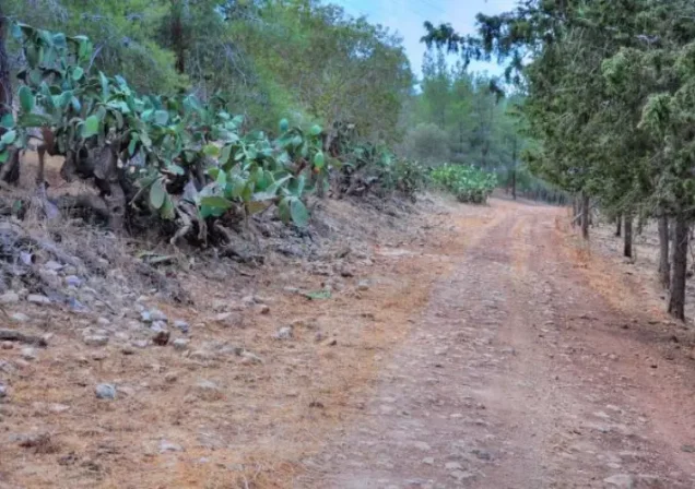
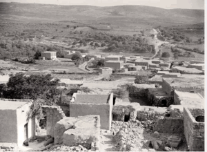
According to Walid Khalidi's historical field description, many partially ruined walls remained standing on the former village site.
Date palms, doum palms, fig trees, and almond trees grew on the village lands.
The surrounding flat land was cultivated, while the hilly areas were used for grazing.
This description is based on fieldwork conducted for Walid Khalidi's All That Remains and should not necessarily be treated as an updated field survey of the site today.
Sources
- PalQuestPalQuest – Interactive Encyclopedia of the Palestine Question: Indur
- PalQuestPalQuest – Interactive Encyclopedia of the Palestine Question: Operation Gideon
- PalQuestPalQuest: Israeli Intelligence Report on the Depopulation of Palestine, 30 June 1948
- Palestine RememberedPalestine Remembered: Indur – Nazareth District
- Palestine RememberedPalestine Remembered: Indur in Walid Khalidi's All That Remains
- palqura.comPalestinian Villages Encyclopedia: Indur / 'Ayn Dur
- pal48.psFilastunna: The Depopulated Village of Indur
- pcbs.gov.psPalestinian Central Bureau of Statistics: Historical Censuses and Reports
Photo gallery
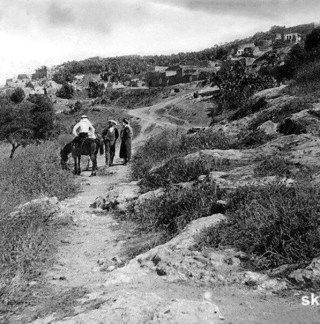
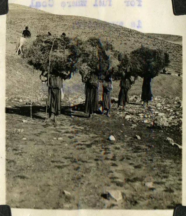
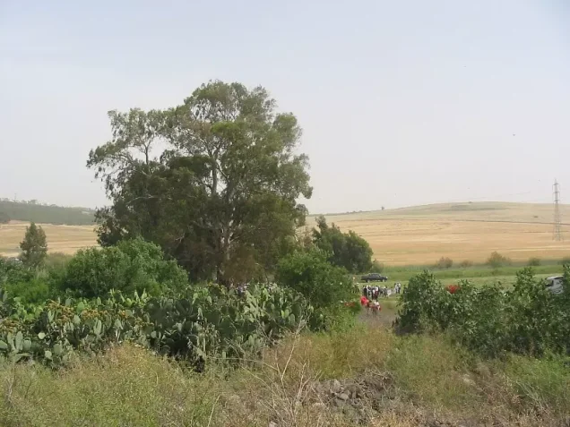
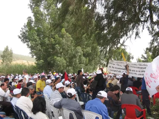

Photos from the village's people
Photos sent in by visitors and published after review.
Add a photo of this village
Log in to add photos of this village.
Other villages from Nazareth
More from the archive
 Download Our Palestine App
The whole archive in the palm of your hand: depopulated villages, the Nakba, the massacres and Al-Aqsa — free, with no ads to erase the story.
Download Our Palestine App
The whole archive in the palm of your hand: depopulated villages, the Nakba, the massacres and Al-Aqsa — free, with no ads to erase the story.



Comments
No comments yet — be the first to write one.
Add your comment
Name and email are optional. Comments appear after review.