
The depopulated village of Tarshiha / District of Akka (Acre)

About the depopulated village of Tarshiha
- District
- Akka (Acre)
- Date Tarshiha was occupied
- 01 November 1948
- Population in 1948
- 4,460
- Military operation
- Operation Dekel
- Brigade that carried it out
- The Seventh Brigade
- Who defended the village
- Local Palestinian militia and some Arab Liberation Army volunteers.
- Distance from the governorate centre
- 27 (km) Northeast of Acre
- Elevation above sea level
- 500 m
- Extent of destruction
- Tarshiha was mostly destroyed during occupation, but the Israelis allowed its residence to rebuild their village after occupation.
- Ethnic cleansing
- Tarshiha was mostly ethnically cleansed, but it's still inhabited by some of its original inhabitants and some internal Palestinian refugees.
- Settlements built on the built-up area of Tarshiha after 1948
- Me‘ona, En Ya‘aqov, Ma‘alot
Hover a dot to read the village name, or click to open its card.
Borders of the depopulated village of Tarshiha
Tarshiha: A Palestinian Town in the Acre District, Most of Whose Residents Were Displaced During the Nakba
Tarshiha is a Palestinian town in the Acre District, located in western Galilee about 27 kilometres northeast of the city of Acre, at an elevation of slightly more than 500 metres above sea level. The town was subjected to bombardment and occupation during Operation Hiram in late October 1948, and most of its inhabitants were displaced during the Nakba and the occupation of Palestine in 1948. Unlike many completely depopulated Palestinian villages, however, Tarshiha was not emptied entirely of its Palestinian population. Some residents remained, others returned after the occupation, and a Palestinian community has continued to live there to the present day.
- Subdistrict
- Akka (Acre)
- Distance from district center
- 27 km Northeast of Acre
- Average Elevation
- 500 meters above sea level
- Population in 1931
- 2,522 inhabitants - Official census
- Number of Houses in 1931
- 584 houses
- Population in 1944/1945
- About 3,830 inhabitants - Figure specific to Tarshiha
- Total Land Area in 1945
- 47,428 dunams
- Attack and Depopulation
- For much of 1948, Tarshiha remained an important Palestinian centre in western Galilee. Local fighters and members of the Arab Liberation Army were present in the town.
- Final Israeli Control
- Morning of 30 October 1948
- Military Operation
- Operation Dekel
- Military Unit
- The 11th Battalion of the Oded Brigade
- Settlements Documented on Village Lands
- Me‘ona, En Ya‘aqov, Ma‘alot
Location
Tarshiha is located in western Galilee on mountainous terrain northeast of Acre. During the British Mandate, paved roads connected it with Acre, Nahariya, Mi'ilya, al-Rama, Hurfeish, Sa'sa', al-Jish, Suhmata, and al-Kabri, making it an important centre for transportation, trade, and services in the region.
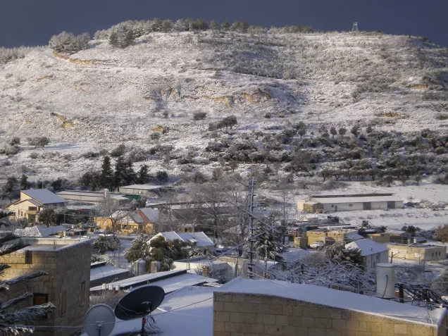
Tarshiha was one of the most important towns in the Acre District during the British Mandate. Its elevated location gave it a distinctive mountain climate, and its lands were characterized by hills and numerous valleys.
Among the villages and towns surrounding Tarshiha were Mi'ilya, Dayr al-Qasi, Suhmata, Yanuh, al-Kabri, Fassuta, Kafr Sami', Hurfeish, and al-Buqay'a.
Tarshiha Before the Nakba
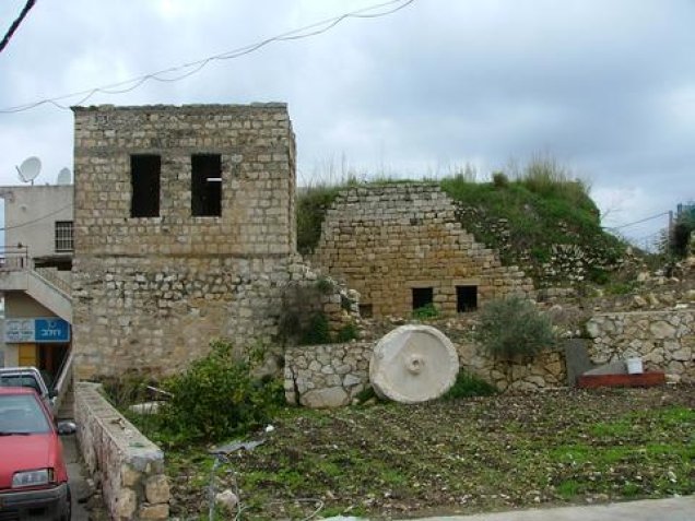
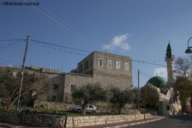
Most of Tarshiha's buildings were constructed of stone, and the town expanded primarily along an east-west axis. It contained shops, mosques, schools, clinics, and other public facilities and services.
Tarshiha had a local council that administered the town and organized its services. A weekly market attracted residents of surrounding villages and reflected the town's important economic and commercial position in western Galilee.
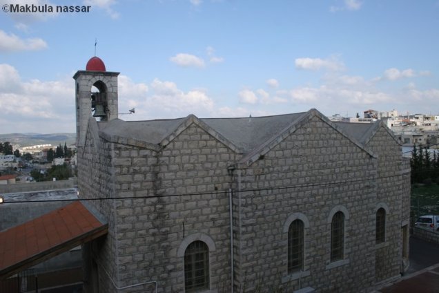
The population included both Muslims and Christians, and the town contained religious institutions belonging to both communities. This religious and social diversity formed an important part of Tarshiha's public life before the Nakba.
Population
Tarshiha had 1,880 inhabitants in the 1922 census. The population increased to 2,522 in the 1931 census, when 584 houses were recorded.
By 1945, the population of Tarshiha itself was approximately 3,830, according to figures published in Palestinian encyclopedic sources and Palestine Remembered.
The figure of 5,360 that appears in some statistical tables includes the populations of Tarshiha and al-Kabri together and should not be presented as the population of Tarshiha alone.
Following the Nakba and the sharp decline caused by displacement, Tarshiha's population was approximately 639 in 1949, according to the Palestinian Encyclopedia. It later increased to 1,150 in 1961.
Population of Tarshiha
- 1596585Historical estimate reported in the sources
- 19221,880Official census
- 19312,522Official census
- 1945About 3,830Figure specific to Tarshiha
- 1949639Post-displacement population according to the Palestinian Encyclopedia
- 19611,150Later census
Education
Tarshiha had two elementary schools, one for boys and another for girls, and the town had a notable educational life during the British Mandate period.
Records published by Palestine Remembered document male and female teachers working in Tarshiha's schools during the 1930s and 1940s, while Mandate-era documents also indicate the continued operation of the boys' school during this period.
Frequently repeated figures concerning exact literacy rates and the number of pupils in individual classes have not been included because they could not be sufficiently confirmed in the principal sources reviewed.
Economic Life
The inhabitants of Tarshiha depended on agriculture, trade, and animal husbandry. The town's lands were mountainous and intersected by numerous valleys. Large areas were used for grazing, while cereals, olives, and fruit trees were also cultivated.
Tarshiha was particularly known for olive and tobacco cultivation and was one of the important olive-producing centres in the Acre District. The Palestinian Encyclopedia reports that approximately 4,047 dunams were planted with olive trees during the Mandate period, making Tarshiha one of the leading olive-growing localities in the district.
The town's weekly market was also an important centre of trade, attracting residents from surrounding Palestinian villages as well as traders and visitors from areas near southern Lebanon.
Tarshiha's Lands and the 1944/1945 Statistics
Land statistics for Tarshiha require an important clarification. The Government of Palestine figures reproduced by PalQuest combine the lands of Tarshiha and al-Kabri in a single statistical unit. The total of 47,428 dunams should therefore not be described as the land area of Tarshiha alone.
According to the combined 1944/1945 statistics, the lands of Tarshiha and al-Kabri together covered 47,428 dunams, of which 37,308 dunams were Arab-owned, 90 dunams were Jewish-owned, and 10,030 dunams were classified as public land.
Land ownership in the combined Tarshiha–al-Kabri statistical unit in 1944/1945
- Arab ownership37,308 dunums79%
- Jewish ownership90 dunums<1%
- Public land10,030 dunums21%
These figures apply to Tarshiha and al-Kabri together and should not be used to determine the land area of either locality separately.
Land Use in 1944/1945
The official land-use tables likewise combine Tarshiha and al-Kabri. In the combined unit, 14,056 dunams of Arab-owned land were devoted to cereals, along with 67 dunams of Jewish-owned land. A further 5,278 dunams of Arab-owned land and 23 dunams of Jewish-owned land were irrigated or used for plantations.
A total of 743 dunams were devoted to citrus and bananas, while sources specific to Tarshiha indicate that approximately 4,047 dunams of its lands were planted with olive trees.
Land use in the combined Tarshiha–al-Kabri statistical unit in 1944/1945
- Arab
- Jewish
- Cereals14,123 dunums
- Irrigated and plantation land5,301 dunums
- Citrus and bananas743 dunums
Archaeology in Tarshiha
Tarshiha stands on a site of archaeological significance. Rock-cut tombs, water cisterns, and other remains have been found in the town and its surroundings.
In 1931, the Department of Antiquities of the Government of Palestine excavated rock-cut tombs dating to the fourth century CE. Rings, earrings, seals, and amulets were among the objects discovered.
Several archaeological sites and khirbas surround Tarshiha, including Khirbat Rusiyyat, Khirbat Jiddin, Khirbat Ja'tun, Khirbat Aliya, and Khirbat Shaghba.
The Nakba and the Occupation of Tarshiha
For much of 1948, Tarshiha remained an important Palestinian centre in western Galilee. Local fighters and members of the Arab Liberation Army were present in the town.
Operation Hiram
Operation Hiram began on 28 October 1948 and continued until 31 October. Its objective was to occupy the remaining areas of Upper and Central Galilee that had not yet come under Israeli control.
Several Israeli brigades participated in the operation, including the Oded Brigade, the Seventh Brigade, the Carmeli Brigade, and the Golani Brigade, together with additional forces operating on different fronts.
With regard to Tarshiha specifically, a study published by the Institute for Palestine Studies states that the 11th Battalion of the Oded Brigade advanced toward the town after passing through the Mi'ilya area, and that the residents who remained in Tarshiha surrendered to Israeli forces on the morning of 30 October 1948.
Aerial and Artillery Bombardment
Tarshiha was subjected to aerial and artillery bombardment at the beginning of Operation Hiram. Studies published by the Institute for Palestine Studies document Israeli air attacks on the town and indicate that the bombardment spread fear and contributed to the flight of a large part of the population.
The studies also document civilian casualties caused by the bombing. However, detailed local accounts concerning the exact number of aircraft and the precise location of every bomb have not been included because they could not be independently verified through the principal sources reviewed.
Date of Occupation
The morning of 30 October 1948 is used here as the date on which Tarshiha came under Israeli control, based on the detailed study published by the Institute for Palestine Studies. Palestine Remembered gives 1 November 1948 in one of its tables, producing a slight discrepancy between the published sources.
The sequence of Operation Hiram and the fall of surrounding villages supports 30 October as the more precise date for the military occupation of the town.
Displacement of Tarshiha's Population
The bombardment and approach of Israeli forces caused most of Tarshiha's residents to flee on 29 and 30 October 1948. Many moved north toward Lebanon, while others temporarily sought refuge in neighbouring Palestinian villages, particularly Druze villages that remained inhabited.
Tarshiha was not, however, completely emptied of its population. A number of residents remained when Israeli forces entered. The Institute for Palestine Studies documents that the remaining residents were gathered in the area of the church and that a curfew was imposed on the rest of the town, while abandoned homes were subjected to looting.
Some residents who had temporarily taken refuge in neighbouring villages began returning gradually from November 1948 onward. What occurred should therefore be described as the large-scale displacement of most of the population rather than the complete and permanent depopulation of the town.
Tarshiha's population had fallen to approximately 639 in 1949, compared with about 3,830 in 1945, illustrating the scale of displacement caused by the Nakba.
Fate of Buildings and Property
Some of Tarshiha's buildings were destroyed by bombardment and military operations, but the town itself was not demolished in its entirety. A substantial number of houses and other buildings remained standing.
The Institute for Palestine Studies documents extensive looting of homes abandoned during the flight of the population. Food supplies, crops, furniture, and other property were taken. Tarshiha was particularly known for tobacco production, and quantities of dried tobacco were stored in houses at the time of the occupation.
Occupation and Depopulation Chronology
- Not specified precisely
The Nakba and the Occupation of Tarshiha
For much of 1948, Tarshiha remained an important Palestinian centre in western Galilee. Local fighters and members of the Arab Liberation Army were present in the town.
- 28 October 1948
Operation Hiram
Operation Hiram began on 28 October 1948 and continued until 31 October. Its objective was to occupy the remaining areas of Upper and Central Galilee that had not yet come under Israeli control.
- Not specified precisely
Aerial and Artillery Bombardment
Tarshiha was subjected to aerial and artillery bombardment at the beginning of Operation Hiram. Studies published by the Institute for Palestine Studies document Israeli air attacks on the town and indicate that the bombardment spread fear and contributed to the flight of a large part of the population.
- 30 October 1948
Date of Occupation
The morning of 30 October 1948 is used here as the date on which Tarshiha came under Israeli control, based on the detailed study published by the Institute for Palestine Studies. Palestine Remembered gives 1 November 1948 in one of its tables, producing a slight discrepancy between the published sources.
Israeli Settlements and Projects on the Lands of Tarshiha
Ma'alot
Ma'alot was established on land belonging to Tarshiha. The Institute for Palestine Studies explicitly lists Ma'alot among Israeli towns established on lands belonging to Palestinian Arab localities.
Kfar Vradim
Kfar Vradim was established on lands taken from Tarshiha, Yanuh, and Kafr Sami', according to a study published by the Institute for Palestine Studies.
Me'ona, Ga'aton, Ein Ya'akov, and Ma'alot
Walid Khalidi states that Ga'aton, established in 1948; Me'ona, established in 1949; Ein Ya'akov, established in 1950; and Ma'alot, established in 1957, stand on lands that belonged either to al-Kabri or to Tarshiha.
It is not possible to determine conclusively which village originally owned every parcel because the last British Mandate land-ownership map combined the lands of al-Kabri and Tarshiha. These settlements should therefore not all be attributed solely to Tarshiha without qualification.
- Ma'alot: established on land belonging to Tarshiha.
- Kfar Vradim: established on lands taken from Tarshiha, Yanuh, and Kafr Sami'.
- Ga'aton, Me'ona, and Ein Ya'akov: located on lands belonging to either al-Kabri or Tarshiha; the available maps do not allow a definitive attribution between the two.
Tarshiha After the Nakba and Today
A Palestinian presence continued in Tarshiha after the Nakba, and some residents who had temporarily taken refuge in neighbouring villages later returned. The town's Arab population reached 1,150 in the 1961 census.
Tarshiha was later administratively merged with the Israeli town of Ma'alot into a single municipality known as Ma'alot-Tarshiha. The Institute for Palestine Studies notes that Tarshiha continues to constitute the Palestinian Arab part of this mixed municipality.
Tarshiha therefore differs from Palestinian villages that were entirely depopulated, demolished, and closed to the return of their inhabitants. Most of its population was displaced during the Nakba, and large areas of its land were lost, but part of its Palestinian community remained and continued to exist after 1948.
Sources
- PalQuest – Interactive Encyclopedia of the Palestine Question: Operation Hiram.
- Palestine Remembered: Tarshiha, Acre District.
- Palestine Remembered: Tarshiha in the Palestinian Encyclopedia.
- Institute for Palestine Studies: Study on Operation Hiram and the occupation of Tarshiha and the Galilee.
- Institute for Palestine Studies: Nakba and Survival, including documentation on the occupation of Tarshiha and the return of some of its residents after the Nakba.
- Institute for Palestine Studies: Population and Social Structure, including reference to Ma'alot-Tarshiha as a mixed municipality.
- Mustafa Murad al-Dabbagh, Biladuna Filastin, Volume VII, Part II, as cited by the Palestinian Encyclopedia.
- Government of Palestine, Department of Statistics, Village Statistics, 1945, with the clarification that the published combined land figures include both Tarshiha and al-Kabri.
Photo gallery
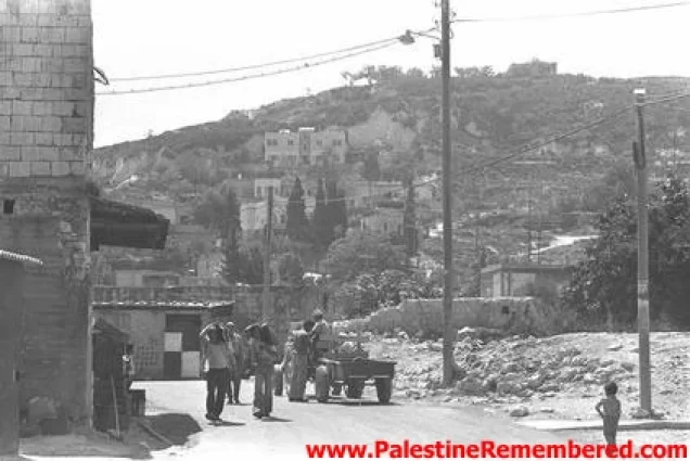
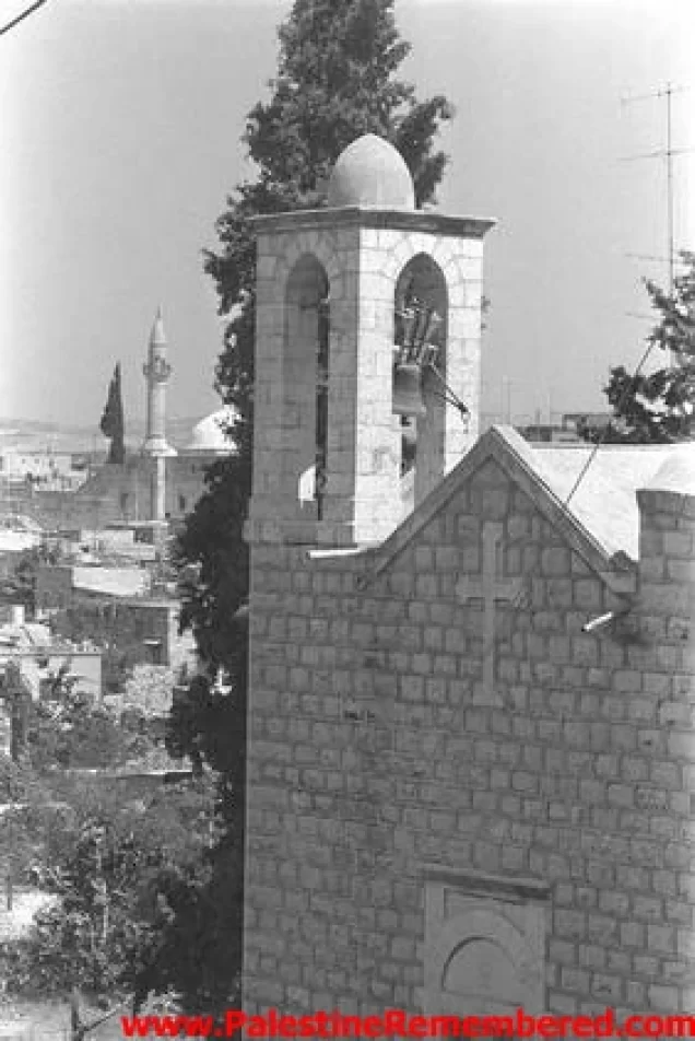
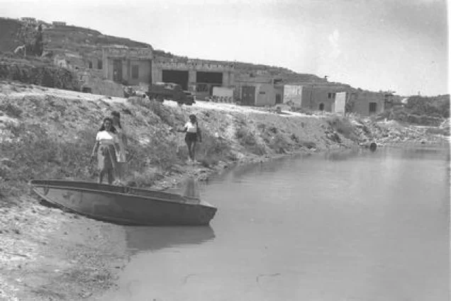
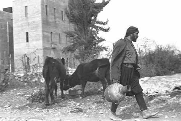

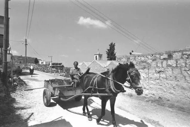
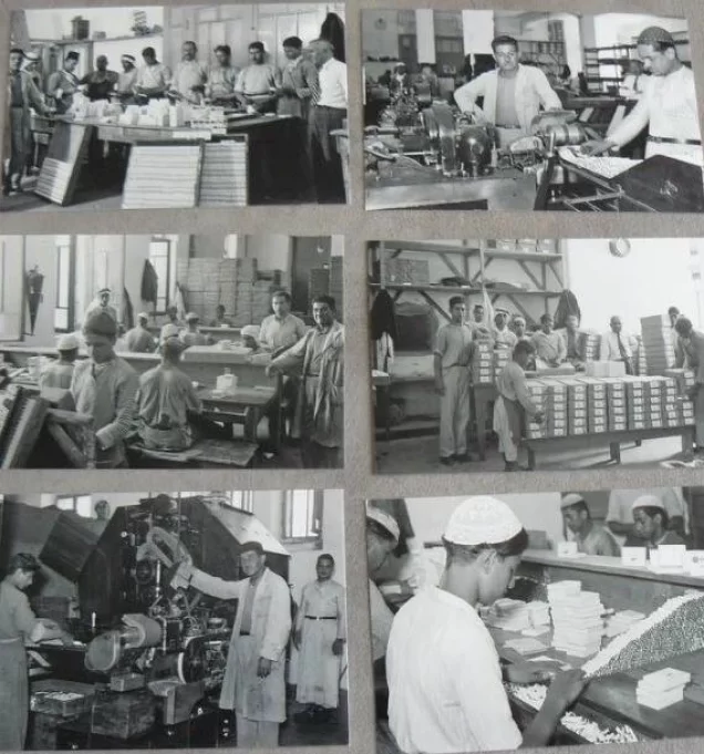
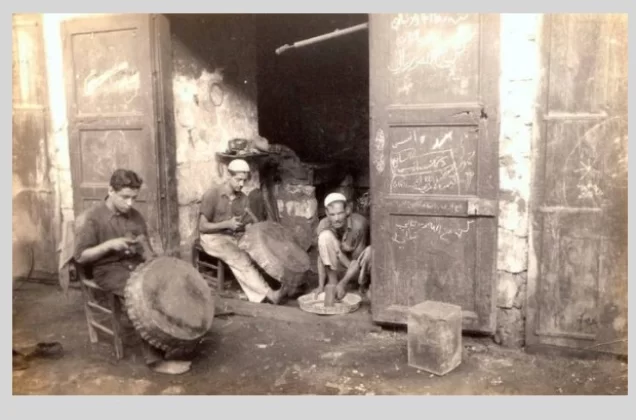
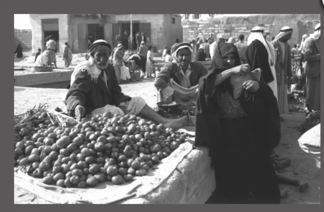
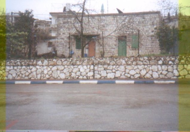
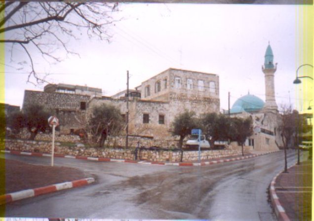
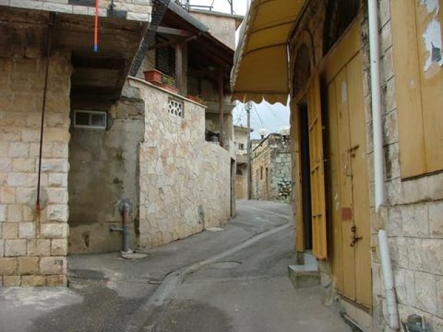
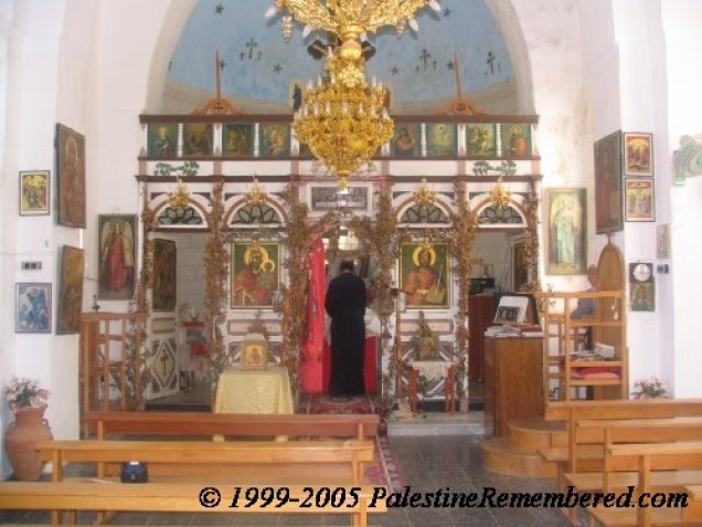


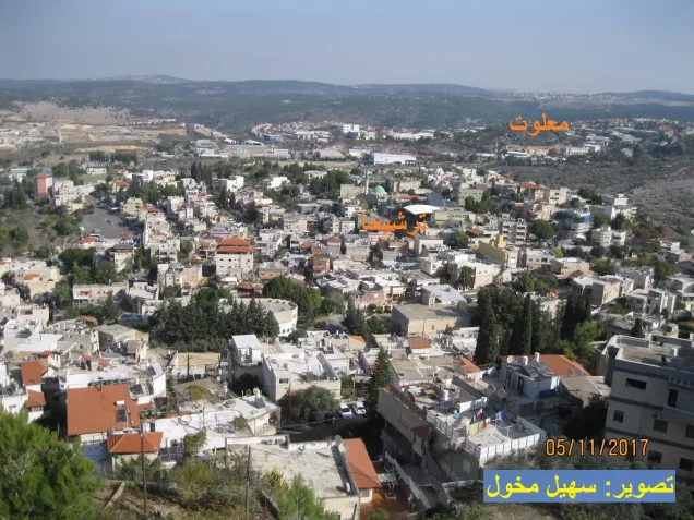
Photos from the village's people
Photos sent in by visitors and published after review.
Add a photo of this village
Log in to add photos of this village.
Other villages from Akka (Acre)


More from the archive


 Download Our Palestine App
The whole archive in the palm of your hand: depopulated villages, the Nakba, the massacres and Al-Aqsa — free, with no ads to erase the story.
Download Our Palestine App
The whole archive in the palm of your hand: depopulated villages, the Nakba, the massacres and Al-Aqsa — free, with no ads to erase the story.



Comments
No comments yet — be the first to write one.
Add your comment
Name and email are optional. Comments appear after review.