
The depopulated village of Al-Kabri / District of Akka (Acre)
About the depopulated village of Al-Kabri
- District
- Akka (Acre)
- Date Al-Kabri was occupied
- 21 May 1948
- Population in 1948
- 1,770
- Military operation
- Second stage of Ben-Ami Operation
- Who defended the village
- Arab Liberation Army
- Distance from the governorate centre
- 12.5 (km) Northeast of Acre
- Elevation above sea level
- 80 m
- Cause of displacement
- Military assault by Zionist troops
- Extent of destruction
- al-Kabri was completely destroyed and defaced.
- Ethnic cleansing
- al-Kabri inhabitants were completely ethnically cleansed.
- Settlements built on the built-up area of Al-Kabri after 1948
- Kibbutz Kabri
Hover a dot to read the village name, or click to open its card.
Borders of the depopulated village of Al-Kabri
```html
- Subdistrict
- Akka (Acre)
- Distance from district center
- 12.5 km Northeast of Acre
- Average Elevation
- 80 meters above sea level
- Population in 1931
- 728 inhabitants - Official census
- Number of Houses in 1931
- 173 houses - Official census
- Population in 1944/1945
- 1,520 inhabitants - Government of Palestine statistics
- Estimated Population in 1948
- About 1,770 inhabitants - a later demographic estimate, not an official census
- Total Land Area in 1945
- 47,428 dunams
- Attack and Depopulation
- Al-Kabri witnessed armed confrontations before its final occupation in May 1948. Its location on the road leading to the Yehi'am settlement gave it military importance during this period.
- Final Israeli Control
- 21 May 1948
- Military Operation
- Operation Ben-Ami
- Military Unit
- Carmeli Brigade
- Cause of Depopulation
- Military assault by Zionist troops
- Settlements Documented on Village Lands
- Kibbutz Kabri
Al-Kabri: A Depopulated Palestinian Village in the Acre District
Al-Kabri was a Palestinian village in the Acre District, located about 12.5 kilometres northeast of the city of Acre, where the western slopes of the Galilee hills meet the Acre Plain, at an average elevation of approximately 80 metres above sea level. It was occupied by forces of the Carmeli Brigade on 21 May 1948 during the second phase of Operation Ben-Ami, and its inhabitants were displaced during the Nakba and the occupation of Palestine in 1948.
Location and Name
Al-Kabri stood at the western foothills of the Galilee, where they meet the Acre Plain. A main road connected the village with Nahariya to the west and, from there, with the coastal road leading south to Acre.
Walid Khalidi suggests that the name al-Kabri may derive from the Syriac word “Kabiraya,” meaning “large” or “rich.” The historian and geographer al-Maqrizi referred to it as “al-Kabira” and recorded that in 1291 the Mamluk Sultan al-Ashraf Khalil assigned its tax revenues to a charitable endowment in Cairo. The Crusaders knew the locality as “Cabra.”
Nearby Villages and Towns
Al-Kabri stood within a closely connected network of villages in western Galilee. Among the most prominent nearby localities were al-Bassa to the north, al-Zib to the west, Mi'ilya to the east, and Umm al-Faraj and al-Nahr to the south and southwest.
Al-Kabri Before the Nakba
In the late nineteenth century, al-Kabri was described as a stone-built village with a population of about 400. Its inhabitants planted the surrounding lands with fig, olive, pomegranate, mulberry, and apple trees.
During the British Mandate period, village houses were built of stone and cement, stone and mud, or reinforced concrete. The inhabitants of al-Kabri were Muslims, and the village had a mosque and an elementary school for boys.
The village economy depended primarily on agriculture and animal husbandry. Fruit trees, citrus, olives, and other crops were cultivated, while some residents also raised livestock during the latter half of the Mandate period.
Population
The population of al-Kabri was 553 in the 1922 census and rose to 728 in the 1931 census, when 173 houses were recorded. In the 1944/1945 Village Statistics, the population stood at 1,520.
A historical study by Dr. Muhammad Aqel published on Palestine Remembered estimates the village population in 1948 at approximately 1,770. This figure is treated as an estimate rather than an official census.
The figure of 6,218 inhabitants for 1948 that appears in one automated table on Palestine Remembered clearly conflicts with the 1945 population and with the historical study published on the same website. It has therefore not been adopted here. The related figures for houses and refugees have likewise not been used.
Population of al-Kabri
- Late nineteenth centuryAbout 400Historical estimate
- 1922553Official census
- 1931728Official census
- 1944/19451,520Government of Palestine statistics
- 1948About 1,770Estimate published by Palestine Remembered
Number of Houses
Documented number of houses in al-Kabri
- 1931173Official census
Land and the 1944/1945 Statistics
The land statistics for al-Kabri require particular care because the official tables published by PalQuest combine al-Kabri and Tarshiha into a single statistical unit. The total of 47,428 dunams should therefore not be presented as the land area of al-Kabri alone.
According to the 1944/1945 statistics for the combined al-Kabri–Tarshiha unit, the total land area was 47,428 dunams, of which 37,308 dunams were Arab-owned, 90 dunams were Jewish-owned, and 10,030 dunams were classified as public land.
Land ownership in the combined al-Kabri–Tarshiha statistical unit in 1944/1945
- Arab ownership37,308 dunums79%
- Jewish ownership90 dunums<1%
- Public land10,030 dunums21%
These figures include both al-Kabri and Tarshiha and should not be used as if they referred to al-Kabri alone.
Agriculture and Land Use
Al-Kabri depended primarily on agriculture and animal husbandry. Olive, fig, pomegranate, mulberry, and apple trees were cultivated in the area, along with citrus fruits, bananas, and cereals.
For the combined al-Kabri–Tarshiha statistical unit, PalQuest records 14,123 dunams devoted to cereals in 1944/1945, including 14,056 dunams of Arab-owned land and 67 dunams of Jewish-owned land. A further 5,301 dunams were irrigated or used for plantations, including 5,278 Arab-owned dunams and 23 Jewish-owned dunams. The total area devoted to citrus and bananas was 743 dunams.
Walid Khalidi also records that 540 dunams were planted with olive trees. However, because the official tables combine al-Kabri and Tarshiha for a number of land-use categories, the total figures should not be presented as if they applied to al-Kabri alone.
Land use in the combined al-Kabri–Tarshiha statistical unit in 1944/1945
- Arab
- Jewish
- Cereals14,123 dunums
- Irrigated and plantation land5,301 dunums
- Citrus and bananas743 dunums
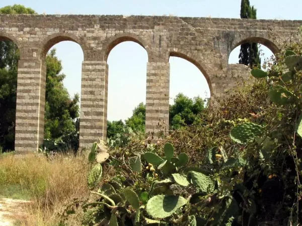
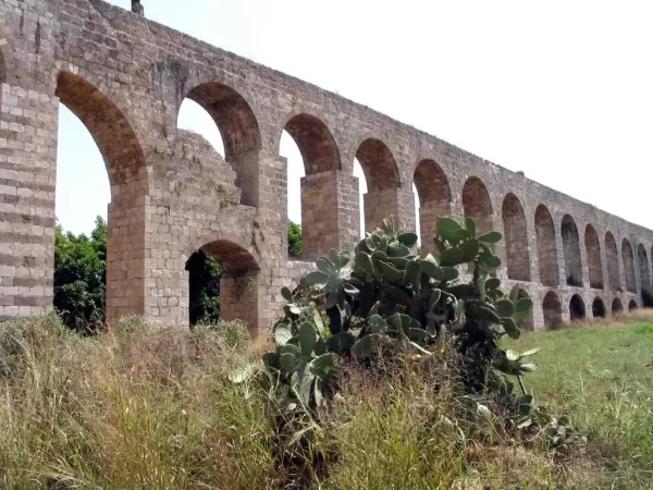
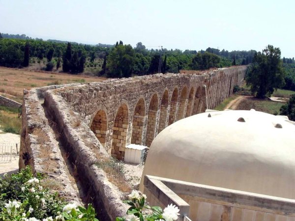
The Springs of Al-Kabri and Its Aqueducts
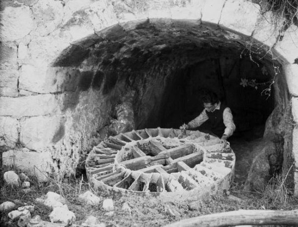
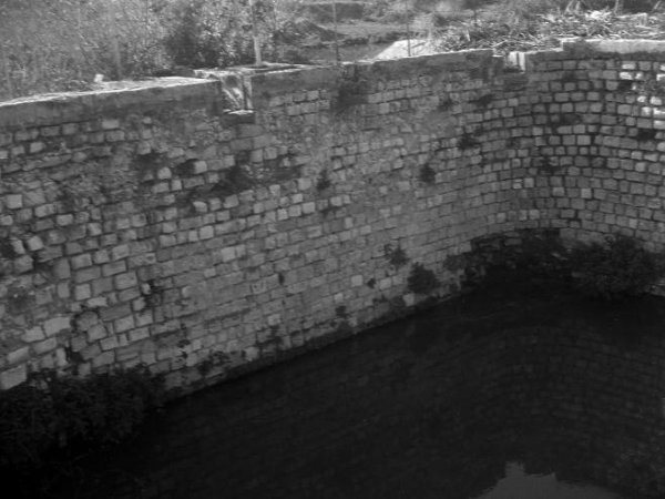
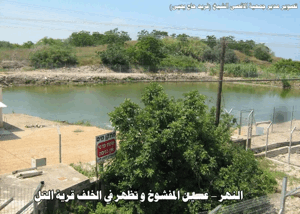
Al-Kabri was renowned for its abundant springs, including Ayn al-Mafshuh, Ayn al-Fawwar, Ayn al-Asal, and Ayn al-Kabri. Sources indicate that their combined flow reached approximately 8.6 million cubic metres per year, making them among the most important freshwater sources in the region and a principal source of water for the Acre District.
The waters of al-Kabri's springs had been used since antiquity to supply the city of Acre. Remains of water channels dating to the Hellenistic period have been documented in the area.
Aqueducts were also constructed during the Ottoman period to carry water to Acre. Sources mention a channel associated with Ahmad Pasha al-Jazzar at the beginning of the nineteenth century. The date of Sulayman Pasha's aqueduct differs between Palestinian sources: the PalQuest page gives 1841, while a detailed study published by Palestine Remembered dates its construction to 1814–1815. Neither date is therefore presented here as universally agreed upon.
Education and Social Life
Al-Kabri had a mosque and an elementary school for boys. A historical study published on Palestine Remembered indicates that the school was operating in 1942–1943 and that education there extended to the fourth elementary grade.
Agriculture and animal husbandry remained the principal economic activities of the population, along with work connected to orchards, springs, and the surrounding agricultural lands.
Archaeology in Al-Kabri
Al-Kabri stood on part of an extensive archaeological site that extended southwest toward the villages of al-Nahr and al-Tall. Sources indicate that the area had been inhabited since approximately 3200 BCE and remained densely settled until around 500 BCE, when the region came under Persian rule.
Building foundations, mosaic fragments, and rock-cut tombs were found at the site. A nearby khirba also contained the remains of a square structure built of dressed stone, along with water cisterns carved into the rock.
Al-Kabri During the Nakba
Al-Kabri witnessed armed confrontations before its final occupation in May 1948. Its location on the road leading to the Yehi'am settlement gave it military importance during this period.
The Convoy Battle in March 1948
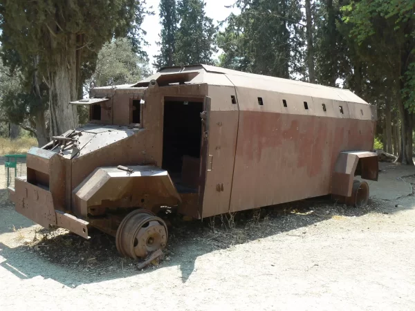
On 28 March 1948, fighters from al-Kabri ambushed a Haganah military convoy passing near the village on its way to Yehi'am. A force from the Arab Liberation Army later joined the battle.
The sources differ regarding the number of casualties in the convoy. Testimonies collected by Palestinian historian Nafez Nazzal from villagers gave a figure of 74 Haganah dead, while PalQuest cites a lower figure from a contemporary press report, and another Palestinian study published by Palestine Remembered gives 47 soldiers killed. No single number should therefore be presented without noting the discrepancy between the sources.
Operation Ben-Ami and the Occupation of Al-Kabri
Operation Ben-Ami began on 13 May 1948 and was carried out by the Carmeli Brigade of the Haganah. Its objective was to seize Palestinian villages and coastal areas in western Galilee north of Acre up to the Lebanese border.
Orders for the Attack
PalQuest reports that orders issued to the Carmeli Brigade on 19 May 1948 instructed its forces to attack and occupy al-Kabri, Umm al-Faraj, and al-Nahr, to kill the men, and to destroy and burn the villages. This information is included on the basis of the documentation reproduced by PalQuest and Walid Khalidi, rather than through direct reliance here on an Israeli source.
Date of Occupation and Displacement
Forces of the Carmeli Brigade occupied al-Kabri during the night of 20–21 May 1948 in the second phase of Operation Ben-Ami. The date 21 May 1948 is used as the date of the village's occupation.
Many inhabitants had already left the village before the final assault because of the fighting, shelling, fear of attacks, and the withdrawal of Arab Liberation Army forces from the area.
Fate of the Remaining Inhabitants
Walid Khalidi, drawing on interviews conducted by Palestinian historian Nafez Nazzal with former residents of al-Kabri, records that an unspecified number of villagers were captured during the final assault and that some were killed. Witnesses also reported that people from al-Kabri were later killed while displaced in Galilee after Zionist forces learned that they came from the village.
A Palestinian study published on Palestine Remembered reports that seven or eight residents of al-Kabri were executed by shooting after the occupation. Because the casualty figures differ between sources, this number is presented as a documented account in that study rather than as a universally agreed final figure.
Fate of the Population and Buildings
The Palestinian inhabitants of al-Kabri were displaced during the Nakba and scattered outside their village. Palestinian sources indicate that many refugees from al-Kabri later settled in Lebanon and Syria.
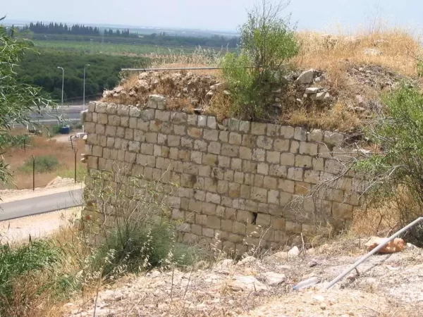
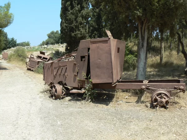
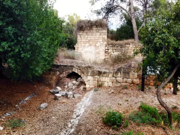
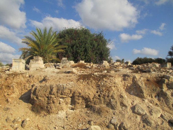
Most of the village buildings were destroyed after the occupation. Only deteriorating walls, piles of stone, and limited remains covered by weeds and wild vegetation survived from the original built-up area.
Occupation and Depopulation Chronology
- March 1948
The Convoy Battle in March 1948
On 28 March 1948, fighters from al-Kabri ambushed a Haganah military convoy passing near the village on its way to Yehi'am. A force from the Arab Liberation Army later joined the battle.
- 13 May 1948
Operation Ben-Ami and the Occupation of Al-Kabri
Operation Ben-Ami began on 13 May 1948 and was carried out by the Carmeli Brigade of the Haganah. Its objective was to seize Palestinian villages and coastal areas in western Galilee north of Acre up to the Lebanese border.
- 19 May 1948
Orders for the Attack
PalQuest reports that orders issued to the Carmeli Brigade on 19 May 1948 instructed its forces to attack and occupy al-Kabri, Umm al-Faraj, and al-Nahr, to kill the men, and to destroy and burn the villages. This information is included on the basis of the documentation reproduced by PalQuest and Walid Khalidi, rather than through direct reliance here on an Israeli source.
- 21 May 1948
Date of Occupation and Displacement
Forces of the Carmeli Brigade occupied al-Kabri during the night of 20–21 May 1948 in the second phase of Operation Ben-Ami. The date 21 May 1948 is used as the date of the village's occupation.
Israeli Settlements Established on the Lands of Al-Kabri
Kabri
Kibbutz Kabri began to be established on 18 January 1949 in the northwestern part of the destroyed village site. It is the most prominent settlement established directly on the site of al-Kabri.
Kfar Vradim
Walid Khalidi states in All That Remains that Kfar Vradim was established on the lands of al-Kabri in 1984. The current Arabic version of the PalQuest page displays the year 1948, while the English text reproduced from Khalidi gives 1984. The year 1984 has therefore been adopted here.
Settlements on the Lands of Al-Kabri or Tarshiha
Ga'aton, established in 1948; Me'ona, established in 1949; Ein Ya'akov, established in 1950; and Ma'alot, established in 1957, lie east of the al-Kabri site on lands that belonged either to al-Kabri or to Tarshiha.
Walid Khalidi notes that it is not possible to determine conclusively which of the two villages each of these four settlements was built on, because the last British Mandate land-ownership map combined the lands of al-Kabri and Tarshiha.
- Kabri, established in 1949 on the village site.
- Kfar Vradim, established in 1984 on the lands of al-Kabri.
- Ga'aton, established in 1948 on land belonging to al-Kabri or Tarshiha.
- Me'ona, established in 1949 on land belonging to al-Kabri or Tarshiha.
- Ein Ya'akov, established in 1950 on land belonging to al-Kabri or Tarshiha.
- Ma'alot, established in 1957 on land belonging to al-Kabri or Tarshiha.
The Site of Al-Kabri Today
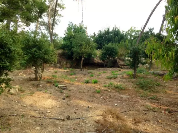
According to the field documentation published by Walid Khalidi, only a number of deteriorating walls and piles of stone covered by thorns, grasses, and shrubs remained from the village. Kibbutz Kabri uses nearby lands for agriculture and grazing.
This description reflects the period in which the original field documentation was conducted and should not necessarily be interpreted as a field survey of the site in 2026.
Sources
- PalQuest – Interactive Encyclopedia of the Palestine Question: Al-Kabri.
- PalQuest: Operation Ben-Ami.
- Palestine Remembered: Al-Kabri, Acre District.
- Palestine Remembered: The Depopulated Village of Al-Kabri, Dr. Muhammad Aqel.
- Institute for Palestine Studies: Nafez Nazzal, The Zionist Occupation of Western Galilee, 1948.
- Walid Khalidi, All That Remains, entry on al-Kabri, as reproduced by PalQuest and Palestine Remembered.
- Nafez Nazzal, The Palestinian Exodus from Galilee, 1948, Institute for Palestine Studies, Beirut, 1978.
- Government of Palestine, Department of Statistics, Village Statistics, 1945, with the note that the published land data combine al-Kabri and Tarshiha.
Photo gallery




Photos from the village's people
Photos sent in by visitors and published after review.
Add a photo of this village
Log in to add photos of this village.
Other villages from Akka (Acre)
More from the archive



 Download Our Palestine App
The whole archive in the palm of your hand: depopulated villages, the Nakba, the massacres and Al-Aqsa — free, with no ads to erase the story.
Download Our Palestine App
The whole archive in the palm of your hand: depopulated villages, the Nakba, the massacres and Al-Aqsa — free, with no ads to erase the story.



Comments
No comments yet — be the first to write one.
Add your comment
Name and email are optional. Comments appear after review.