
The depopulated village of Salama / District of Jaffa
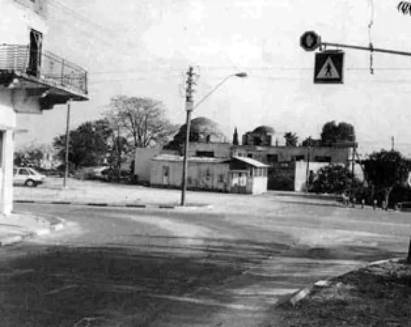
About the depopulated village of Salama
- District
- Jaffa
- Date Salama was occupied
- 29 April 1948
- Population in 1948
- 7,810
- Military operation
- Operation Bi'ur Hametz
- Brigade that carried it out
- Alexandroni Brigade
- Who defended the village
- Local militia & Arab Liberation Army
- Distance from the governorate centre
- 5 (km) East of Jaffa
- Elevation above sea level
- 25 m
- Cause of displacement
- Military assault by Zionist troops
- Extent of destruction
- Salama was mostly destroyed with the exception of ten houses and the village schools.
Hover a dot to read the village name, or click to open its card.
Borders of the depopulated village of Salama
Salama: A Depopulated Palestinian Village in the Jaffa District
Salama was a Palestinian village in the Jaffa District, situated on the central coastal plain approximately 5 kilometres east of the city of Jaffa, at an average elevation of about 25 metres above sea level. Its population reached 6,730 in the 1944/1945 statistics, making it one of the largest villages in the Jaffa subdistrict. Salama was subjected to repeated attacks beginning in December 1947 and fell to Haganah forces on 29 April 1948 during Operation Hametz, after most of its inhabitants had been compelled to leave.
- Subdistrict
- Jaffa
- Distance from district center
- 5 km East of Jaffa
- Average Elevation
- 25 meters above sea level
- Population in 1931
- 3,691 inhabitants - Official census
- Number of Houses in 1931
- 800 houses
- Population in 1944/1945
- 6,730 inhabitants - 6,670 Muslims and 60 Christians
- Estimated Population in 1948
- About 7,807 inhabitants - a later demographic estimate, not an official census
- Total Land Area in 1945
- 6,782 dunams
- Attack and Depopulation
- Salama was surrounded by several Jewish settlements and came under repeated attacks and sniper fire beginning on 5 December 1947. A further assault on 19 December failed, while Palestinian historian Arif al-Arif records another attack on 28 December that the defenders of Salama succeeded in repelling.
- Final Israeli Control
- 29-30 April 1948
- Military Operation
- Operation Hametz
- Military Unit
- Haganah forces in Operation Hametz; the accounts differ between Alexandroni, Kiryati, and Givati
- Cause of Depopulation
- Military assault by Zionist troops
Location
Salama stood on flat terrain on the central coastal plain, north of the main road leading to Jaffa.
The village had an average elevation of approximately 25 metres above sea level and lay about 5 kilometres east of Jaffa.
Its proximity to Jaffa and the surrounding road network facilitated close economic and commercial connections with the city.
The Village Name and the Shrine of Sayyiduna Salama
The inhabitants believed that their village was named after a Companion of the Prophet who was buried at the site in 634 CE. His tomb, in the northwestern part of the village, became known as the shrine of Sayyiduna Salama.
Walid Khalidi and PalQuest give the name as “Salama Abu Hashim,” while some local Palestinian sources identify the figure as “Salama ibn Hisham al-Makhzumi.”
Because Palestinian sources themselves differ over the precise identification, it is more appropriate to record the local tradition and the existence of the shrine without presenting one detailed identification as conclusively established.
Salama Through History
In 1596, Salama was a village in the nahiya of Ramla in the Gaza district, with an estimated population of approximately 94.
The inhabitants paid taxes on wheat and barley, as well as goats, beehives, and other forms of agricultural property.
The Syrian Sufi traveller al-Bakri al-Siddiqi visited the shrine of Sayyiduna Salama while travelling through the region in the mid-eighteenth century.
In the late nineteenth century, Salama was described as a village built mainly of adobe brick, with several gardens and wells.
Architecture
During the British Mandate, Salama was divided into quarters, each generally inhabited by a hamula, or clan, or one of its branches.
The houses of each clan were typically grouped around a large communal courtyard, or hawsh, with a shared entrance. It provided space for household work, children's play, family gatherings, and social occasions.
Some families also constructed houses in the orchards outside the main built-up area.
Most village houses were built of adobe brick, although some were constructed of stone or in the locally known Baghdadi style, using wood, mud, and lime for insulation.
The Arab built-up area amounted to approximately 114 dunams in the 1944/1945 statistics.
Population
Salama had 1,187 inhabitants in the 1922 census.
By the 1931 census, the population had increased to 3,691, living in 800 houses.
According to the 1944/1945 statistics, Salama had 6,730 inhabitants, including 6,670 Muslims and 60 Christians.
The estimates of approximately 7,807 inhabitants in 1948 and 47,942 refugees and descendants in 1998 published by Palestine Remembered are later estimates rather than official British Mandate censuses.
Population of Salama
- 1596About 94Historical estimate based on Ottoman records
- 19221,187Official census
- 19313,691Official census
- 1944/19456,7306,670 Muslims and 60 Christians
- 1948About 7,807Later estimate
- 199847,942Estimate of refugees and their descendants
Number of Houses
The 1931 census recorded 800 houses in Salama.
The figure of approximately 1,692 houses for 1948 is a later estimate rather than an official census count.
Education and Social Life
Salama had two elementary schools, one for boys and one for girls.
The boys' school opened in 1920 and the girls' school in 1936. In 1941, they enrolled 504 boys and 121 girls respectively.
The villagers also supported a football team, while Salama contained shops and a variety of economic and social institutions.
Economic Life
The inhabitants of Salama worked primarily in agriculture and related occupations, while smaller numbers were employed in commerce and the civil service.
The village had numerous shops and five coffeehouses.
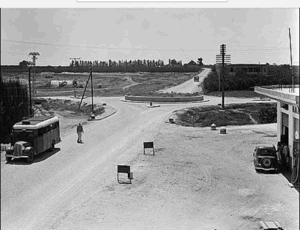
During the British Mandate, the Salama–al-'Abbasiyya Automobile Company was established. It owned cars and buses and included partners from neighbouring al-'Abbasiyya.
Agriculture was both rain-fed and irrigated, with approximately 85 artesian wells providing irrigation water.
Farmers shipped produce to the markets of Jaffa and also sold part of their output in nearby Jewish settlements. Milk was transported to a dairy factory in Jaffa owned by two men from Salama.
Land of Salama
According to the 1944/1945 statistics, Salama had a total land area of 6,782 dunams.
Arab ownership amounted to 5,633 dunams, Jewish ownership to 885 dunams, while 264 dunams were classified as public land.
Land Ownership in Salama in 1944/1945
- Arab ownership5,633 dunums83%
- Jewish ownership885 dunums13%
- Public land264 dunums4%
Land Use and Agriculture
Citrus cultivation was particularly important in Salama. Citrus and banana plantations covered a total of 3,248 dunams, including 2,853 Arab-owned dunams and 395 Jewish-owned dunams.
Irrigated and plantation land covered 684 dunams, including 370 Arab-owned dunams and 314 Jewish-owned dunams.
Cereal cultivation covered 2,406 dunams, including 2,266 Arab-owned dunams and 140 Jewish-owned dunams.
Palestine Remembered records approximately 25 dunams of Arab-owned land planted with olive trees. This represents a crop category within cultivated land and should not be added separately to the overall land-use totals.
Land Use in Salama in 1944/1945, in Dunams
- Arab
- Jewish
- Public
- Citrus and bananas3,248 dunums
- Irrigated and plantation land684 dunums
- Cereals2,406 dunums
- Built-up area114 dunums
- Uncultivable land330 dunums
Attacks on Salama Before Its Occupation
Salama was surrounded by several Jewish settlements and came under repeated attacks and sniper fire beginning on 5 December 1947.
A further assault on 19 December failed, while Palestinian historian Arif al-Arif records another attack on 28 December that the defenders of Salama succeeded in repelling.
In early January 1948, the villagers erected defensive roadblocks and trenches. Al-Arif states that the villagers themselves organized a local militia of approximately thirty men after the UN Partition Resolution.
The 18 January Attack
PalQuest, through Walid Khalidi, who in this case relies on Benny Morris and military documentation, reports that the Third Battalion of the Alexandroni Brigade launched a major assault against northern Salama on 18 January 1948.
The military orders transmitted through the Palestinian source indicate that the attack was intended to inflict casualties, blow up houses, and burn property. Several houses were reportedly destroyed.
This Israeli military material is cited only as transmitted through Walid Khalidi and PalQuest and not through direct reliance on Israeli sources.
The February and April Attacks
Salama faced another major attack on 28 February 1948. Twenty Arab Liberation Army fighters joined the local defenders during the battle.
According to an Arab communiqué published by the Palestinian newspaper Filastin, a large attacking force participated in the assault, and casualties were sustained on both sides.
A further attack and mortar bombardment took place on 15–16 April.
As the attacks and siege continued and ammunition became increasingly scarce during the second half of April, growing numbers of residents began to leave Salama.
Operation Hametz and the Occupation of Salama
Operation Hametz
Operation Hametz was a major Haganah offensive designed to occupy Palestinian villages east of Jaffa and on both sides of the railway, severing Jaffa from its Palestinian hinterland and facilitating the city's eventual fall.
PalQuest dates the operation as a whole from 24 April to 13 May 1948, while its detailed narrative states that the coordinated offensive by the Alexandroni, Kiryati, and Giv'ati brigades was launched on 29 April.
The operation was under the overall command of Dan Epstein, commander of the Alexandroni Brigade.
The Occupation of Salama
Salama fell to Haganah forces on 29 April 1948 during Operation Hametz.
There is an important discrepancy regarding the force directly responsible. The PalQuest entry for Salama, reproducing the account used by Walid Khalidi, attributes the village's occupation to units of the Alexandroni Brigade.
However, PalQuest's detailed page on Operation Hametz states that the Kiryati Brigade advanced from Tel Aviv to attack Salama and that by the evening of 29 April the village had fallen to units of the Kiryati and Giv'ati brigades.
Because this discrepancy exists within the Palestinian source itself, the most accurate formulation is to attribute the occupation to Haganah forces participating in Operation Hametz, while noting that the sources differ over which brigade entered Salama directly.
Arif al-Arif states that the forces did not enter until they were certain that the village had been evacuated and that Salama was empty by 30 April. Contemporary reports also described the village as surrendering on that date.
Displacement of the Inhabitants
The depopulation of Salama did not take place in a single event on the day of occupation. It developed gradually after months of attacks, shelling, siege, and declining defensive capacity.
Some families began leaving as early as December 1947, while the exodus accelerated during the second half of April 1948 as the defenders ran short of ammunition and Zionist forces closed in on Jaffa and its surrounding villages.
PalQuest, through Walid Khalidi, records that displaced inhabitants of Salama were scattered across several areas, including the Ramallah and Nablus regions, Gaza, and Jordan.
Salama After the Nakba
Walid Khalidi and PalQuest do not list a separate Israeli settlement established over Salama after the Nakba. Instead, they state that the expansion of Tel Aviv gradually engulfed the village site and its lands.
Later Palestinian sources identify much of the former village area with the zone now known as Kfar Shalem within Tel Aviv's urban expansion.
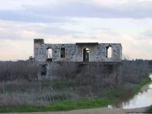
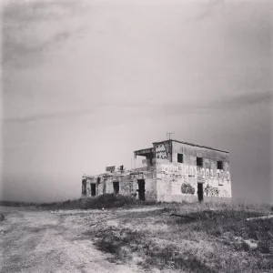
Surviving Buildings and the Village Site
According to the field documentation relied upon by Walid Khalidi, a substantial number of buildings and landmarks from Salama remained.
These included several houses, four coffeehouses, the mosque, the shrine of Sayyiduna Salama, and the two village schools.
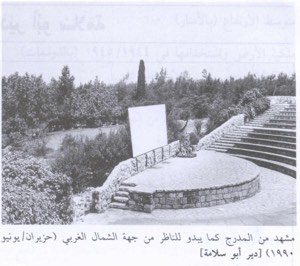
The village cemeteries also remained identifiable. One was abandoned and covered with wild vegetation, while another had been converted into a small park at the time of documentation.
The four coffeehouses were known by the names of their owners: Muhammad al-Hawtari, Abu 'Asba, Sha'ban al-Naji, and al-'Arbid.
Most surviving houses were made of concrete and consisted of one or two storeys. Some continued to be used after the Nakba, while others fell into disrepair.
Fig, cypress, palm, Christ's-thorn, and cactus plants grew throughout the site, while dense urban construction came to dominate most of the surrounding lands.
This description reflects the condition of the site during the field documentation relied upon by Walid Khalidi and should not necessarily be interpreted as a comprehensive survey updated to 2026.
Occupation and Depopulation Chronology
- 5 December 1947
Attacks on Salama Before Its Occupation
Salama was surrounded by several Jewish settlements and came under repeated attacks and sniper fire beginning on 5 December 1947. A further assault on 19 December failed, while Palestinian historian Arif al-Arif records another attack on 28 December that the defenders of Salama succeeded in repelling.
- 18 January 1948
The 18 January Attack
PalQuest, through Walid Khalidi, who in this case relies on Benny Morris and military documentation, reports that the Third Battalion of the Alexandroni Brigade launched a major assault against northern Salama on 18 January 1948. The military orders transmitted through the Palestinian source indicate that the attack was intended to inflict casualties, blow up houses, and burn property.
- 28 February 1948
The February and April Attacks
Salama faced another major attack on 28 February 1948. Twenty Arab Liberation Army fighters joined the local defenders during the battle.
- 13 May 1948
Operation Hametz
Operation Hametz was a major Haganah offensive designed to occupy Palestinian villages east of Jaffa and on both sides of the railway, severing Jaffa from its Palestinian hinterland and facilitating the city's eventual fall. PalQuest dates the operation as a whole from 24 April to 13 May 1948, while its detailed narrative states that the coordinated offensive by the Alexandroni, Kiryati, and Giv'ati brigades was l...
- 29 April 1948
The Occupation of Salama
Salama fell to Haganah forces on 29 April 1948 during Operation Hametz. There is an important discrepancy regarding the force directly responsible.
Sources
- PalQuest – Interactive Encyclopedia of the Palestine Question: Salama.
- PalQuest: Salama.
- PalQuest: Operation Hametz.
- Palestine Remembered: Salama, Jaffa District.
- Walid Khalidi, All That Remains: Salama, as reproduced by Palestine Remembered.
- Walid Khalidi, All That Remains, entry on Salama.
- Arif al-Arif, writings on the Nakba and the battles around Jaffa and Salama.
- Government of Palestine, censuses of 1922 and 1931.
- Government of Palestine, Department of Statistics, Village Statistics, 1945.
Photo gallery


Photos from the village's people
Photos sent in by visitors and published after review.
Add a photo of this village
Log in to add photos of this village.
Other villages from Jaffa
More from the archive
 Download Our Palestine App
The whole archive in the palm of your hand: depopulated villages, the Nakba, the massacres and Al-Aqsa — free, with no ads to erase the story.
Download Our Palestine App
The whole archive in the palm of your hand: depopulated villages, the Nakba, the massacres and Al-Aqsa — free, with no ads to erase the story.



Comments
No comments yet — be the first to write one.
Add your comment
Name and email are optional. Comments appear after review.