
The depopulated village of Mi'ar / District of Akka (Acre)

About the depopulated village of Mi'ar
- District
- Akka (Acre)
- Date Mi'ar was occupied
- 15 July 1948
- Population in 1948
- 890
- Military operation
- Operation Dekel
- Brigade that carried it out
- The Seventh Brigade
- Distance from the governorate centre
- 17.5 (km) Southeast of Acre
- Elevation above sea level
- 275 m
- Cause of displacement
- Military assault by Zionist troops
- Extent of destruction
- Mi'ar was completely destroyed, and only house rubble left behind.
- Ethnic cleansing
- Mi'ar inhabitants were completely ethnically cleansed.
Hover a dot to read the village name, or click to open its card.
Borders of the depopulated village of Mi'ar
Mi'ar: A Depopulated Palestinian Village in the Acre District
Mi'ar, also rendered as Mi'ar or Ma'ar, was a depopulated Palestinian village in the Acre District. It stood approximately 17.5 kilometers southeast of Acre on a rocky hill at the eastern edge of the Acre plain, at an average elevation of about 275 meters above sea level.
The Government of Palestine's 1944/1945 statistics recorded 770 inhabitants, all Muslims, and a total land area of 10,788 dunums. During the Nakba and the occupation of Palestine in 1948, Mi'ar was subjected to military pressure and entered by units of the Sheva' Brigade, also known as the Seventh Brigade, between 15 and 18 July during the second phase of Operation Dekel. Its Palestinian population was displaced and scattered among neighboring Palestinian towns and villages and outside Palestine.
Key Facts About Mi'ar
- Subdistrict: Acre.
- Distance from Acre: approximately 17.5 kilometers southeast.
- Average elevation: approximately 275 meters above sea level.
- Population in 1944/1945: 770.
- Estimated population in 1948: 893 according to Palestine Remembered.
- Total land area: 10,788 dunums.
- Occupation: between 15 and 18 July 1948; Palestine Remembered gives 15 July as a specific date.
- Military operation: Operation Dekel.
- Unit that entered the village: Sheva' (Seventh) Brigade.
Location of Mi'ar
Mi'ar stood on a rocky hill at the eastern edge of the Acre plain, approximately 275 meters above sea level.
A secondary road connected the village with al-Damun to the northwest and from there with the road network leading toward Acre and neighboring villages.
The village lands bordered those of Sha'b, Kabul, Kawkab Abu al-Hija, Sakhnin, and Tamra. Mi'ar itself lay approximately three kilometers south of Sha'b.
The Origin of the Name Mi'ar
The Palestinian Encyclopedia suggests that Mi'ar or Ma'ar may derive from an ancient Canaanite name, Ma'ara, interpreted as meaning an “exposed place” or a “place bare of trees.” The interpretation corresponds to the village's position on a rocky, exposed hill.
This linguistic derivation remains a historical hypothesis rather than a conclusively established etymology.
During the Crusader period, the village was known as Myary.
Mi'ar During the Ottoman Period
In 1596, Mi'ar was recorded in the nahiya of Acre within the liwa' of Safad and had an estimated population of approximately 55.
The inhabitants paid taxes on wheat, barley, fruit, goats, beehives, and other forms of agricultural production.
In 1859, the population was estimated at approximately 1,500, cultivating about thirty faddans of land. This figure should be understood as a historical estimate rather than an official census directly comparable with the later Mandate censuses.
Mi'ar During the 1936–1939 Palestinian Revolt
Mi'ar was subjected to severe British punitive measures during the 1936–1939 Palestinian Revolt.
Palestinian local documentation records that on 25 October 1938 the British army shelled the village after gunfire had twice been directed from the area toward British soldiers.
The attack and subsequent punitive measures destroyed approximately forty houses. Hundreds of villagers were detained, and residents were also compelled to perform road-building labor.
Many inhabitants temporarily left the village following the attack but later returned. It is therefore more accurate to state that Mi'ar suffered extensive destruction in 1938 rather than that the entire village was permanently destroyed at that time.
The Built Environment of Mi'ar
The houses of Mi'ar were closely clustered and constructed mainly of stone and mud brick, with narrow streets and alleys following the contours of the rocky hill.
The built-up area covered approximately 37 dunums according to the 1944/1945 statistics.
The surrounding village lands combined rough rocky terrain with cereal fields, orchards, and olive trees.
Population of Mi'ar
The 1922 Census of Palestine recorded 429 inhabitants in Mi'ar.
In the 1931 census, the population had increased to 543, including 262 males and 281 females, living in 109 houses.
The Government of Palestine's 1944/1945 statistics recorded 770 inhabitants, all Muslims.
The figures of 893 inhabitants for 1948 and 5,485 refugees for 1998 published by Palestine Remembered are later demographic estimates rather than official censuses.
Population of Mi'ar
- 1596About 55Historical estimate based on Ottoman tax records
- 1859About 1,500Historical estimate, not an official census
- 1922429Official census
- 1931543Official census
- 1944/1945770Government of Palestine statistics; all Muslims
- 1948893Later estimate published by Palestine Remembered
- 19985,485Later refugee-population estimate published by Palestine Remembered
Number of Houses in Mi'ar
The 1931 Census of Palestine recorded 109 houses in Mi'ar.
The figure of 179 houses for 1948 published by Palestine Remembered is a later estimate rather than the result of an official census conducted that year.
Number of Houses in Mi'ar
- 1931109Official census
- 1948179Later estimate published by Palestine Remembered
Education in Mi'ar
The Ottoman authorities established a school in Mi'ar in 1888.
According to Walid Khalidi and PalQuest, this school was closed during the final years of the Ottoman Empire.
Palestinian local documentation provides a somewhat different chronology, stating that the school was closed during the Second World War and that the British Mandate authorities constructed an elementary school in Mi'ar in 1944.
Because the accounts differ, both are preserved with attribution rather than combined into an uncertain single chronology.
Land Ownership in Mi'ar
The Government of Palestine's 1944/1945 statistics recorded a total land area of 10,788 dunums for Mi'ar, with no Jewish land ownership recorded.
The Arabic Palestine Remembered table uses the categories “Palestinian,” “Transferred to Zionists,” and “Masha'.” These terms are retained below as the terminology used by that source. The corresponding official Government of Palestine categories were “Arab” and “Public.”
Land Ownership in Mi'ar, 1944/1945, Using Palestine Remembered Terminology
- Palestinian10,785 dunums100%
- Transferred to Zionists0 dunums0%
- Masha' (source terminology)3 dunums<1%
Land Use in Mi'ar in 1944/1945
A total of 2,991 dunums was cultivated or classified as cultivable, all recorded as Arab land.
Cereals occupied 2,878 dunums, while plantations and irrigable land covered 113 dunums.
The built-up area covered 37 dunums. Non-cultivable land totaled 7,760 dunums, consisting of 7,757 dunums of Arab land and 3 dunums of public land.
Land Use in Mi'ar According to the 1944/1945 Statistics
- Arab
- Jewish
- Public
- Plantations and Irrigable Land113 dunums
- Cereals2,878 dunums
- Built-up Area37 dunums
- Non-Cultivable Land7,760 dunums
Palestine Remembered separately records 361 dunums planted with olive trees. This figure is presented as supplementary agricultural information and is not added again to the official land-use categories.
Economic Life in Mi'ar
Agriculture formed the basis of Mi'ar's economy, and grain cultivation was particularly important.
Palestinian local documentation states that the village was known for its cereal production, part of which was sold to surrounding villages and transported by camels and pack animals.
The inhabitants also cultivated olives, fruit, and orchards, while goats and beehives had formed part of the local economy since the Ottoman period.
Archaeological Remains in Mi'ar
Mi'ar occupied a site of archaeological significance, with remains in and around the village indicating a long history of settlement.
Recorded remains included rock carvings, traces of ancient buildings, column fragments, olive presses, and water cisterns.
Khirbat Ra's al-Zaytun lay north of the village, while Khirbat al-Jumayjima was situated between Mi'ar and Sakhnin.
Operation Dekel
The occupation of Mi'ar was associated with Operation Dekel, an Israeli military offensive carried out between 8 and 18 July 1948 during the renewed fighting between the two truces.
The operation resulted in the occupation of most of Lower Galilee, including Nazareth, and expanded Israeli military control in western Galilee.
The Sheva', Golani, and Carmeli Brigades participated in different phases of Operation Dekel.
Mi'ar itself, however, was entered during the second phase by units of the Sheva' Brigade, also known as the Seventh Brigade.
The Occupation and Depopulation of Mi'ar
During the second phase of Operation Dekel, units of the Sheva' Brigade advanced toward Mi'ar from areas of Lower Galilee that had recently come under Israeli control.
Walid Khalidi, citing Israeli historian Benny Morris, records that the brigade entered Mi'ar between 15 and 18 July 1948. Palestine Remembered gives 15 July as the specific occupation date.
The account cited by Khalidi indicates that the inhabitants left either as a result of artillery fire or under the influence of the occupation of large areas of Lower Galilee.
Palestinian local documentation additionally records artillery shelling and gunfire accompanying the approach of the attacking forces, forcing the population to leave.
Information originating in Israeli sources is presented here through the Palestinian intermediary sources Walid Khalidi and PalQuest rather than through independent reliance on Israeli sources.
The People of Mi'ar After the Nakba
After the Nakba, the people of Mi'ar were dispersed among Palestinian towns and villages as well as neighboring Arab countries.
The Palestinian Encyclopedia and local documentation record significant communities of internally displaced people from Mi'ar in Kabul, Sakhnin, Sha'b, 'Arraba, Tamra, al-Makr, Shafa 'Amr, Haifa, and Nazareth.
Other villagers and their families were displaced to Lebanon, Syria, and elsewhere.
Because contemporary estimates of the community's total population vary according to date and the inclusion of descendants, this article does not use an undated modern total as a definitive figure.
Israeli Settlements on Mi'ar's Lands
Walid Khalidi and PalQuest identify three principal settlements established on the lands of Mi'ar after the Nakba:
- Segev: established in 1953 east of the former village site.
- Ya'ad: established in 1975 northeast of the village according to PalQuest; some Palestinian local sources give 1974.
- Manof: established in 1980 on Mi'ar's lands.
Palestinian local documentation states that Segev was reorganized or transformed into Atzmon in 1983 and also associates part of the later settlement of Rakefet with Mi'ar's lands.
Yuvallim, established in 1982 approximately two kilometers east of the village site, is identified by Walid Khalidi as standing on land traditionally belonging to neighboring Sakhnin and is therefore not included among the settlements established on Mi'ar's lands.
The Destruction of Mi'ar
The built-up area of Mi'ar was demolished after the displacement of its inhabitants. Palestinian local documentation states that the Israeli authorities completed the destruction of the village houses in 1963.
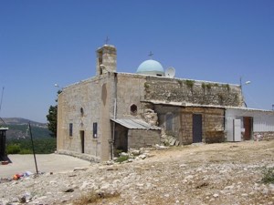
The destruction of the houses did not eliminate every physical trace of the village. Portions of stone walls, graves, and old trees remained visible, as also recorded in Walid Khalidi's field description.
The Site of Mi'ar After the Nakba
According to Walid Khalidi's historical field description, truncated stone walls and simple graves remained on the village site, together with fig and olive trees.
Cypress trees covered much of the site, and the area had been converted into recreational and picnic grounds.
Palestinian local documentation additionally records two cemeteries and surviving fig, olive, and cactus plants and describes the former village site as lying within the area known as Segev Forest.
Khalidi's description is based on fieldwork conducted for All That Remains and should not necessarily be treated as an updated field survey of the site today.
Sources
- PalQuestPalQuest – Interactive Encyclopedia of the Palestine Question: Mi'ar
- PalQuestPalQuest – Interactive Encyclopedia of the Palestine Question: Operation Dekel
- Palestine RememberedPalestine Remembered: Mi'ar – Acre District
- palestinapedia.psPalestinian Encyclopedia: Mi'ar
- palqura.comPalestinian Villages Encyclopedia: Mi'ar / Ma'ar
- pal48.psFilastunna: The Depopulated Village of Mi'ar
Photo gallery


Photos from the village's people
Photos sent in by visitors and published after review.
Add a photo of this village
Log in to add photos of this village.
Other villages from Akka (Acre)

More from the archive


 Download Our Palestine App
The whole archive in the palm of your hand: depopulated villages, the Nakba, the massacres and Al-Aqsa — free, with no ads to erase the story.
Download Our Palestine App
The whole archive in the palm of your hand: depopulated villages, the Nakba, the massacres and Al-Aqsa — free, with no ads to erase the story.



Comments
No comments yet — be the first to write one.
Add your comment
Name and email are optional. Comments appear after review.