
The depopulated village of Bayt 'Itab / District of Al-Quds (Jerusalem)
About the depopulated village of Bayt 'Itab
- District
- Al-Quds (Jerusalem)
- Date Bayt 'Itab was occupied
- 21 October 1948
- Population in 1948
- 626
- Military operation
- Operation Ha-Har
- Distance from the governorate centre
- 17.5 (km) West of Jerusalem
- Elevation above sea level
- 675 m
- Cause of displacement
- Military assault by Zionist troops
- Extent of destruction
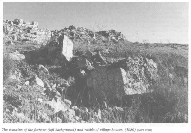
- Beit 'Itab was completely obliterated with the exception of some house rubble left behind.
- Ethnic cleansing
- Bayt 'Itab inhabitants were completely ethnically cleansed.
- Settlements built on the built-up area of Bayt 'Itab after 1948
- Nes Harim, Bar Giora
Hover a dot to read the village name, or click to open its card.
Borders of the depopulated village of Bayt 'Itab
Bayt 'Itab – A Depopulated Palestinian Village in the Jerusalem Subdistrict
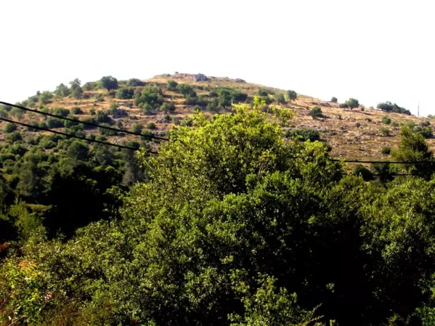
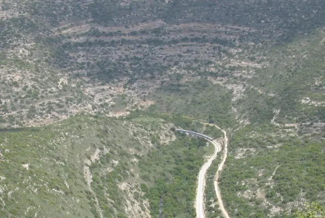
Bayt 'Itab was a Palestinian village in the Jerusalem Subdistrict, situated approximately 17.5 km west of Jerusalem on a high mountain in the western Jerusalem hills, at an average elevation of about 675 meters above sea level.
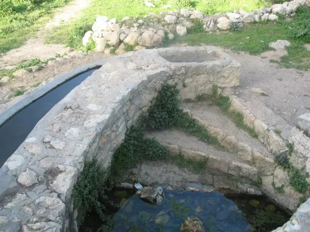
The village overlooked lower mountain peaks, while its lands extended southwest toward Wadi al-Maghara. Several springs surrounding Bayt 'Itab provided water for drinking and irrigation. A secondary road connected the village with the Bayt Jibrin–Bethlehem road approximately 3 km to the south.
Israeli occupation forces captured Bayt 'Itab on 21 October 1948 during Operation ha-Har, following the end of the second truce. Khalidi's village-specific account does not identify a particular brigade or battalion as the force that physically entered Bayt 'Itab, although Har'el and Etzioni were the principal brigades of the wider offensive.
- Subdistrict
- Jerusalem
- Historical region
- al-'Arqub
- Distance from Jerusalem
- Approximately 17.5 km west
- Average elevation
- Approximately 675 m above sea level
- Population, 1944/45
- 540
- Estimated population, 1948
- 626
- Total land area
- 8,757 dunums
- Date of occupation
- 21 October 1948
- Military operation
- Operation ha-Har
- Village-specific military unit
- Israeli occupation forces participating in Operation ha-Har; the principal village entry does not conclusively identify the assault unit
- Confirmed Israeli settlement on village land
- Nes Harim, established in 1950
Location and Geography of Bayt 'Itab
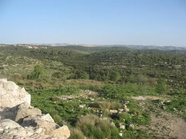
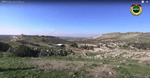
Bayt 'Itab stood on a high mountain in the western Jerusalem hills, on a rocky knoll overlooking lower surrounding peaks.
Its lands extended southwest to Wadi al-Maghara. A secondary road linked the village with the Bayt Jibrin–Bethlehem road, which passed approximately three kilometers to the south.
Local roads also linked Bayt 'Itab with neighboring villages in the al-'Arqub region and with routes toward Jerusalem and Bab al-Wad.
Neighboring Villages
Palestinian maps and local documentation indicate the following approximate geographical relationships:
- Northwest: Dayr al-Hawa.
- West: Sufla.
- Southwest: Bayt Nattif; some broader local boundary descriptions also include Jarash.
- South: Khirbat al-Tannur.
- Southeast: 'Allar.
- East: Ras Abu 'Ammar.
- Northeast: Dayr al-Shaykh.
These directions describe approximate geographical relationships and are not substitutes for historical cadastral boundary maps.
Name and Historical Forms
Khalidi identifies Bayt 'Itab with the locality called Enadab in the fourth-century list of Palestinian towns compiled by Eusebius.
During the Crusader period, the village was known as Bethahatap.
Local oral history preserves Bayt 'Itab, with the Arabic pronunciation used by its inhabitants, as the inherited village name.
Ottoman local documentation also refers to Bayt 'Itab al-Fawqa and Bayt 'Itab al-Sufla. Over time, the upper locality retained the name Bayt 'Itab, while the lower locality came to be known as Sufla.
Ancient and Medieval Background
Bayt 'Itab occupied a site with a long historical record. Scholars have associated it with Byzantine Enadab and the Crusader Bethahatap.
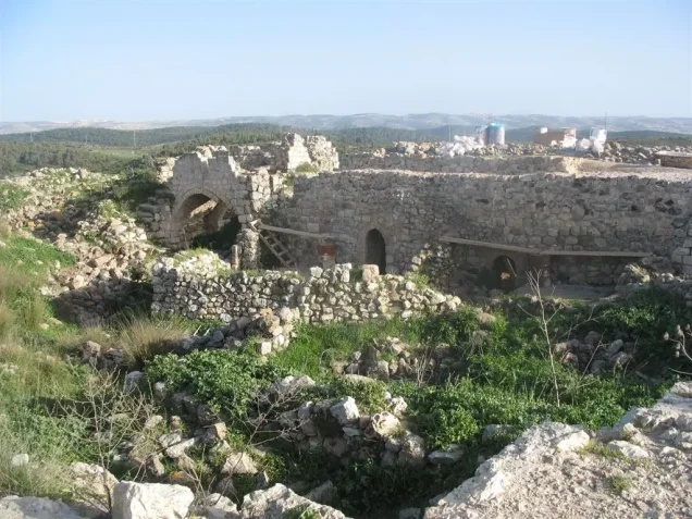
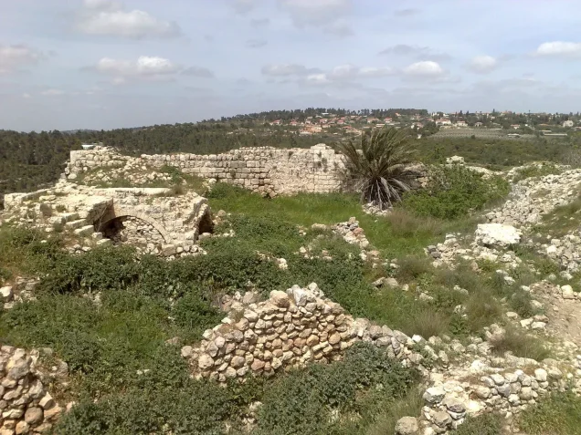
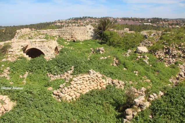
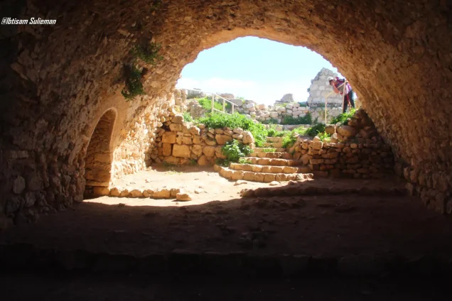
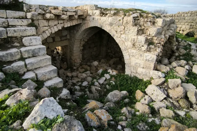
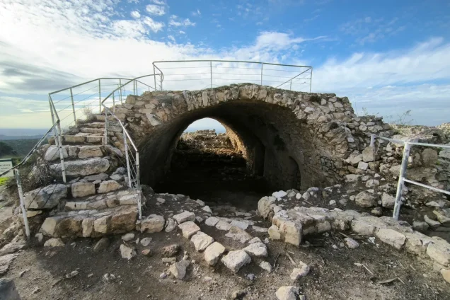
The most prominent surviving historical structure was the ruin of a Crusader-era fortress in the center of the village.
Bayt 'Itab under Ottoman Rule
Later Palestinian research based on Ottoman land and Islamic court documents records Bayt 'Itab al-Fawqa and al-Sufla during the sixteenth century.
A document dated 1553/54 lists household heads and agricultural taxpayers and records taxation on wheat, barley, olives, and fruit trees.
An earlier document from 1538 is also reported to refer to an imam serving a mosque in the village.
The Lahham Family and al-'Arqub
During the nineteenth century, Bayt 'Itab became a center of the influential Lahham family in the al-'Arqub region.
Khalidi states that in the 1850s the family controlled as many as twenty-four villages in the subdistrict.
In 1855, armed conflict broke out between the Lahham family and their Abu Ghawsh rivals, and Bayt 'Itab became the scene of intense fighting.
The later extension of regular Ottoman administrative authority reduced the political and military influence of both families.
Built Form of Bayt 'Itab
Edward Robinson visited Bayt 'Itab in 1838 and described its stone houses as solidly constructed. Some were two storeys high.
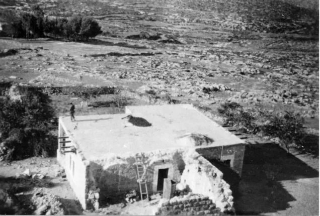
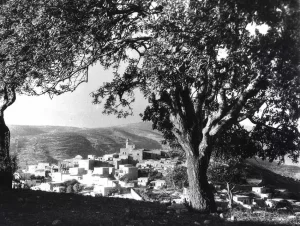
By the late nineteenth century, the village stood on a rocky knoll above the surrounding ridge and most houses were built of stone.
The original village plan was circular. Later construction extending southwest along the road toward Sufla gradually gave the built-up area an arc-like shape.
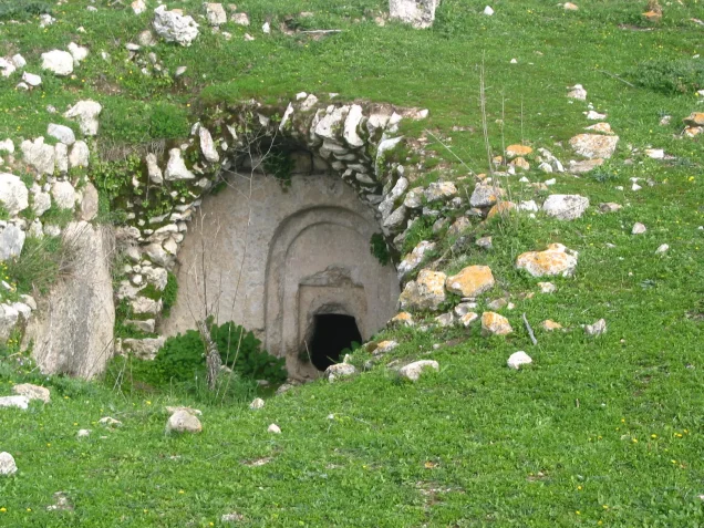
A large cavern approximately eighteen feet wide and six feet high extended beneath some of the village houses.
Population of Bayt 'Itab
The official 1922 Census of Palestine recorded 504 inhabitants in Bayt 'Itab, all Muslims.
By the 1931 census, the population had risen to 606, again all Muslims, living in 187 occupied houses.
The 1944/45 Village Statistics recorded 540 Arab Muslim inhabitants.
Palestine Remembered later estimated the population at 626 in 1948 and the number of refugees and their descendants at 3,847 in 1998. These are retrospective estimates rather than official British Mandate census counts.
- 1838Approximately 600–700Edward Robinson's estimate
- 1875Approximately 700Historical estimate
- 1922504Official census; all Muslims
- 1931606Official census; all Muslims
- 1944/45540Official British Mandate statistics
- 1948626Later estimate, not an official census
- 19983,847 refugeesLater estimate of refugees and descendants
Number of Houses
- 1931187Occupied houses recorded in the official census
- 1948193Later Palestine Remembered estimate, not an official census count
Education in Bayt 'Itab
Khalidi's principal village entry does not provide details about education, but later Palestinian local documentation states that Bayt 'Itab had a traditional kuttab before the establishment of a formal school.
According to this local documentation, the school existed before the British Mandate and was expanded in 1921 to provide instruction through the sixth grade.
The school stood west of the village and had a large yard planted with trees and a small library.
These details derive from local Palestinian documentation and oral-history material rather than a formal Mandate Department of Education statistical table.
The Mosque
Bayt 'Itab's inhabitants were Muslims. Local Ottoman documentation reportedly records an imam serving a village mosque as early as the sixteenth century.
Local history also recalls teachers who taught both at the school and in the mosque.
Khalidi's principal entry does not provide a detailed architectural description, so no unsupported claims about the mosque's design or construction chronology have been added.
Land Ownership in Bayt 'Itab
The total land area recorded for Bayt 'Itab in the 1944/45 Village Statistics was 8,757 dunums.
Palestine Remembered presents the simplified ownership categories as follows:
- Palestinian5,447 dunums62%
- Transferred to Zionists0 dunums0%
- Communal/Public3,310 dunums38%
The official Village Statistics use the original categories Arab and Public: 5,447 dunums were classified as Arab and 3,310 as public land. No land was recorded under the Jewish category.
Local oral accounts refer to wider areas owned or used by Bayt 'Itab families in surrounding localities, but those areas should not be added automatically to the official 8,757-dunum cadastral/statistical total for the village unit.
Land Use in 1944/45
- Arab
- Public
- Cereals1,400 dunums
- Plantations and irrigable land665 dunums
- Built-up land14 dunums
- Non-cultivable land6,678 dunums
Cultivable land totaled 2,065 dunums, approximately 24 percent of the total area.
Built-up and non-cultivable land totaled 6,692 dunums, approximately 76 percent.
The full 6,678 dunums of non-cultivable land should not be assigned to Palestinian private ownership: 3,368 dunums were Arab and 3,310 were public.
Approximately 116 dunums were planted with olive trees. This was a crop-specific subset of the 665 dunums classified as plantations and irrigable land, not an additional category.
Economic Life
Agriculture and livestock raising formed the principal basis of village life.
Villagers cultivated cereals, olives, grapes, and other fruit trees. They also owned extensive areas on the coastal plain that were used for cereal cultivation.
In 1944/45, 1,400 dunums were allocated to cereals and 665 dunums to plantations and irrigable cultivation.
Some crops were rain-fed, while springs supplied irrigation water for orchards and other cultivation.
During the Mandate, the authorities expropriated some village land to establish a large government-owned woodland.
Water and Springs
Several springs surrounding Bayt 'Itab supplied drinking and irrigation water.
Local Palestinian documentation preserves names including 'Ayn Bir al-Malik, 'Ayn Bint Nuh, 'Ayn al-Rummani, 'Ayn Khirbat al-Tannur, 'Ayn al-Muna, 'Ayn al-Khinzir, 'Ayn al-Balad, and 'Ayn al-Birka.
Local oral accounts describe some as perennial, while smaller springs sometimes dried during the summer.
Khalidi's principal entry confirms the general importance of the springs for drinking and irrigation; the individual names come from later local geographical documentation.
Olives, Vineyards, and Orchards
Olive terraces were especially prominent north of the village.
Villagers also cultivated grapevines and other fruit trees on the slopes and in areas where spring water made irrigation possible.
In 1944/45, approximately 116 dunums were planted with olive trees within the broader plantation and irrigable-land category.
The Fortress and Archaeological Heritage
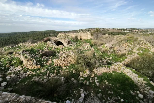
The village center contained the remains of a prominent Crusader-era fortress.
Edward Robinson observed the ruins during his 1838 visit, and the fortress remained one of the most visible features after the destruction of the village.
Bayt 'Itab is also associated with Eusebius's Enadab and the Crusader Bethahatap.
Name identification alone, however, should not be taken as proof of uninterrupted settlement from the fourth century to the modern period without independent archaeological evidence.
The Lahham–Abu Ghawsh Conflict
In the 1850s Bayt 'Itab was the center of the powerful Lahham family, whose influence extended over many villages of al-'Arqub.
Armed conflict between the Lahham and Abu Ghawsh families broke out in 1855, and Bayt 'Itab became a major scene of fighting.
The expansion of centralized Ottoman administration later reduced the power of both local leadership networks.
Operation ha-Har
Operation ha-Har began on 19 October 1948 and continued through 24 October following the end of the second truce.
Its objective was to widen Israeli-controlled territory in the southern Jerusalem corridor and link it with areas occupied toward the Hebron hills.
The operation complemented Operation Yoav, which was being carried out simultaneously farther south.
PalQuest lists the Har'el, Etzioni, and Giv'ati brigades among the Zionist units associated with Operation ha-Har, while its narrative identifies Har'el and Etzioni as the principal attacking brigades.
Egyptian forces defended several villages in this sector, while Israeli forces sought to avoid drawing the Transjordanian Arab Legion directly into the fighting.
Occupation and Depopulation of Bayt 'Itab
Bayt 'Itab was one of a chain of Palestinian villages in the southern Jerusalem corridor captured during Operation ha-Har.
Khalidi, citing Israeli historian Benny Morris, gives 21 October 1948 as the date of occupation.
Palestine Remembered classifies the cause of depopulation as direct military assault.
Khalidi's village-specific entry does not identify the brigade or battalion that physically entered Bayt 'Itab. It would therefore be unwarranted to assign the village conclusively to Har'el's Sixth Battalion merely because that battalion captured nearby villages such as Jarash and Sufla during the same operation.
The most precise formulation is that Israeli occupation forces captured Bayt 'Itab on 21 October 1948 during Operation ha-Har, while the village-specific assault unit remains unspecified in the principal source.
- 19 October 1948
Beginning of Operation ha-Har
Offensive begins in the southern Jerusalem corridor after the second truce
- 21 October 1948
Occupation of Bayt 'Itab
Village captured during Operation ha-Har
- Not conclusively identified
Village-specific assault unit
Har'el, Etzioni, and Giv'ati were associated with the wider operation; the village entry does not name the unit that entered Bayt 'Itab
- October 1948
Cause of depopulation
Direct military assault according to Palestine Remembered
- 24 October 1948
End of Operation ha-Har
End of the offensive after the occupation of a chain of villages southwest of Jerusalem
Israeli Settlements on Bayt 'Itab's Lands
Nes Harim: Established in 1950 on land belonging to Bayt 'Itab, north of the former village site.
Khalidi also identifies Nes Harim as standing on Bayt 'Itab land when discussing neighboring Dayr al-Shaykh.
Some later Palestinian institutional sources list additional settlements in the wider historical land area, but the principal Khalidi/PalQuest village entry clearly confirms Nes Harim; it is therefore the settlement listed here as securely established on Bayt 'Itab's lands.
Bayt 'Itab Today
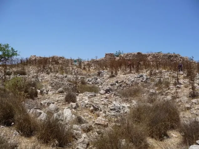
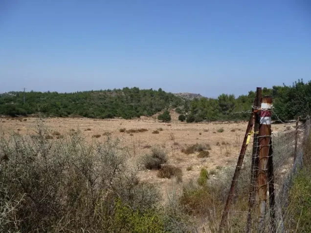
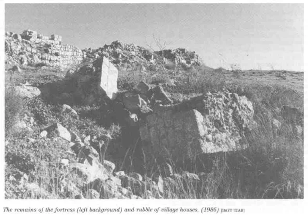
According to Walid Khalidi's field description in All That Remains, large quantities of rubble from the demolished village houses covered the site.
The remains of the Crusader fortress were still prominent. Two cemeteries lay east and west of the former village, and some graves had been disturbed at the time of the survey.
Almond, carob, and olive trees grew on the site and along its lower approaches, while cactus grew on the southern edge.
Part of the surrounding agricultural land was under cultivation.
This account is based on fieldwork conducted before the publication of All That Remains in 1992; one of Khalidi's principal site photographs is dated 1986. It therefore should not be treated as direct verification of every feature in 2026.
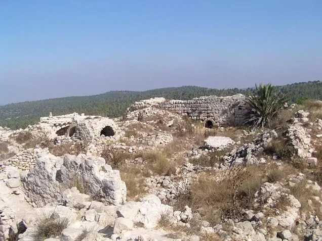
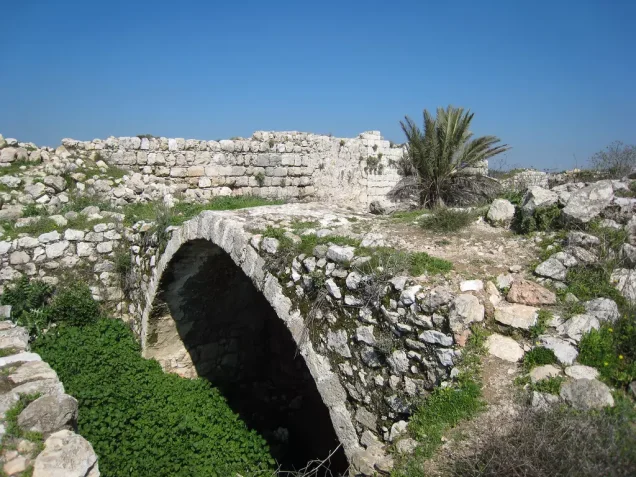
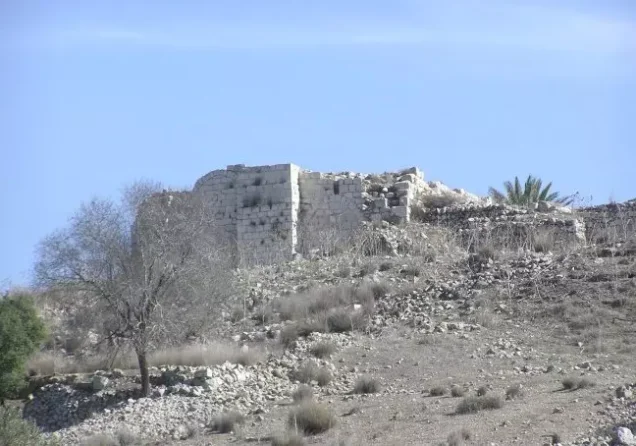
Palestine Remembered contains later community documentation, including sets of images uploaded in June and July 2025 that depict rubble and remains associated with the village site. Upload dates do not necessarily establish the actual date on which each photograph was taken, and the material does not constitute a comprehensive independent archaeological or architectural survey conducted in 2026.
Sources
- PalQuestPalQuest – Interactive Encyclopedia of the Palestine Question: Bayt 'Itab
- PalQuestPalQuest – Operation ha-Har
- Palestine RememberedPalestine Remembered – Bayt 'Itab, Jerusalem
- Palestine RememberedPalestine Remembered – Bayt 'Itab entry from All That Remains
- Institute for Palestine StudiesInstitute for Palestine Studies – Walid Khalidi, All That Remains
- pcbs.gov.psGovernment of Palestine – Census of Palestine 1922
- fada.birzeit.eduBirzeit University Repository – Census of Palestine 1931
- sabil.meGovernment of Palestine – Village Statistics 1945: Jerusalem Sub-District, Population and Land Ownership
- maktabatsabil.comGovernment of Palestine – Village Statistics 1945: Jerusalem Sub-District, Built-up and Non-Cultivable Land
- palqura.comPalestinian Villages Encyclopedia – Bayt 'Itab: local history, education, water sources, and oral documentation
Photo gallery


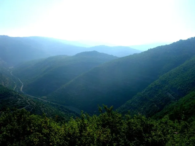
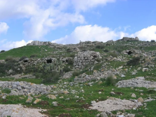
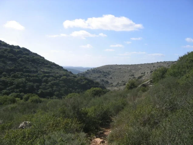
Photos from the village's people
Photos sent in by visitors and published after review.
Add a photo of this village
Log in to add photos of this village.
Other villages from Al-Quds (Jerusalem)
More from the archive
 Al-Quds (Jerusalem)
The depopulated village of Khirbat al-Tannur - Allar al-Sifla / District of Al-Quds (Jerusalem)
 Al-Quds (Jerusalem)
The depopulated village of Jarash / District of Al-Quds (Jerusalem)
 Al-Quds (Jerusalem)
The depopulated village of al-Burayj (Bayarat Burayj) / District of Al-Quds (Jerusalem)
 Download Our Palestine App
The whole archive in the palm of your hand: depopulated villages, the Nakba, the massacres and Al-Aqsa — free, with no ads to erase the story.
Download Our Palestine App
The whole archive in the palm of your hand: depopulated villages, the Nakba, the massacres and Al-Aqsa — free, with no ads to erase the story.



Comments
No comments yet — be the first to write one.
Add your comment
Name and email are optional. Comments appear after review.