
The depopulated village of Zayta / District of Hebron
About the depopulated village of Zayta
- District
- Hebron
- Date Zayta was occupied
- 17 July 1948
- Population in 1948
- 380
- Military operation
- Operation Yoav
- Who defended the village
- Local Palestinian militias and some Arab Liberation Army volunteers
- Distance from the governorate centre
- 29 (km) Northwest of Hebron
- Elevation above sea level
- 75 m
- Cause of displacement
- Military assault by Zionist troops
- Extent of destruction
- Zayta was completely destroyed and defaced.
- Ethnic cleansing
- Zayta inhabitants were completely ethnically cleansed.
Hover a dot to read the village name, or click to open its card.
Borders of the depopulated village of Zayta
Zayta – Depopulated Palestinian Village of the Hebron District
Zayta was a depopulated Palestinian village in the Hebron District, located approximately 29 kilometers northwest of Hebron. PalQuest gives an average elevation of about 75 meters above sea level.
The final village stood on a hill approximately one kilometer north of Wadi Zayta. During the British Mandate, the inhabitants moved north from the older site known as Khirbat Zayta al-Kharab because stagnant water in the wadi encouraged insects and disease.
The Giv'ati Brigade occupied Zayta during Operation An-Far in July 1948. The precise date is disputed: one account places the capture on 9–10 July, while another gives 17–18 July.
Location and Geography
Zayta lay northwest of Hebron, near the transitional zone between the western foothills of the Hebron highlands and the southern coastal plain.
It was approximately 29 kilometers northwest of Hebron. PalQuest gives an average elevation of about 75 meters above sea level, while the Palestinian Encyclopedia gives approximately 175 meters for the new village site. This source discrepancy is retained rather than merged into a single figure.
The village stood on a hill about one kilometer north of Wadi Zayta. A dirt track connected it with 'Iraq al-Manshiyya, which lay on the main east–west road between the coastal town of al-Majdal and Bayt Jibrin.
Nearby villages included 'Iraq al-Manshiyya, Bayt Jibrin, Kudna, Ra'na, Zikrin, Summil, al-Jusayr, and Barqusya.
Old Zayta and the Relocation of the Village
The older settlement, known as Khirbat Zayta al-Kharab, stood south of the later village on the southern bank of Wadi Zayta.
Walid Khalidi places the distance between the old and new sites at approximately 1.5 kilometers, while the Palestinian Encyclopedia rounds it to about two kilometers.
During the British Mandate, the inhabitants moved to the new site north of the wadi because stagnant water in the old location encouraged insects and disease.
The new village extended along a northeast–southwest axis, and its houses were constructed of mud, wood, and cane.
Ottoman Period
In 1596, Zayta belonged to the nahiya of Gaza in the liwa' of Gaza and had an estimated population of approximately 165.
The villagers paid taxes on wheat, barley, goats, and beehives.
In the late nineteenth century, the old settlement was described as a small adobe-built hamlet at the edge of the wadi, flanked by low hills.
Population and Houses
The inhabitants of Zayta were Muslims.
- 1596About 165Historical estimate derived from Ottoman records
- 1922139Official Census of Palestine: 68 males and 71 females, all Muslims
- 1931234Official census; all inhabitants were Muslims
- 1945330Official statistics; all inhabitants were Palestinian Arab Muslims
- 1948About 383Later Palestine Remembered estimate, not an official Mandate census
- 1998About 6,839 refugees and descendantsLater demographic estimate published by Palestine Remembered
The official 1931 census recorded 44 inhabited houses.
Palestine Remembered currently displays an estimate of 209 houses for 1948. No independent official basis for that number was located in the sources reviewed, so it is not treated as an official or securely established figure.
Built Environment and Public Services
The new village extended along a northeast–southwest axis, with houses built from mud, wood, and cane.
The Palestinian Encyclopedia describes Zayta as having few public facilities or services.
Walid Khalidi and PalQuest do not document an independent formal school or a specifically identified mosque in the village. Neither is therefore added without clearer village-specific documentation.
Water Resources
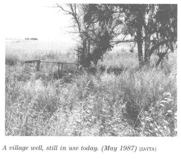
Zayta relied on artesian wells for drinking water.
Most wells were dug south of the village near Wadi Zayta, where groundwater lay close to the surface.
Another well stood north of the village.
The unhealthy stagnant water in the wadi was one of the principal reasons the villagers moved from the old settlement to the newer site during the Mandate.
Economic Life and Agriculture
Most inhabitants depended on rainfed agriculture and livestock raising, particularly sheep and goats.
Cereals were cultivated across extensive areas, while remaining suitable land was used as grazing ground.
The official 1944/45 land-use table does not list a separate orchard or olive category for Zayta, so no unsupported crop acreage is added.
Land Ownership, 1944/45
The total land area of Zayta was 10,490 dunams. Under the official Government of Palestine classification, ownership was distributed as follows:
- Arab3,127 dunums30%
- Jewish1,273 dunums12%
- Public6,090 dunums58%
Palestine Remembered presents the same figures using its simplified terminology: 3,127 dunams “Palestinian,” 1,273 dunams “Transferred to Zionists,” and 6,090 dunams “Communal/Public.” The wording “Transferred to Zionists” should be preserved when reproducing that source's terminology rather than replacing it with the official “Jewish” category.
Land Use, 1944/45
- Arab
- Jewish
- Public
- Cereals10,150 dunums
- Total cultivable/cultivated land10,150 dunums
- Non-cultivable land308 dunums
- Built-up land32 dunums
- Total non-cultivable and built-up340 dunums
The official table balances exactly: 10,150 dunams of cultivated or cultivable land plus 340 dunams of built-up and non-cultivable land equal Zayta's total area of 10,490 dunams.
Palestine Remembered's simplified land-use display requires correction when interpreted. It places 8,899 cereal dunams in the Palestinian column, while the official table shows that this figure combines 3,027 Arab dunams with 5,872 Public dunams. Public land has therefore been kept separate above.
Archaeological Sites
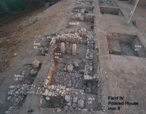
Palestine Remembered lists several archaeological localities associated with Zayta, including Khirbat Rujum al-Darbi, Zayta al-Kharab, and Bisiya.
The principal sources reviewed do not provide sufficient archaeological dating to assign these remains securely to particular historical periods.
Operation An-Far
Operation An-Far began on 8 July and officially ended on 15 July 1948.
It was an offensive launched by the Giv'ati Brigade on the southern front during the Ten Days between the two truces, intended to expand Israeli control southward and eastward and link coastal territory with Jewish settlements in the Negev.
The Giv'ati Brigade carried out the operation, with its First Battalion serving as the principal spearhead at the operational level.
PalQuest explicitly lists Zayta among the villages affected by Operation An-Far.
Occupation and Depopulation
The sources cited by Walid Khalidi do not agree on a single occupation date.
The History of the War of Independence, as cited through Khalidi, places the occupation on 9–10 July 1948, during the early phase of Operation An-Far.
Benny Morris, as cited by Khalidi, gives a later date of 17–18 July 1948.
This creates a chronological difficulty because PalQuest dates the official end of Operation An-Far to 15 July, even though both Khalidi and PalQuest clearly classify Zayta among the villages taken in the context of the operation.
The discrepancy is therefore preserved rather than artificially resolved: 9–10 July according to one account, and 17–18 July according to another.
The 1 July date currently displayed by the Palestinian Villages Encyclopedia predates the beginning of Operation An-Far and is therefore not used.
Correction of the Military Operation
The summary field on Palestine Remembered currently identifies “Operation Yoav” as the operation associated with Zayta.
However, the historical text on the same page, quoting Khalidi, explicitly states that Zayta was captured during Operation An-Far.
Operation Yoav did not begin until 15 October 1948, approximately three months after Zayta had already been depopulated.
The correct military context is therefore Operation An-Far, not Operation Yoav.
Military Unit
The military formation associated with Zayta's capture at the operational level was the Giv'ati Brigade.
The brigade's First Battalion spearheaded Operation An-Far as a whole.
The village-specific Zayta account does not explicitly identify the First Battalion as the formation that physically entered the village, so the distinction between operation-level participation and village-level attribution is retained.
Occupation Chronology
- 8 July 1948
End of the First Truce
Fighting resumed on the southern front.
- 8 July 1948
Beginning of Operation An-Far
The Giv'ati Brigade launched its southward and eastward offensive.
- 9–10 July 1948
Occupation according to the History of the War of Independence
This account places the capture of Zayta during the early phase of An-Far.
- 15 July 1948
Official end of Operation An-Far
PalQuest's formal end date for the operation.
- 17–18 July 1948
Occupation according to Morris as cited by Khalidi
A second account places the village's capture after the formal end date of the operation, leaving the precise date disputed.
- July 1948
Depopulation
The military assault resulted in the complete displacement of the Palestinian population.
- Exact date not documented
Destruction
The village houses were subsequently removed; the later field survey found only a surviving well.
- 20 August 1948
Settlement proposal
The Jewish National Fund submitted a plan to establish a kibbutz called Gal-On at the village site, but no settlement was ultimately established on Zayta's lands.
Israeli Settlements on Village Lands
According to Walid Khalidi and PalQuest, no Israeli settlement was established on Zayta's village lands.
Approximately one month after the village was occupied, a plan dated 20 August 1948 proposed establishing Kibbutz Gal-On on the village site.
Other sources, however, indicate that Gal-On had already been established in early 1947 on land traditionally belonging to neighboring Ra'na, about two kilometers east of Zayta.
Gal-On is therefore not listed as a settlement established on Zayta's lands.
Zayta Today
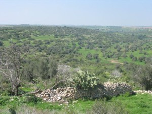
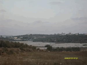
According to the field description published in Walid Khalidi's All That Remains, no traces of the village houses remained.
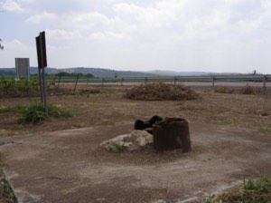
One village well was still present and in use at the time of the survey, while tall grass, wildflowers, and trees covered parts of the site.
The surrounding lands were under cultivation.
This description should not be treated as a comprehensive field verification of conditions in 2026. Fieldwork for All That Remains was conducted between 1987 and 1990 and therefore records the condition of the site during that survey period.
Sources
- PalQuest – Interactive Encyclopedia of the Palestine Question: Zayta
- PalQuest – Operation An-Far
- Palestine Remembered – Zayta, Hebron District
- Palestine Remembered – Walid Khalidi's account of Zayta
- Palestinian Encyclopedia – Zayta
- Palestinian Villages Encyclopedia – Zayta; supporting Palestinian documentation
- Government of Palestine – Census of Palestine 1922, Hebron Sub-District
- Palestinian Central Bureau of Statistics – Historical Census Archive
- Sami Hadawi – Village Statistics 1945; reproduction of the Government of Palestine tables
- Institute for Palestine Studies – Walid Khalidi, All That Remains
- PalQuest – All That Remains: Methodology
Photo gallery


Photos from the village's people
Photos sent in by visitors and published after review.
Add a photo of this village
Log in to add photos of this village.
Other villages from Hebron

More from the archive
 Download Our Palestine App
The whole archive in the palm of your hand: depopulated villages, the Nakba, the massacres and Al-Aqsa — free, with no ads to erase the story.
Download Our Palestine App
The whole archive in the palm of your hand: depopulated villages, the Nakba, the massacres and Al-Aqsa — free, with no ads to erase the story.



Comments
No comments yet — be the first to write one.
Add your comment
Name and email are optional. Comments appear after review.