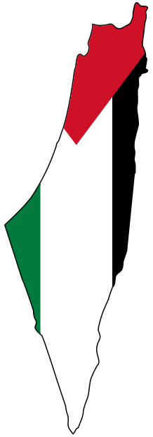
Beisan Before the Nakba: The Ghor’s Breadbasket, From Threshing Floors to Exile
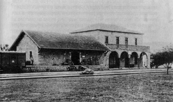
Beisan, the breadbasket of the Ghor, is a Palestinian city where the Marj Ibn Amer plain meets the Jordan Valley, about 150 meters below sea level. Before the Nakba it was a city of water and springs and wheat threshing floors, a station on the Hejaz railway, and a market for the Ghor tribes and the villages of the plain. It fell on May 12, 1948; its people were then loaded onto buses and trucks and taken away, and not one Arab remained. [1] [2] [3]
This article tells the story of Beisan before the Nakba: its history, market and landmarks; its water, farming and railway; the Ghor lands and tribes; its schools and its resistance; then the days of May 1948, its fall and the expulsion of its people and the villages of its district. Find more on our Beisan page.
Beisan Before the Nakba at a Glance
| Item | Details |
|---|---|
| Location | Where Marj Ibn Amer meets the Jordan Valley, about 150 meters below sea level [3] |
| Population | 1,914 in 1922, 3,101 in 1931, and 5,180 in 1945, including only 20 Jews [3] |
| District population (1945) | About 23,590 in the city and 30 villages [3] |
| Houses | About 480 houses of black basalt stone [4] |
| Railway | A station on the Haifa–Daraa line from 1905 [3] |
| Fall of the city | May 12–13, 1948, in Operation "Gideon" [3] [4] [7] |
| Depopulated villages in the district | 31 villages on our site [1] |
From Beit Shan to the Ottoman Saraya
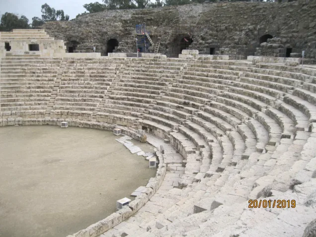
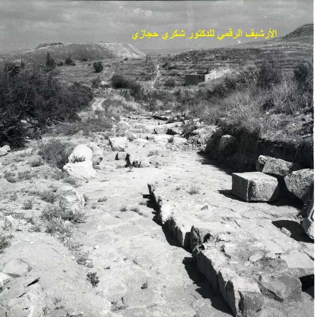
Beisan is one of the oldest cities in Palestine, inhabited for more than five thousand years. Its name goes back to the Canaanite "Beit Shan"; in Roman times it was called "Scythopolis" and flourished, and Muslims entered it in 634 CE. [1] A devastating earthquake struck it in the 8th century, reducing it from a major city to a small town, and its Roman theater and Byzantine remains still bear witness to its early ages. [1]
Under the Ottomans, Beisan's history was bound up with the Ghor tribes around it: the Ghazzawi tribe controlled the Ajloun district from the mid-16th century, and the Saqr tribe established a sheikhdom in the area from the 17th century, allied with the Zayadina, the family of Zahir al-Umar. [10] Tribal leaders took part in local struggles until the Ottomans exiled Aqil Agha al-Hasi, leader of the Hanadi tribe, in 1863–1864. [10]
Under the Ottomans there was a government Saraya housing the district's offices, which under the Mandate became the seat of the district governor and the agriculture and finance departments. [2] Under the Mandate, Beisan was the administrative, agricultural, commercial and educational center of a district of 30 villages. [2] [3]
The Town, the Market and the Landmarks
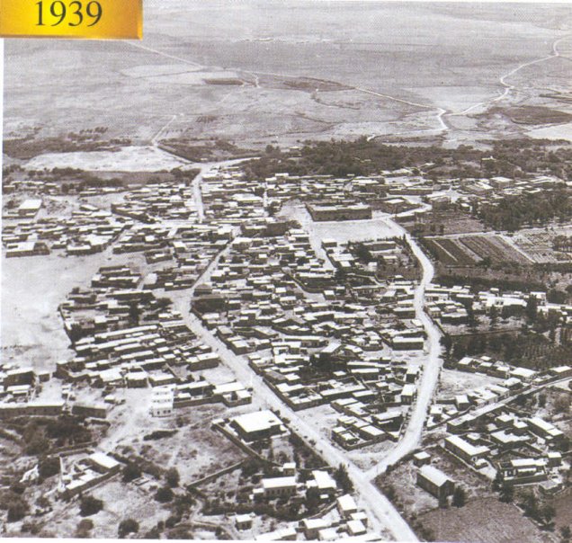
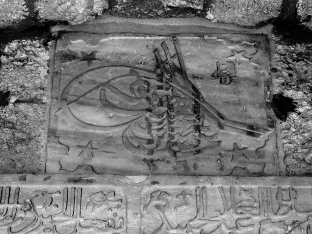
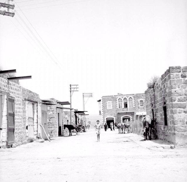
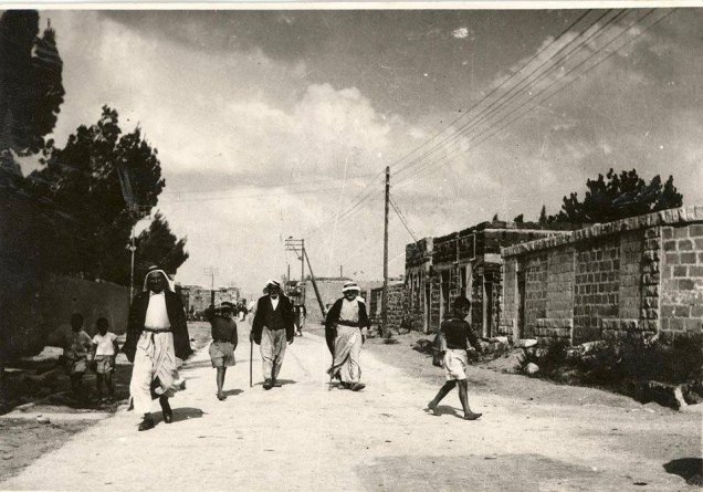
Beisan stood on a small plateau at the western edge of the Ghor, and its houses, about 480 of them, were built of black basalt stone. [3] [4] Its main market lay in the center of town, where the north–south Ghor road crossed the road running east to the coast, drawing traders and people from the surrounding villages. [3]
- Saraya Square: the administrative heart of the town. [4]
- The municipal garden: a public garden with water channels, where many of Beisan's people had memories and trees they planted as children. [4]
- Palm Street: lined with palm trees more than a century old. [4]
- The post office, the public swimming pool, the cinema and the youth club: landmarks of modern life in the town. [2] [4]
Beisan's families included al-Hasri, al-Shaykhani, Hamdan, Abu Khalil, al-Ruqub, al-Arsan, al-Jibali, Abu Qa'ud, Abu Rahhal and al-Mandawi. [9]
The Jalud, the Springs and the Threshing Floors
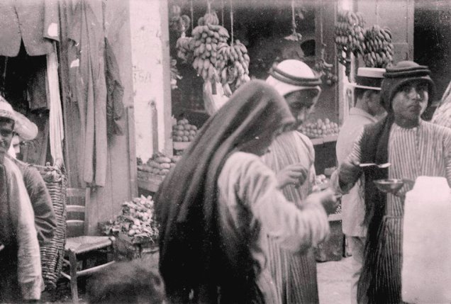
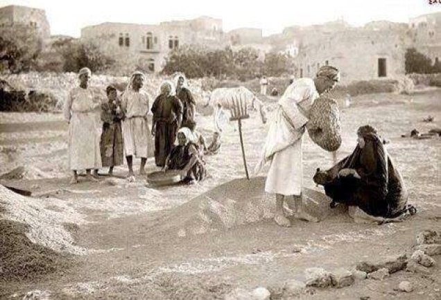
The Jalud River, a tributary of the Jordan, ran north and south of the town, and many springs surrounded it, together irrigating the farmland around it. [3] Its springs included Ain al-Madna and al-Mafjar [1], and in the nearby villages Ain al-Sakhina and Ain al-Asi. [9] Because rainfall was low, about 305 mm a year, irrigation made up for its irregularity. [3]
Farming, Crafts and Trade
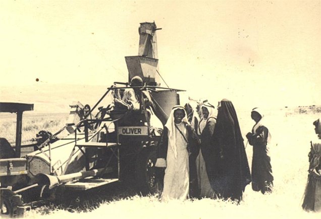
- Grain and vegetables: Beisan was above all a farming town; in 1944 its district produced about 2,214 tons of wheat, 2,394 tons of barley, 7,532 tons of vegetables and 928 tons of grapes. [3]
- Citrus and bananas: citrus covered 1,617 dunams and bananas 48 dunams in 1945, and the town was known for its bananas. [2] [3]
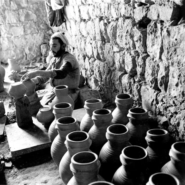
- Crafts: dairy, grain milling, olive pressing, dates, mats, wool, fruit drying and pottery. [1] [3]
- Trade: its position at a crossroads made it the market of the Ghor and the plain. [3]
Read also: Palestinian Industries Before the Nakba.
Beisan Station and the Hejaz Railway
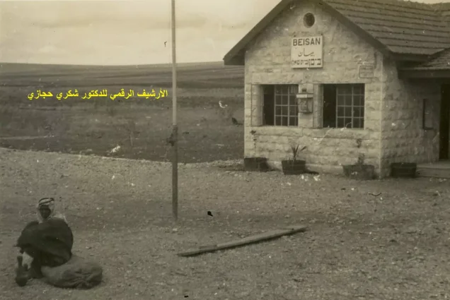
The Haifa–Daraa line, opened in 1905 as a branch of the Hejaz railway, passed north of the town, with its station at the northern end, linking it to Samakh and on to Daraa and Damascus. [3] The station was among the first places taken by Zionist forces in 1948. [4]
Read: Trains and Ports in Palestine Before the Nakba.
The Ghor Lands and the 1921 Settlement
The Ghor lands around Beisan were "jiftlik" or "mudawwara" lands, properties of the Ottoman sultan farmed by peasants and tribes. In April 1921 the High Commissioner Herbert Samuel visited Beisan, the nationalist Jubran Kazma was briefly arrested, and then the "Ghor Mudawwara Agreement," or Beisan land settlement, was signed between the government and the cultivators. [5] [6]
- The terms: the settlement recognized the cultivators as the original owners of nearly half the jiftlik lands in 15 villages with about 5,000 inhabitants, including the Ghazzawiyya, Saqr and Bashatwa tribes, in return for high payments to the government. [5]
- The consequences: the installments became a burden for most owners, and the settlement undercut the tribes' grazing rights and seasonal movement, pushing many to sell their land, much of which ended up with the Jewish National Fund. [5]
- Shatta as an example: the Arab inhabitants of Shatta were expelled by the end of 1935 after absentee owners sold their land. [1]
The Ghor Tribes
The Bedouin of Beisan district numbered about 6,000–7,000, out of about 15,920 Muslims in the district in 1945, and had about 600 tents. [10] Their main tribes were:
- Arab al-Saqr: the largest tribe, mostly in the south of the district; its villages included al-Hamra (770 inhabitants), al-Safa (650), al-Sakhina (530) and Umm Ajra (260). [10]
- Arab al-Ghazzawiyya: between Beisan and the Jordan River on both banks of Wadi Jalud; its villages included Arab al-Bawati and Masil al-Jizl. [10]
- Arab al-Bashatwa: between Jisr al-Majami and the Ghawarina area south of Beisan; their number grew from 950 in 1922 to 1,560 in 1945. [10]
The tribes combined farming with herding; some moved seasonally between the hills near Jenin in summer and the Ghor and Beisan in winter, while others settled in villages and towns. [10] Beisan was their market: tribesmen bought their daily needs there, and some of their sheikhs lived in the town. [10] With the 1921 settlement and land sales, the tribes lost much of their pasture, and the settlement of "Sde Eliyahu" was built on Bedouin land in 1939. [5] [10]
Schools and Public Life
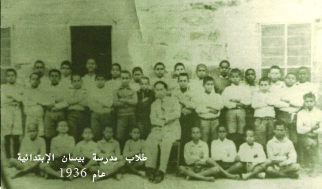
Beisan had two government schools, for boys and for girls; in the 1942/1943 school year they had about 366 boys and 243 girls. [3] In 1945/1946 the first agricultural secondary class was added to the boys' school. [2] [3] The town's health doctor was Dr. Ibrahim Habibi. [4]
Read: Education in Palestine Before the Nakba.
Beisan Against the Mandate
The Ghor tribes resisted colonial rule from its start: the Ghazzawi tribe sent 900 horsemen to Emir Faisal's army and took part in the 1920 Qum conference in Irbid, which planned attacks on British and Zionist positions. [10]
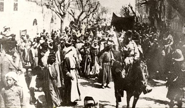
From the first year of British civil rule, the people of Beisan stood up to the Mandate's policies: they turned out in a mass demonstration when Herbert Samuel visited in 1921 and defended the Ghor lands, and about 500 horsemen of Arab al-Saqr joined the protest against Samuel's visit. [1] [5] [10] In the 1936 revolt the hills of the district were a field for the rebels: on August 23, 1936, Hasan al-Ali Zubaidat of Beisan was killed in a clash with British forces at Kawkab al-Hawa. [8] Arab al-Saqr fought in the revolt alongside the followers of Sheikh Izz al-Din al-Qassam, losing 32 men. [10]
May 1948: The Fall of Beisan
In December 1947 Yosef Weitz, the Jewish National Fund's land official, proposed "transferring" the Bedouin of Beisan to the East Bank [10], and in March 1948 the people of Qumya left on British trucks under pressure. [1] Then, between May 10 and 15, 1948, "Golani" forces carried out Operation "Gideon" to occupy the Beisan valley and expel its people, just before the declaration of the occupying state. [7] On May 10 they took Tell Husan overlooking the town and began shelling it intermittently, while young men of Beisan resisted with light weapons. [4]
Morale had collapsed after news of the fall of Safad, Haifa and al-Qastal and the Deir Yassin massacre, so the town's notables chose to surrender, since the defenders were only a few dozen young men; the agreement stipulated that residents would stay in their homes. [4] Beisan fell on May 12–13, 1948. [2] [3] [4]
Days later the Iraqi army entered Palestine across Jisr al-Majami south of Beisan, clashed with Zionist forces and lost about 40 soldiers [11], and Iraqi forces fought at Kawkab al-Hawa, overlooking the Ghor, until the village was finally occupied on May 21. [1] But the town was not recovered, and "Golani" went on emptying the Ghor villages until the end of May.
The Buses Into Exile
The surrender agreement was not honored: residents were gathered in the town garden, then loaded onto buses and trucks on the pretext that Iraqi aircraft and Arab armies would bomb the town, and taken to Transjordan, Jenin and Nazareth. [2] [4] About 1,500 were still in the town in June before they too were removed, and not one Arab remained. [2]
Most of Beisan's people went to Jordan and Syria, a few to Nazareth and Galilee, and many live today in Irbid and the Jordan Valley. [2] [4] Mohammad Sarhan, who was eighteen on the day of the expulsion, recounts that he took refuge in Syria, slipped back in 1951, and lives today in Fureidis. [4]
The Depopulated Villages of Beisan District
Thirty-one villages of Beisan district are listed as depopulated on our site. [1] Some were emptied before the war after their land was sold, and most fell in May 1948 during Operation "Gideon" and after the fall of the town. Here are brief profiles; each village has a detailed page in the depopulated villages section of our site: [1]
Before the war: villages whose land was sold or emptied early
- Shatta: about 10 km northwest of Beisan, near the Beisan–Afula road and the Hejaz railway. Its Arab inhabitants were expelled by the end of 1935 after absentee owners sold its land, and the settlement of "Beit HaShitta" was built on it.
- Arab al-Zarra'a: southeast of Beisan in the Jordan Valley. Absentee owners sold most of its land in the 1930s, and its remaining inhabitants were removed around May 20, 1948.
- Qumya: on a hill about 12.5 km northwest of Beisan, with 440 inhabitants. Most of its people left on March 26, 1948, fearing a Zionist attack and under the pressure of isolation; about 12 men who stayed to guard it were later expelled.
- al-Tira (Tirat al-Zubiyya): about 17.5 km north of Beisan, with 150 Arab inhabitants. Its people left on April 15, 1948 under Haganah pressure.
May 10–12, 1948: Operation "Gideon" and the fall of Beisan
- Farwana: about 4.5 km south of Beisan on the Beisan–Jericho road, with 330 inhabitants. "Golani" occupied it on the night of May 10–11, 1948; its people fled across the Jordan River, and the Haganah blew up its houses.
- al-Ashrafiyya: about 4.5 km southwest of Beisan, with 230 inhabitants. It was occupied on the night of May 10–11, 1948 and its people were expelled.
- Sirin: about 17 km north of Beisan, with 810 inhabitants. "Golani" occupied it on May 12, 1948; only its cemetery and one house remain.
- Zab'a: about 5 km northeast of Beisan in the Jordan Valley, with 170 inhabitants. It was occupied on May 12, 1948 and its people were expelled.
- al-Hamidiyya: on a hill about 5 km north of Beisan, with 220 Arab inhabitants. Its people left on May 12, 1948 after the fall of Beisan.
- al-Sakhina: about 5 km west of Beisan, near the Sakhina spring, with 530 Arab inhabitants. It was depopulated around May 12, 1948 and completely destroyed.
- Tall al-Shawk: about 5 km west of Beisan at the foot of the Gilboa (Fuqu'a) hills, with 120 inhabitants. It was depopulated on May 12, 1948, the day Beisan fell, and almost completely destroyed.
May 16–31, 1948: villages of the valley and the Ghor after the city fell
- al-Bira: about 7.5 km north of Beisan, with 260 Arab inhabitants. It was depopulated on May 16, 1948 after the fall of Beisan, and some house walls remain.
- Kawkab al-Hawa: about 11 km north of Beisan at 300 meters, a village that grew inside and around the Crusader castle of "Belvoir," with 300 inhabitants. The attack on it began on May 16, 1948 and Iraqi forces fought there; it was finally occupied on May 21 and completely destroyed.
- Kafra: about 10 km north of Beisan, with 430 inhabitants. It was depopulated on May 16, 1948; rubble, cactus and fruit trees remain.
- Yubla: about 9 km north of Beisan, with 210 inhabitants. It was depopulated on May 16, 1948.
- al-Murassas: on a hill about 7 km north of Beisan between Wadi al-Ushsha and Wadi Jalud, with 460 inhabitants. It was depopulated on May 16, 1948.
- Arab al-Bawati: about 4 km northeast of Beisan, with 520 inhabitants. It was depopulated in May 1948 with the fall of Beisan, and its ruins remain.
- Jabbul: about 7 km north of Beisan, with 250 Arab inhabitants. Its people left on May 18, 1948 in fear of attack, and it was completely destroyed.
- al-Ghazzawiyya: about 2 km east of Beisan, west of the Jordan River, with 1,020 Arab inhabitants, one of the Ghor tribes covered by the 1921 Beisan land settlement. It was occupied on May 20, 1948 and razed.
- Arab al-Arida: about 6 km south of Beisan, with 150 inhabitants. It was depopulated on May 20, 1948.
- Arab al-Safa: about 7.5 km south of Beisan near the Jordan River, with 650 inhabitants. It was depopulated on May 20, 1948 after "Golani" took control of the valley.
- Khirbat Umm Sabuna (Arab al-Saqr): about 10 km northeast of Beisan on the western edge of the Ghor, in the lands of the Saqr tribe. It was occupied in the second half of May 1948, and only stone rubble remains.
- Khirbat al-Zawiya: about 11 km northeast of Beisan, below the slope of Kawkab al-Hawa, with about 60 inhabitants. It was depopulated in the second half of May 1948 and became pasture.
- Khirbat al-Taqa: on the north bank of Wadi al-Bira, about 14 km north of Beisan. It fell in May 1948.
- Danna: about 13 km north of Beisan, with 190 inhabitants. Its people were expelled on May 28, 1948.
- Masil al-Jizl (Arab al-Zinati): about 6 km southeast of Beisan on the western edge of the Ghor, with 100 inhabitants. It was depopulated around May 30–31, 1948, its people most likely expelled to Transjordan.
- Umm Ajra: about 4 km south of Beisan, with 260 inhabitants. Its people were expelled in May 1948 and it was destroyed.
The full list of the district's villages, with a page for each, is on our Beisan district page.
Beisan After the Nakba
- An empty town: Beisan stood empty for about a year; then most of its houses were demolished, its historic character was changed, and Jewish families were settled there. [2] [3]
- What remains: the Saraya, the old municipal building (now a restaurant), parts of the boys' and girls' schools, the post office building (now an archaeological museum), and the palm trees of the Umm Saraiys quarter. [2]
- The cemetery: half of the town's cemetery was destroyed. [4]
- The land: the land of the town and its villages was confiscated, and settlements were built on it. [1]
Read more on our site: Tiberias and its depopulated villages, Jenin and Nazareth.
Conclusion
Beisan was the breadbasket of the Ghor: houses of black basalt, a river and springs, wheat threshing floors and banana groves, a railway station linking it to Haifa and Damascus, and a market for the Ghor tribes and the villages of the plain. In May 1948 the town surrendered in the hope of staying, but its people were loaded onto buses into exile, and the villages of its district followed. Its sons and daughters in Irbid and the Jordan Valley still remember the municipal garden and Palm Street, and still wait to return.
Frequently Asked Questions About Beisan Before the Nakba
When did Beisan fall in 1948?
Beisan fell on May 12–13, 1948 during Operation "Gideon," carried out by "Golani" forces in the Beisan valley between May 10 and 15.
What was Beisan's population before the Nakba?
It had 5,180 inhabitants in 1945, almost all Arabs, with only 20 Jews, and its district had about 23,590 inhabitants.
What was the 1921 Beisan land settlement?
An agreement between the Mandate government and the cultivators of the Ghor lands, known as the Ghor Mudawwara Agreement, which recognized them as owners in return for high payments; the installments weighed on them and pushed many to sell their land.
Did Beisan surrender?
Yes. Its notables chose to surrender because there were few defenders, and the agreement stipulated that residents would stay, but it was not honored, and the residents were loaded onto buses to Transjordan, Jenin and Nazareth.
Why was Beisan called the breadbasket of the Ghor?
Because of its abundant water from the Jalud River and its springs, and its fertile land, which produced wheat, barley, vegetables, citrus and bananas.
What were the Bedouin tribes of the Beisan Ghor?
The main ones were Arab al-Saqr, the largest, Arab al-Ghazzawiyya and Arab al-Bashatwa; the Bedouin of the district numbered about 6,000–7,000 and combined farming with herding.
How many villages were depopulated in Beisan district?
Our site lists 31 depopulated villages in Beisan district, including al-Ghazzawiyya, Kawkab al-Hawa, al-Murassas, Sirin, Farwana, al-Sakhina and Qumya.
Sources and References
Arabic-language sources are listed with translated titles.
- "Beisan," Depopulated Palestinian Villages section, Palestinina (Arabic).
- Nahed Darbas, "Return to Beisan: A Story of Palestine's History," Al-Araby Al-Jadeed, November 9, 2016 (Arabic).
- "The City of Beisan," The Palestinian Encyclopedia, via Palestine Remembered (Arabic).
- Omar Dallasha, "A Displaced Man's Testimony: A Journey to Beisan Before the Nakba," Arab48, May 6, 2018 (Arabic).
- Munir Fakher Eldin, study on the 1921 Ghor Mudawwara land settlement in Beisan, Institute for Palestine Studies.
- Munir Fakher Eldin, "Jubran Kazma and the Beisan Land Affair: 1921–1923," This Week in Palestine, no. 233, September 2017, Birzeit University repository.
- "Operation Gideon," Interactive Encyclopedia of the Palestine Question, Institute for Palestine Studies (Arabic).
- "Martyrs of the 1936–1939 Revolt," Palestinian National Information Center – WAFA (Arabic).
- "The City of Beisan," Thakert Watan (Arabic).
- Taizo Imano, "The Colonization of Palestine: Geography and History of the Bedouin Tribes in the Beisan Region," Institute for Palestine Studies (Arabic).
- Taha al-Ani, "73 Years Ago: How Iraqi Volunteers Helped Prevent the Displacement of Palestinians," Al Jazeera Net, March 8, 2021 (Arabic).
More from the archive
 Download Our Palestine App
The whole archive in the palm of your hand: depopulated villages, the Nakba, the massacres and Al-Aqsa — free, with no ads to erase the story.

Comments
No comments yet — be the first to write one.
Add your comment
Name and email are optional. Comments appear after review.