
The depopulated village of Qannir / District of Haifa
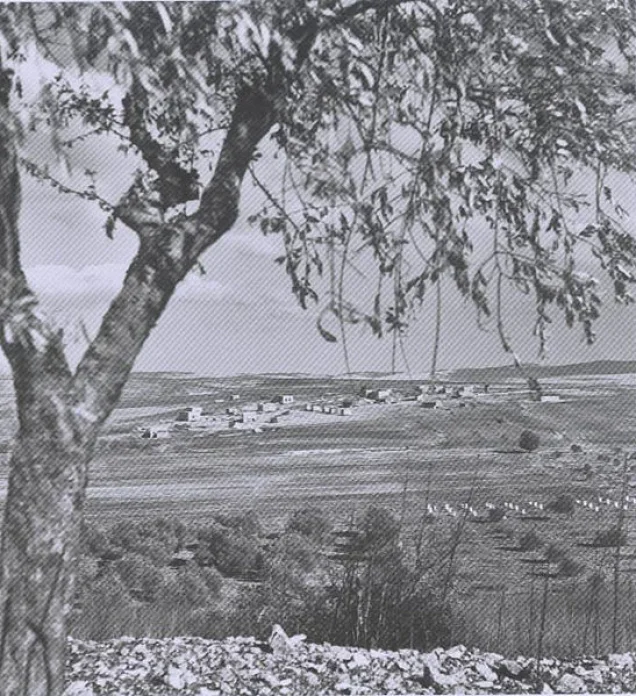
Subdistrict: Haifa
Estimated population of Qannir in 1948: approximately 870
Occupation and depopulation: Displacement began around 25 April 1948, but Arab Liberation Army records indicate that Qannir remained contested into early May. The precise date of its final occupation has not been conclusively established.
Military forces: Haganah forces; an Israeli archival account associates a raid on 9 May with the Alexandroni Brigade.
Military operation: Possibly associated with the coastal-clearing operations; the available sources do not conclusively identify a formal operation.
Israeli settlements established on Qannir’s lands before 1948: None
Israeli settlements established on Qannir’s lands after 1948: Regavim
Qannir was a depopulated Palestinian village in the Haifa Subdistrict, located approximately 35 kilometres south of Haifa.
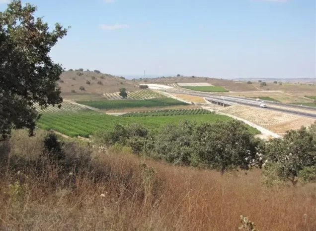
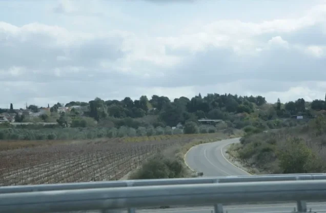
The village stood on slightly elevated terrain in Bilad al-Rawha, a name commonly interpreted as referring to the area’s fragrant landscape. The land descended gently toward the northern section of the coastal plain. A secondary road linked Qannir with the principal coastal highway.
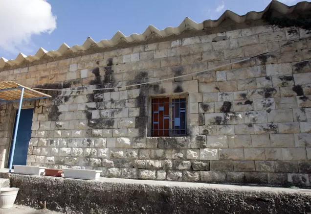
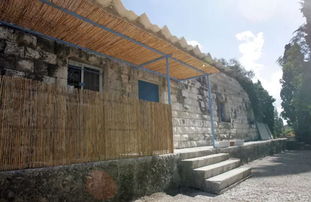
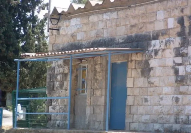
In the late nineteenth century, the village was described as a moderately sized settlement built of adobe bricks on a low hill. A later account described its houses as stone structures built side by side. The inhabitants were Palestinian Muslims.
Qannir stood at an elevation of approximately 100 metres, along the lower foothills of Mount Carmel, also known as the hills of al-Rawha. It lay on the northern bank of Wadi al-Marrah, which formed part of the drainage system leading toward Wadi al-Tamasih.
The village lands were bordered by those of Umm al-Shawf, Kafr Qari‘, al-Sindiyana, al-Marrah, al-Butaymat, and other nearby localities.
Boundaries of Qannir
Qannir lay among the following Palestinian villages and localities:
- North: Umm al-Shawf.
- Northwest and west: al-Sindiyana.
- South: Kafr Qari‘.
- East: ‘Ar‘ara.
- Northeast: al-Butaymat.
Population of Qannir
The British Mandate census recorded 400 inhabitants in Qannir in 1922. The population increased to 483 in 1931, when the village contained 92 occupied houses. All residents recorded in these censuses were Muslims. By 1945, the village population had risen to 750.
Village Lands
The lands associated with Qannir covered 11,331 dunams. This total comprised 10,826 dunams under Palestinian ownership, 50 dunams under Jewish ownership, and 455 dunams classified as public land. The village lands were bordered by those of Umm al-Shawf, Kafr Qari‘, al-Sindiyana, al-Marrah, and neighbouring localities.
Land Ownership in Qannir, 1944/45
| Ownership category | Area in dunams |
|---|---|
| Palestinian ownership | 10,826 |
| Jewish ownership | 50 |
| Public land | 455 |
| Total | 11,331 |
* One dunam equals approximately 1,000 square metres.
Land Use in Qannir, 1944/45
| Land-use category | Palestinian ownership (dunams) | Jewish ownership (dunams) | Public land (dunams) | Total (dunams) |
|---|---|---|---|---|
| Irrigated land and orchards | 460 | 20 | 0 | 480 |
| Olive groves* | 780 | 0 | 0 | 780 |
| Cereal cultivation | 5,760 | 30 | 0 | 5,790 |
| Built-up area | 22 | 0 | 0 | 22 |
| Cultivable land | 6,220 | 50 | 0 | 6,270 |
| Uncultivated land, excluding the built-up area | 4,584 | 0 | 455 | 5,039 |
* One dunam equals approximately 1,000 square metres. The figure for olive groves is a supplementary crop statistic and should not be added separately when calculating the total cultivable area. The original table incorrectly assigned all 5,039 dunams of uncultivated land to Palestinian ownership; 455 dunams were classified as public land.
Population of Qannir by Year
| Year | Population | Notes |
|---|---|---|
| Late nineteenth century | Approximately 250 | Contemporary survey estimate |
| 1922 | 400 | British Mandate census; all recorded as Muslims |
| 1931 | 483 | British Mandate census; all recorded as Muslims |
| 1945 | 750 | Official British Mandate village statistics |
| 1948 | Approximately 870 | Later demographic estimate |
| Estimated registered refugee population, 1998 | 5,343 | Later estimate including descendants |
* The 1948 and 1998 figures are demographic estimates rather than contemporary official censuses.
Number of Houses in Qannir
| Year | Number of houses | Statistical status |
|---|---|---|
| 1931 | 92 | Occupied houses recorded by the census |
| 1948 | Approximately 165 | Later estimate |
Archaeological Sites in Qannir
Several archaeological ruins or khirbas were situated around the village, including Khirbat Umm al-Kudaysh, Khirbat al-Nabi Balyan, and Khirbat Qannir. Archaeological descriptions record ruined walls and cisterns on Qannir’s lands and indicate that the modern village may have been constructed over an earlier, unidentified settlement.
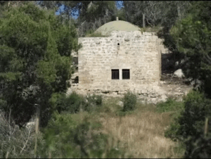
Local village accounts identify several religious shrines, including a shrine attributed to al-Nabi Balya south of the village and shrines associated with Shaykh Amin al-‘Atayli, Shaykh Amin al-‘Arqub, and Shaykh Salih in or near the old cemetery. These names and locations derive principally from local memory and should be distinguished from independently excavated archaeological findings.
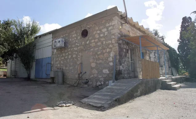
The village cemetery reportedly extended across several dunams. Surviving documentation and photographs indicate that some built grave markers remained visible after the village’s depopulation.
Public Facilities in Qannir
The village had one mosque, locally described as covering approximately 100 square metres. It had a minaret and a prayer niche and served as an important religious and communal institution.
Local accounts state that a community-funded elementary school operated in Qannir by 1937, teaching pupils from the first through the fourth grades. The villagers reportedly financed the construction of the school and paid the teachers’ salaries.
Economic Life in Qannir
Qannir’s economy depended primarily on field crops, vegetables, olive cultivation, and cattle raising. Agricultural fields and olive trees surrounded much of the village, while the terrain immediately to the south was less extensively cultivated.
In 1944/45, 5,760 dunams under Palestinian ownership were allocated to cereal cultivation, while 460 dunams were irrigated or used for orchards.
Local accounts identify several water sources used by the villagers. These included Bi’r Qannir, also known as Bi’r Fajr, which was described as an old well whose water overflowed during the rainy season; Bi’r al-Fari east of the village, where Bedouin pastoralists sometimes camped; ‘Ayn al-Rashrasha to the south, near vegetable fields; and ‘Ayn al-Hannana, which was used for watering livestock. The claimed Roman-period origin of Bi’r Qannir has not been conclusively verified archaeologically.
Occupation and Depopulation of Qannir
Qannir was attacked repeatedly during the first phase of the Nakba. The Palestinian newspaper Filastin reported an attack on 5 March 1948 and described it as the third assault against the village within one week. According to the report, Qannir’s National Guard contingent repelled the attackers, and no casualties were mentioned.
Israeli historian Benny Morris states that the villagers began leaving on 25 April, following the fall of Haifa and amid fears that Qannir would be attacked or become caught in the fighting. This date is widely listed as the village’s depopulation date. Arab Liberation Army records, however, indicate that Qannir was still in Palestinian and Arab hands during early May.
According to a dispatch by Arab Liberation Army commander Fawzi al-Qawuqji, an armoured Haganah assault was launched from the direction of ‘Ein Ha-Shofet against Qannir and neighbouring Kafr Qari‘ at 4:00 a.m. on 8 May. Al-Qawuqji reported that the attack was repelled, that the attackers withdrew, and that Palestinian and Arab forces recovered both villages. He recorded one Palestinian or Arab fighter killed and four wounded.
An Israeli archival account cited by Morris states that the Alexandroni Brigade raided Qannir on 9 May, killed four Palestinians, and demolished 55 houses. According to this account, the remaining inhabitants probably left at that stage.
The surviving accounts therefore describe several stages: the departure of some residents around 25 April, the continued Arab defence of the village in early May, and further Haganah attacks on 8–9 May. It is not possible to establish from these sources the exact date on which Israeli forces secured permanent control of Qannir. Estimates vary between sources.
Village families were subsequently dispersed among refugee camps and communities in Jordan and Syria, as well as Jenin refugee camp, Nur Shams refugee camp, ‘Attil, Kafr Rumman, Wadi ‘Ara, Kafr Qari‘, ‘Ara, and Barta‘a. These places of displacement are documented mainly through community records and oral history rather than a comprehensive contemporary refugee register.
Israeli Settlement on the Lands of Qannir
Regavim was established on Qannir’s lands in 1949. According to Benny Morris, the settlement had initially been founded at the neighbouring Palestinian village of al-Butaymat in July 1948 and was subsequently moved to Qannir.
Qannir Today
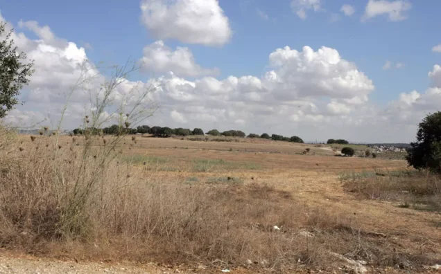
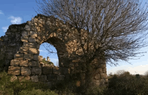
Stone rubble is scattered across the village site, which is covered with thorn bushes, fig trees, and cactus plants. Part of the surrounding land has been used by Israelis as pasture, while other areas are cultivated.
Sources
- PalQuest, “Qannir”.
- Palestine Remembered, “Qannir—Haifa”.
- Palestine Open Maps, “Qannir”.
- Institute for Palestine Studies, Walid Khalidi’s All That Remains.
- Israel Antiquities Authority, archaeological excavation report for Qannir South.
- Government of Palestine, Report and General Abstracts of the Census of 1922.
- Government of Palestine, Census of Palestine, 1931.
- Government of Palestine, Village Statistics, April 1945.
- Walid Khalidi, ed., All That Remains: The Palestinian Villages Occupied and Depopulated by Israel in 1948 (Washington, DC: Institute for Palestine Studies, 1992).
Photo gallery

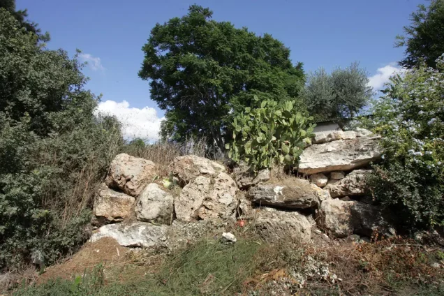
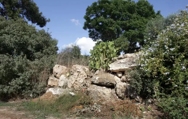
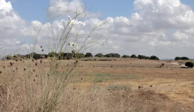
Photos from the village's people
Photos sent in by visitors and published after review.
Add a photo of this village
Log in to add photos of this village.
Other villages from Haifa

 Download Our Palestine App
The whole archive in the palm of your hand: depopulated villages, the Nakba, the massacres and Al-Aqsa — free, with no ads to erase the story.
Download Our Palestine App
The whole archive in the palm of your hand: depopulated villages, the Nakba, the massacres and Al-Aqsa — free, with no ads to erase the story.



Comments
No comments yet — be the first to write one.
Add your comment
Name and email are optional. Comments appear after review.