
The depopulated village of Abu Zurayq / District of Haifa
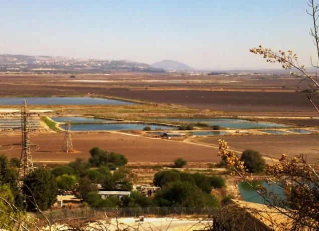
Abu Zurayq
About the depopulated village of Abu Zurayq
- District
- Haifa
- Date Abu Zurayq was occupied
- 12 April 1948
- Population in 1948
- 638
- Military operation
- The Battle of Mishmar ha-'Emeq
- Brigade that carried it out
- Palmach
- Who defended the village
- Arab Liberation Army volunteers and some local Palestinian militia
- Distance from the governorate centre
- 24 km southeast of Haifa
- Elevation above sea level
- 100 m
- Cause of displacement
- Direct military assault by Zionist forces, followed by the capture of the inhabitants and the expulsion of the women and children towards Jenin
- Extent of destruction
- The village has been completely defaced on April 15th 1948.
- Ethnic cleansing
- Upon occupation, 15 adult males and some 200 women and children from Abu Zurayq inhabitants were taken captives. The women and children were sent towards Jinin.
- Settlements built on the built-up area of Abu Zurayq after 1948
- There are no Israeli settlements on village lands, according to Khalidi; the settlement of ha-Zore'a, built in 1936, is close by, to the north
Hover a dot to read the village name, or click to open its card.
Borders of the depopulated village of Abu Zurayq
Abu Zurayq: A Depopulated Palestinian Village in the Haifa District
Abu Zurayq was a depopulated Palestinian village in the Haifa District, located approximately 24 kilometers from Haifa on the northern foothills of Bilad al-Rawha', overlooking the plain of Marj ibn Amir. PalQuest gives its average elevation as approximately 100 meters above sea level.
- Subdistrict
- Haifa
- Distance from district center
- 24 km southeast of Haifa
- Average Elevation
- 100 m above sea level
- Population in 1944/1945
- 550
- Estimated Population in 1948
- About 638 – a later demographic estimate, not an official census
- Total Land Area in 1945
- 6,493 dunams
- Attack and Depopulation
- In the course of the battle of Mishmar ha-Emeq, which began on 4 April 1948, Zionist forces briefly seized the village on the night of 8–9 April, and Palmach units then gained control of it on 12 April 1948, taking fifteen men and some 200 women and children captive; the women and children were expelled towards Jenin. The Palestinian daily Filastin reports that a Haganah unit surrounded villagers in the fields and opened fire, killing two women and four children, and the village's houses were blown up until its demolition was completed by 15 April 1948.
- Final Israeli Control
- 12 April 1948, after a brief seizure three days earlier (the night of 8–9 April 1948)
- Military Unit
- Palmach units (control gained on 12 April 1948); the forces that seized the village on the night of 8–9 April belonged to the First Battalion of the Palmach and to the Carmeli and Alexandroni Brigades, according to PalQuest's Abu Shusha entry
- Cause of Depopulation
- Direct military assault by Zionist forces, followed by the capture of the inhabitants and the expulsion of the women and children towards Jenin
- Settlements Documented on Village Lands
- There are no Israeli settlements on village lands, according to Khalidi; the settlement of ha-Zore'a, built in 1936, is close by, to the north
The Government of Palestine's 1944/1945 statistics recorded 550 inhabitants, all Arab Muslims, and a total land area of 6,493 dunums. During the Nakba and the occupation of Palestine in 1948, Abu Zurayq was attacked in the course of the fighting around Mishmar ha-'Emeq. It was seized briefly on the night of 8–9 April and came under final Palmach control on 12 April. Its inhabitants were displaced and the village was demolished during the following days.
Location of Abu Zurayq
- Abu Zurayq was located approximately 24 kilometers from Haifa.
- PalQuest gives its average elevation as approximately 100 meters above sea level.
- The village stood on the northern foothills of Bilad al-Rawha' at the edge of Marj ibn Amir.
- It overlooked the fertile Marj ibn Amir plain.
- Some houses stood on a small hill beside the Haifa–Jenin highway.
- The al-Muqatta' River passed to the northeast, while several wadis and springs crossed or originated in the village lands.
Bilad al-Rawha' and Marj ibn Amir
Abu Zurayq was one of the villages of Bilad al-Rawha', a hilly area associated with the southern and eastern Carmel region. The name is commonly interpreted as meaning the “fragrant country.”
Part of the village lands extended across the Carmel hills, while another portion reached into the fertile Marj ibn Amir plain. This geography strongly shaped a village economy based on agriculture and animal husbandry.
The Origin of the Name Abu Zurayq
Palestinian sources offer different explanations for the village's name, and no single interpretation can be treated as conclusively established.
Walid Khalidi and PalQuest suggest that the name probably referred to the Abu Zurayq Bedouin who settled in the area.
The Palestinian Encyclopedia instead associates the name with a bird known as Abu Zurayq. Palestinian documentation citing historian Mustafa Kabha gives another possible explanation, connecting the name with Shaykh Abu Zurayq al-'Utayli, whose shrine was associated with the village, while also mentioning the bird interpretation.
These explanations are therefore preserved as competing traditions rather than reduced to a single definitive origin.
The Built Environment of Abu Zurayq
The houses of Abu Zurayq were relatively dispersed and extended broadly from northwest to southeast along the edge of the Carmel hills overlooking Marj ibn Amir.
Homes were built of stone and mud or stone and cement, while reinforced concrete was also used in some structures.
Some roofs were made of concrete, whereas others were constructed with wood, straw, and mud.
The village contained a mosque and an elementary school for boys, as well as wells, springs, and other water sources.
Population of Abu Zurayq
In the earlier Mandatory censuses, the community later identified with Abu Zurayq appeared under the tribal name of the Tawatiha rather than under the later village name.
The 1922 Census of Palestine recorded 301 members of the al-Tawatha group, including 142 males and 159 females, all Muslims.
In the 1931 census, the Tawatiha population was recorded as 361, all Muslims, living in 78 houses.
The Palestinian Encyclopedia gives an estimate of approximately 406 inhabitants in the late 1930s. The Government of Palestine's 1944/1945 statistics recorded 550 inhabitants in Abu Zurayq, all Arab Muslims.
The figures of 638 inhabitants for 1948 and 3,918 refugees for 1998 published by Palestine Remembered are later estimates and are not official Government of Palestine censuses.
Population of Abu Zurayq
- 1922301Official census under the name al-Tawatha; all Muslims
- 1931361Official census under the name Tawatiha; all Muslims
- Late 1930sAbout 406Historical estimate recorded by the Palestinian Encyclopedia
- 1944/1945550Government of Palestine statistics; all Arab Muslims
- 1948638Later estimate published by Palestine Remembered
- 19983,918Later refugee-population estimate published by Palestine Remembered
Number of Houses in Abu Zurayq
The 1931 census recorded 78 houses among the Tawatiha community associated with Abu Zurayq.
Number of Houses in Abu Zurayq
- 193178Official census under the Tawatiha name
Education in Abu Zurayq
Abu Zurayq had an elementary school for boys. Walid Khalidi and PalQuest confirm its existence without specifying a date of establishment.
Palestinian local documentation states that the school was built in 1935, taught through the third elementary grade, and was also attended by some pupils from neighboring Abu Shusha.
Palestine Remembered also preserves documents concerning the appointment of teacher Muhammad 'Ali Sakhnini to Abu Zurayq's school between 1945 and 1947, providing further evidence of the school's activity during the final years before the Nakba.
The Mosque of Abu Zurayq
Abu Zurayq had a mosque serving its Muslim population.
Khalidi does not provide a construction date. Palestinian local documentation associated with a Dayruna field visit records that the mosque was built in 1931. This date is therefore presented as local Palestinian documentation rather than as a Government of Palestine statistical record.
Water Sources in Abu Zurayq
Abu Zurayq had access to a comparatively rich network of water sources, including Wadi Abu Zurayq, springs, and wells.
The Palestinian Encyclopedia identifies 'Ayn al-Jarba, 'Uyun al-Barrak, 'Uyun al-Baqar, and 'Ayn al-Janb among the principal springs in the village lands.
Wadi al-Janb joined waters flowing from 'Uyun al-Baqar and 'Ayn al-Jarba to form Wadi Abu Zurayq, a tributary of the al-Muqatta' River.
The Palestinian Encyclopedia also describes the Abu Zurayq well east of the village near the Haifa–Jenin road as an ancient Roman well. That dating is presented according to the Palestinian source.
Land Ownership in Abu Zurayq
The total land area recorded for Abu Zurayq in the 1944/1945 statistics was 6,493 dunums. The official statistics recorded no Jewish land ownership in the village.
The Arabic Palestine Remembered table uses the categories “Palestinian,” “Transferred to Zionists,” and “Masha'.” These terms are preserved below to reflect the terminology of that source. The official Government of Palestine figures classify the same lands as Arab and Public.
Land Ownership in Abu Zurayq, 1944/1945, Using the Terminology of Palestine Remembered
- Palestinian4,401 dunums68%
- Transferred to Zionists0 dunums0%
- Masha' (source terminology)2,092 dunums32%
Land Use in Abu Zurayq in 1944/1945
A total of 4,375 dunums was cultivated or classified as cultivable, all of it Arab land.
Cereals covered 4,092 dunums, plantations and irrigable land another 282 dunums, and one dunum was devoted to citrus and bananas.
Non-cultivable land totaled 2,118 dunums, consisting of 26 dunums of Arab land and 2,092 dunums of public land.
Land Use in Abu Zurayq According to the 1944/1945 Statistics
- Arab
- Jewish
- Public
- Citrus and Bananas1 dunums
- Plantations and Irrigable Land282 dunums
- Cereals4,092 dunums
- Non-Cultivable Land2,118 dunums
In the 1942/1943 season, approximately 100 dunums were planted with olive trees. Because this figure belongs to a different agricultural year, it is presented as supplementary information rather than added again to the 1944/1945 land-use totals.
Economic Life in Abu Zurayq
The village economy depended on agriculture and animal husbandry, with cereals forming the principal crop.
The villagers also grew irrigated vegetables and tended olive, fruit, and citrus trees, although the area planted with oranges was very small.
The fertility of the Marj ibn Amir lands and the relative abundance of water supported agriculture, while hilly and uneven lands were also used for grazing.
Archaeological Sites in Abu Zurayq
A tell next to the village contained remains dating mainly to the Bronze and Iron Ages, together with material from the early Islamic period.
A rich sequence of Paleolithic stone tools was discovered on the terraced ground above the tell and below the village.
Archaeological sources also recorded the remains of an isolated Roman farm northwest of 'Ayn Abu Zurayq.
Palestinian local documentation additionally records nearby khirbas, including Khirbat Fari and Khirbat Furayr, containing foundations, caves, burials, and piles of ancient stone, as well as ruins and caves around Tall Abu Zurayq.
The Battle of Mishmar ha-'Emeq and the Military Context
The fall of Abu Zurayq was connected with the Haganah counteroffensive following the battle of Mishmar ha-'Emeq.
The battle began on 4 April 1948 when the Arab Liberation Army launched an attack on the settlement of Mishmar ha-'Emeq. After the offensive stalled and a British-mediated truce was proposed, the Haganah command moved instead to a counteroffensive against surrounding Palestinian villages.
The principal Palestinian sources do not identify a separately named formal military operation for the capture of Abu Zurayq. It is therefore described here as part of the Haganah counteroffensive during the battle of Mishmar ha-'Emeq.
The First Seizure on the Night of 8–9 April 1948
On the night of 8–9 April 1948, Haganah forces broke out from the Mishmar ha-'Emeq area and seized several nearby Palestinian villages, including Abu Zurayq, Abu Shusha, and al-Naghnaghiyya.
Walid Khalidi's account of the wider fighting identifies units from the First Battalion of the Palmach together with elements of the Carmeli and Alexandroni Brigades as participating in this phase of the counteroffensive.
Control of Abu Zurayq at this stage was not permanent. The village's PalQuest entry states that Palmach forces had seized it briefly before gaining final control on 12 April.
The Occupation of Abu Zurayq on 12 April 1948
Palmach units gained final control of Abu Zurayq on 12 April 1948, after the village had been briefly seized approximately three days earlier.
Walid Khalidi, citing The New York Times, places this within the renewed Haganah advance from Mishmar ha-'Emeq after a short truce, when a group of surrounding Palestinian villages was overrun.
Accordingly, 12 April is used as the date of final occupation, while the first temporary seizure on the night of 8–9 April is also recorded.
Captivity and Displacement of the Villagers
Walid Khalidi and PalQuest, citing Israeli historian Benny Morris, state that Palmach forces captured fifteen adult men and approximately 200 women and children upon entering Abu Zurayq.
The cited account does not state what happened to the fifteen men. It records that the women and children were expelled in the direction of Jenin.
These details are presented through the Palestinian intermediary source Khalidi/PalQuest rather than through independent reliance on the Israeli source.
The Filastin Newspaper Account
The Palestinian newspaper Filastin published a different and more detailed account of events following the occupation.
According to its correspondent, on the morning after the village had been occupied, a Haganah unit came across a group of villagers in the fields, including elderly people, women, and children, surrounded them, and opened fire.
The newspaper reported that two women and four children were killed and that thirty people were taken captive.
The same account states that an Arab force later counterattacked, freed the captured villagers, and took them safely to Jenin.
Because this account differs in detail from other narratives, each version is attributed to its own source rather than merged into a single unsupported reconstruction.
Occupation and Depopulation Chronology
- 4 April 1948
Battle of Mishmar ha-Emeq
The Arab Liberation Army launched an offensive against the kibbutz of Mishmar ha-Emeq that failed in its objective; after it ended in a standoff, a truce was proposed with British mediation, but the Haganah rejected it and its commanders decided to counterattack extensively, occupying and destroying the surrounding villages, according to PalQuest's Abu Shusha entry.
- Night of 8–9 April 1948
Temporary occupation
The New York Times reported that Haganah units that had been besieged in Mishmar ha-Emeq broke out and occupied three villages, Abu Shusha, Abu Zurayq and al-Naghnaghiyya; the units belonged to the First Battalion of the Palmach and to the Carmeli and Alexandroni Brigades. The village's entry states that the Palmach seized it briefly three days before gaining control of it.
- 12 April 1948
Final occupation
Palmach units gained control of the village; according to the New York Times, this occurred when the Haganah broke a two-day truce to emerge from the settlement of Mishmar ha-Emeq and overrun a cluster of neighbouring villages.
- April 1948 (on the Palmach's entry into the village)
Capture of the inhabitants and expulsion of the women and children
On entering the village, the Palmach attackers took fifteen adult males captive, along with some 200 women and children, according to Israeli historian Benny Morris as cited by Khalidi. No mention is made of the fate of the men, but the women and children were expelled towards Jenin.
- April 1948 (at dawn on the morning after the village was occupied)
Killing of civilians and capture of others
The correspondent of the Palestinian newspaper Filastin wrote that a Haganah unit stationed to the north came across villagers lying face down in the fields, surrounded them, old men, women and children, and opened fire, killing two women and four children and taking thirty captive. Later an Arab force counterattacked, freed the villagers and took them to safety in Jenin.
- April 1948 (completed by 15 April)
Destruction of the village
Filastin stated that thirty houses were blown up in the course of capturing the village, five of which were still occupied, and Morris quotes Israeli sources as saying that some houses were blown up on the night of occupation and that the demolition was completed by 15 April. The New York Times quoted the British authorities as saying on 16 April that Haganah engineers had blown up the houses left standing in the village.
The Destruction of Abu Zurayq
The demolition of Abu Zurayq began during the assault and continued after final control had been established.
The Palestinian newspaper Filastin reported that thirty houses were blown up during the capture of the village and that five of them were still occupied.
Walid Khalidi, citing Benny Morris, states that the destruction of Abu Zurayq was completed by 15 April 1948.
The New York Times also reported, citing British authorities on 16 April, that Haganah engineers had blown up the houses that remained standing.
The occupation of Abu Zurayq was therefore followed within days by the systematic destruction of most of its built environment.
Israeli Settlements and the Lands of Abu Zurayq
According to Walid Khalidi and PalQuest, no Israeli settlement was established on the lands of Abu Zurayq itself.
HaZore'a, founded in 1936, lies close to the former village site to the north but is not located on Abu Zurayq's lands.
No separately founded Israeli settlement is therefore listed as having been established directly on village land.
The Site of Abu Zurayq After the Nakba
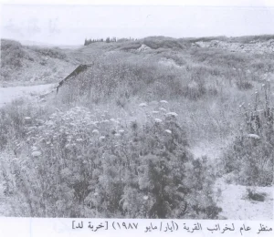
According to Walid Khalidi's field description, the village site was overgrown with cactuses and fig and olive trees.
The level lands surrounding the site were used for agriculture, while uneven land on the hills served as pasture.
This description is based on fieldwork conducted for Walid Khalidi's All That Remains and should not necessarily be treated as an updated field survey of the site today.
Sources
- PalQuestPalQuest – Interactive Encyclopedia of the Palestine Question: Abu Zurayq
- PalQuestPalQuest: Abu Shusha – Context of the Battle of Mishmar ha-'Emeq and the Counteroffensive
- Palestine RememberedPalestine Remembered: Abu Zurayq – Haifa District
- palestinapedia.psPalestinian Encyclopedia: Abu Zurayq
- pal48.psFilastunna: Abu Zurayq – Palestinian Local Documentation
- arab48.comArab48: Dayruna Visit to Abu Zurayq and Abu Shusha, Including Documentation by Mustafa Kabha
- pcbs.gov.psPalestinian Central Bureau of Statistics: Historical Censuses of Palestine
Photo gallery
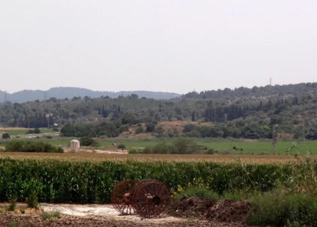

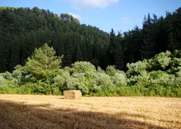
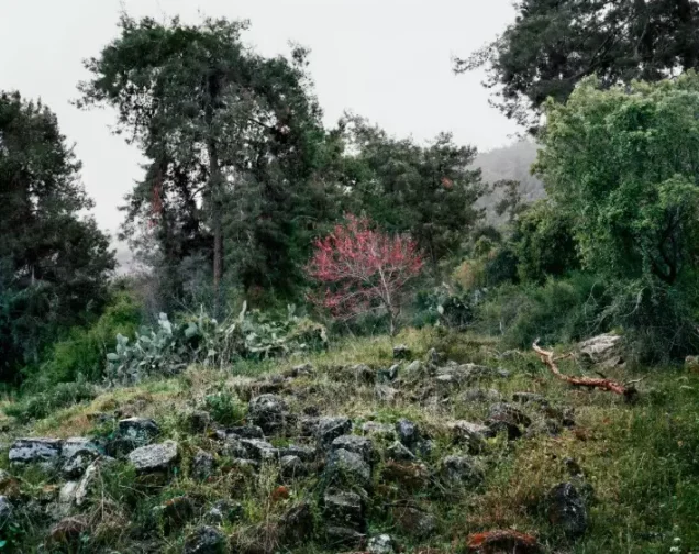
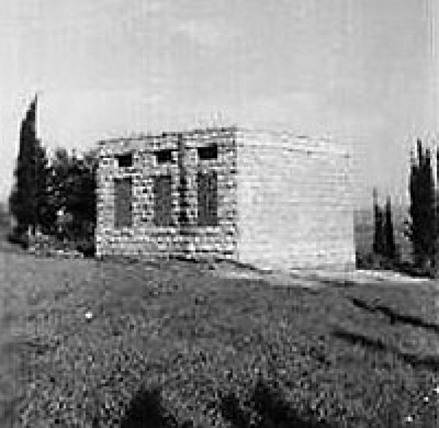
Photos from the village's people
Photos sent in by visitors and published after review.
Add a photo of this village
Log in to add photos of this village.
Other villages from Haifa
More from the archive



 Download Our Palestine App
The whole archive in the palm of your hand: depopulated villages, the Nakba, the massacres and Al-Aqsa — free, with no ads to erase the story.
Download Our Palestine App
The whole archive in the palm of your hand: depopulated villages, the Nakba, the massacres and Al-Aqsa — free, with no ads to erase the story.



Comments
No comments yet — be the first to write one.
Add your comment
Name and email are optional. Comments appear after review.