
The depopulated village of : Ayn Hawd / District of Haifa
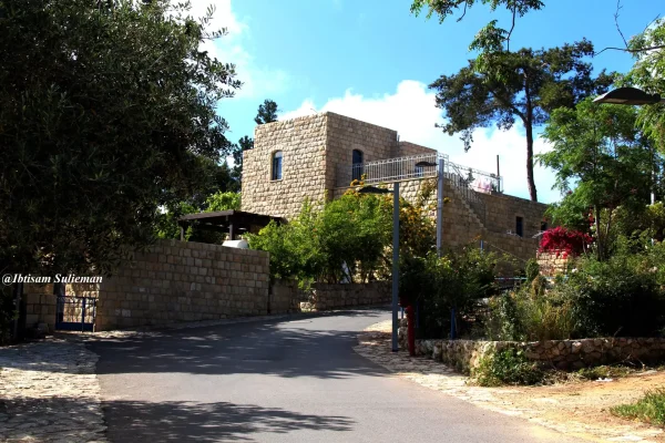
: Ayn Hawd
About the depopulated village of : Ayn Hawd
- District
- Haifa
- Date : Ayn Hawd was occupied
- 15 July 1948
- Population in 1948
- 754
- Military operation
- Probably an unnamed limited operation during the 'Ten Days' against villages south of Haifa, with Israeli naval participation, according to Khalidi
- Brigade that carried it out
- Not identified in the sources; Israeli naval forces took part in the probable operation, providing covering fire and bombarding the villages
- Who defended the village
- Local Arab militia, Arab Liberation Army volunteers, and some support from the Iraqi Army in Tulkarm
- Distance from the governorate centre
- 14.5 km south of Haifa
- Elevation above sea level
- 125 m
- Cause of displacement
- Probably a direct military assault by Israeli occupation forces; the inhabitants may have suffered the fate of those of al-Tira, who were expelled southwards or sent to POW camps, according to Benny Morris as cited by Khalidi
- Extent of destruction
- The village was not destroyed, and since 1954 it has been converted into an artists' colony.
- Ethnic cleansing
- 'Ayn Hawd inhabitants were completely ethnically cleansed.
- Settlements built on the built-up area of : Ayn Hawd after 1948
- Nir Etziyon, established in 1949 on village land; and En Hod, established in 1954 on the village site itself
- Refugees' migration routes
- 'Ayn Hawd inhabitants were mostly expelled eastward to Jinin (West Bank). On the other hand, few people were allowed to stay behind.
Hover a dot to read the village name, or click to open its card.
Borders of the depopulated village of : Ayn Hawd
'Ayn Hawd – A Depopulated Palestinian Village in the Haifa Subdistrict
'Ayn Hawd was a Palestinian village in the Haifa Subdistrict, situated on the western slopes of Mount Carmel approximately 14.5 km south of Haifa, at an average elevation of about 125 meters above sea level. The village overlooked the coastal plain and the Mediterranean Sea and was connected to the coastal highway by a secondary road approximately one kilometer long.
'Ayn Hawd survived several attacks during the early months of 1948. Its inhabitants repelled assaults in April and May and remained in the village after another attack around 20 May. Walid Khalidi ultimately places its probable final occupation around 15 July 1948 during a limited Israeli offensive south of Haifa in the “Ten Days” between the two truces.
- Subdistrict
- Haifa
- Distance from Haifa
- 14.5 km south of Haifa
- Elevation
- 125 m above sea level
- Population in 1931
- 459
- Number of Houses in 1931
- 81
- Physical setting
- Western slopes of Mount Carmel overlooking the coastal plain and Mediterranean Sea
- Population, 1944/45
- 650
- Estimated Population in 1948
- About 754 – a later demographic estimate, not an official census
- Total land area
- 12,605 dunams
- Attack and Depopulation
- An attack by a Zionist force of 150 men on 'Ayn Hawd and 'Ayn Ghazal on the evening of 11 April 1948 was repulsed, as was a more serious one the following month; Israeli occupation forces then stormed the village in late May 1948, but its inhabitants apparently stayed put. Khalidi considers it probable that it fell around 15 July 1948 in a limited operation during the 'Ten Days' in which Israeli naval forces took part.
- Final Israeli Control
- Probably around 15 July 1948, according to Khalidi's assessment that the village was one of a number of villages south of Haifa occupied in a limited operation during the 'Ten Days' between the two truces; the sources give no confirmed day
- Probable final occupation
- Around 15 July 1948
- Military operation
- Probably a limited operation, not named in the sources, launched during the 'Ten Days' between the two truces against villages south of Haifa (al-Tira, Kafr Lam and al-Sarafand), according to Khalidi
- Military Unit
- The sources do not identify the unit that occupied the village; in the probable operation, Israeli naval forces assisted the land-based attackers by providing covering fire and bombarding the villages, according to the History of the War of Independence as cited by Khalidi
- Cause of Depopulation
- Probably a direct military assault by Israeli occupation forces; the inhabitants may have suffered the same fate as those of al-Tira, who were expelled southwards or sent to POW camps, according to Benny Morris as cited by Khalidi
- Military force
- Ground forces supported by Israeli naval fire; Khalidi does not independently identify one village-specific assault unit
- Israeli settlements on village land
- Nir Etziyon, established in 1949 on village land; and En Hod, established in 1954 on the village site itself
Location and Geography of 'Ayn Hawd
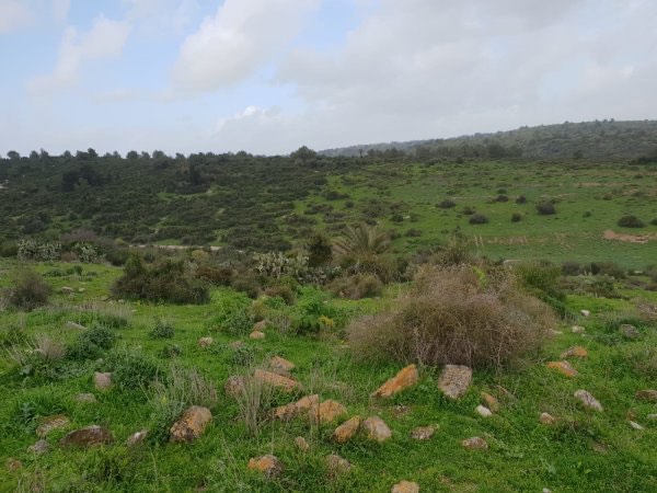
'Ayn Hawd extended across a high hillside amid the western slopes of Mount Carmel and overlooked both the coastal plain and the Mediterranean Sea. A secondary road approximately one kilometer long linked it with the coastal highway.
The village lands bordered those of al-Tira, al-Mazar, 'Atlit, and Daliyat al-Karmil. Springs and valleys in and around the village formed an important part of the local agricultural and pastoral landscape.
Several springs were located near 'Ayn Hawd, some within the village itself, helping support permanent settlement and the cultivation of trees and crops.
Origins and Ottoman-Era History
The inhabitants traditionally believed that 'Ayn Hawd had been established by Abu al-Hayja', a commander associated with Salah al-Din who died after the Battle of Hattin in 1187. This is best understood as a local historical tradition rather than definitive documentary proof of the precise foundation date of the village.
In the Ottoman tax register of 1596, 'Ayn Hawd was recorded in the nahiya of Shafa in the liwa' of Lajjun, with an estimated population of about 44. Taxes were levied on wheat, barley, goats, beehives, and other forms of agricultural property.
In the late nineteenth century, the Survey of Western Palestine described 'Ayn Hawd as a small village situated at the end of a spur, with approximately fifty inhabitants cultivating the surrounding land.
Built Form of 'Ayn Hawd
The village had a broadly rectangular plan and its houses extended from east to west. In the center, houses—most of them constructed of stone—were clustered relatively closely together, while buildings farther from the center were more dispersed.
As the village expanded it developed two principal quarters, eastern and western. It had a mosque in its center, as well as a coffeehouse and a diwan that served as a gathering place, particularly during winter when agricultural work was less demanding.
The survival of much of this stone architecture after 1948 later distinguished 'Ayn Hawd from many other depopulated Palestinian villages whose built fabric was systematically destroyed.
Population of 'Ayn Hawd
The 1596 Ottoman tax register suggests an estimated population of approximately 44. This is a historical demographic estimate rather than a modern census count.
The late nineteenth-century Survey of Western Palestine estimated the population at around fifty.
The official 1922 Census of Palestine recorded 350 inhabitants: 347 Muslims and three Maronite Christians.
By the 1931 census the population had risen to 459, all Muslims, living in 81 occupied houses. The 1944/45 statistics recorded 650 Arabs.
Palestine Remembered later estimated the population at 754 in 1948 and the number of refugees and their descendants at 4,630 in 1998. These latter figures are retrospective estimates rather than official British Mandate census counts.
- 1596Approximately 44Estimate derived from an Ottoman tax register
- Late 19th centuryApproximately 50Historical estimate in the Survey of Western Palestine
- 1922350Official census; 347 Muslims and 3 Maronite Christians
- 1931459Official census; all Muslims
- 1944/45650Official British Mandate statistics
- 1948754Later Palestine Remembered estimate, not an official census
- 19984,630 refugeesLater estimate of refugees and their descendants
Number of Houses
- 193181Occupied houses recorded in the official census
- 1948133Later estimate reported by Palestine Remembered
Education in 'Ayn Hawd
'Ayn Hawd had an elementary school for boys established in 1888 during the Ottoman period, making it a comparatively early rural school in the region.
The principal sources used here do not provide a sufficiently secure enrollment figure for the final years before the Nakba, so no unsupported pupil total has been added.
Land Ownership in 'Ayn Hawd
The total area of 'Ayn Hawd in the 1944/45 statistics was 12,605 dunums. Palestine Remembered presents the simplified ownership categories as follows:
- Palestinian6,656 dunums53%
- Transferred to Zionists0 dunums0%
- Communal/Public5,949 dunums47%
The official table uses the categories Arab and Public: 6,656 dunums were classified as Arab land and 5,949 dunums as public land. No land was recorded under the Jewish category.
Land Use in 1944/45
- Arab
- Public
- Cereals4,422 dunums
- Plantations and irrigable land1,503 dunums
- Built-up land50 dunums
- Non-cultivable land6,630 dunums
Cultivable land totaled 5,925 dunums, comprising 5,726 Arab dunums and 199 public dunums. Built-up and non-cultivable land together totaled 6,680 dunums.
The full 4,422-dunum cereal figure should not be attributed entirely to Palestinian private ownership: the official table divides it into 4,223 Arab dunums and 199 public dunums. Likewise, the 6,630 dunums of non-cultivable land consisted of 880 Arab dunums and 5,750 public dunums.
Economic Life in 'Ayn Hawd
Agriculture and livestock raising formed the basis of village life. Wheat, olives, carob, and sesame were among the principal products.
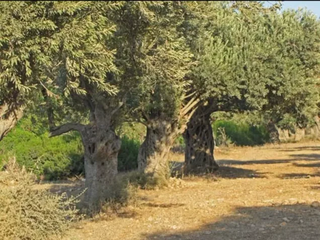
In 1943, olive trees covered approximately 845 dunums, and part of the crop was processed in a hand-operated olive press. The 845-dunum figure is crop-specific and should not be added separately to the 1944/45 cultivable-land total.
'Ayn Hawd was locally known for its carob trees, whose fruit was used to produce dibs, or carob molasses. Eucalyptus and pine trees had also been planted on village land.
Villagers marketed wheat, carob, sesame, and other produce in Haifa and Acre. Economic activity also included the extraction and sale of building stone from three quarries, as well as the production and sale of lime.
In 1944/45, cereal land totaled 4,422 dunums across all ownership categories, while plantations and irrigable land covered 1,503 dunums.
Water
Several springs were located in and around 'Ayn Hawd, including some within the built-up village area, and they supported domestic and agricultural needs.
Palestinian local documentation preserves the names of additional springs and valleys around the village, although Khalidi's principal village entry does not provide a single comprehensive list. Such names should therefore be treated as local geographical documentation rather than automatically as an official cadastral inventory.
Public Facilities
The village contained a mosque in its center, a boys' elementary school established in 1888, a coffeehouse, and a diwan used for community gatherings.
A hand-operated olive press also served local agriculture, while three stone quarries provided another source of livelihood.
Archaeological Remains
Khirbat Hajla was among the archaeological sites associated with the lands of 'Ayn Hawd. Khalidi records foundations of buildings, dressed stones, and rock-hewn cisterns there.
Palestinian local documentation also refers to remains identified as a Crusader-period fortress in the village. Khalidi and PalQuest, however, do not independently establish that dating, so this should be treated as a locally preserved archaeological identification rather than a firmly dated conclusion.
The April 1948 Attack
'Ayn Hawd did not fall during the first attack it faced in 1948. According to the Palestinian newspaper Filastin, as cited by Khalidi, a force of approximately 150 attacked 'Ayn Hawd and neighboring 'Ayn Ghazal on the night of 11 April 1948.
The attack was repelled. A more serious assault the following month was also turned back, and the inhabitants remained in 'Ayn Hawd even after the fall of Haifa in late April.
The May 1948 Attacks
'Ayn Hawd was attacked again in late May in the context of Israeli efforts to secure traffic on the Tel Aviv–Haifa coastal road.
An Associated Press report cited an informant as saying that 'Ayn Hawd and 'Ayn Ghazal were attacked on 20 May 1948. Khalidi's account indicates, however, that the inhabitants of 'Ayn Hawd apparently remained in the village after this assault. It should therefore not be treated as the final occupation or depopulation date.
Final Occupation in July 1948
Khalidi considers it probable that 'Ayn Hawd was among a group of villages south of Haifa occupied during a limited military offensive conducted in the “Ten Days” between the first and second truces.
If this reconstruction is correct, 'Ayn Hawd fell to Israeli occupation forces around 15 July 1948, together with villages in the same area such as al-Tira, Kafr Lam, and al-Sarafand. Naval forces participated in these operations by providing covering fire and shelling coastal villages in support of the ground assault.
Palestine Remembered attributes the attack to a special force assembled from naval personnel and elements of the Golani, Carmeli, and Alexandroni brigades. Khalidi's village-specific entry, however, does not independently establish this exact composition as the force that entered 'Ayn Hawd, so no single assault unit can be identified with complete confidence.
Palestine Remembered also classifies the village under Operation Shoter. This creates a chronological difficulty: Operation Shoter proper was conducted on 24–26 July against the Little Triangle of Ijzim, Jaba', and 'Ayn Ghazal, later than the probable occupation of 'Ayn Hawd. The occupation of 'Ayn Hawd is therefore not presented here as definitively part of Operation Shoter.
Benny Morris, as cited by Khalidi, suggests that the remaining inhabitants may have met a fate similar to that of nearby al-Tira, with some expelled southward and others sent to prisoner-of-war camps. This remains a qualified reconstruction rather than a documented account of the fate of every villager.
- 11 April 1948
First attack on the village
A Zionist force of 150 men struck at 'Ayn Hawd and the neighbouring village of 'Ayn Ghazal in the evening, according to the Palestinian newspaper Filastin as cited by Khalidi; the attack was repulsed.
- May 1948
Second attack
A more serious attack launched the following month was also repulsed, and the villagers of 'Ayn Hawd remained in their village after the fall of Haifa in late April, according to Khalidi.
- Late May 1948 (20 May according to the Associated Press)
Storming of the village
Israeli occupation forces stormed the village after Arab snipers had allegedly halted traffic on the Tel Aviv–Haifa road, and an unnamed informant told an Associated Press reporter that 'Ayn Hawd and 'Ayn Ghazal had been broken into on 20 May. The residents of 'Ayn Hawd apparently stayed put after that attack.
- Probably around 15 July 1948
Final occupation
Khalidi considers it probable that 'Ayn Hawd was one of a number of villages south of Haifa (including al-Tira, Kafr Lam and al-Sarafand) occupied in a limited operation during the 'Ten Days' between the two truces, in which Israeli naval forces assisted the land-based attackers by providing covering fire and bombarding the villages, according to the History of the War of Independence. According to Benny Morris as cited by Khalidi, its inhabitants may have suffered the same fate as those of al-Tira, who were expelled southwards or sent to POW camps.
- 1949
Settlement on village lands
The settlement of Nir Etziyon was established on village land.
- 1954
Settlement on the village site
The settlement of En Hod was established on the village site itself; the village was not destroyed but has been an artists' colony since that year, and its mosque was turned into a restaurant and bar.
Israeli Settlements on the Lands of 'Ayn Hawd
Nir Etzion: According to Khalidi and PalQuest, it was established in 1949 on land belonging to 'Ayn Hawd. Some secondary references use 1950, but the date given by the principal source used for this project is retained here.
Ein Hod: In 1954, an Israeli artists' village named Ein Hod was established on the site of the original Palestinian village. Unlike many depopulated Palestinian villages, much of 'Ayn Hawd's stone-built fabric was not razed but was instead reused after its Palestinian inhabitants were displaced.
Old 'Ayn Hawd and the New Palestinian Village
A number of the original inhabitants remained inside the country after the Nakba. They settled near their former village and created a new Palestinian community that retained the name 'Ayn Hawd.
For decades the new village was denied effective official recognition and municipal services, including water, electricity, roads, sewage infrastructure, and building permits.
Institute for Palestine Studies documentation records stages of nominal recognition during the 1990s, which did not immediately translate into normal municipal status or basic services.
More recent academic research identifies 2005 as the decisive administrative change, when the new 'Ayn Hawd was formally incorporated into the Hof HaCarmel Regional Council after decades of campaigning for recognition. Older descriptions of the new village as still wholly “unrecognized” are therefore no longer accurate as a description of its present legal status.
'Ayn Hawd Today
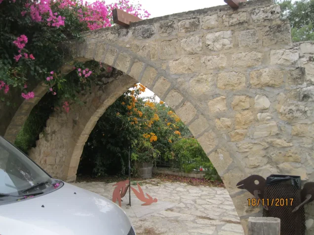
'Ayn Hawd differs from many other depopulated Palestinian villages because much of the original built fabric survived. In Khalidi's pre-1992 field description, the original village had become an artists' colony and tourist site, with Palestinian stone houses reused following the displacement of their owners.
The former village mosque had been converted into a restaurant and café, identified in Khalidi's survey by the name “Bonanza.” Recent academic scholarship continues to describe the former mosque as having been repurposed as a restaurant/bar within the artists' village.
Surrounding land has been used for agriculture, while nearby forests have served as recreational and tourism areas.
Meanwhile, the new Palestinian 'Ayn Hawd established by inhabitants who remained in the area continues to exist near the original village. After decades of lacking effective recognition and services, it was incorporated into the Hof HaCarmel Regional Council in 2005.
Khalidi's description of the original village site derives from fieldwork conducted before the publication of All That Remains in 1992 and should not by itself be treated as a direct field verification of every detail at the site in 2026. Later academic research, however, allows the legal and administrative status of the new Palestinian village to be updated beyond Khalidi's earlier description.
Sources
- PalQuestPalQuest – Interactive Encyclopedia of the Palestine Question: 'Ayn Hawd
- Palestine RememberedPalestine Remembered – 'Ayn Hawd, Haifa
- Palestine RememberedPalestine Remembered – 'Ayn Hawd entry from All That Remains
- Institute for Palestine StudiesInstitute for Palestine Studies – Walid Khalidi, All That Remains
- Institute for Palestine StudiesInstitute for Palestine Studies – Ayn Hawd and the Unrecognized Villages
- pcbs.gov.psGovernment of Palestine – Census of Palestine 1922
- fada.birzeit.eduBirzeit University Repository – Census of Palestine 1931
- palqura.comPalestinian Villages Encyclopedia – 'Ayn Hawd: local historical documentation
- journals.sagepub.comYosef Jabareen – The Architecture of Dispossession: recent academic study of 'Ayn Hawd and Ein Hod
Photo gallery






Photos from the village's people
Photos sent in by visitors and published after review.
Add a photo of this village
Log in to add photos of this village.
Other villages from Haifa
More from the archive



 Download Our Palestine App
The whole archive in the palm of your hand: depopulated villages, the Nakba, the massacres and Al-Aqsa — free, with no ads to erase the story.
Download Our Palestine App
The whole archive in the palm of your hand: depopulated villages, the Nakba, the massacres and Al-Aqsa — free, with no ads to erase the story.



Comments
No comments yet — be the first to write one.
Add your comment
Name and email are optional. Comments appear after review.