
The depopulated village of 'Arab al-Nufay'at / District of Haifa
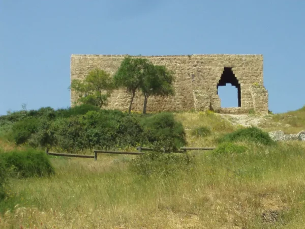
'Arab al-Nufay'at
About the depopulated village of 'Arab al-Nufay'at
- District
- Haifa
- Date 'Arab al-Nufay'at was occupied
- 10 April 1948
- Population in 1948
- 951
- Military operation
- Coastal Clearing
- Distance from the governorate centre
- 45 (km) South of Haifa
- Elevation above sea level
- 25 m
- Cause of displacement
- Expulsion by Zionist troops
- Extent of destruction
- Early May 1948, the village has been mostly destroyed with the exception of one of its houses.
- Ethnic cleansing
- 'Arab al-Nufay'at inhabitants were completely ethnically cleansed.
Hover a dot to read the village name, or click to open its card.
Borders of the depopulated village of 'Arab al-Nufay'at
'Arab al-Nufay'at – Depopulated Palestinian Village of Haifa
'Arab al-Nufay'at was a Palestinian community in the Haifa Subdistrict, situated on the southern coastal plain approximately 45 kilometers south of Haifa according to PalQuest and at an average elevation of about 25 meters above sea level.
Its lands extended between the Mediterranean coast to the west and the Hadera area to the east. The northern boundary lay about 2.5 kilometers south of Wadi al-Mafjar, while the southern boundary lay approximately one kilometer north of Wadi al-Iskandaruna. Two small ponds, Birkat 'Ata and Birkat al-Sanakhiyya, were important landscape features.
The population reached 820 in the official 1944/45 statistics. The statistical land unit covered 8,937 dunums. The inhabitants relied primarily on livestock raising and agriculture, particularly cereal and citrus cultivation.
On 10 April 1948, the Haganah ordered all inhabitants of 'Arab al-Nufay'at to leave. A contemporary intelligence report later reproduced by PalQuest records that the entire population departed toward Baqa al-Gharbiyya and Jit and that the village was empty. Most of the village was then demolished in late April and early May 1948.
Basic Information
| Field | Information |
|---|---|
| Name | 'Arab al-Nufay'at |
| Arabic name | عرب النفيعات |
| Alternative Mandate spelling | Arab en-Nufei'at |
| Subdistrict | Haifa |
| Location | Southern coastal plain, southwestern end of the Haifa Subdistrict |
| Distance from Haifa | Approximately 45 km according to PalQuest; some Palestinian geographical sources give about 50 km |
| Average elevation | Approximately 25 m above sea level |
| Population in 1922 | 336 according to the Palestine Encyclopedia and Mustafa Murad al-Dabbagh |
| Population in 1931 | No separate figure; the community was included with Hadera |
| Population in 1944/45 | 820 |
| 1948 population estimate | Approximately 951 – later estimate, not an official census |
| Total statistical land area | 8,937 dunums |
| Depopulation date | 10 April 1948 |
| Military force | Haganah; no village-specific brigade or battalion is independently documented |
| Named military operation | No formal operation securely documented; “Coastal Clearing” appears only as a possible designation in a secondary source |
| Cause of depopulation | Direct Haganah order requiring all inhabitants to evacuate |
| Documented destinations | Baqa al-Gharbiyya and Jit |
| Destruction | Near-total demolition in late April and early May 1948; one house survived in Khalidi's field description |
| Pre-1948 settlement | Mikhmoret, established on village lands in 1945 south of the site |
Origins of the Community
The Palestine Encyclopedia, drawing on Mustafa Murad al-Dabbagh, associates the Nufay'at with Nafi' ibn Marwan of Tha'laba of Tayy and connects the Palestinian community with Nufay'at groups in Egypt.
Palestinian oral-history and community material preserves several differing genealogical traditions and records the later incorporation of families of different origins into the settlement.
Detailed tribal genealogy is therefore treated here as inherited local tradition rather than as a single conclusively established historical lineage.
Location and Geography
The lands of 'Arab al-Nufay'at stretched between the Mediterranean coast and the Hadera area over a relatively narrow strip of coastal plain.
The northern boundary lay approximately 2.5 kilometers south of Wadi al-Mafjar, while the southern boundary lay about one kilometer north of Wadi al-Iskandaruna, adjoining the broader Wadi al-Hawarith plain.
The terrain was generally flat to gently undulating, with dunes and sandy stretches along parts of the coast.
The Palestine Encyclopedia records Tall al-Shaykh Zurraq near the coast as one of the highest local points, approximately 33 meters above sea level.
Birkat 'Ata and Birkat al-Sanakhiyya
Two small ponds were important natural features within the village lands.
Birkat 'Ata, the larger of the two, lay in the southeastern part of the village territory.
Birkat al-Sanakhiyya lay nearer the central part of the lands.
Together with the surrounding wadis, dunes, and cultivated plain, the ponds formed part of the environmental setting in which the community practiced pastoralism and agriculture.
Built Environment
The dwellings of 'Arab al-Nufay'at were dispersed over a relatively broad area, reflecting the community's Bedouin and semi-sedentary history.
Khalidi records that most houses were built of mud and stone.
Palestinian community documentation additionally recalls tents, wooden dwellings, and later houses constructed of stone and cement as settlement became more permanent.
No separate 1931 house count is available because the community was statistically included with Hadera.
Population
| Year | Population | Status |
|---|---|---|
| 1922 | 336 | Figure reported by the Palestine Encyclopedia and Mustafa Murad al-Dabbagh for the Mandate census |
| 1931 | No separate figure | 'Arab al-Nufay'at was included with Hadera in the census |
| 1944/45 | 820 | Official Mandate-period population figure |
| 1948 | 951 | Later demographic estimate, not an official 1948 census |
| 1998 | 5,841 | Later Palestine Remembered estimate of refugees and descendants |
Number of Houses
No independently documented 1931 house count exists for 'Arab al-Nufay'at because the population was counted together with Hadera.
No official separate house census was conducted for the village in 1948.
No number of houses is therefore inferred from population estimates.
Land Ownership, 1944/45
The land-ownership statistics require particular care.
PalQuest records a total statistical land unit of 8,937 dunums, with the following official categories:
- Palestinian / official “Arab” category0 shown in the published table dunums0%
- Transferred to Zionists / official “Jewish” category7,466 dunums84%
- Public1,471 dunums16%
The figures balance exactly: 7,466 + 1,471 = 8,937 dunums.
The Palestine Encyclopedia similarly states that 7,466 dunums had come under Jewish ownership by 1945.
A simplified Palestine Remembered table reverses the Arab and Jewish columns. Because that conflicts with both PalQuest and the Palestine Encyclopedia, the reversed presentation is not used here.
Land Use, 1944/45
- Cereals5,902 dunums39%
- Citrus and bananas176 dunums1%
- Total cultivated/cultivable land6,078 dunums40%
- Non-cultivable land2,859 dunums19%
The figures reconcile exactly: 5,902 + 176 = 6,078 cultivable dunums, and 6,078 + 2,859 = 8,937.
Khalidi's prose states that the villagers cultivated 176 dunums of communal land with citrus.
Because some electronic reproductions display inconsistent ownership columns for land use, this article presents the land-use totals without reallocating them among ownership categories where the source is not fully clear.
Economy
The economy depended primarily on livestock raising and agriculture.
Cereals and citrus were the main crops documented by Khalidi, while Palestinian community sources additionally mention vegetables, carob, figs, and other produce.
Animal husbandry remained particularly important because of the community's pastoral and semi-sedentary background.
Education
No formal government school is documented at 'Arab al-Nufay'at during the British Mandate.
Palestinian local documentation states that elementary instruction was provided through the traditional kuttab system.
No securely documented pupil or teacher totals are available.
Religious Buildings and Services
Khalidi and PalQuest do not independently document a specific mosque or shrine within 'Arab al-Nufay'at.
Palestinian sources also describe public services in the community as very limited.
No particular religious structure is therefore inferred without direct documentation.
Archaeological Remains
Khalidi records that the village lands contained a number of historic sites and khirbas.
His short village profile does not name or date them individually.
Tall al-Shaykh Zurraq appears in the Palestine Encyclopedia primarily as a prominent topographical feature near the coast.
No specific archaeological period is assigned to the village's unnamed remains without more detailed evidence.
Military Context in Spring 1948
During the spring of 1948, Palestinian communities along the coastal plain south of Haifa were increasingly subjected to military pressure and evacuation.
'Arab al-Nufay'at, 'Arab al-Fuqara, and 'Arab Zahrat al-Dumayri were among the communities that received direct Haganah evacuation orders on the same date.
Some secondary sources describe this regional policy as “Coastal Clearing,” but no securely established formal operation name is attached to 'Arab al-Nufay'at in Khalidi's village-level account.
Depopulation – 10 April 1948
On 10 April 1948, the Haganah ordered the inhabitants of 'Arab al-Nufay'at to leave.
This date is supported not only by later village histories but by a contemporary intelligence report from 1948 reproduced by PalQuest.
The report records that the entire population received an evacuation order from the Haganah and that the village was empty.
It also records the villagers' destinations as Baqa al-Gharbiyya and Jit.
Military Unit and Operation
The military organization specifically documented at village level is the Haganah.
No brigade or battalion is independently identified in Khalidi or PalQuest as carrying out the evacuation order at 'Arab al-Nufay'at.
Palestine Remembered lists “Coastal Clearing” only as a possible operation.
The most accurate formulation is therefore: forced evacuation by direct Haganah order within the broader clearing of Palestinian communities from the coastal plain; no village-specific subordinate unit or formally documented operation name is established.
Cause of Depopulation
The cause of depopulation is unusually clear in the surviving documentation.
The Haganah issued a direct order requiring the entire population to leave, and the contemporary report records the village as empty on 10 April.
The cause should therefore not be reduced to generalized fear or the indirect effect of a neighboring village's fall.
The most accurate description is: forced depopulation through a direct Haganah evacuation order.
Destruction
The destruction of 'Arab al-Nufay'at did not occur on the same day as the population's removal.
Khalidi dates the demolition of the village to late April and early May 1948.
Destruction was extensive enough that later fieldwork identified only one surviving village house.
The 10 April depopulation and subsequent demolition should therefore be treated as separate historical stages.
Ethnic Cleansing in Source Classification
Palestine Remembered classifies 'Arab al-Nufay'at using the term “complete ethnic cleansing.” The phrase is retained here only as an attributed source classification.
The more specifically documented facts are the Haganah order requiring the entire population to leave, the emptying of the village on 10 April, displacement toward Baqa al-Gharbiyya and Jit, destruction of most buildings in late April and early May, and the absence of permanent collective Palestinian return.
Occupation and Depopulation Chronology
| Date | Event |
|---|---|
| Spring 1948 | Military pressure and evacuation expand among Palestinian communities along the coastal plain south of Haifa. |
| 10 April 1948 | The Haganah orders all inhabitants of 'Arab al-Nufay'at to leave. |
| 10 April 1948 | A contemporary intelligence report records the entire population departing toward Baqa al-Gharbiyya and Jit and the village becoming empty. |
| Late April 1948 | Demolition of the village begins after the population has been removed. |
| Early May 1948 | Most of the village's built environment has been destroyed. |
| Later period | One village house and an old mulberry tree remain, while a large military camp occupies part of the surrounding area. |
Israeli Settlements on 'Arab al-Nufay'at's Lands
Mikhmoret was established in 1945 on the village lands south of the Palestinian settlement site.
Because it predates the Nakba, it should be classified as a pre-1948 settlement on village lands rather than as a settlement established after depopulation.
Khalidi and PalQuest do not identify a new post-1948 Israeli settlement independently founded on 'Arab al-Nufay'at's lands.
The Palestine Encyclopedia and another Palestinian source state that portions of the former lands later became incorporated into the Giv'at Olga neighborhood of Hadera.
Because this attribution does not appear in Khalidi's settlement list, Giv'at Olga is treated here as a secondary Palestinian claim concerning later urban expansion over part of the village lands, rather than as an equally secure cadastral identification.
'Arab al-Nufay'at Today
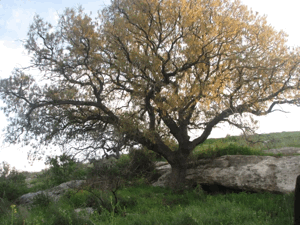
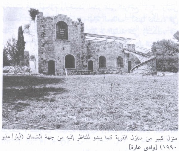
According to the field description used by Walid Khalidi before the publication of All That Remains in 1992, only one surviving house and an old mulberry tree remained from the Palestinian village.
The house was still inhabited by an Arab family at the time of the survey.
A large Israeli military camp occupied a substantial area near the former village site.
The remaining surrounding lands were cultivated with melons, wheat, and barley, while mulberry and eucalyptus trees grew nearby.
PalQuest reproduces a photograph of the surviving house taken by Hasan Hawari in May 1987.
This should be understood as historical field documentation from before 1992 rather than as a comprehensive archaeological or cadastral survey of the entire village territory in 2026.
Sources
- PalQuest – Interactive Encyclopedia of the Palestine Question: 'Arab al-Nufay'at
- PalQuest – Israeli Intelligence Report on the Depopulation of Palestine, 30 June 1948
- Palestine Remembered – 'Arab al-Nufay'at, Haifa Subdistrict
- Palestine Remembered – 'Arab al-Nufay'at entry from Walid Khalidi's All That Remains
- Palestine Encyclopedia – 'Arab al-Nufay'at, drawing on Mustafa Murad al-Dabbagh
- Palestinian Villages Encyclopedia – 'Arab al-Nufay'at
Photo gallery

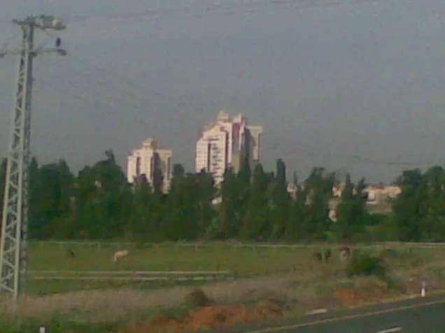


Photos from the village's people
Photos sent in by visitors and published after review.
Add a photo of this village
Log in to add photos of this village.
Other villages from Haifa

More from the archive


 Download Our Palestine App
The whole archive in the palm of your hand: depopulated villages, the Nakba, the massacres and Al-Aqsa — free, with no ads to erase the story.
Download Our Palestine App
The whole archive in the palm of your hand: depopulated villages, the Nakba, the massacres and Al-Aqsa — free, with no ads to erase the story.



Comments
No comments yet — be the first to write one.
Add your comment
Name and email are optional. Comments appear after review.