
The depopulated village of Khirbat al-Damun / District of Haifa

Khirbat al-Damun
About the depopulated village of Khirbat al-Damun
- District
- Haifa
- Date Khirbat al-Damun was occupied
- 30 April 1948
- Population in 1948
- 390
- Distance from the governorate centre
- 10.5 (km) South East of Haifa
- Elevation above sea level
- 245 m
- Cause of displacement
- Military assault by Zionist troops
- Extent of destruction
- The village has been mostly destroyed with the exception of a village building now used as a prison.
- Ethnic cleansing
- The majority of Khirbat al-Damun inhabitants were terrorized into fleeing, on the other hand, few villagers were allowed to stay behind.
Hover a dot to read the village name, or click to open its card.
Borders of the depopulated village of Khirbat al-Damun
Khirbat al-Damun – Haifa Subdistrict
Khirbat al-Damun was a depopulated Palestinian village in the Haifa subdistrict. It stood on the upper slopes of Mount Carmel, along the eastern edge of Wadi Falah, approximately 10.5 km from Haifa. PalQuest gives an average elevation of about 435 meters above sea level.
Khirbat al-Damun in Haifa must not be confused with al-Damun in the Acre subdistrict. They were two entirely different Palestinian villages with different populations, lands, locations, and histories of depopulation.
The official 1944/45 statistics recorded 340 inhabitants and a total land area of 2,797 dunums. The village was most probably occupied by Haganah forces in late April 1948 during the campaign to consolidate control over Haifa and its rural hinterland. Walid Khalidi does not give a definite occupation date, although evidence strongly suggests that Khirbat al-Damun may have been the unnamed village attacked near al-Tira on 26 April.
Location of Khirbat al-Damun
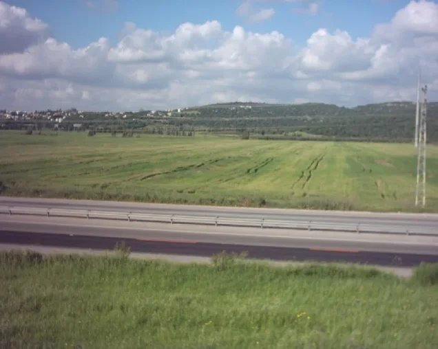
Khirbat al-Damun stood high on Mount Carmel along the eastern side of Wadi Falah.
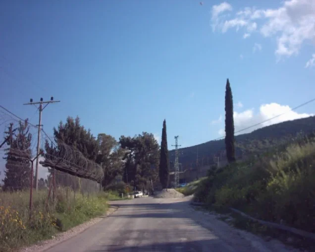
One secondary road connected it directly with Haifa, while another, shorter secondary road linked it with the main highway leading to the city.
Its elevated location placed the small settlement within the southern and southeastern rural hinterland of Haifa, close to al-Tira, 'Ayn Hawd, 'Isfiya, and Daliyat al-Karmil.
Elevation
PalQuest gives an average elevation of approximately 435 meters, based on the Mandate-era topographical maps used for the All That Remains project.
Palestine Remembered's statistical header gives a different figure of 245 meters, while Palestinian local reference material also gives approximately 435 meters. This article therefore follows the PalQuest/Khalidi geographical data.
Neighboring Village Lands
Palestine Remembered identifies the following village lands among those surrounding Khirbat al-Damun:
| Village / Area | Relationship to Khirbat al-Damun |
|---|---|
| al-Tira | One of the nearest villages, particularly to the north and west, and directly relevant to the chronology of Khirbat al-Damun's occupation |
| 'Ayn Hawd | In the southwestern surroundings |
| Daliyat al-Karmil | To the south and southeast |
| 'Isfiya | Within the neighboring lands to the southeast |
| Balad al-Shaykh and Yajur | Shown in the broader geographical surroundings to the northeast and east, without necessarily proving a direct cadastral boundary at every point |
Some Palestinian local material also places al-Mazar in the broader southwestern surroundings.
A local reference that lists “al-Damun” itself as a northern boundary appears to confuse Khirbat al-Damun in Haifa with the separate village of al-Damun in Acre and is therefore not adopted here.
Name and the Local Designation “Mazra'at Qarman”
The principal Mandate and Khalidi sources identify the locality as Khirbat al-Damun.
Palestine Remembered also records the local designation “Mazra'at Qarman.”
Later Palestinian community material associates that name with the Qarman family and states that Hajj Tahir Qarman acquired land there and built a large structure. Since these details are not part of Khalidi's core village entry, this article records Mazra'at Qarman as a local alternative designation without treating the full ownership narrative as independently established fact.
Khirbat al-Damun during the Mandate
The Palestine Index Gazetteer classified Khirbat al-Damun as a hamlet during the British Mandate.
This classification helps explain the nature of the locality. It was not a large village with an extensive urban center, but a small rural settlement whose inhabitants depended on agriculture, livestock, and the surrounding mountain lands.
Population of Khirbat al-Damun
| Year | Population | Nature of figure / Notes |
|---|---|---|
| 1922 | 19 | Official Census of Palestine; all were Muslims |
| 1931 | No independent figure | Khirbat al-Damun was counted with 'Isfiya in the 1931 census; an independent village figure should not be reconstructed without evidence |
| 1944/45 | 340 | Official Government of Palestine statistics; all were recorded as Arabs and are described by the village sources as Muslims |
| 1948 | 394 | Later Palestine Remembered estimate; not an official census |
| 1998 | 2,422 refugees and descendants | Later demographic estimate published by Palestine Remembered |
The increase from 19 inhabitants in 1922 to 340 in 1945 was substantial, but the absence of a separate 1931 count prevents a precise independent demographic series between the two dates.
Number of Houses
The core sources reviewed do not provide a separate official house count for Khirbat al-Damun in 1931 because the locality was counted with 'Isfiya.
Palestine Remembered likewise does not provide a securely sourced independent 1948 house estimate on its village statistics page. No figure has therefore been inferred.
Land Ownership in 1944/45
Khirbat al-Damun's registered lands totaled 2,797 dunums.
Using Palestine Remembered's simplified terminology:
- Palestinian1,904 dunums68%
- Transferred to Zionists0 dunums0%
- Communal/Public893 dunums32%
The official categories record 1,904 Arab dunums and 893 Public dunums, with no land registered in the Jewish ownership category.
Land Use in 1944/45
- Arab
- Public
- Citrus and bananas5 dunums
- Plantations and irrigable land280 dunums
- Cereals1,619 dunums
- Non-cultivable land893 dunums
The land-use categories balance exactly with the official ownership totals.
Palestine Remembered's simplified display can give the impression that the 893 dunums of non-arable land belonged entirely to the Palestinian private category. PalQuest's official breakdown places those 893 dunums in the Public category.
The reproduced official table does not provide a separate reliable built-up-area figure for the hamlet, and none has been inferred from another category.
Economic Life in Khirbat al-Damun
The inhabitants depended principally on agriculture and animal husbandry.
Cereals were the most important crops, occupying 1,619 dunums in 1944/45. Another 280 dunums were classified as plantations or irrigable land, while 5 dunums were devoted to citrus and bananas.
The villagers also cultivated olives, although Khalidi's principal 1945 table does not provide a separate olive acreage.
Parts of the village lands were forested, while the mountain slopes and uncultivated areas supported livestock raising.
Education and Public Services
Khalidi's village entry does not document a formal school in Khirbat al-Damun.
Palestinian local reference material drawing on Mustafa al-Dabbagh likewise states that the hamlet lacked an independent school and formal public services.
No school founding date or enrollment total has therefore been added.
Water and Natural Environment
Khirbat al-Damun lay on the eastern side of Wadi Falah, one of the principal natural features of its immediate environment.
Palestinian local sources also record caves, rock-cut cisterns, and a rock-cut pool in the area, indicating longstanding adaptation to the mountainous landscape and its water resources.
The core sources reviewed do not securely identify one named spring or well as the village's principal drinking-water source, so none has been invented.
Archaeological Remains
Khirbat al-Damun was an archaeological site of considerable antiquity.
At the base of the village was a cave used as a sheepfold. It led to a series of subterranean chambers.
Flint artifacts found at the cave entrance were dated no later than the Neolithic period, indicating very early human use of the site.
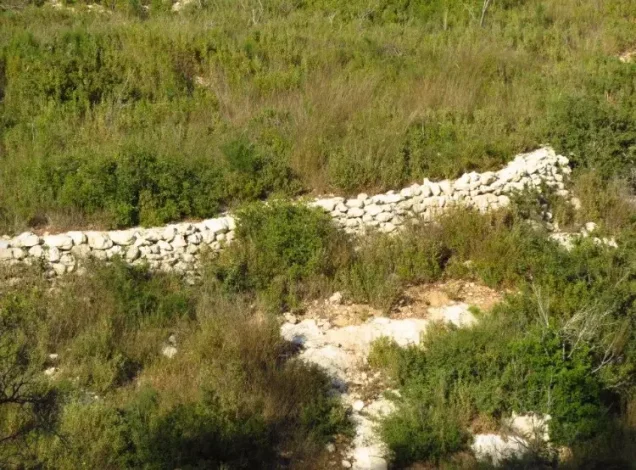
Palestinian local documentation additionally records ruined walls, tombs, rock-cut cisterns, a rock-cut pool, and numerous caves and archaeological remains in the surrounding area.
These features should not all be assigned to a single historical period without specialized archaeological study.
Khirbat al-Damun before the Nakba
The location of Khirbat al-Damun near Haifa and al-Tira gave it strategic significance during the spring of 1948.
As the Zionist offensive against Haifa intensified, the city's Palestinian rural hinterland came under increasing pressure as the Haganah sought to control surrounding roads and villages and consolidate its hold on the city.
Haifa fell on 22 April 1948, after which Haganah forces intensified operations against nearby Palestinian communities.
The Assault on al-Tira and Its Connection to Khirbat al-Damun
Al-Tira was the nearest major Palestinian village to Khirbat al-Damun and was repeatedly attacked in April 1948.
On 25–26 April, al-Tira was subjected to a major mortar and machine-gun assault, during which women and children were evacuated from the village.
A contemporary press report stated that while al-Tira was being attacked on 26 April, Zionist forces were also attacking “another nearby village.”
Khalidi concludes that Khirbat al-Damun is the most likely candidate because it was the nearest village to al-Tira whose fate is otherwise unaccounted for in the surviving reports.
This remains a historical inference, however, and should not be transformed into an unquestionable claim that Khirbat al-Damun was definitively captured on 26 April.
Occupation and Depopulation of Khirbat al-Damun
The exact date of Khirbat al-Damun's occupation is not known.
Palestine Remembered lists 30 April 1948 in its statistical header, and some later Palestinian compilations repeat that date.
Khalidi's detailed account is more cautious. It explicitly states that no occupation date is available and concludes that the village was probably taken shortly before or after the fall of Haifa, in late April 1948.
The events of 26 April provide the strongest village-specific chronological clue but do not conclusively settle the matter.
The most accurate formulation is therefore: Khirbat al-Damun was occupied in late April 1948, possibly around 26 April, while Palestine Remembered indexes 30 April as the occupation date.
Cause of Depopulation
Palestine Remembered classifies the immediate cause of depopulation as a direct military assault by Zionist forces.
This is consistent with Khalidi's broader reconstruction: the fall of Haifa, the major assault on neighboring al-Tira, and the subsequent Haganah campaign to secure the city's rural hinterland.
The principal sources do not provide a complete family-by-family account of the villagers' departure or an exact time for the departure of the last inhabitants, so unsupported details have not been added.
Military Unit
The military organization that can be securely identified is the Haganah.
Carmeli Brigade units were extensively active in Haifa and its hinterland during the final week of April and took part in operations designed to consolidate Zionist control of the city.
The village-specific Khirbat al-Damun entry, however, does not identify Carmeli or any particular battalion as the force that occupied the hamlet.
Khirbat al-Damun is also not listed among the specifically identified affected villages in PalQuest's entry for Operation Bi'ur Hametz. The village is therefore not assigned definitively to that operation or brigade.
Occupation Chronology
- April 1948
Zionist offensive against Haifa and its hinterland
Haganah operations intensified in and around Haifa as part of efforts to seize the city and secure surrounding territory.
- 22 April 1948
Fall of Haifa
The fall of the city was followed by intensified Haganah operations against surrounding Palestinian villages.
- 25–26 April 1948
Major assault on al-Tira
Al-Tira was heavily mortared and attacked, and part of its civilian population was evacuated.
- 26 April 1948
Attack on “another nearby village”
A contemporary report referred to another village being attacked near al-Tira; Khalidi considers Khirbat al-Damun the most likely locality.
- Late April 1948
Most probable period of occupation
The core source does not provide a definite day but considers occupation in this period highly likely.
- 30 April 1948
Palestine Remembered indexed date
This date appears in the statistical header but is not established by Khalidi's detailed narrative.
- Later; exact date not documented
Destruction of most of the village
Most of the built-up settlement was destroyed, while one principal building survived according to the later field survey.
Refugees from Khirbat al-Damun
Palestine Remembered estimates the village's 1948 population at approximately 394. This is a later estimate rather than an official Mandate census figure.
The same source estimates that refugees from Khirbat al-Damun and their descendants numbered approximately 2,422 in 1998.
The principal sources reviewed do not provide a comprehensive final census of the later places of residence of every displaced family.
Israeli Settlements on Khirbat al-Damun Village Lands
Walid Khalidi and PalQuest state that no Israeli settlement was established on Khirbat al-Damun's village lands.
The later use of the site for a prison, woodland, and recreational purposes should therefore be distinguished from the establishment of a residential settlement on the village lands.
Damon Prison
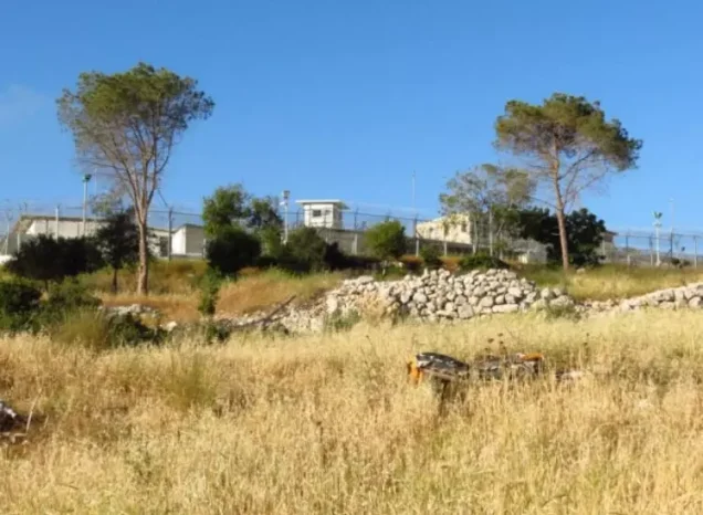
The most prominent surviving structure associated with the former village site became part of Damon Prison.
Khalidi's field description states that the only surviving village building was being used as a prison at the time of the survey.
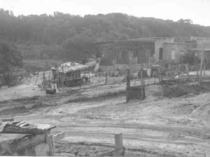
Palestine Remembered contains later documentation from 2003 showing Damon Prison and village rubble in the immediate area.
Recent Palestinian reporting also confirms that Damon Prison remains in operation in 2026. WAFA and Palestinian detainee organizations continued to report on Palestinian women held there as recently as August 2026.
Khirbat al-Damun Today
In Walid Khalidi's field description, only one building remained from Khirbat al-Damun and was being used as a prison.
Cactuses and several surviving fruit trees, including pomegranate and almond trees, grew across the site. The surrounding area had become forested and was being used for recreation.
This description does not constitute direct field verification of the entire site in 2026. Field research for All That Remains was conducted between 1987 and 1990, before the book's publication in 1992.
Palestine Remembered provides later photographs from 2003 documenting the prison, rubble, and surviving traces of houses. Palestinian reports from 2026 confirm the continued operation of Damon Prison.
These later sources, however, do not constitute a comprehensive contemporary archaeological or cadastral survey of all former village lands. The present condition of every feature should therefore not be inferred solely from Khalidi's late-1980s field description.
Sources
- PalQuestPalQuest – Khirbat al-Damun
- Palestine RememberedPalestine Remembered – Khirbat al-Damun, Haifa District
- Palestine RememberedPalestine Remembered – Khirbat al-Damun entry from Walid Khalidi's All That Remains
- Institute for Palestine StudiesInstitute for Palestine Studies – Walid Khalidi, All That Remains
- commons.wikimedia.orgGovernment of Palestine – Census of Palestine 1922
- fada.birzeit.eduBirzeit University – Census of Palestine 1931
- sabil.meVillage Statistics 1945 – Official population and land statistics
- palqura.comPalestinian Villages Encyclopedia – Khirbat al-Damun; supplementary Palestinian documentation
- PalQuestPalQuest – All That Remains: Methodology and Field Research
- english.wafa.psWAFA – 2026 reporting confirming continued use of Damon Prison
Photo gallery



Photos from the village's people
Photos sent in by visitors and published after review.
Add a photo of this village
Log in to add photos of this village.
Other villages from Haifa


More from the archive


 Download Our Palestine App
The whole archive in the palm of your hand: depopulated villages, the Nakba, the massacres and Al-Aqsa — free, with no ads to erase the story.
Download Our Palestine App
The whole archive in the palm of your hand: depopulated villages, the Nakba, the massacres and Al-Aqsa — free, with no ads to erase the story.



Comments
No comments yet — be the first to write one.
Add your comment
Name and email are optional. Comments appear after review.