
The depopulated village of Khirbat al-Shuna (al-Shuna) / District of Haifa
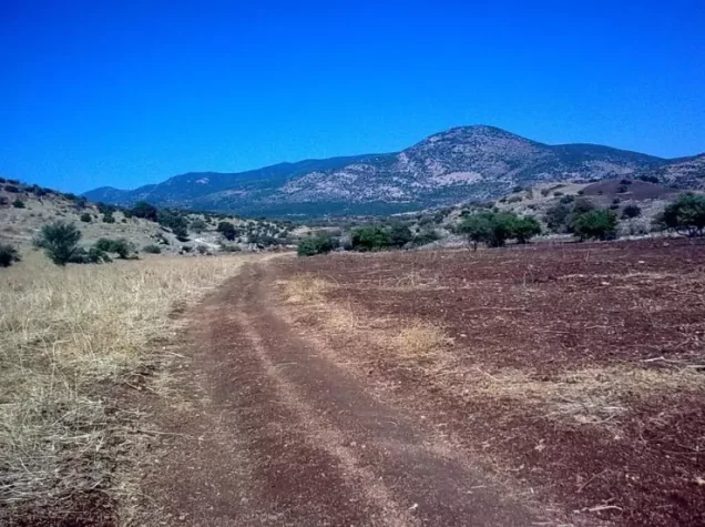
Khirbat al-Shuna (al-Shuna)
About the depopulated village of Khirbat al-Shuna (al-Shuna)
- District
- Haifa
- Date Khirbat al-Shuna (al-Shuna) was occupied
- 15 March 1948
- Population in 1948
- 197
- Distance from the governorate centre
- 32.5 (km) South of Haifa
- Elevation above sea level
- 25 m
- Cause of displacement
- Expulsion by Zionist troops
- Extent of destruction
- The village has been mostly destroyed with the exception of few houses which have been renovated and turned into tourist facilities.
- Ethnic cleansing
- Village inhabitants were completely ethnically cleansed.
Hover a dot to read the village name, or click to open its card.
Khirbat al-Shuna (al-Shuna) – Depopulated Palestinian Village of the Haifa Subdistrict
Khirbat al-Shuna, originally known simply as al-Shuna, was a depopulated Palestinian village in the Haifa Subdistrict. It was located at the southwestern foot of Mount Carmel, approximately 32.5 kilometers south of Haifa, at an average elevation of about 25 meters above sea level.
The village stood very close to the main coastal road, while the Haifa–Tel Aviv railway passed along its western edge. The establishment and subsequent expansion of the Zionist settlement of Binyamina south of the village during the 1920s also affected the way al-Shuna appeared in British Mandate statistical records.
- District
- Haifa
- Distance from Haifa
- Approximately 32.5 km south of Haifa
- Elevation
- Approximately 25 m above sea level
- Natural Setting
- At the southwestern foot of Mount Carmel, close to the coastal highway and the Haifa–Tel Aviv railway
- Population in 1944/1945
- No reliable separate figure is provided for Khirbat al-Shuna in the principal sources used; the locality had been statistically incorporated into larger units
- Estimated Population in 1948
- No independently documented village-specific estimate is available; the figure 197 should not be used because it belongs to al-Shuna in the Safad Subdistrict
- Depopulation Period
- Palestine Remembered gives 15 March 1948; Khalidi's detailed account places the village within a broader campaign extending from mid-March through the first half of May 1948
- Military Context
- Campaign against Palestinian villages along the coastal zone between Tel Aviv and Zikhron Ya'aqov
- Military Unit
- Haganah and Irgun participated in the wider campaign; the village-specific source does not identify the force that entered Khirbat al-Shuna
- Total Land Area
- No independently documented village-specific total is provided by the principal sources used
- Israeli Settlements Established on Village Lands
- None documented; Binyamina was established south of the site and later expanded close to the original village boundaries
The Name Khirbat al-Shuna
The village was originally known simply as al-Shuna. By the mid-1920s, the Palestinian locality came to be called Khirbat al-Shuna, distinguishing it from the nearby Zionist settlement that had initially been associated with the name “Jewish al-Shuna” before the name Binyamina became established.
Walid Khalidi's account describes the Palestinian locality as having become increasingly surrounded by the development associated with Binyamina. During the Mandate period, the Palestine Index Gazetteer classified Khirbat al-Shuna as a hamlet.
Location and Transportation
Khirbat al-Shuna stood at the southwestern foot of Mount Carmel on relatively low ground, approximately 25 meters above sea level.
The main coastal highway passed very close to the village, while the Haifa–Tel Aviv railway ran along its western edge. The village therefore lay beside one of Mandatory Palestine's principal coastal transportation corridors.
Population and Statistical Problems
Population figures for Khirbat al-Shuna require particular caution because the locality was not consistently enumerated as an independent statistical unit.
In the official 1922 Census of Palestine, a locality named Shuneh had a total population of 66: 15 Muslims and 51 Jews. The total of 66 should not be presented as the population of the Palestinian community alone, since the statistical entry reflected both the Palestinian inhabitants and Jewish residents associated with the locality that subsequently developed as Binyamina.
| Year | Figure | Nature of Figure and Notes |
|---|---|---|
| 1922 | 66 total: 15 Muslims and 51 Jews | Official census entry for Shuneh; 66 is not the Palestinian population alone |
| 1931 | 1,429 total | Combined statistical unit under Zikhron Ya'aqov, including Esh Shuna and Umm al-'Alaq; no separate population for Khirbat al-Shuna can be extracted |
| 1944/1945 | No reliable separate figure | The principal sources used do not provide Khirbat al-Shuna as a separately enumerated population unit |
| 1948 | Not reliably established | The figure 197 appearing in some secondary material belongs to al-Shuna in the Safad Subdistrict, not Khirbat al-Shuna in Haifa |
The 1931 Census and Number of Houses
PalQuest and Palestine Remembered display a 1931 population of 1,429 and 191 occupied houses, but these figures require an important qualification.
The official 1931 census treated Zikhron Ya'aqov as the parent locality and listed Esh Shuna and Umm al-'Alaq as subordinate or attached localities. The census methodology assigned the population of such attached hamlets to the parent village rather than publishing a separate figure for each one.
The combined unit contained 1,429 people: 214 Muslims, 1,192 Jews, and 23 Christians, with 191 occupied houses. These figures therefore cannot be presented as the population or housing stock of Khirbat al-Shuna alone.
Land Ownership and Land Use
The principal sources reviewed for Khirbat al-Shuna do not provide an independent 1944/45 land-ownership or land-use table for the Palestinian village.
Because Khirbat al-Shuna had been statistically and administratively incorporated into larger surrounding units during the Mandate period, figures belonging to Binyamina or Zikhron Ya'aqov should not be reassigned to Khirbat al-Shuna and presented as the village's land area. No unsupported total is therefore supplied.
Economic Life in Khirbat al-Shuna
The principal sources used here do not provide sufficient village-specific quantitative evidence concerning agricultural production, crops, or land distribution in Khirbat al-Shuna during the 1940s.
The statistical incorporation of the locality into neighboring units makes it unsafe to attribute agricultural data published for Binyamina or Zikhron Ya'aqov directly to the Palestinian residents of Khirbat al-Shuna. No unverified crop or land-use figures are therefore added.
Tall Mubarak and Archaeological Remains
West of Khirbat al-Shuna stood an archaeological site known as Tall Mubarak. PalQuest reports that archaeological work identified fourteen strata extending from the early second millennium BCE through the Roman, Byzantine, and Crusader periods, as late as approximately the thirteenth century CE.
The summit of the mound also served as a cemetery for the nearby Palestinian village of Jisr al-Zarqa.
This archaeological information is presented as reported by PalQuest; the original Israeli excavation publication is not used independently as a source for this article.
Occupation and Depopulation of Khirbat al-Shuna
Walid Khalidi's detailed account does not establish an exact independently verified date for the entry of military forces into Khirbat al-Shuna. It is therefore important to distinguish the date displayed in a database summary from the wider documented military chronology.
Palestine Remembered gives 15 March 1948 as the date associated with the village's depopulation or occupation and classifies the cause of departure as expulsion by Zionist forces.
Khalidi's fuller historical narrative places Khirbat al-Shuna within the Palestinian coastal zone extending northward from Tel Aviv to Zikhron Ya'aqov. From mid-March through April and the first half of May 1948, Haganah and Irgun forces carried out a series of raids intended to remove Palestinian inhabitants from this coastal region.
The village-specific account does not name a distinct military operation for the occupation of Khirbat al-Shuna, nor does it identify a particular brigade or battalion as the independently documented force that entered the village.
Occupation Chronology
- Mid-March 1948
Beginning of the Coastal Campaign
Haganah, with Irgun participating in parts of the wider campaign, began a series of raids aimed at removing Palestinian communities from the coastal zone extending toward Zikhron Ya'aqov.
- 15 March 1948
Palestine Remembered Depopulation Date
The summary field gives this date and attributes the villagers' departure to expulsion, but Khalidi's detailed narrative does not independently establish it as the exact date on which Khirbat al-Shuna was entered.
- April – first half of May 1948
Continuation of Regional Operations
Military raids continued across Palestinian localities in the coastal area. Khalidi's account states that by mid-May most Palestinian inhabitants had been removed from this part of the coastal plain.
- After depopulation; precise date undocumented
Destruction of Most Village Buildings
Most of the village's buildings were subsequently destroyed, while a small number survived.
Military Operation and Unit
Military Operation: The principal sources do not identify a separately named operation specifically responsible for the occupation of Khirbat al-Shuna. Its depopulation is situated within the broader campaign against Palestinian villages in the central and northern coastal plain during the spring of 1948.
Military Unit: Haganah and Irgun forces participated in the broader coastal campaign. Khalidi's village-specific account does not independently identify which organization, brigade, or battalion entered Khirbat al-Shuna itself, so no more specific unit is assigned.
Cause of Depopulation
Palestine Remembered classifies the cause of departure as the expulsion of the villagers by Zionist forces. Khalidi's historical account places the village within a broader military campaign intended to remove Palestinian communities from the coastal area.
The village's depopulation can therefore be documented in the context of military raids, pressure, and expulsions affecting the region, while the precise village-level date and executing unit remain uncertain.
Destruction of Khirbat al-Shuna
The sources indicate that most of the village's houses were destroyed, although a small number of buildings survived. The principal sources do not provide a separate exact date for the demolition, so no unsupported date is supplied.
Israeli Settlements on Khirbat al-Shuna Village Lands
According to Walid Khalidi and PalQuest, no Israeli settlement was established on the lands of Khirbat al-Shuna itself.
Binyamina had been established in 1922 south of the village site. Its built-up area later expanded until some buildings stood very close to the original boundaries of Khirbat al-Shuna.
In 1946, Binyamina was combined with Nahalat Jabotinsky. Although some simplified online database fields may create the impression that Binyamina and Nahalat Jabotinsky were established directly on Khirbat al-Shuna's lands, Khalidi's detailed account explicitly states that no Israeli settlement was founded on the village lands themselves.
Khirbat al-Shuna Today
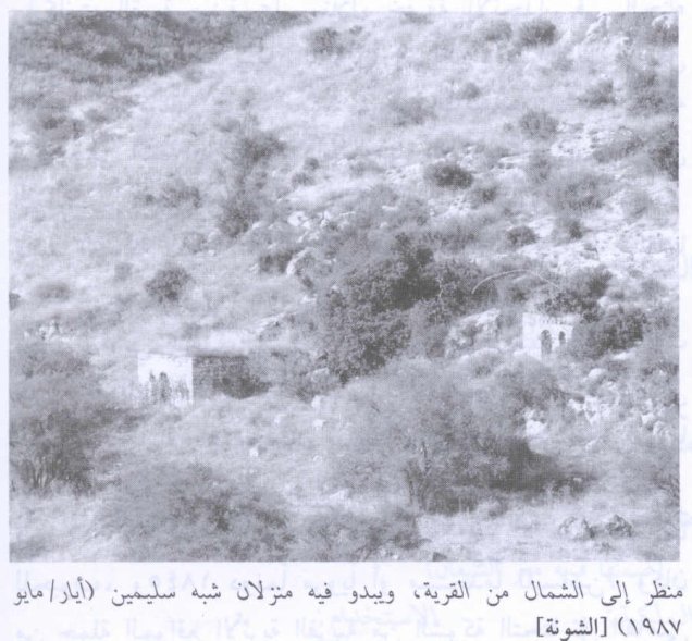
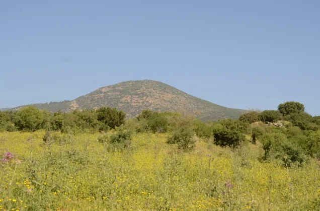
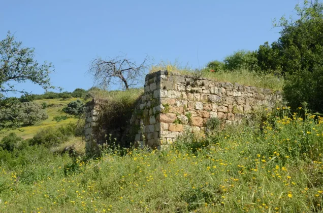
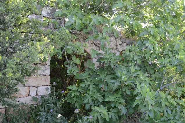
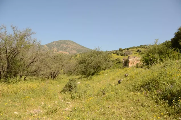
According to the field documentation used by Walid Khalidi, including a photograph published by PalQuest and dated May 1990, the village site had been fenced. A few surviving houses had been renovated and converted into tourist facilities.
Tall eucalyptus and palm trees, together with cactus plants, grew around the surviving structures, while most of the original Palestinian built environment had disappeared.
This description reflects field documentation preceding the publication of All That Remains in 1992, specifically documentation from 1990. It should therefore not be treated as a direct field verification of conditions at the site in 2026.
Sources
- PalQuest – Interactive Encyclopedia of the Palestine Question: Khirbat al-Shuna
- Palestine Remembered – Khirbat al-Shuna, Haifa District
- Palestine Remembered – Historical account of Khirbat al-Shuna from Walid Khalidi's All That Remains
- Government of Palestine – Census of Palestine, 1922
- Government of Palestine – Census of Palestine, 1931, E. Mills
- Walid Khalidi, All That Remains: The Palestinian Villages Occupied and Depopulated by Israel in 1948.
Photo gallery
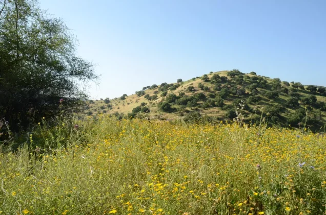

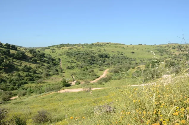
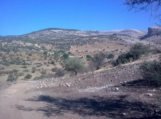
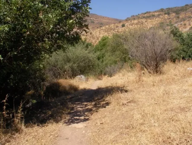
Photos from the village's people
Photos sent in by visitors and published after review.
Add a photo of this village
Log in to add photos of this village.
Other villages from Haifa


More from the archive



 Download Our Palestine App
The whole archive in the palm of your hand: depopulated villages, the Nakba, the massacres and Al-Aqsa — free, with no ads to erase the story.
Download Our Palestine App
The whole archive in the palm of your hand: depopulated villages, the Nakba, the massacres and Al-Aqsa — free, with no ads to erase the story.



Comments
No comments yet — be the first to write one.
Add your comment
Name and email are optional. Comments appear after review.