
The depopulated village of Burayka / Ibraikeh / al-Sindiyanaat / District of Haifa

Burayka / Ibraikeh / al-Sindiyanaat
About the depopulated village of Burayka / Ibraikeh / al-Sindiyanaat
- District
- Haifa
- Date Burayka / Ibraikeh / al-Sindiyanaat was occupied
- 12 May 1948
- Population in 1948
- 340
- Distance from the governorate centre
- 29 (km) South of Haifa
- Elevation above sea level
- 100 m
- Cause of displacement
- Influence of fall of, or exoduce from, neighboring town
- Extent of destruction
- The village has been mostly destroyed.
- Ethnic cleansing
- Burayka inhabitants were completely ethnically cleansed.
Hover a dot to read the village name, or click to open its card.
Borders of the depopulated village of Burayka / Ibraikeh / al-Sindiyanaat
Burayka / Ibraikeh / al-Sindiyanaat – Depopulated Palestinian Village of Haifa
Burayka, also rendered as Ibraikeh or Bureika and locally referred to in some Palestinian sources as al-Sindiyanaat, was a Palestinian village in the Haifa Subdistrict and the al-Ruha region.
The village stood on the western side of Mount Carmel approximately 29 kilometers south of Haifa and about 100 meters above sea level. A secondary road connected it with the main coastal highway.
The population reached 290 in the official 1944/45 statistics, while the statistical village land unit covered 11,434 dunums. Rain-fed farming and animal husbandry formed the principal economic activities, with cereals the dominant Palestinian crop.
Palestinian sources differ over the chronology of depopulation. Palestine Remembered and a Palestinian official register give 5 May 1948, while later Palestinian local research documents an Irgun attack on Burayka and several neighboring al-Ruha villages on 12 May. The evidence is therefore best understood as a sequence of displacement followed by military attack and clearing rather than as one fully documented event on a single uncontested date.
Basic Information
| Field | Information |
|---|---|
| Name | Burayka |
| Arabic name | بُرَيْكَة |
| Alternative forms | Ibraikeh, Bureika, al-Burayka, al-Sindiyanaat |
| Subdistrict | Haifa |
| Region | al-Ruha, western side of Mount Carmel |
| Distance from Haifa | Approximately 29 km south |
| Average elevation | Approximately 100 m above sea level |
| Palestine Grid | Approximately 148/213 |
| Population in 1922 | 249, all Muslims |
| Population in 1931 | 237 – the figure includes Burayka al-Jadida |
| Houses in 1931 | 45 – the figure includes Burayka al-Jadida |
| Population in 1944/45 | 290 |
| 1948 population estimate | 336 – later estimate, not an official census |
| Total statistical land area | 11,434 dunums |
| Probable principal depopulation date | 5 May 1948 in Palestine Remembered and a Palestinian official register |
| Later documented attack/clearing | 12 May 1948 during an Irgun attack on several al-Ruha villages |
| Military force | Irgun/Etzel documented for the 12 May attack; no village-specific force is securely identified for the earlier 5 May displacement |
| Cause of depopulation | Impact of the fall and flight of neighboring communities followed by military attack and clearing; the precise sequence for all inhabitants remains incompletely documented |
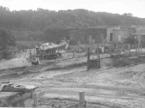
| Destruction | Most of the village was destroyed; the site later became a closed military-industrial area |
| New post-1948 settlement | None identified by Walid Khalidi or PalQuest as established on Burayka's village lands |
Burayka, al-Sindiyanaat, and the Separate Village of al-Sindiyana
Some Palestinian community sources use al-Sindiyanaat as an alternative name for Burayka.
This should not be confused with al-Sindiyana, a separate Palestinian village in the Haifa Subdistrict that stood east of Burayka.
Palestine Remembered's neighboring-village layout and Palestinian al-Ruha documentation treat Burayka and al-Sindiyana as distinct localities.
Name
Khalidi derives Burayka from the Arabic word birka, “pool,” in diminutive form.
Crusader-era sources rendered the locality with a name similar to Broiquet.
The spelling Ibraikeh appears in Mandate-era English records, including the 1922 census.
Location and Geography
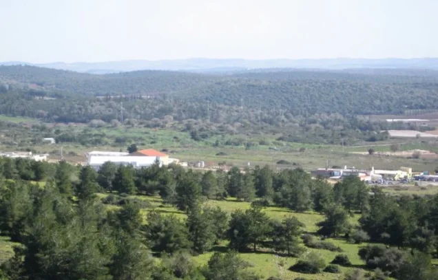
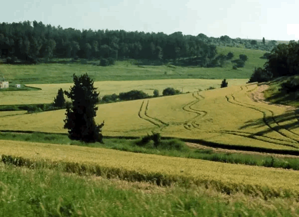
Burayka stood on a hill along the western side of Mount Carmel.
In the late nineteenth century, the hill on which the village stood was surrounded by woodland.
A secondary road connected Burayka with the coastal highway and thereby with Haifa and the surrounding al-Ruha and coastal communities.
Kabara lay to the west, al-Sindiyana to the east, Safsafa to the south, and the Zammarin/Zikhron Ya'akov area to the north and northwest.
Built Environment
The modern village extended mainly along a north-south axis.
Its houses were built of stone bonded with mud or cement.
The Arab built-up area covered fifteen dunums in the 1944/45 statistics.
The 1931 figure of forty-five houses should not be treated as a Burayka-only count because it also included Burayka al-Jadida.
Population
- 1922249Official census; all Muslims
- 1931237Official census figure, but it includes Burayka al-Jadida
- 1944/45290Official Mandate-period estimate
- 1948336Later demographic estimate, not an official census
- 19982,066Later Palestine Remembered estimate of refugees and descendants
A Palestinian community encyclopedia displays 294 inhabitants for 1922, but census-based sources give 249. This article therefore uses the official census figure of 249.
Number of Houses
- 193145Combined with Burayka al-Jadida
- 194863Later demographic estimate, not an official government house census
Land Ownership, 1944/45
The original Mandate statistics use the categories Arab, Jewish, and Public, which are preserved here:
- Arab1,864 dunums16%
- Jewish9,384 dunums82%
- Public186 dunums2%
The figures balance exactly: 1,864 + 9,384 + 186 = 11,434 dunums.
The Public category should remain separate rather than being merged into either Arab or Jewish ownership.
Land Use, 1944/45
- Arab
- Jewish
- Public
- Cereals2,959 dunums
- Plantations and irrigable land1,919 dunums
- Citrus and bananas254 dunums
- Built-up area15 dunums
- Non-cultivable land6,287 dunums
The land-use categories reconcile exactly with the ownership totals.
Correction to a Simplified Land Table
A simplified Palestine Remembered table places 419 dunums of non-arable land under the Arab side.
The detailed PalQuest table shows that this number combines 233 Arab dunums with 186 Public dunums.
This article therefore preserves Public land as a separate category.
Economy and Agriculture
Burayka's Palestinian inhabitants relied mainly on rain-fed agriculture and animal husbandry.
Cereals were the principal crop, occupying 1,538 Arab-owned dunums in 1944/45.
A further seventy-eight Arab dunums were classified as plantations or irrigable land.
Khalidi also records a limited number of fruit and olive trees.
Water
Springs and wells supplied the village with water for domestic use.
The principal village profile does not provide a securely documented list of their individual names, so additional names are not introduced without stronger evidence.
Education
A village school was built during the Ottoman period in 1889.
It was later closed during the British Mandate.
Some secondary summary fields give 1887, but Khalidi and PalQuest state 1889, which is therefore used here.
No securely documented pre-Nakba pupil or teacher totals were located in the principal sources reviewed.
Religious Buildings
The inhabitants were Muslims in the Mandate-period census records.
Khalidi and PalQuest do not independently document a specific mosque or shrine in the village profile.
No religious building is therefore inferred solely from the inhabitants' religious affiliation.
Archaeology
Several archaeological localities lay in or near Burayka's territory.
Khalidi records Khirbat Rusaissa, an artificial mound probably dating to the Byzantine period, and Khirbat Burayka, where foundations of ruined buildings were visible.
Palestinian community documentation additionally records Khirbat al-Sawawin, with building foundations, pottery fragments, a mosaic floor, and caves.
Local descriptions of Khirbat Rusaissa also mention a rock-cut winepress, burials, a cistern, columns, mosaic remains, and tiles.
These features belong to several archaeological localities and should not all be assigned automatically to the same historical period.
Military Context before Depopulation
Burayka formed part of the al-Ruha cluster of Palestinian villages between Mount Carmel, Wadi 'Ara, and the coastal plain.
During April and early May 1948, warfare around Mishmar ha-'Emeq and subsequent military clearing operations destabilized many nearby Palestinian communities.
Palestine Remembered therefore classifies Burayka's depopulation as influenced by the fall or exodus of neighboring localities and associates it broadly with either the Mishmar ha-'Emeq fighting or coastal clearing operations.
5 May 1948 – Probable Principal Depopulation
Palestine Remembered records 5 May 1948 as Burayka's depopulation date.
A Palestinian official register of localities occupied and depopulated in 1948 gives the same date.
The Palestinian Villages Encyclopedia also uses 5 May in its principal heading and notes that, because detailed village-level occupation information is lacking, the date is inferred from Burayka's location and the chronology of neighboring villages.
This article therefore treats 5 May as the best-supported date for the village's principal depopulation or effective abandonment, rather than as a securely documented village battle date.
The Irgun Attack of 12 May 1948
Palestinian local research preserves a more detailed account of a later phase on 12 May.
According to this account, Irgun units assembled from the Zikhron Ya'akov, Hadera, Binyamina, and Netanya areas and attacked five al-Ruha villages: Burayka, al-Sindiyana, Sabbarin, Khubbayza, and Umm al-Shawf.
Most inhabitants reportedly left as the forces approached and subjected the villages to fire, after which the attacking units searched the localities.
The same regional account states that more than one hundred elderly people, women, and children who remained in the affected villages were held for several days at Sabbarin and then expelled toward Umm al-Fahm.
Because this figure refers to the group of targeted villages, it should not be treated as a Burayka-only count.
Military Unit
For the 12 May phase, Palestinian local research identifies the Irgun/Etzel as the attacking and clearing force.
For the earlier 5 May depopulation, however, Khalidi and PalQuest do not identify a securely documented village-specific military unit.
It is therefore more accurate to distinguish between principal displacement around 5 May and the Irgun attack and sweep documented on 12 May, rather than attributing every phase to one formation on one date.
Cause of Depopulation
Palestine Remembered classifies the principal cause as the effect of the fall or exodus of neighboring communities.
This is consistent with the progressive collapse and depopulation of surrounding Palestinian villages during April and early May.
The 12 May local account adds direct military pressure, bombardment, and the approach of Irgun units, which caused remaining residents in the targeted villages to flee or be removed afterward.
The most precise formulation is therefore: progressive depopulation under the impact of nearby village collapses and military pressure, followed by an Irgun attack and clearing of the al-Ruha villages on 12 May 1948.
Destruction
Palestine Remembered classifies Burayka as mostly destroyed.
Khalidi's village profile does not provide a precise demolition date.
The destruction of the built environment should therefore be distinguished from the May 1948 stages of depopulation and military occupation.
Ethnic Cleansing in Source Classification
Palestine Remembered classifies Burayka using the term “complete ethnic cleansing.” The phrase is retained here only as an attributed source classification.
The more specifically documented sequence consists of displacement under the impact of neighboring village collapses and military pressure, the subsequent Irgun attack on the al-Ruha villages, removal of remaining civilians from the affected area, and the absence of permanent collective Palestinian return to Burayka.
Occupation and Depopulation Chronology
| Date | Event |
|---|---|
| April 1948 | Fighting around Mishmar ha-'Emeq and military operations destabilize Palestinian villages throughout the al-Ruha region. |
| Late April–early May 1948 | Nearby Palestinian communities are emptied or occupied, increasing pressure on Burayka. |
| 5 May 1948 | Date recorded by Palestine Remembered and a Palestinian official register for Burayka's principal depopulation; detailed village-level combat information is unavailable. |
| 12 May 1948 | Palestinian local research records an Irgun attack on Burayka, al-Sindiyana, Sabbarin, Khubbayza, and Umm al-Shawf; remaining inhabitants flee or are removed. |
| After 12 May 1948 | A regional account states that more than one hundred elderly people, women, and children from the affected villages were held at Sabbarin and later expelled toward Umm al-Fahm. |
| Later period | Most of Burayka's built environment is destroyed; no precise demolition date is documented. |
Israeli Settlements on Burayka's Lands
According to Walid Khalidi and PalQuest, no new Israeli settlement was established on Burayka's village lands after the Nakba.
Palestinian community sources state that portions of the former village lands later became incorporated into the wider Zikhron Ya'akov and Alona areas.
Zikhron Ya'akov, however, predated 1948 and already existed north of Burayka before the Nakba, so it should not be presented as a post-1948 settlement newly founded on the village lands.
A label associating “Neve Sharett” with Zikhron Ya'akov appears in one secondary page but is not confirmed by the Khalidi/PalQuest village record and is therefore not included as a documented settlement on Burayka's lands.
Burayka Today
According to the field description used by Walid Khalidi before the publication of All That Remains in 1992, the former Burayka site was closed and used as a military-industrial area.
Because the site was inaccessible, Khalidi's account does not provide the kind of detailed surviving-building inventory available for many other depopulated villages.
The Palestinian Villages Encyclopedia repeats the description of the site as a closed military-industrial zone.
Later Palestinian references to expansion of the Zikhron Ya'akov or Alona areas over portions of the former lands provide additional community documentation but do not constitute a comprehensive cadastral or archaeological survey.
Khalidi's description should therefore be understood as historical field documentation from before 1992 rather than as a complete direct verification of the entire Burayka site in 2026.
Sources
- PalQuest – Interactive Encyclopedia of the Palestine Question: Burayka
- Palestine Remembered – Burayka, Haifa Subdistrict
- Palestine Remembered – Burayka entry from Walid Khalidi's All That Remains
- Palestinian Villages Encyclopedia – Burayka / al-Burayka / al-Sindiyanaat
- Our Palestine – Ibraikeh / al-Burayka / Burayka / al-Sindiyanaat
- Palestinian Ministry of Foreign Affairs – Register of Palestinian Localities Occupied and Depopulated in 1948
Photo gallery


Photos from the village's people
Photos sent in by visitors and published after review.
Add a photo of this village
Log in to add photos of this village.
Other villages from Haifa

More from the archive


 Download Our Palestine App
The whole archive in the palm of your hand: depopulated villages, the Nakba, the massacres and Al-Aqsa — free, with no ads to erase the story.
Download Our Palestine App
The whole archive in the palm of your hand: depopulated villages, the Nakba, the massacres and Al-Aqsa — free, with no ads to erase the story.



Comments
No comments yet — be the first to write one.
Add your comment
Name and email are optional. Comments appear after review.