
The depopulated village of Khirbat al-Burj / District of Haifa
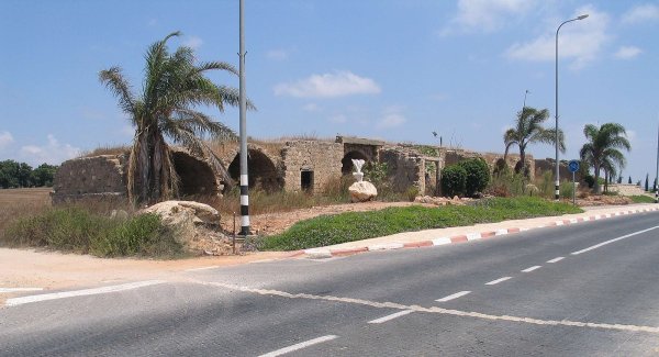
Khirbat al-Burj
About the depopulated village of Khirbat al-Burj
- District
- Haifa
- Date Khirbat al-Burj was occupied
- 15 February 1948
- Distance from the governorate centre
- 34.5 (km) South of Haifa
- Elevation above sea level
- 25 m
- Cause of displacement
- Fear of Jewish attack, or of being caught in the fighting
- Extent of destruction
- The village has been completely obliterated, only house rubble left behind.
- Ethnic cleansing
- al-Burj, Khirbat inhabitants were completely ethnically cleansed.
Hover a dot to read the village name, or click to open its card.
Khirbat al-Burj / Tall al-Burayj – Depopulated Palestinian Locality of Haifa
Khirbat al-Burj was a Palestinian village or hamlet in the Haifa Subdistrict, situated on rolling ground in the central coastal plain approximately 34.5 kilometers south of Haifa and about 25 meters above sea level.
The locality lay east of Qisarya, south of Jisr al-Zarqa and Khirbat al-Shuna, west of Khirbat al-Safsaf, and north of Khirbat Hadidun. Binyamina was founded nearby to the north in 1922, but Walid Khalidi and PalQuest explicitly state that it was not established on Khirbat al-Burj's village lands.
The area was known for citrus cultivation and its 1944/45 statistical land unit covered 5,291 dunums. The principal Palestinian sources, however, do not provide a separate documented population figure for Khirbat al-Burj in 1945, and no unsupported 1948 population estimate is therefore introduced.
Khalidi considers it likely that Khirbat al-Burj was seized during the early weeks of the 1948 fighting, amid the campaign that emptied Palestinian coastal communities between Tel Aviv and Zikhron Ya'akov. Palestinian secondary sources commonly give 15 February 1948, approximately when neighboring Qisarya was occupied, but Khalidi does not establish that precise day as certain.
Basic Information
| Field | Information |
|---|---|
| Name | Khirbat al-Burj |
| Arabic name | خربة البرج |
| Common local rendering | Tall al-Burj |
| Archaeological-site name in Khalidi | Tall al-Burayj |
| Subdistrict | Haifa |
| Location | Central coastal plain, south of Haifa |
| Distance from Haifa | 34.5 km |
| Average elevation | 25 m above sea level |
| Population in 1922 | No securely documented separate figure used in this article |
| Population in 1931 | No separate figure; the locality was included with Binyamina in later census listings |
| Population in 1944/45 | No independent population figure; Khirbat al-Burj appears as a separate land unit |
| 1948 population estimate | No securely documented independent figure |
| Total statistical land area | 5,291 dunums |
| Probable occupation date | Mid-February 1948; 15 February is widely used in Palestinian secondary sources |
| Military operation | No securely documented named operation at village level; seizure occurred in the context of the campaign to empty Palestinian coastal communities |
| Military unit | Not independently documented for the locality |
| Cause of depopulation | Displacement in the context of the coastal-clearing campaign; the precise village-level mechanism is not independently documented |
| Destruction | Extensive destruction, while the walls of a large stone structure, probably a khan, and other rubble survived |
| Post-1948 settlements | No new Israeli settlement is identified by Khalidi as established on village land |
Khirbat al-Burj and Tall al-Burj / Tall al-Burayj
The Palestinian locality of Khirbat al-Burj should be distinguished from the adjacent archaeological mound.
Walid Khalidi calls the archaeological site Tall al-Burayj, while Palestinian local sources also use the form Tall al-Burj.
The mound contained building foundations and ancient granite columns.
The popular title “Khirbat al-Burj / Tall al-Burj” may therefore be retained, while noting that Khalidi's own rendering for the archaeological site is Tall al-Burayj.
Location and Geography
Khirbat al-Burj stood on gently rolling terrain in the central coastal plain.
Qisarya lay to the west, Jisr al-Zarqa and Khirbat al-Shuna to the north, Khirbat al-Safsaf to the east, and Khirbat Hadidun to the south.
The locality formed part of the agriculturally productive coastal zone between Hadera and Zikhron Ya'akov, an area noted for citrus cultivation.
Built Environment and the Khan
The 1945 land-use table records no separate built-up acreage for Khirbat al-Burj.
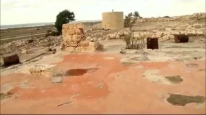
Later descriptions emphasize a large stone structure that Khalidi believed may have been a khan.
Its walls survived the destruction of most of the village site.
Palestinian community photographs also identify the khan ruins as among the most visible physical remains of Khirbat al-Burj.
Population
Khirbat al-Burj requires particular caution in population reporting.
| Year | Statistical Status |
|---|---|
| 1922 | No separate figure used because the principal Palestinian sources reviewed do not provide a securely documented independent population |
| 1931 | No separate population figure; census listings later grouped Khirbat al-Burj with Binyamina |
| 1944/45 | The locality appears as an independent statistical land unit but without a separate population entry |
| 1948 | No independently documented estimate used |
No population is inferred from land area, from Binyamina's population, or from neighboring Palestinian communities.
Number of Houses
No securely documented separate house count is available for Khirbat al-Burj for 1931 or 1948.
No house total is inferred from undocumented population estimates.
Land Ownership, 1944/45
- Palestinian / official “Arab” category15 dunums<1%
- Transferred to Zionists / official “Jewish” category4,933 dunums93%
- Public343 dunums6%
The figures reconcile exactly: 15 + 4,933 + 343 = 5,291 dunums.
By 1945, the overwhelming majority of the statistical land unit was recorded in the Jewish ownership category, while only fifteen dunums appeared in the Arab category.
Land Use, 1944/45
- Palestinian
- Transferred to Zionists
- Public
- Cereals2,607 dunums
- Plantations and irrigable land1,203 dunums
- Citrus and bananas968 dunums
- Non-cultivable land513 dunums
The land-use figures reconcile exactly with the ownership totals.
Citrus Cultivation and Ownership
Khalidi describes Khirbat al-Burj as being known for citrus cultivation.
The 1945 table, however, records the 968 dunums of citrus and bananas in the Jewish ownership category.
The fifteen dunums recorded in the Arab category consisted of thirteen dunums of plantations or irrigable land and two dunums of non-cultivable land.
The general description of a citrus-growing locality should therefore not be converted into a claim that the 968 dunums of citrus were Palestinian-owned in 1945.
Economy
The surrounding land unit was strongly agricultural.
Citrus, cereals, and irrigated plantations dominated recorded land use.
Palestinian community sources also describe livestock raising as part of the local economy.
Education and Services
No independently documented school is recorded for Khirbat al-Burj in Khalidi or PalQuest.
No secure pupil, teacher, or public-service figures are therefore introduced.
Religious Buildings
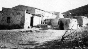
Palestine Remembered contains community photographs captioned as a mosque at Khirbat al-Burj.
Khalidi and PalQuest, however, do not independently document a mosque name, construction date, or institutional history for the village.
The existence of a mosque is therefore treated as later Palestinian community documentation rather than as a fully documented Mandate-period institutional record.
Archaeology
Tall al-Burayj / Tall al-Burj was the principal archaeological locality associated with Khirbat al-Burj.
It contained building foundations and granite columns.
A large surviving stone structure, probably a khan, was another prominent architectural feature.
The principal Palestinian sources do not securely date all surviving remains to one archaeological period.
Military Context in Early 1948
Khirbat al-Burj stood in a coastal region targeted by military operations against Palestinian communities during the first months of 1948.
Qisarya, the nearest large Arab community to the west, was occupied and its inhabitants expelled in mid-February.
By the end of March, numerous coastal settlements between Tel Aviv and Zikhron Ya'akov had been attacked, resulting in depopulation through direct expulsion in some places and flight under fear of attack in others.
When Was Khirbat al-Burj Occupied?
Khalidi does not give a certain day for the occupation of Khirbat al-Burj.
He states that the village was probably seized during the early weeks of the fighting.
Palestine Remembered and the Palestinian Villages Encyclopedia use 15 February 1948, apparently connecting its fate closely with the fall of neighboring Qisarya and the broader coastal campaign.
Another Palestinian page gives 1 May in its summary header but supplies no independent evidence for that later date and repeats Khalidi's early-war narrative in its text.
The most careful formulation is therefore: mid-February 1948 is the probable period of occupation, with 15 February widely used in Palestinian secondary sources, although Khalidi does not establish that exact day as certain.
Military Operation
The occupation is described as part of a campaign intended to empty a broad stretch of the Palestinian coast of its Arab population.
Some Palestinian sources call this “coastal clearing.”
PalQuest does not identify a formally defined named operation with a village-specific chronology and participating unit for Khirbat al-Burj.
The expression is therefore used as a description of the regional campaign rather than as a securely established formal operation name for this village.
Military Unit
Khalidi and PalQuest do not identify a particular brigade or battalion as having entered Khirbat al-Burj.
The force that occupied neighboring Qisarya should not automatically be attributed to Khirbat al-Burj without independent evidence.
The most accurate entry is therefore: village-level military unit not independently documented; seizure occurred within Zionist operations to clear Palestinian coastal communities.
Cause of Depopulation
Palestine Remembered classifies the cause as fear of attack or fear of becoming caught in fighting.
Khalidi describes the broader coastal campaign as producing depopulation through both direct expulsion and flight under fear, but does not establish which mechanism specifically applied to Khirbat al-Burj.
The most cautious formulation is therefore: depopulation in the context of the early-1948 campaign to empty Palestinian coastal communities; whether the inhabitants of Khirbat al-Burj were directly expelled or fled under fear of attack is not independently documented.
Destruction
Khirbat al-Burj suffered extensive destruction after its depopulation.
Some secondary summary fields describe it as completely destroyed, but this should not be read literally.
Khalidi's field survey records the surviving walls of a large stone structure, probably a khan, together with rubble spread across the former village site.
The more accurate description is therefore: most of the built environment was destroyed, while the khan or large stone building and scattered ruins survived.
Ethnic Cleansing in Source Classification
Palestine Remembered classifies Khirbat al-Burj using the term “complete ethnic cleansing.” The phrase is retained here only as an attributed source classification.
The more specifically documented sequence is that the locality fell within an early campaign to empty Palestinian coastal settlements, its Palestinian community disappeared from the site, there was no permanent collective return, and most of the built environment was subsequently destroyed.
Occupation and Depopulation Chronology
| Date | Event |
|---|---|
| Early 1948 | A series of military raids and pressure begins against Palestinian coastal communities between Tel Aviv and Zikhron Ya'akov. |
| Mid-February 1948 | Neighboring Qisarya is occupied and its population expelled as part of the coastal-clearing campaign. |
| 15 February 1948 | Date used by Palestine Remembered and the Palestinian Villages Encyclopedia for Khirbat al-Burj; treated here as probable rather than conclusively established by Khalidi. |
| By the end of March 1948 | Raids continue against numerous Palestinian coastal communities, producing expulsions and flight. |
| Later period | Most structures at Khirbat al-Burj are destroyed, while the walls of the large stone building and scattered rubble remain. |
Israeli Settlements Established on Khirbat al-Burj's Lands
Binyamina was founded in 1922 immediately north of Khirbat al-Burj.
Khalidi and PalQuest explicitly state that it was not established on the village lands.
No new post-1948 Israeli settlement is identified by the principal village sources as having been founded on Khirbat al-Burj's lands.
Khirbat al-Burj Today
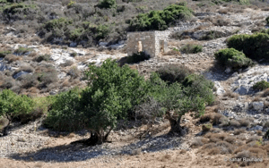
According to the field description used by Walid Khalidi before the publication of All That Remains in 1992, most of the former village site was covered with rubble scattered among grass and cactus plants.
The walls of a large stone structure, probably a khan, remained standing.
Surrounding lands were being used for citrus cultivation.
Palestine Remembered contains later Palestinian community photographs of the khan ruins, the village lands, and other remains.
Khalidi's account should be understood as historical field documentation from before 1992 rather than as a comprehensive archaeological or cadastral survey of the entire Khirbat al-Burj area in 2026.
Sources
- PalQuest – Interactive Encyclopedia of the Palestine Question: Khirbat al-Burj
- Palestine Remembered – Khirbat al-Burj, Haifa Subdistrict
- Palestine Remembered – Khirbat al-Burj entry from Walid Khalidi's All That Remains
- Palestinian Villages Encyclopedia – Khirbat al-Burj / al-Ruha Villages
- Our Palestine – Khirbat al-Burj / Tall al-Burj, Haifa Subdistrict
Photo gallery


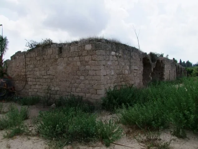


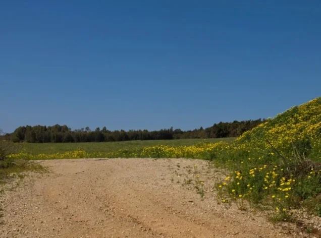

Photos from the village's people
Photos sent in by visitors and published after review.
Add a photo of this village
Log in to add photos of this village.
Other villages from Haifa
More from the archive



 Download Our Palestine App
The whole archive in the palm of your hand: depopulated villages, the Nakba, the massacres and Al-Aqsa — free, with no ads to erase the story.
Download Our Palestine App
The whole archive in the palm of your hand: depopulated villages, the Nakba, the massacres and Al-Aqsa — free, with no ads to erase the story.



Comments
No comments yet — be the first to write one.
Add your comment
Name and email are optional. Comments appear after review.