
The depopulated village of 'Arab al-Fuqara' ('Arab al-Shaykh Muhammad al-Hilu) / District of Haifa
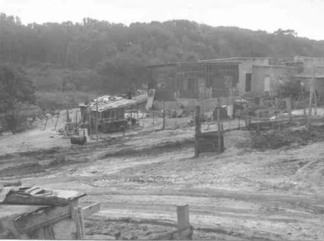
'Arab al-Fuqara' ('Arab al-Shaykh Muhammad al-Hilu)
About the depopulated village of 'Arab al-Fuqara' ('Arab al-Shaykh Muhammad al-Hilu)
- District
- Haifa
- Date 'Arab al-Fuqara' ('Arab al-Shaykh Muhammad al-Hilu) was occupied
- 10 April 1948
- Population in 1948
- 360
- Military operation
- Coastal Clearing
- Distance from the governorate centre
- 42 (km) South West of Haifa
- Elevation above sea level
- 25 m
- Cause of displacement
- Expulsion by Zionist troops
- Extent of destruction
- The village has been completely defaced
- Ethnic cleansing
- 'Arab al-Fuqara' inhabitants were completely ethnically cleansed.
Hover a dot to read the village name, or click to open its card.
'Arab al-Fuqara' ('Arab al-Shaykh Muhammad al-Hilu) – Depopulated Palestinian Community of the Haifa Subdistrict
'Arab al-Fuqara' was a depopulated Palestinian community in the Haifa Subdistrict. PalQuest also records the alternative name 'Arab al-Shaykh Muhammad al-Hilu. The community stood approximately 42 kilometers southwest of Haifa on flat, sandy ground in Palestine's coastal plain, at an average elevation of about 25 meters above sea level.
The site lay south of Wadi al-Mafjar and northwest of Hadera, close to a secondary road connecting with the coastal highway. The surrounding area was historically swampy and affected by malaria, which limited population growth during the early decades of the twentieth century.
- District
- Haifa
- Distance from Haifa
- Approximately 42 km southwest of Haifa
- Elevation
- Approximately 25 m above sea level according to PalQuest
- Natural Setting
- Flat sandy ground on the coastal plain, south of Wadi al-Mafjar and northwest of Hadera
- Population in 1944/1945
- 310 inhabitants
- Estimated Population in 1948
- 360 inhabitants – a later estimate published by Palestine Remembered, not an official census
- Depopulation Date
- 10 April 1948 according to Palestine Remembered, within the wider campaign to remove Palestinian communities from the coastal area around Hadera
- Military Context
- Campaign against Palestinian communities in the coastal plain; “Coastal Clearing” is the label used by Palestine Remembered
- Military Unit
- Haganah in the regional chronology; no specific brigade or battalion is independently documented for 'Arab al-Fuqara'
- Total Land Area
- 2,714 dunums
- Post-1948 Development on the Site
- Northwestern neighborhoods of Hadera expanded across the site, including the neighborhood of Newe Chayyim
The Names 'Arab al-Fuqara' and al-Shaykh Muhammad al-Hilu
PalQuest records the community as 'Arab al-Fuqara' and lists 'Arab al-Shaykh Muhammad al-Hilu as an alternative name. Other Palestinian historical sources, however, preserve a more complicated local geography.
Mustafa Murad al-Dabbagh describes al-Shaykh Hilu as a settlement or seasonal station that developed around the mosque of Shaykh Muhammad al-Hilu, whom he identifies as one of the leaders of the al-Nufay'at tribes. Members of al-Nufay'at, 'Arab al-Fuqara', and Turkmen Bedouins gathered there during certain seasons.
Al-Dabbagh also distinguishes the two localities spatially, stating that 'Arab al-Fuqara' lived south of Wadi al-Mafjar and west of al-Shaykh Hilu. The alternative name is therefore retained, while the article notes that al-Dabbagh's description suggests a distinction between the Fuqara' encampment and the nearby Shaykh Hilu station.
Origins of the Community
Walid Khalidi records that the inhabitants of 'Arab al-Fuqara' descended from a branch of the al-Balawina Bedouin tribe, whose earlier principal territory lay near Bir al-Sabi'.
The community gradually established itself in the coastal area around Wadi al-Mafjar and Hadera, combining animal husbandry with agricultural work and increasingly settled residence.
Location Before the Nakba
'Arab al-Fuqara' stood on flat sandy terrain in the coastal plain. A secondary road connected it eastward with the main coastal highway, while Wadi al-Mafjar lay to its north and Hadera to the southeast.
The wider area was low-lying and swampy, and malaria remained a serious constraint on population growth until the drainage and environmental transformation of parts of the coastal plain during the Mandate period.
The gradual expansion of Hadera severely reduced the land available to 'Arab al-Fuqara'. Khalidi states that ultimately only a narrow strip of land remained between Hadera and Wadi al-Mafjar.
Population of 'Arab al-Fuqara'
Population figures require care because the community was not always enumerated independently and was incorporated statistically with Hadera in 1931.
| Year | Population | Nature of Figure and Notes |
|---|---|---|
| 1922 | 193 | Figure reported by Mustafa Murad al-Dabbagh from Mandate-period population data |
| 1931 | No independent figure available | 'Arab al-Fuqara' was statistically included with Hadera; Hadera's total should not be presented as the population of the community |
| 1944/1945 | 310 | Official independent figure; all residents were classified as Arab |
| 1948 | 360 | Later estimate published by Palestine Remembered; not an official census |
| 1998 | 2,208 refugees | Later estimate of refugees and descendants; not an official village census |
Number of Houses
The principal sources used here do not provide a reliable independent figure for the number of houses in 'Arab al-Fuqara' in 1931 or a documented estimate for 1948. Since the community was statistically incorporated with Hadera in the 1931 census, Hadera's housing total should not be reassigned to 'Arab al-Fuqara'.
Land Ownership in 'Arab al-Fuqara'
The 1944/45 statistical land unit of 'Arab al-Fuqara' covered 2,714 dunums. By that time, the overwhelming majority of the registered land area was classified as Jewish-owned.
Palestine Remembered presents the simplified ownership categories as follows:
- Palestinian15 dunums<1%
- Transferred to Zionists2,513 dunums93%
- Communal/Public186 dunums7%
The official Village Statistics use the categories Arab, Jewish, and Public: 15 Arab dunums, 2,513 Jewish dunums, and 186 public dunums.
Mustafa Murad al-Dabbagh states that only 201 dunums remained to the Fuqara'. This figure corresponds mathematically to the 15 Arab dunums plus the 186 public dunums. It should therefore not be reclassified as 201 dunums of private Palestinian ownership.
Land Use in 1944/1945
- Arab
- Jewish
- Public
- Cereals900 dunums
- Plantations and Irrigable Land25 dunums
- Citrus and Bananas575 dunums
- Built-up Area243 dunums
- Non-Cultivable Land971 dunums
The table balances exactly to the total of 2,714 dunums. The 1,500 dunums classified as cultivated or cultivable were all listed in the Jewish category: 900 dunums of cereals, 25 of plantations and irrigable land, and 575 of citrus and bananas.
Palestine Remembered displays 201 dunums as Palestinian “waste” land. Under the official classification, however, this consists of 15 Arab dunums and 186 public dunums and should be separated accordingly.
Economic Life
Animal husbandry formed the principal livelihood of the inhabitants, reflecting the community's Bedouin origins. Agriculture nevertheless formed an additional part of the local economy.
Mustafa Murad al-Dabbagh specifically records the cultivation of watermelons and maize. Agricultural activity should not be equated automatically with registered land ownership: villagers could cultivate land through tenancy, use rights, or agricultural labor even where title was registered under another category.
Public Services and Education
Al-Dabbagh states that public services were not provided to the Fuqara' and neighboring Bedouin communities. The principal sources reviewed here do not document an independent school in 'Arab al-Fuqara', an establishment date, or an enrollment figure.
No school, clinic, or other institution is therefore added without independent documentation.
The Mosque of Shaykh Muhammad al-Hilu
The name al-Shaykh Hilu is associated with Shaykh Muhammad al-Hilu, whom al-Dabbagh describes as one of the leaders of the al-Nufay'at tribes. A settlement or seasonal station developed around his mosque and served as a gathering place for al-Nufay'at, 'Arab al-Fuqara', and Turkmen Bedouins during parts of the year.
Al-Dabbagh nevertheless locates 'Arab al-Fuqara' west of al-Shaykh Hilu. The mosque and station should therefore not automatically be treated as the physical center of the Fuqara' settlement without acknowledging this distinction.
Depopulation in 1948
Palestine Remembered gives 10 April 1948 as the date on which 'Arab al-Fuqara' was depopulated and classifies the cause as the expulsion of the inhabitants by Zionist forces.
This date fits the regional chronology around Hadera and Wadi al-Mafjar. PalQuest records that the Haganah ordered the inhabitants of neighboring 'Arab al-Nufay'at to leave on 10 April 1948, while related historical accounts place 'Arab al-Fuqara' and 'Arab Zahrat al-Dumayri within the same wave of displacement.
The PalQuest entry for 'Arab al-Fuqara' itself does not provide a detailed independent military narrative, so no brigade, battalion, or tactical description is added without further evidence.
Occupation and Depopulation Chronology
- Spring 1948
Increasing Pressure on Coastal Palestinian Communities
Small Palestinian communities around Hadera and Wadi al-Mafjar came under increasing military pressure during the campaign to remove Arab communities from the coastal sector.
- 10 April 1948
Expulsion / Depopulation of 'Arab al-Fuqara'
Palestine Remembered gives this date; it is consistent with the documented Haganah order to neighboring 'Arab al-Nufay'at to leave on the same day.
- After 10 April 1948
Palestinian Population Removed from the Site
'Arab al-Fuqara' became one of the depopulated Palestinian communities surrounding Hadera.
- After depopulation; precise date undocumented
Destruction of the Built Environment
The principal sources do not establish an exact demolition date; later documentation describes the original village landmarks as having disappeared.
Military Context and Unit
Military Context: The campaign to remove Palestinian communities from the coastal sector around Hadera and Wadi al-Mafjar. Palestine Remembered uses the label “Coastal Clearing,” but the sources reviewed here do not establish it as a separately named village-specific military operation.
Military Unit: The regional chronology points to the Haganah, which PalQuest identifies as the force that ordered neighboring 'Arab al-Nufay'at to leave on the same date. The village-specific 'Arab al-Fuqara' entry does not identify a particular brigade or battalion, so no more specific unit is assigned.
Cause of Depopulation
Palestine Remembered classifies the cause of departure as expulsion by Zionist forces. The regional chronology also documents direct removal orders affecting neighboring Arab communities around Hadera in the same period.
The depopulation of 'Arab al-Fuqara' can therefore be placed within the military campaign and forced removal of Palestinian communities in the coastal region in April 1948, while details at the household level remain insufficiently documented.
Destruction of 'Arab al-Fuqara'
The principal sources do not establish an exact date for the destruction of the community's buildings. Khalidi's later description records that identifiable village landmarks had disappeared.
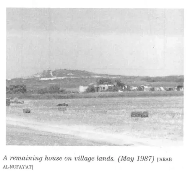
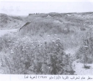
Palestine Remembered also hosts a photograph captioned as showing a surviving house in 1987. Because this caption conflicts with the textual field description, it is not treated on its own as conclusive evidence that a house remained at that date.
Hadera and Newe Chayyim on the Village Site
Khalidi does not identify a separate new Israeli settlement founded after 1948 specifically on 'Arab al-Fuqara' lands. Instead, the northwestern neighborhoods of the already existing town of Hadera expanded over the village site.
These include the neighborhood known as Newe Chayyim. Hadera itself had been established in 1890, and its gradual expansion before and after 1948 fundamentally transformed the area surrounding 'Arab al-Fuqara'.
'Arab al-Fuqara' Today
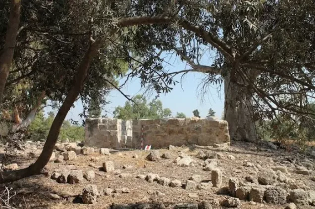
According to Walid Khalidi's field description documented before the publication of All That Remains in 1992, no identifiable village landmarks remained at the site, where eucalyptus trees were growing.
Parts of the former village site had also become incorporated into the northwestern urban expansion of Hadera, including the Newe Chayyim area.
This is historical field documentation from the period preceding the publication of Khalidi's book in 1992 and should not be treated as a direct field verification of conditions in 2026. Later community photographs and materials hosted by Palestine Remembered are useful as community documentation but do not constitute an independent comprehensive contemporary survey.
Sources
- PalQuest – Interactive Encyclopedia of the Palestine Question: 'Arab al-Fuqara'
- Palestine Remembered – 'Arab al-Fuqara', Haifa District
- Palestine Remembered – Historical account of 'Arab al-Fuqara' from Walid Khalidi's All That Remains
- Palestine Remembered – Mustafa Murad al-Dabbagh's account of al-Shaykh Hilu and 'Arab al-Fuqara'
- PalQuest – 'Arab al-Nufay'at: regional context of the 10 April 1948 expulsion order
- Government of Palestine – Census of Palestine, 1922
- Government of Palestine – Census of Palestine, 1931, E. Mills
- Sami Hadawi – Village Statistics 1945, reproducing Government of Palestine statistics
- Institute for Palestine Studies – Walid Khalidi, All That Remains
Photo gallery
Photos from the village's people
Photos sent in by visitors and published after review.
Add a photo of this village
Log in to add photos of this village.
Other villages from Haifa
More from the archive


 Download Our Palestine App
The whole archive in the palm of your hand: depopulated villages, the Nakba, the massacres and Al-Aqsa — free, with no ads to erase the story.
Download Our Palestine App
The whole archive in the palm of your hand: depopulated villages, the Nakba, the massacres and Al-Aqsa — free, with no ads to erase the story.



Comments
No comments yet — be the first to write one.
Add your comment
Name and email are optional. Comments appear after review.