
The depopulated village of Zir'in / District of Jenin
Estimated population in 1948: 1,647
Date of occupation and depopulation: 28 May 1948
Israeli localities established on or associated with the village’s lands: Yizre’el was established beside the village site in 1948. Avital had been established in 1933 on land traditionally associated with Zir’in. Some secondary accounts also associate Ya’el and parts of Perazon and Meitav with the village’s wider lands, but this attribution is not consistently documented.
Zir’in was located approximately 11 kilometres north of Jenin.
Zir’in was a depopulated Palestinian village in the Jenin Subdistrict. Its population was officially estimated at 1,420 in 1945 and at approximately 1,647 in 1948. Israeli forces occupied the village on 28 May 1948 during the Nakba, displaced its Palestinian inhabitants, and destroyed most of its houses.
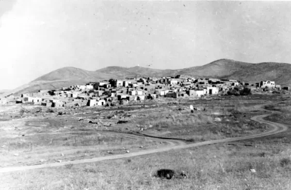
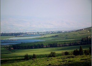
The village stood on a small plateau projecting from the Faqqu’a Mountains to the south. The plateau rose only slightly above Marj Ibn Amir, which surrounded it on its western and southern sides. Its northern and eastern slopes descended towards Wadi Jalud. As the northernmost village in the Jenin Subdistrict, Zir’in stood on a secondary road linking two principal routes: one leading to Jenin and the other to Baysan, southeast of the village.
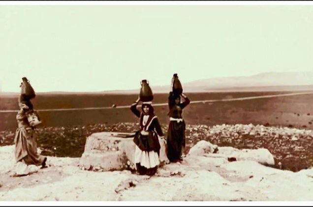
In the late nineteenth century, Zir’in consisted of approximately twenty to thirty houses. The village’s most prominent family lived in a tall, tower-like residence at its centre. A well and a spring supplied the residents with water. In the twentieth century, Zir’in was the home of Mahmud Salim, one of the local leaders associated with the Palestinian Revolt of 1936–1939.
The centre of the village contained a mosque that had been renovated during the rule of al-Zahir Baybars.
Zir’in also had a small market and a school established during the Ottoman period.
Boundaries of Zir’in
Zir’in was surrounded by the following villages, towns, and localities:
- North: Sulam
- Northwest: Afula
- West: Qabbaniyat
- Southwest: Muqeible
- South: Arrana
- Southwest: Nuris
- East: Qumya
- Northeast: Na’ura
Architecture in Zir’in
Most of the village’s houses were constructed from mud brick. They were built close together and separated by narrow alleys. Residential construction increased during the British Mandate, while many of the existing houses were renovated or improved.
The village’s most distinctive structure was a tall, almost tower-like house at its centre. This building was associated with one of Zir’in’s leading families and reflected an architectural form designed partly for protection and surveillance over the surrounding plain.
Economic Life in Zir’in
The residents of Zir’in cultivated cereals, vegetables, and fruit. Some crops were irrigated with water drawn from the village’s wells and springs. According to the 1944/45 Village Statistics, Palestinians cultivated 20,964 dunams with cereals, while 1,633 dunams under Jewish ownership were similarly allocated to cereal cultivation.
Agriculture formed the principal basis of the village economy. Wheat and barley were among its major crops, while livestock, goats, and beehives had also contributed to its economy during earlier historical periods.
Land Ownership in Zir’in
| Ownership category | Area (dunams)* |
|---|---|
| Palestinian ownership | 22,034 |
| Jewish ownership | 1,711 |
| Public land | 175 |
| Total | 23,920 |
* One dunam equals approximately 1,000 square metres.
Land Use in Zir’in in 1945
| Land-use category | Palestinian land (dunams)* | Jewish-owned land (dunams)* | Public land (dunams)* | Total (dunams)* |
|---|---|---|---|---|
| Cereal cultivation | 20,964 | 1,633 | 0 | 22,597 |
| Built-up area | 81 | 0 | 0 | 81 |
| Cultivable land | 20,964 | 1,633 | 0 | 22,597 |
| Uncultivated land | 989 | 78 | 175 | 1,242 |
* One dunam equals approximately 1,000 square metres. The cereal-cultivation figures form part of the cultivable-land totals and should not be added to them as separate categories.
Population of Zir’in
The 1922 British Mandate census recorded 722 residents in Zir’in. By 1931, the population had increased to 978, all of whom were recorded as Arabs, living in 239 houses. The official population estimate for 1945 was 1,420. A later demographic estimate placed the village’s population at approximately 1,647 in 1948. The number of Palestinian refugees descended from or associated with Zir’in was estimated at 10,116 in 1998.
Historical Population of Zir’in
| Year | Population* |
|---|---|
| 1596 | 22 |
| 1922 | 722 |
| 1931 | 978 |
| 1945 | 1,420 |
| 1948 | 1,647 |
| Estimated refugee population, 1998 | 10,116 |
* The figures for 1922 and 1931 are census totals. The 1945 figure is an official British Mandate estimate, while the figures for 1948 and the refugee population in 1998 are later demographic estimates.
Archaeological Remains in Zir’in
The archaeological remains recorded in and around Zir’in included a medieval vaulted building, a chapel, the foundations of earlier structures, several cisterns, and wine presses. An archaeological excavation programme began at the site in 1990 and was planned to continue for five years.
The site has been identified with the ancient Canaanite settlement of Yizre’el. The Arabic name Zir’in and the ancient Semitic name share a linguistic association with sowing or seed. During the Crusader period, the locality appeared in sources as Le Petit Gerin, distinguishing it from Jenin, which was called Le Grand Gerin.
Zir’in also stood close to Ayn Jalut, where the forces led by the Mamluk commander al-Zahir Baybars defeated the Mongols in 1260. The spring of Ayn Jalut was located between Zir’in and the neighbouring village of Nuris.
Education in Zir’in
Despite the growth of Zir’in’s population to more than one thousand inhabitants by the 1940s, formal education remained limited to a single elementary school. The school had been established during the Ottoman period and continued to serve the village’s children throughout the British Mandate until Zir’in was occupied and depopulated in 1948.
Occupation and Depopulation of Zir’in
Zir’in was subjected to repeated attacks during the months preceding its occupation. In March 1948, the Arab Liberation Army reported attempts by Zionist forces to eliminate resistance in Zir’in and the neighbouring village of Nuris. These attacks were temporarily halted after the attacking forces sustained heavy losses.
An order issued by Palmach headquarters on 19 April 1948 instructed that most of Zir’in’s houses were to be destroyed following its occupation, while a limited number were to be left standing for military accommodation and defensive use.
Israeli forces occupied Zir’in on 28 May 1948 during the Nakba. The attack was carried out by the Fourth Battalion of the Golani Brigade, the same formation that subsequently occupied neighbouring Nuris. The occupation followed the capture of the Baysan Valley to the northeast and formed part of Israeli preparations for an attack on Jenin.
Many women and children had reportedly left the village during the preceding weeks as attacks intensified. The remaining residents were displaced when Israeli forces took control of Zir’in. Arab forces launched an unsuccessful counterattack on 30 May. Iraqi forces based around Jenin made further attempts to recapture the village on 10 and 19 July 1948, but they were unable to break through the Israeli defensive lines. The armistice line was eventually drawn south of Zir’in.
Israeli Localities on the Lands of Zir’in
Yizre’el was established on the northwestern side of the depopulated village in August 1948. Avital had been founded in 1933 on land traditionally associated with Zir’in and therefore was not a post-1948 settlement.
Some secondary lists also associate Ya’el and parts of Perazon and Meitav with Zir’in’s wider historical lands. However, the principal Palestinian academic reference consulted specifically identifies Yizre’el and Avital. The broader attribution of the other localities could not be verified consistently and should therefore not be treated as definitive.
Zir’in Today
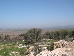
Only one dilapidated building remains at the village site. Grass, thorns, and cactus plants cover much of the area, interspersed with prominent piles of stone and rubble. An old well also survives. Cactus, pomegranate, and almond trees continue to grow around the village outskirts.
The village site and the surrounding hills are used as grazing land, while other sloping areas are cultivated. The remains stand as material evidence of the Palestinian village that was occupied and depopulated during the Nakba.
Sources
Photo gallery


Photos from the village's people
Photos sent in by visitors and published after review.
Add a photo of this village
Log in to add photos of this village.
Other villages from Jenin

 Download Our Palestine App
The whole archive in the palm of your hand: depopulated villages, the Nakba, the massacres and Al-Aqsa — free, with no ads to erase the story.
Download Our Palestine App
The whole archive in the palm of your hand: depopulated villages, the Nakba, the massacres and Al-Aqsa — free, with no ads to erase the story.



Comments
No comments yet — be the first to write one.
Add your comment
Name and email are optional. Comments appear after review.