
The depopulated village of Bayt Nattif / District of Hebron

Subdistrict: Hebron Subdistrict
Estimated population of Bayt Nattif in 1948: Approximately 2,490 Palestinians
Occupation and depopulation: 21–22 October 1948. Palestinian academic sources note a one-day discrepancy between the available accounts.
Military operation and unit: Operation ha-Har; Fourth Battalion of the Har'el Brigade, which originated as a Palmach formation
Israeli settlements established on Bayt Nattif’s lands before 1948: None
Israeli settlements established on Bayt Nattif’s lands after 1948: Netiv HaLamed-Heh, Aviezer, Roglit and Neve Michael. Some local maps also associate part of Zanoah with the former village lands, but this requires additional cadastral verification.
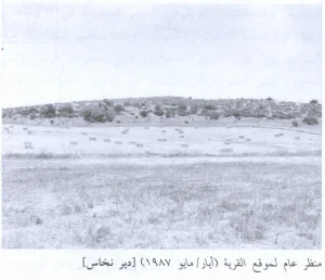
Bayt Nattif was a depopulated Palestinian village in the Hebron Subdistrict. It stood on a mountaintop in the western section of the Hebron Mountains, approximately 21 kilometres northwest of al-Khalil (Hebron), at an average elevation of about 425 metres above sea level.
The village overlooked the coastal plain to the west and faced a broad mountain range to the east. It stood approximately 1 kilometre north of the Bayt Jibrin–Bethlehem road and was linked by secondary roads with neighbouring Palestinian villages.
Bayt Nattif had an estimated population of approximately 2,490 Palestinians immediately before its occupation and depopulation during the Nakba. The village was subsequently destroyed, and its residents were displaced from their homes and lands.
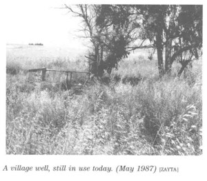
All the village’s residents were Muslims. Bayt Nattif had a mosque, several religious shrines, an elementary school and shops distributed throughout its quarters. The villagers obtained drinking water from three wells situated around the edges of the village.
The local economy depended principally on rainfed agriculture and animal husbandry. Bayt Nattif was also an important archaeological site containing caves, cisterns, mosaic floors, columns and remains of a Roman road.
Boundaries and Neighbouring Villages
Bayt Nattif was surrounded by the following Palestinian villages and localities:
- Northwest: Bayt Jimal.
- West: Zakariyya.
- Southwest: Ajjur.
- South: Khirbat Umm Burj.
- Southeast: Surif.
- East: al-Jab'a.
- Northeast: Jarash.

The Depopulated Palestinian Village of Bayt Nattif
The Depopulated Palestinian Village of Bayt Nattif
Historical Background
The site of Bayt Nattif has been associated with ancient Tappuach and with the Roman-period settlement known as Bethletepha or Bayt Letepha. The modern Arabic name is generally understood to have developed from this earlier place-name.
In 1596, Bayt Nattif was recorded as a village in the Jerusalem subdistrict of the Jerusalem district. Its population was estimated at approximately 572. The villagers paid taxes on wheat, barley, olives and fruit, as well as goats and beehives.
By the late nineteenth century, Bayt Nattif stood on a flat-topped ridge between two broad valleys. Olive groves surrounded the village, while cereals were cultivated in the fertile valleys below.
Architectural Character of Bayt Nattif
Bayt Nattif had a distinctive star-shaped plan, with separate residential quarters connected by relatively broad streets. Shops were distributed throughout the different quarters.
The village contained a mosque and several religious shrines. The most prominent shrine was dedicated to Shaykh Ibrahim. Bayt Nattif also had an elementary school serving the village population.
Population of Bayt Nattif
The British Mandate census of 1922 recorded 1,112 residents in Bayt Nattif, all of whom were Muslims.
By 1931, the population had increased to 1,649 Muslims living in 329 houses. The census figures included the nearby locality of Khirbat Umm al-Rus.
The British Mandate’s 1945 Village Statistics recorded 2,150 Palestinian residents. The population immediately before the village’s depopulation in 1948 has been retrospectively estimated at approximately 2,494, commonly rounded to 2,490.
Palestine Remembered estimated the number of refugees from Bayt Nattif and their descendants at approximately 15,316 in 1998. This was a retrospective estimate rather than a census of a single resident population.
Historical Population of Bayt Nattif
| Year | Recorded or estimated population | Notes |
|---|---|---|
| 1596 | Approximately 572 | Estimated from Ottoman tax records. |
| 1922 | 1,112 | Recorded in the British Mandate census; all residents were Muslims. |
| 1931 | 1,649 | The census figure included Khirbat Umm al-Rus. |
| 1945 | 2,150 | Recorded in the British Mandate’s Village Statistics. |
| 1948 | Approximately 2,494 | Projected estimate, commonly rounded to 2,490, rather than a new official census. |
| 1998 | Approximately 15,316 refugees and descendants | A retrospective estimate published by Palestine Remembered. |
Number of Houses in Bayt Nattif
| Year | Number of houses | Notes |
|---|---|---|
| 1931 | 329 | Recorded in the British Mandate census; the figure included Khirbat Umm al-Rus. |
| 1948 | Not conclusively documented | No comparable official village housing census was conducted in 1948. |
Economic Life in Bayt Nattif
The residents of Bayt Nattif depended primarily on rainfed agriculture and animal husbandry. They cultivated cereals, vegetables and fruit trees, particularly grapevines and olives.
In 1944/45, 20,149 dunams were allocated to cereal cultivation, while 688 dunams were irrigated or used for orchards. Approximately 620 dunams were planted with olive trees. The olive figure formed part of the wider agricultural classifications and should not be added separately to the total cultivable area.
The villagers obtained drinking water from three wells located around the outskirts of the village.
Land Ownership in Bayt Nattif, 1944/45
| Ownership category | Area (dunams)* |
|---|---|
| Palestinian ownership | 32,762 |
| Jewish ownership | 0 |
| Public land | 11,825 |
| Total | 44,587 |
* One dunam equals approximately 1,000 square metres.
Land Use in Bayt Nattif, 1944/45
| Land-use category | Palestinian ownership (dunams)* | Jewish ownership (dunams)* | Public land (dunams)* | Total (dunams)* |
|---|---|---|---|---|
| Irrigated land and orchards | 688 | 0 | 0 | 688 |
| Olive cultivation, included within the broader agricultural classifications | Approximately 620 | 0 | 0 | Approximately 620 |
| Cereal cultivation | 20,149 | 0 | 0 | 20,149 |
| Built-up area | 162 | 0 | 0 | 162 |
| Cultivable land | 20,837 | 0 | 0 | 20,837 |
| Uncultivated land | 11,763 | 0 | 11,825 | 23,588 |
* One dunam equals approximately 1,000 square metres.
Archaeological Remains in Bayt Nattif
Bayt Nattif was an important archaeological site containing caves, rock-cut cisterns, mosaic floors, columns and remains of an ancient Roman road.
In 1934, Dimitri Baramki of the British Mandate Department of Antiquities directed the excavation of two cisterns in the village. The excavations produced pottery dating principally from the first to the third centuries CE.
Approximately twelve khirbas were recorded in the vicinity of Bayt Nattif, further indicating the area’s long history of settlement.
Occupation and Depopulation of Bayt Nattif
Bayt Nattif was occupied during Operation ha-Har by the Fourth Battalion of the Har'el Brigade. Although the brigade had developed from a Palmach formation, identifying the force only as “Palmach” is insufficiently precise.
The exact date is disputed by one day. The account compiled by the Palestinian academic resource PalQuest states that one record dates the attack to 21 October 1948, while another places the occupation on 22 October. The village should therefore be described as having been occupied on 21–22 October rather than assigning an entirely undisputed date.
The available accounts also differ over the immediate circumstances of the population’s departure. One account describes the residents leaving as the troops advanced, while another refers to limited resistance before the village was occupied. Since these accounts are not identical, neither should be presented as the sole definitive description.
Bayt Nattif occupied an important strategic position overlooking the Bethlehem–Ajjur–Bayt Jibrin road, a major transport route used by Egyptian forces in that sector. The village’s occupation enabled Israeli forces to cut this road.
Military raids continued in the Bayt Nattif area during the months between the village’s occupation and the signing of the 1949 Armistice Agreement. Palestinian refugees sheltering in the surrounding area were also driven away during subsequent operations.
The village itself was demolished after its occupation, preventing its displaced Palestinian population from returning to their homes.
Israeli Settlements on Bayt Nattif’s Lands
Four Israeli settlements are documented by Walid Khalidi and PalQuest as having been established on Bayt Nattif’s lands:
- Netiv HaLamed-Heh: established in 1949.
- Aviezer: established in 1958.
- Roglit: established in 1958.
- Neve Michael: established in 1958.
Some local maps also associate part of Zanoah with the former lands of Bayt Nattif. This attribution does not appear in the principal village list provided by Khalidi and requires verification through detailed historical cadastral maps.
Bayt Nattif Today
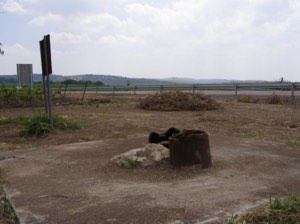
Piles of rubble cleared and redistributed by bulldozers remain scattered across a wide area of the former village site. Several steel beams stand among the debris near its centre.
Remnants of arched house entrances remain visible among the ruins. Two large open graves have also been documented on the northeastern side of the site.
An area east of the village site is sparsely covered with cactus plants, carob trees and olive trees. These remains and vegetation mark parts of the former Palestinian village landscape.
Sources
- Interactive Encyclopedia of the Palestine Question (PalQuest), “Bayt Nattif”.
- Palestine Remembered, “Bayt Nattif—Hebron”.
- Walid Khalidi, ed., All That Remains: The Palestinian Villages Occupied and Depopulated by Israel in 1948, Institute for Palestine Studies, 1992, pp. 211–212.
- Palestine Remembered, “Village Statistics of 1945”.
- Government of Palestine, Census of Palestine, 1922.
- Government of Palestine, Census of Palestine, 1931.
- Government of Palestine, Department of Statistics, Village Statistics, April 1945.
- Sami Hadawi, Village Statistics of 1945: A Classification of Land and Area Ownership in Palestine, Palestine Liberation Organization Research Center.
- The New York Times, contemporary reports published on 18–19 January 1948.
Photo gallery


Photos from the village's people
Photos sent in by visitors and published after review.
Add a photo of this village
Log in to add photos of this village.
Other villages from Hebron
 Download Our Palestine App
The whole archive in the palm of your hand: depopulated villages, the Nakba, the massacres and Al-Aqsa — free, with no ads to erase the story.
Download Our Palestine App
The whole archive in the palm of your hand: depopulated villages, the Nakba, the massacres and Al-Aqsa — free, with no ads to erase the story.



Comments
No comments yet — be the first to write one.
Add your comment
Name and email are optional. Comments appear after review.