
The depopulated village of Ajjur / District of Hebron

Subdistrict: Hebron
Estimated population in 1948: approximately 4,327
Occupation and depopulation: The principal depopulating assault occurred on 23–24 July 1948; the village was occupied by the Giv'ati Brigade on 23 October 1948 during Operation Yoav.
Military unit: The Fourth Battalion of the Giv'ati Brigade
Israeli settlements established on Ajjur's lands before 1948: None
Israeli settlements established on Ajjur's lands after 1948: Agur, Tirosh, Givat Yeshayahu, Tzafririm, and Li-On
Ajjur was a Palestinian village in the Hebron Subdistrict that was depopulated during the Nakba. The official population was 3,730 in 1945 and was later estimated at approximately 4,327 in 1948. Most residents fled following military assaults, while those who remained were expelled when Israeli forces occupied the village.
Boundaries of Ajjur
Ajjur was surrounded by the following villages and localities:
- North: al-Burayj.
- Northwest: Mughallis.
- West: Tall al-Safi.
- Southwest: Dayr al-Dubban.
- South: Dayr Nakhkhas.
- Southeast: Khirbat Umm Burj.
- East: Bayt Nattif.
- Northeast: Zakariyya.

General Information about Ajjur
Ajjur lay 24 kilometres northwest of Hebron. Its lands bordered those of Nuba, Tall al-Safi, Zakariyya, Surif, and Dayr al-Dubban. Most of its inhabitants and their descendants live away from the village as a result of the displacement caused by Israeli military assaults in 1948. The final occupation occurred during Operation Yoav in October 1948.
The village extended across a hilly area in the western foothills of the Hebron Mountains. In the late nineteenth century, Ajjur was described as a small village containing olive trees. Its population was predominantly Muslim, and most houses were clustered together, although some stood farther west and south. Ajjur had two schools, two mosques, and four shrines within the village.
The nearby sites of Khirbat Jannaba al-Fawqa and Khirbat Jannaba al-Tahta have been proposed as possible locations of the Battle of Ajnadayn, fought in 634 CE between the Rashidun Caliphate and the Byzantine Empire. The precise identification of the battlefield remains a matter of scholarly debate. The battle ended in a major Rashidun victory and contributed to the subsequent Muslim conquest of much of Palestine.
The architectural character of the old village—particularly a waqf building—suggests that modern Ajjur developed during the early Fatimid period. Local historical accounts date an old mosque to the Fatimid era and state that it remained in use until the village was depopulated.
Economic Life in Ajjur
Ajjur's economy was based primarily on rainfed agriculture, with wheat and olives among its most important crops. In 1944/45, 25,227 dunams were devoted to cereal cultivation, while 2,428 dunams were irrigated or used for orchards. Animal husbandry—especially goat herding—was the village's second most important economic activity.
A Friday market was held on a large tract east of the village. It attracted residents and merchants from towns and villages across Palestine.
Land Ownership in Ajjur
| Ownership category | Area (dunams)* |
|---|---|
| Palestinian ownership | 44,771 |
| Jewish ownership | 0 |
| Public land | 13,303 |
| Total | 58,074 |
* One dunam equals approximately 1,000 square metres. The figures include Khirbat Ammuriyya.
Land Use in Ajjur, 1944/45
| Land-use category | Palestinian ownership (dunams)* | Public land (dunams)* | Total (dunams)* |
|---|---|---|---|
| Irrigated land and orchards | 2,428 | 0 | 2,428 |
| Olive cultivation** | 3,070 | 0 | 3,070 |
| Cereal cultivation | 25,227 | 0 | 25,227 |
| Cultivable land | 27,655 | 0 | 27,655 |
| Built-up area | 171 | 0 | 171 |
| Uncultivated land | 16,945 | 13,303 | 30,248 |
| Total land area | 44,771 | 13,303 | 58,074 |
* One dunam equals approximately 1,000 square metres. The figures include Khirbat Ammuriyya.
** Olive acreage is a supplementary crop figure contained within the broader agricultural classifications and must not be added again to the cultivable-land total.
Population Figures for Ajjur
| Year | Population* |
|---|---|
| 1596 estimate | 193 |
| 1922 | 2,073 |
| 1931 | 2,917 |
| 1945 | 3,730 |
| 1948 estimate | Approximately 4,327 |
| Estimated refugees and descendants, 1998 | 26,571 |
* The 1922 and 1931 figures derive from the British Mandate censuses, while the 1945 figure comes from the official Village Statistics. The 1948 and 1998 figures are later estimates. The 1931 total includes Khirbat al-Sura, and the 1945 total includes Khirbat Ammuriyya.
Education in Ajjur
Ajjur had two schools. The Abu Hasan private school had operated since the Ottoman period and occupied the waqf building mentioned above. A second school opened in 1934. Children from other villages in the region also attended Ajjur's schools.
Mosques in Ajjur
The village had two mosques: an old mosque associated with the Fatimid period and a second, more recently constructed mosque.
Archaeological Sites in Ajjur
- Ajjur stood in an area rich in archaeological remains. In addition to the village itself, at least twenty-two archaeological sites lay within its lands.
- Four religious shrines stood inside the village, with another four in its vicinity on village land.
Occupation and Depopulation of Ajjur
Ajjur experienced more than one Israeli military assault in 1948. Israeli historian Benny Morris identifies an assault on 23–24 July as the primary cause of depopulation. Most inhabitants had fled by October. During Operation Yoav, the Fourth Battalion of the Giv'ati Brigade occupied Ajjur on 23 October 1948; those residents who remained were expelled. The occupation of the village formed part of Israeli operations extending into the Hebron Subdistrict while the main offensive targeted the southern coastal region.
Israeli Settlements on Ajjur's Lands
Five Israeli settlements were established on village lands:
- Agur, established near the village site in 1950.
- Tirosh, established in 1955 northwest of the site.
- Givat Yeshayahu, established in 1958 near the boundary between Ajjur's lands and those of Zakariyya.
- Tzafririm, established in 1958 southeast of the site.
- Li-On, established in 1960 southeast of the site.
Ajjur Today
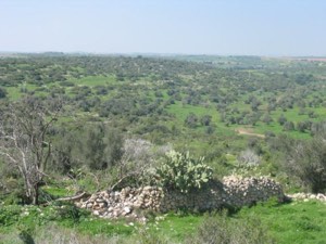
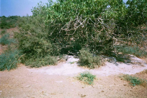
Published field surveys report that only three village houses remained: two were deserted and one had been converted into a warehouse. Cactuses and eucalyptus, almond, and carob trees grow among truncated stone walls and rubble. The site is fenced and used for grazing, while parts of the surrounding land have been taken over by the settlement of Agur.
Sources
Photo gallery


Photos from the village's people
Photos sent in by visitors and published after review.
Add a photo of this village
Log in to add photos of this village.
Other villages from Hebron
 Download Our Palestine App
The whole archive in the palm of your hand: depopulated villages, the Nakba, the massacres and Al-Aqsa — free, with no ads to erase the story.
Download Our Palestine App
The whole archive in the palm of your hand: depopulated villages, the Nakba, the massacres and Al-Aqsa — free, with no ads to erase the story.



Comments
No comments yet — be the first to write one.
Add your comment
Name and email are optional. Comments appear after review.