
The depopulated village of Mughallis / District of Hebron
Subdistrict: Hebron
Estimated population of Mughallis in 1948: 626
Date of occupation and depopulation: 9–10 July 1948
Military operation: Operation An-Far
Military unit: Giv‘ati Brigade, particularly its Fifty-First Battalion
Israeli settlements established on Mughallis’s lands before 1948: None
Israeli settlements established on Mughallis’s lands after 1948: Gefen
Mughallis was a depopulated Palestinian village and one of the smaller communities in the Hebron Subdistrict. It lay approximately 30.5 km northwest of Hebron, about 6 km from ‘Ajjur, and at an average elevation of approximately 200 metres.
The village’s built-up area covered 23 dunums in 1944/45, while its entire landholding extended over 11,459 dunums. Its lands bordered those of ‘Ajjur and Tall al-Safi in the Hebron Subdistrict and Jilya and Idnibba in the Ramla Subdistrict.
Mughallis stood on the summit of a long hill extending from east to west and surrounded by a shallow wadi. It overlooked the coastal plain to the west and faced the broad range of the Jerusalem Mountains to the east. A secondary road following an older caravan route between Bayt Jibrin and Ramla gave villagers access to both centres.
The inhabitants were Muslim and depended primarily on rainfed agriculture, particularly cereal cultivation. They also grew vegetables and fruit and raised livestock.
Boundaries of Mughallis
Mughallis was situated among the following Palestinian villages:
North: Qazaza.
Northwest: Idnibba.
Southwest: Tall al-Safi.
South: Dayr al-Dubban.
Southeast: ‘Ajjur.
East: al-Burayj.
Northeast: Idnibba.
Idnibba’s lands extended along more than one sector north of Mughallis, which explains its appearance in both the northwestern and northeastern directions in local boundary descriptions.
Economic Life in Mughallis
The inhabitants of Mughallis depended heavily on agriculture and livestock raising. The village’s principal crops were rainfed cereals and pulses, including wheat, barley, lentils, bitter vetch, chickpeas, and broad beans. Summer cultivation included maize and sesame, as well as rainfed vegetables and melons such as cucumbers, tomatoes, okra, watermelons, and cantaloupes.
Villagers also cultivated figs, almonds, carob, peaches, and cactuses. Official statistics record 88 dunums of irrigated land or orchards, of which 55 dunums were planted with olive trees. Local accounts sometimes estimate a larger olive-growing area of approximately 100 dunums, but the official 1944/45 figure is more securely documented.
Livestock formed an important part of the village economy. Residents raised sheep and cattle, while camels, mules, and donkeys were used for transport and ploughing. Poultry and beekeeping were also practised, and merchants visited the village to purchase honey, butter, and clarified butter.
Local histories record four small shops selling basic goods, as well as a barber, carpenter, and blacksmith. Villagers marketed their produce and purchased supplies in Ramla and Hebron. These details derive mainly from village memory and local historical accounts.
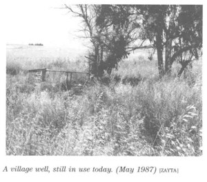
People from neighbouring villages also visited Mughallis’s well because its water was traditionally believed to help dissolve kidney stones. This was a local belief, not a medically verified property of the water.
Land Ownership in Mughallis
| Ownership category | Land ownership in dunums* |
|---|---|
| Palestinian Arab-owned | 11,286 |
| Jewish-owned | 0 |
| Public land | 173 |
| Total | 11,459 |
*One dunum is equivalent to approximately 1,000 square metres. “Public land” follows the classification used in the official 1944/45 village statistics and should not be confused with private communal ownership.
Land Use in Mughallis in 1944/45
| Land-use category | Area in dunums* |
|---|---|
| Irrigated land and orchards | 88 |
| Land planted with olive trees, included within the orchard category | 55 |
| Land planted with cereals | 7,277 |
| Built-up area | 23 |
| Total cultivable land | 7,365 |
| Non-cultivable land | 4,071 |
*One dunum is equivalent to approximately 1,000 square metres. The 55 dunums planted with olive trees formed part of the 88 dunums classified as irrigated land or orchards and should not be added separately.
Education in Mughallis
According to local village histories, Mughallis’s first school was established and financed by its residents in 1925 near the mosque. It initially operated as a traditional kuttab, or elementary Qur’anic school. Its first teacher is identified as ‘Isa al-Baz from the neighbouring village of Sajad.
In 1940, the school reportedly came under the administration of the Department of Education in Hebron. Local accounts identify Shawkat al-Nabulsi and ‘Abd al-Mu‘ti Tahbub among its teachers. The school temporarily closed in 1942, while residents contributed to teachers’ salaries either in cash or through portions of the village harvest.
In 1945, Shaykh Mahmud Ahmad Abu ‘Ajmiyya reportedly became the schoolteacher. The school consisted of one large classroom and provided instruction through the fourth elementary grade. Local testimony also records the attendance of more than ten girls, including Zaynab Sa‘id Jabr Abu ‘Ajmiyya, ‘A’isha ‘Abd al-Rahman Abu ‘Ajmiyya, Fatima Khalil Ahmad Husayn Abu ‘Ajmiyya, Rahma Ahmad Ibrahim al-Sarabta, and ‘Adawiyya ‘Isa Khalid Abu ‘Ajmiyya.
Students wishing to continue their education beyond the fourth grade attended the school in Tall al-Safi. These detailed educational accounts derive from local history and oral testimony rather than a complete surviving Mandate school register.
Population of Mughallis
Mughallis had approximately 311 inhabitants in 1922. The 1931 census recorded 447 residents living in 93 houses. By 1945, its population had increased to 540.
A later demographic projection estimated that approximately 626 people lived in Mughallis in 1948. The rounded figure of 630 appears in some secondary summaries. The inhabitants were displaced during the Nakba, and the village was subsequently destroyed.
Population of Mughallis
| Year | Population* |
|---|---|
| 1596 | Approximately 424 |
| 1922 | 311 |
| 1931 | 447 |
| 1945 | 540 |
| 1948 estimate | 626 |
| Estimated number of refugees in 1998 | 3,847 |
*The sixteenth-century figure is derived from Ottoman fiscal records and is approximate. The 1948 and 1998 figures are later demographic estimates rather than contemporary official census counts.
Number of Houses in Mughallis
| Year | Number of houses |
|---|---|
| 1931 | 93 |
| 1948 estimate | 130 |
*The 1931 figure comes from the official census, whereas the 1948 figure is a later estimate.
Archaeological Sites in Mughallis
The village itself was built over an archaeological site. Two additional sites within its vicinity—Khirbat Ghallus and Khirbat Samra—contained archaeological remains. The available village profile does not provide a complete chronology or detailed inventory of these remains.
Occupation and Depopulation of Mughallis
During the “Ten Days” between the first and second truces, from 8 to 18 July 1948, Israeli forces launched Operation An-Far on the southern front.
According to Israeli historian Benny Morris and the account reproduced in Walid Khalidi’s All That Remains, Mughallis was occupied on 9–10 July during the first stage of the operation. The date of 17 July given in the original summary is therefore inconsistent with the documented operational chronology.
The village lay within a group of communities seized by the Giv‘ati Brigade’s Fifty-First Battalion. Military accounts state that the battalion occupied Mughallis and nearby villages, expelled their inhabitants, and demolished or burned a number of houses.
The available sources do not record a separate casualty figure for Mughallis. No unverified account of deaths has therefore been added.
Israeli Settlements on Mughallis’s Lands
Gefen was established in 1955 on Mughallis’s lands, north of the former village site.
The original summary also listed Tirosh. However, the principal academic account of Mughallis identifies only Gefen as a settlement established on the village’s lands. Tirosh is located in the wider area but is not identified in the consulted village profile as having been built on Mughallis’s lands.
Mughallis Today
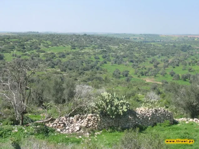
The village site and the surrounding area are fenced. The ruins of most houses have been levelled, although fragments of buildings remain visible.
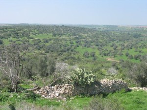
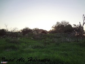
On the eastern side of the site, the remains of one house are surrounded by stone markers that once defined the boundaries of its garden. Olive and carob trees grow throughout the area, while cactuses remain along the northern and southern edges of the former village.
Sources
- Interactive Encyclopedia of the Palestine Question: Mughallis.
- Walid Khalidi, ed., All That Remains: The Palestinian Villages Occupied and Depopulated by Israel in 1948, Institute for Palestine Studies, 1992.
- Palestine Remembered: Mughallis, Hebron Subdistrict.
- Historical account of Mughallis reproduced by Palestine Remembered.
- Village Statistics of 1945: A Classification of Land and Area Ownership in Palestine.
Photo gallery


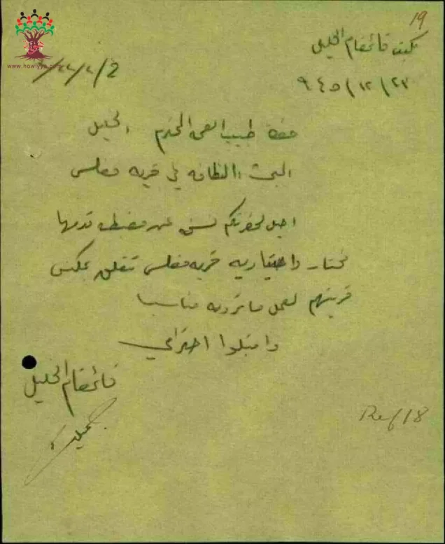
Photos from the village's people
Photos sent in by visitors and published after review.
Add a photo of this village
Log in to add photos of this village.
Other villages from Hebron
 Download Our Palestine App
The whole archive in the palm of your hand: depopulated villages, the Nakba, the massacres and Al-Aqsa — free, with no ads to erase the story.
Download Our Palestine App
The whole archive in the palm of your hand: depopulated villages, the Nakba, the massacres and Al-Aqsa — free, with no ads to erase the story.



Comments
No comments yet — be the first to write one.
Add your comment
Name and email are optional. Comments appear after review.