
The depopulated village of Kudna / District of Hebron

About the depopulated village of Kudna
- District
- Hebron
- Date Kudna was occupied
- 22 October 1948
- Population in 1948
- 520
- Military operation
- Operation Yoav
- Brigade that carried it out
- Givati Brigade
- Who defended the village
- Egyptian Muslim Brotherhoods, local Palestinian militias and some Arab Liberation Army volunteers
- Distance from the governorate centre
- 25 (km) Northwest of Hebron
- Elevation above sea level
- 250 m
- Cause of displacement
- Military assault by Zionist troops
- Extent of destruction
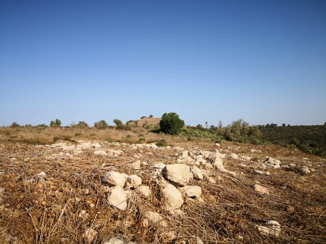
- The village has been completely obliterated and defaced.
- Ethnic cleansing
- Kudna inhabitants were completely ethnically cleansed.
- Settlements built on the built-up area of Kudna after 1948
- Beit Nir
Hover a dot to read the village name, or click to open its card.
Borders of the depopulated village of Kudna
Kudna – Depopulated Palestinian Village of the Hebron District
Kudna, also rendered Kidna, was a depopulated Palestinian village in the Hebron District. It stood on the lower western slopes of the Hebron hills, approximately 25 kilometers northwest of Hebron, at an average elevation of about 250 meters above sea level.
Israeli occupation forces captured Kudna on 22–23 October 1948 during Operation Yoav. The village-level attacking formation was the Giv'ati Brigade. The inhabitants who remained when the village fell were expelled, and the village buildings were subsequently destroyed.
Location and Geography
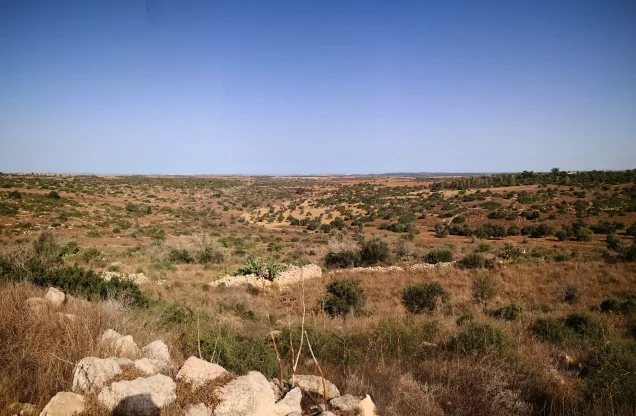
Kudna stood on the lower western slopes of the Hebron hills, in the transitional zone between the mountain range and the southern coastal plain.
It lay approximately 25 kilometers northwest of Hebron at an average elevation of about 250 meters above sea level. The Palestinian Encyclopedia gives a somewhat higher elevation of approximately 272 meters, probably reflecting a different measuring point within the village lands.
A secondary road connected Kudna with Bayt Jibrin, approximately four kilometers to the south. From there, major routes continued east toward Hebron, north toward Bethlehem, and west toward al-Faluja.
Tracks and secondary roads also connected Kudna with nearby villages including Ra'na, Dayr al-Dubban, 'Ajjur, Dayr Nakhkhas, Zikrin, and Zayta.
Name and Historical Background
PalQuest records the Arabic name as Kudna, with Kidna as an alternative form. During the Crusader period the locality was known as Kidna.
Supporting Palestinian local documentation offers a possible linguistic derivation from “Kafr Idna,” but this explanation is not firmly established and is best treated as a local interpretation rather than a certain etymology.
In the late nineteenth century, Kudna was described as a small village standing on a low hill and surrounded by olive trees. The walls of an old castle rose from the center of the settlement.
Built Environment
The houses of Kudna were built along both sides of the road running between Bayt Jibrin and Dayr al-Dubban. This road crossed the village from south to north and formed its principal street.
Most houses were constructed of stone and mud. During the British Mandate period, additional houses were built along the road and the village expanded northward.
The official 1944/45 statistics classified approximately 15 dunams as built-up land.
Population and Houses
The inhabitants of Kudna were Muslims. The population grew from 281 in 1922 to 353 in 1931 and 450 in 1945.
- 1922281Official Mandate census; all inhabitants were Muslims
- 1931353Official Mandate census
- 1945450Official statistics; all inhabitants were Palestinian Arab Muslims
- 1948About 522Later estimate, not an official British census
- 1998About 3,206 refugees and descendantsLater demographic estimate published by Palestine Remembered
The 1931 census recorded 75 houses. The figure of approximately 110 houses for 1948 is a later estimate rather than an official census count.
Education and Public Services
Walid Khalidi's principal village entry does not document an independent school or a specifically identified mosque in Kudna.
The Palestinian Encyclopedia describes the village as having few public facilities and states that its inhabitants depended on nearby Bayt Jibrin for many services.
No independent school or mosque is therefore added without stronger village-specific documentation.
Water Resources
Walid Khalidi records that the villagers obtained drinking water from a well on the eastern edge of the village.
Supporting Palestinian local documentation refers more broadly to several wells in the valley north of Kudna. The principal sources do not provide securely documented names for these wells, so no unverified names are added.
Economic Life and Agriculture
Agriculture and animal husbandry were the principal economic activities. Most cultivated land lay west of the village.
The villagers grew cereals, vegetables, figs, olives, and other fruit trees. Cultivation was predominantly rainfed.
Uncultivated land covered with shrubs and wild grasses was used as grazing ground for goats and sheep.
In 1944/45, 6,505 dunams were devoted to cereals and 825 dunams were classified as plantations and irrigable land.
Palestine Remembered separately gives a crop-specific figure of 670 dunams planted with olives. This figure falls within the broader cultivated categories and should not be added again to the official land-use total.
Land Ownership, 1944/45
The total land area of Kudna was 15,744 dunams. Under the official Government of Palestine classification, ownership was distributed as follows:
- Arab11,607 dunums74%
- Jewish0 dunums0%
- Public4,137 dunums26%
Palestine Remembered presents the same figures using its simplified terminology: 11,607 dunams “Palestinian,” 0 dunams “Transferred to Zionists,” and 4,137 dunams “Communal/Public.” The phrase “Transferred to Zionists” should be preserved when reproducing that source's terminology.
The Palestinian Encyclopedia gives a total land area of 15,724 dunams. Because this does not match the balanced official table, the official figure of 15,744 dunams is used here.
Land Use, 1944/45
- Arab
- Public
- Cereals6,505 dunums
- Plantations and irrigable land825 dunums
- Total cultivable/cultivated land7,330 dunums
- Non-cultivable land8,399 dunums
- Built-up land15 dunums
- Total non-cultivable and built-up8,414 dunums
The official table balances exactly: 7,330 dunams of cultivated or cultivable land plus 8,414 dunams of built-up and non-cultivable land equal the total village area of 15,744 dunams.
Archaeology and Khirbas
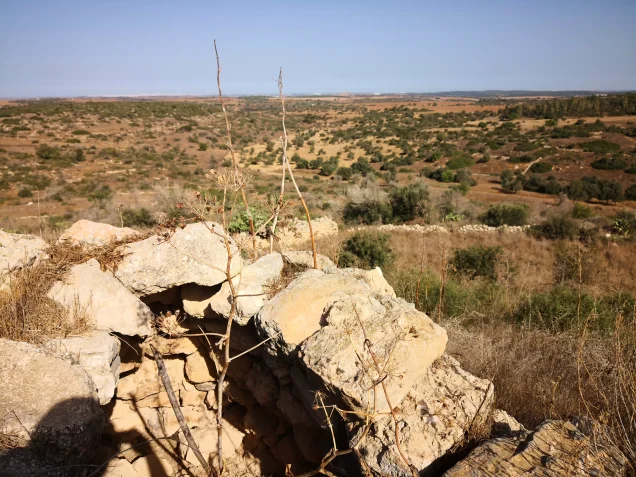
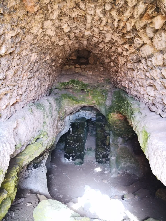
Kudna and its surroundings contained extensive archaeological remains. Khalidi records a site with the remnants of a fort, ruined building foundations, formerly inhabited caves, and water cisterns.
Approximately half a dozen khirbas were located nearby.
The Palestinian Encyclopedia and supporting Palestinian documentation give names for several surrounding archaeological localities, including Khirbat al-Khalq or al-Khalf, Barnata, al-Jadida, 'Alma, Umm al-Daraj, Farash, and al-'Aziza.
The fort was associated in nineteenth-century descriptions with the Crusader period, but the archaeological landscape contains remains from different periods and should not be assigned wholesale to a single era.
Operation Yoav
Operation Yoav began on 15 October 1948 and continued until 4 November. It had initially been called Operation Ten Plagues before being renamed.
Its main objective was to break through Egyptian lines and link Israeli forces in the Negev with Israeli-held territory farther north.
At the overall operational level, the Giv'ati, Yiftach, Negev, and Har'el brigades participated in different sectors. PalQuest explicitly lists Kudna among the Palestinian villages affected by Operation Yoav.
The participation of several brigades in the operation as a whole does not mean that all of them captured Kudna. Khalidi's village-specific entry explicitly identifies the Giv'ati Brigade as the force that took the village.
Occupation and Depopulation
The Giv'ati Brigade occupied Kudna under circumstances similar to those of neighboring 'Ajjur during Operation Yoav.
The sources summarized by Walid Khalidi agree that the village fell on 22–23 October 1948. Palestine Remembered and some Palestinian local documentation index 22 October specifically.
The range 22–23 October is therefore retained as the more cautious village-specific dating.
Khalidi, citing Benny Morris through his own account, states that the inhabitants who remained when Kudna was overrun were expelled, as occurred in other villages captured during this phase of the operation.
Military Unit
The military formation securely identified with the occupation of Kudna is the Giv'ati Brigade.
The village-specific entry does not identify a particular battalion within the brigade. No battalion number is therefore assigned without direct documentation.
The Yiftach, Negev, and Har'el brigades participated in Operation Yoav at the broader operational level but should not be listed as village-level attacking units without specific evidence.
Occupation Chronology
- 15 October 1948
Beginning of Operation Yoav
Israeli forces launched the southern offensive intended to break Egyptian lines and connect the Negev with Israeli-held territory farther north.
- Second half of October 1948
Advance toward the western Hebron hills
Military operations expanded toward Palestinian villages on the lower slopes of the Hebron hills.
- 22–23 October 1948
Occupation of Kudna
The Giv'ati Brigade captured the village. Some Palestinian indexes give 22 October specifically.
- During and immediately after the occupation
Expulsion of remaining inhabitants
Khalidi records that those who remained in the village were expelled after Israeli forces entered.
- 23 October 1948
Breakthrough of Egyptian lines
Israeli forces broke through Egyptian lines during the broader operation, linking parts of the Hebron hills with the Jerusalem corridor.
- 4 November 1948
End of Operation Yoav
The operation concluded after a major expansion of Israeli control in the south and Negev.
- Exact date not documented
Destruction of the village
Kudna's houses were destroyed and levelled, but the principal sources do not give a precise date for the demolition of all structures.
Israeli Settlements on Village Lands
Beyt Nir was established in 1955 on Kudna's lands, west of the former village site.
Khalidi also states that Paggit, established in 1952 and apparently unsuccessful as a lasting settlement, may have been built on village land.
The Palestinian Encyclopedia associates Gal-On with Kudna. However, Khalidi's entry for neighboring Ra'na identifies Gal-On as having been established on lands traditionally belonging to Ra'na. Gal-On is therefore not listed here as a securely documented settlement on Kudna's lands.
Kudna Today
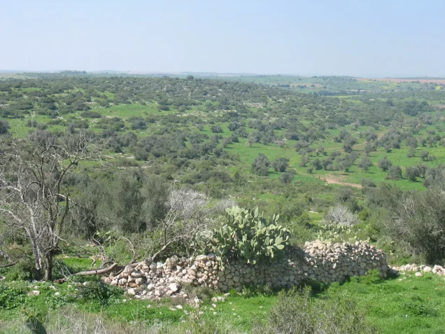
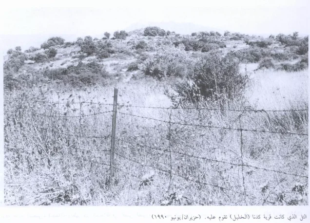
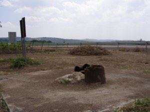
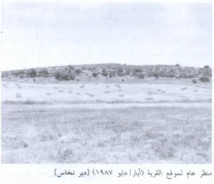
According to the field description published in Walid Khalidi's All That Remains, the village houses had been reduced to rubble and levelled, with wild vegetation growing over the debris.
Stones that had formed walls around house gardens could still be seen. Cactuses and carob, fig, and olive trees grew at the site, with cypress trees to the south.
The entire area was fenced and used by Israeli farmers as grazing land.
This description should not be treated as a field verification of conditions in 2026. Fieldwork for All That Remains was carried out between 1987 and 1990, so it documents the site's condition during that survey period rather than providing a comprehensive contemporary assessment.
Sources
- PalQuest – Interactive Encyclopedia of the Palestine Question: Kudna
- PalQuest – Operation Yoav
- Palestine Remembered – Kudna, Hebron District
- Palestinian Encyclopedia – Kudna
- Palestinian Villages Encyclopedia – Kudna; supporting Palestinian local documentation
- PalQuest – Ra'na; used to verify the cadastral attribution of Gal-On
- Institute for Palestine Studies – Walid Khalidi, All That Remains
- PalQuest – All That Remains: Methodology
Photo gallery



Photos from the village's people
Photos sent in by visitors and published after review.
Add a photo of this village
Log in to add photos of this village.
Other villages from Hebron
More from the archive
 Download Our Palestine App
The whole archive in the palm of your hand: depopulated villages, the Nakba, the massacres and Al-Aqsa — free, with no ads to erase the story.
Download Our Palestine App
The whole archive in the palm of your hand: depopulated villages, the Nakba, the massacres and Al-Aqsa — free, with no ads to erase the story.



Comments
No comments yet — be the first to write one.
Add your comment
Name and email are optional. Comments appear after review.