
The depopulated village of Khirbat Umm Burj / District of Hebron
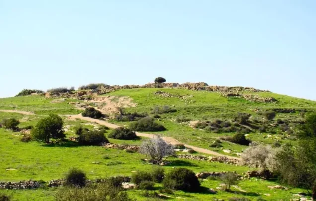
Khirbat Umm Burj
About the depopulated village of Khirbat Umm Burj
- District
- Hebron
- Date Khirbat Umm Burj was occupied
- 06 November 1948
- Population in 1948
- 160
- Military operation
- Operation Yoav
- Brigade that carried it out
- Harel Brigade
- Who defended the village
- Egyptian Army
- Distance from the governorate centre
- 31 (km) Northwest of Hebron
- Elevation above sea level
- 425 m
- Cause of displacement
- Expulsion by Zionist troops
- Extent of destruction
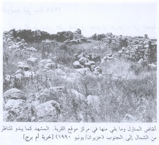
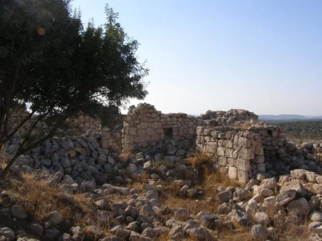
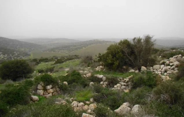
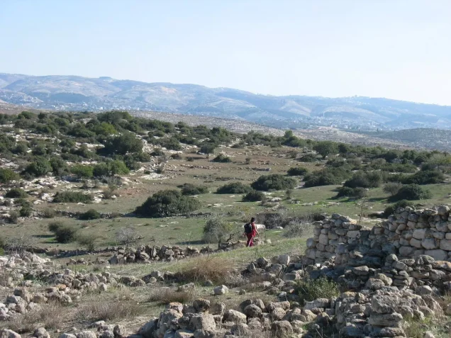
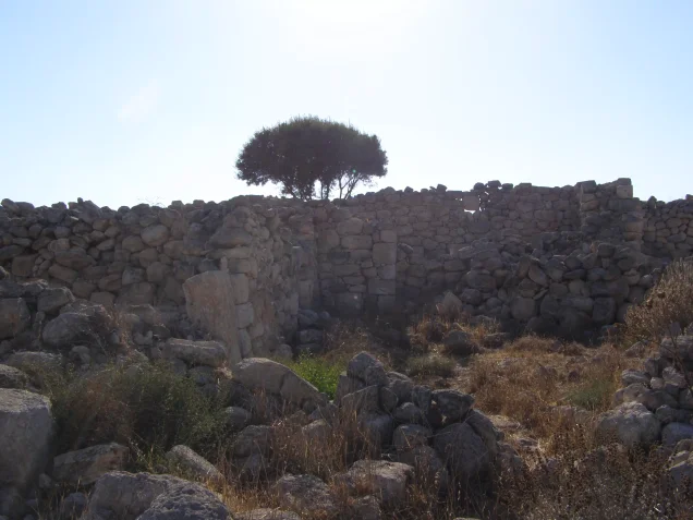
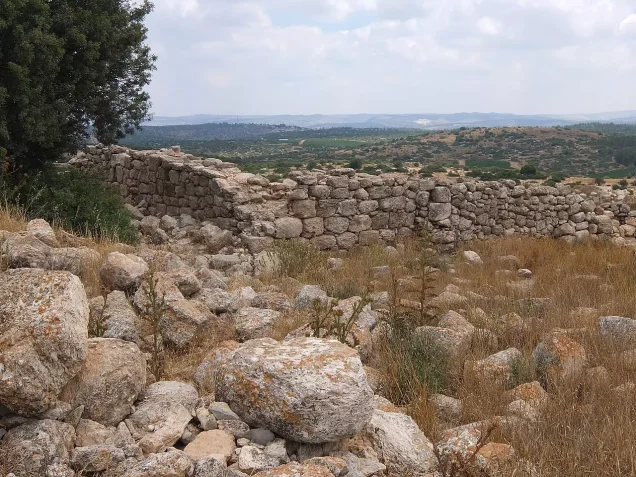
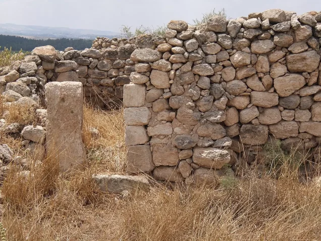
- Umm al-Burg was completely destroyed, and only house walls and rubble left behind.
- Ethnic cleansing
- Umm al-Burg was completely ethnically cleansed between November and April, 1949 (see Zakariyya for more details).
Hover a dot to read the village name, or click to open its card.
Borders of the depopulated village of Khirbat Umm Burj
Khirbat Umm Burj – Depopulated Palestinian Village of the Hebron District
Khirbat Umm Burj was a depopulated Palestinian village in the Hebron District. It stood on a hilltop overlooking a broad expanse of surrounding country, approximately 17 kilometers from Hebron, at an average elevation of about 425 meters above sea level.
The village was a small rural settlement, classified during the Mandate period as a hamlet. Its stone houses extended along an east–west axis. Its Muslim inhabitants depended primarily on rainfed agriculture and animal husbandry and obtained drinking water from three wells on the northern edge of the village site.
Israeli occupation forces probably entered Khirbat Umm Burj on 28–29 October 1948 during the third stage of Operation Yoav. Depopulation, however, was not completed at that point. Some villagers remained, and on 6 November a platoon of the Har'el Brigade was sent to expel people still in the area. Further clearing raids continued along the Israeli–Jordanian front line into the spring of 1949.
Location and Geography
Khirbat Umm Burj stood on a hilltop in the western foothills of the Hebron Mountains and overlooked a wide expanse of land in all directions.
Walid Khalidi and PalQuest place it approximately 17 kilometers from Hebron at an average elevation of about 425 meters above sea level.
Palestine Remembered gives a distance of 31 kilometers northwest of Hebron. This differs from the principal-source figure, so the article uses 17 kilometers while recording the discrepancy.
Two dirt roads linked the village with the Bayt Jibrin–Hebron highway and with another road leading northeast from Bayt Jibrin toward the Jerusalem–Jaffa highway.
Mountain tracks also connected Khirbat Umm Burj with neighboring communities, particularly Dayr Nakhkhas, Surif, and Nuba.
Its lands bordered or adjoined the broader lands of Bayt Nattif, Surif, Nuba, Bayt Ula, 'Ajjur, and other communities in the western Hebron hills.
Name
Walid Khalidi suggests that the name Umm Burj derived from a tower that once stood in the center of the site.
In the late nineteenth century, the location was described as a ruined village dominated by a central tower, which some contemporary observers believed to be of recent construction, an interpretation Khalidi questioned.
He also raises the possibility that the site's earlier, now-lost name may have contained the Greek word pyrgos, meaning “tower.”
This remains a possible historical and linguistic connection rather than a securely attested ancient name.
Built Environment
Khirbat Umm Burj was classified as a hamlet in the Mandate-era Palestine Index Gazetteer.
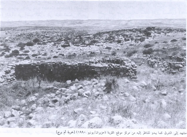
The village extended along an east–west axis and its houses were constructed of stone.
The official 1944/45 statistics classified approximately 15 dunams as built-up land.
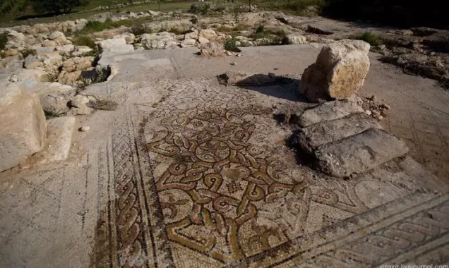
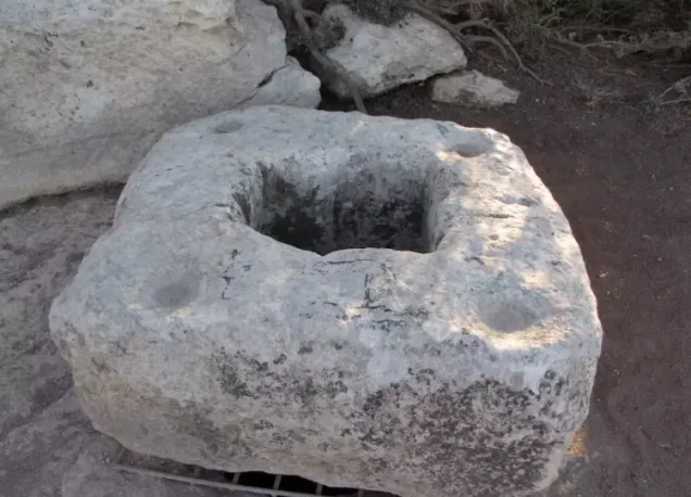
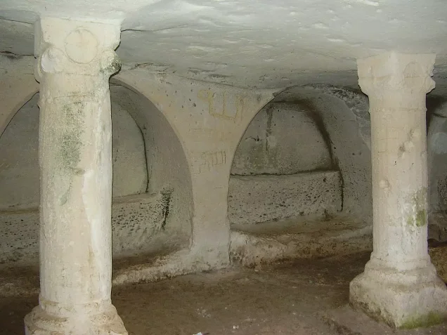
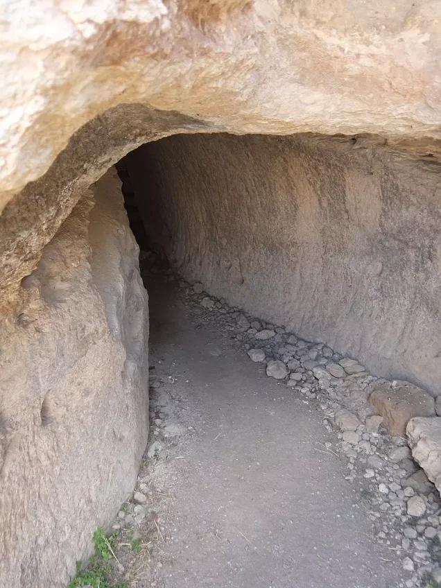
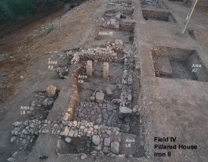
The inhabited village overlapped with a much older archaeological site containing walls, cisterns, caves, and rock-cut features.
Population and Houses
The inhabitants of Khirbat Umm Burj were Muslims.
- 1931119 with SanabraCombined official census entry for Sanabra and Umm Burj; not a village-specific population figure
- 1945140Official statistics; all inhabitants were Palestinian Arab Muslims
- 1948About 162Later demographic estimate, not an official Mandate census
- 1998About 997 refugees and descendantsLater estimate published by Palestine Remembered
The 1931 census requires particular caution. The Government of Palestine grouped “Sanabra and Umm Burj” together in a single entry of 119 Muslims—57 males and 62 females—living in 26 houses.
Neither the population of 119 nor the 26-house count should therefore be assigned to Khirbat Umm Burj alone, even though some later databases display the house figure as if it were village-specific.
Education and Religious Institutions
Walid Khalidi and PalQuest do not provide clear village-specific documentation of an independent school or a specifically identified mosque in Khirbat Umm Burj before the Nakba.
No particular educational or religious institution is therefore added without stronger Palestinian village-level evidence.
Water Resources
The inhabitants obtained their drinking water from three wells at the northern edge of the village site.
Agriculture was predominantly rainfed, while the wells served domestic and other local water needs.
Economic Life and Agriculture
Rainfed agriculture and livestock raising formed the foundation of the village economy.
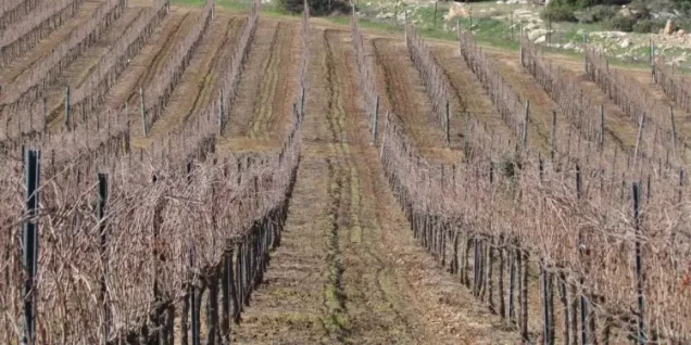
The inhabitants cultivated cereals and fruit trees, especially olives and grapevines.
In 1944/45, 3,546 dunams were devoted to cereals and 28 dunams were classified as plantations and irrigable land.
Palestine Remembered separately records 33 dunams planted with olives. This is a crop-specific figure and should not be added a second time to the official agricultural total.
Land Ownership, 1944/45
The total land area of Khirbat Umm Burj was 13,083 dunams.
- Arab13,079 dunums100%
- Jewish0 dunums0%
- Public4 dunums<1%
The official figures balance exactly: 13,079 + 4 = 13,083 dunams.
Palestine Remembered presents the corresponding figures using its own terminology: 13,079 dunams “Palestinian,” 0 dunams “Transferred to Zionists,” and 4 dunams “Communal/Public.”
The wording “Transferred to Zionists” should be preserved when reproducing that source's classification rather than automatically replacing it with the official “Jewish” category.
Land Use, 1944/45
- Arab
- Public
- Cereals3,546 dunums
- Plantations and irrigable land28 dunums
- Total cultivable/cultivated land3,574 dunums
- Non-cultivable land9,494 dunums
- Built-up land15 dunums
- Total non-cultivable and built-up9,509 dunums
The official table balances exactly: 3,574 dunams of cultivated or cultivable land plus 9,509 dunams of built-up and non-cultivable land equal the total village area of 13,083 dunams.
Archaeological Site and Khirbas
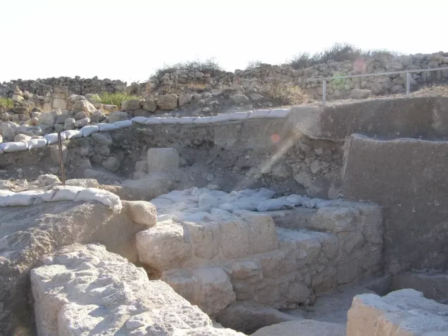
Khirbat Umm Burj itself stood on an ancient archaeological site containing walls, cisterns, caves, and rock-cut features.
At least twenty khirbas or archaeological sites were located within the village lands.
One of the most notable was Khirbat Jamrura, which Khalidi suggests may possibly be connected with the ancient site of Gemmruris.
The presence of cisterns and a columbarium suggests occupation during the Roman period.
Khalidi nevertheless stresses that the site's complete ancient history remained to be determined, so its archaeological remains should not all be assigned conclusively to one historical period.
Operation Yoav
Operation Yoav began on 15 October 1948 and continued until 4 November.
Its objective was to break through Egyptian positions on the southern front and link Israeli forces in the Negev with forces stationed farther north.
At the broader operational level, the participating Israeli formations included the Giv'ati, Yiftach, Negev, and Har'el brigades.
During the final week of October, the operational zones in the south, the Hebron hills, and the Jerusalem corridor increasingly merged after Israeli units broke through Egyptian lines on 23 October.
PalQuest explicitly lists Khirbat Umm Burj among the villages affected by Operation Yoav.
Initial Entry into Khirbat Umm Burj
Walid Khalidi considers it probable that Israeli occupation forces entered Khirbat Umm Burj on 28–29 October 1948, during the third stage of Operation Yoav.
Palestine Remembered indexes 28 October as the single occupation date, which falls within Khalidi's more precise range.
This phase of the offensive was accompanied by panic-driven flight and expulsions in parts of the region, amid severe violence in nearby villages, particularly al-Dawayima on 29 October.
The entry of Israeli forces into Khirbat Umm Burj did not, however, immediately result in the complete removal of its population.
Villagers Remaining after Occupation
Khalidi's account establishes that a substantial number of people remained in Khirbat Umm Burj after the initial Israeli entry.
On 6 November 1948, an Israeli unit was dispatched to the area to expel people who were still present.
The unit found approximately 150 people in Khirbat Umm Burj.
Expulsion on 6 November
The force sent to Khirbat Umm Burj on 6 November was a platoon of the Har'el Brigade, which had recently occupied positions north of the village.
Khalidi, citing Benny Morris, states that the platoon expelled about 100 people and that some of them were apparently injured.
This distinction is important when identifying the military unit: the Har'el Brigade is directly documented for the 6 November expulsion, but the principal village account does not establish that Har'el was the force that first entered Khirbat Umm Burj on 28–29 October.
Continued Depopulation into 1949
The 6 November raid was not an isolated incident.
Similar operations continued between November 1948 and April 1949 with the objective of clearing populated areas along the front line separating Israeli- and Jordanian-held territory.
Khirbat Umm Burj eventually lay very close to the armistice lines.
The village chronology must therefore distinguish between military occupation on 28–29 October 1948 and the continued process of expulsion and depopulation that followed.
Military Unit
Khalidi's village-specific account does not identify the formation responsible for the initial entry into Khirbat Umm Burj on 28–29 October.
The Har'el Brigade, however, is directly documented in the later phase, when one of its platoons entered the village on 6 November to expel inhabitants who remained.
The most precise formulation is therefore: Israeli occupation forces entered the village during the third stage of Operation Yoav; a Har'el Brigade platoon carried out a documented expulsion on 6 November 1948.
This article does not adopt the later secondary claim of “27 November – Palmach,” because it conflicts with the more detailed chronology in Khalidi and PalQuest.
Occupation Chronology
- 15 October 1948
Beginning of Operation Yoav
Israeli forces launched a major southern offensive intended to break Egyptian lines and link the Negev with Israeli-held territory farther north.
- 23 October 1948
Merging of operational zones
Israeli forces broke through Egyptian lines and linked Israeli-held areas of the Hebron hills with the Jerusalem corridor.
- 28–29 October 1948
Initial entry into Khirbat Umm Burj
Khalidi considers it likely that Israeli occupation forces entered the village during the third stage of Operation Yoav.
- Late October–early November 1948
Part of the population remained
The village was not completely emptied; residents and displaced people remained at the site.
- 6 November 1948
Documented expulsion raid
A Har'el Brigade platoon found about 150 people and expelled approximately 100, with some apparently injured.
- November 1948–April 1949
Continued clearing operations
Further raids sought to empty populated areas along the Israeli–Jordanian front line.
- After occupation and depopulation; exact date not documented
Destruction
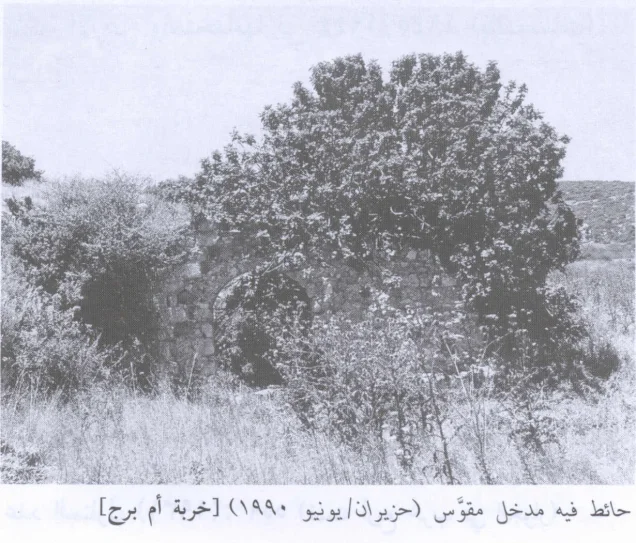
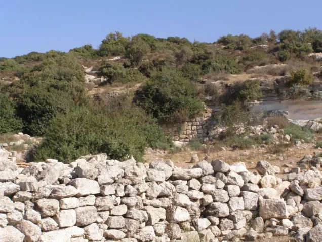
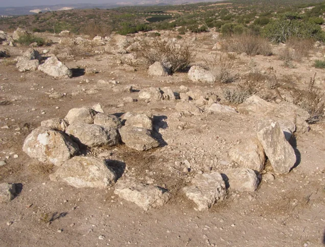
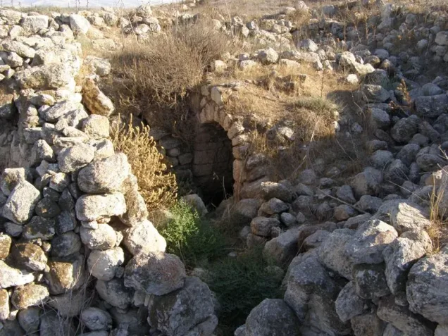
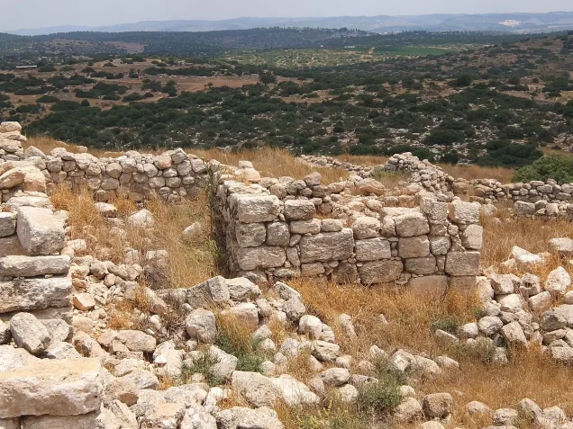
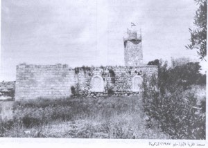
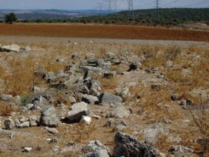
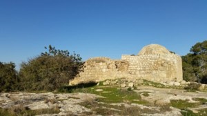
Most village structures deteriorated or were destroyed, although walls, arches, and parts of houses remained visible during later field surveys.
Israeli Settlements on Village Lands
According to Walid Khalidi and PalQuest, Nehusha was established in 1982 on Khirbat Umm Burj village land west of the former village site.
Some secondary sources give different dates for the establishment or re-establishment of the locality, but 1982 is retained here because it is the date used by the principal sources for this project.
Khirbat Umm Burj Today
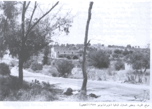
According to the field description published in Walid Khalidi's All That Remains, a cluster of crumbling village houses remained attached to one another.
Their doors and windows were still clearly visible even though roofs and sections of the walls had disappeared.
A large arch stood amid the remains.
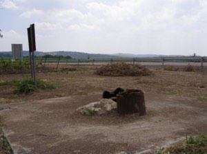
At the foot of the hill on the western side stood a large abandoned structure that had once contained an irrigation pump. A carob tree grew inside it.
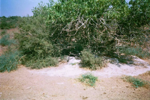
A pool and a well remained nearby, while caves formerly used as dwellings were visible along the northern and northeastern edges of the site. Cactuses grew along the southern edge.
Field photographs accompanying this documentation are dated 1990.
This description should not be treated as a comprehensive field verification of conditions in 2026. Fieldwork for All That Remains was conducted between 1987 and 1990 and therefore documents the site's condition during that survey period.
Sources
- PalQuest – Interactive Encyclopedia of the Palestine Question: Khirbat Umm Burj
- PalQuest – Operation Yoav
- Palestine Remembered – Khirbat Umm Burj, Hebron District
- Palestine Remembered – Walid Khalidi's account of Khirbat Umm Burj
- Palestinian Villages Encyclopedia – Khirbat Umm Burj; supporting Palestinian documentation
- Government of Palestine / PCBS – Census of Palestine 1931: Sanabra and Umm Burj
- PalQuest – All That Remains: Methodology and Fieldwork
Photo gallery



Photos from the village's people
Photos sent in by visitors and published after review.
Add a photo of this village
Log in to add photos of this village.
Other villages from Hebron
More from the archive
 Download Our Palestine App
The whole archive in the palm of your hand: depopulated villages, the Nakba, the massacres and Al-Aqsa — free, with no ads to erase the story.
Download Our Palestine App
The whole archive in the palm of your hand: depopulated villages, the Nakba, the massacres and Al-Aqsa — free, with no ads to erase the story.



Comments
No comments yet — be the first to write one.
Add your comment
Name and email are optional. Comments appear after review.