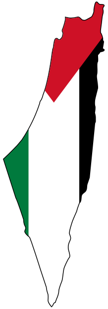
Safad Before the Nakba: Upper Galilee’s Capital, From Its Quarters to Exile
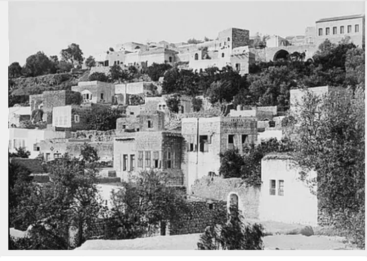
Safad, the bride of Galilee and capital of Upper Galilee, is a mountain city about 800 meters above sea level, overlooking Lake Tiberias and the hills of Galilee. Before the Nakba it was the center of a district of more than seventy villages, Palestine's leading summer resort, and a city of a citadel, water mills and quarters of white stone. On a rainy night in May 1948 its Arab inhabitants left it, and they have not returned to this day. [1] [2] [4]
This article tells the story of Safad before the Nakba: its history, quarters and landmarks, its mills, springs and summer resort, its winters and daily life, its schools, and its role in Palestine's revolts, then the spring of 1948, the fall of the city and the expulsion of its people and the villages of its district. Find more on our Safad page.
Safad Before the Nakba at a Glance
| Item | Details |
|---|---|
| Location | Upper Galilee, 790–840 meters above sea level, about 29 km from the Lebanese border [2] |
| City area | 3,002 dunams [2] |
| Population on the eve of the Nakba | About 12,000, including about 2,000 Jews [7] |
| District population (1945) | 53,620 [2] |
| British withdrawal | April 16, 1948 [2] [7] |
| Fall of the city | The night of May 10–11, 1948 [6] [11] |
| Depopulated villages in the district | 77 villages [1] |
From the Canaanites to Zahir al-Umar
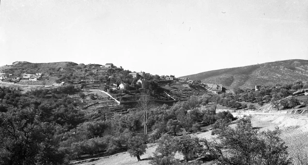
The Canaanites founded Safad on the fortress of "Trifut" on the southwestern slope of Mount Canaan. It is mentioned among the cities of Galilee in Egyptian inscriptions from the 14th century BCE, and the Romans called it "Sifa," meaning the fortified citadel. [2] [3]
The Crusaders occupied it in 1140 and built their castle there. Saladin liberated it in 1188, but it returned to the Crusaders when al-Salih Ismail, ruler of Damascus, ceded it to them, until Sultan al-Zahir Baybars recovered it in 1266. [2] Under the Mamluks it became a provincial seat and a station on the carrier-pigeon postal route between Damascus and Egypt. [2]
The Ottomans took it in 1517 after the Battle of Marj Dabiq, when its district had 78 villages. [2] An earthquake in 1759 destroyed about half its houses, and Zahir al-Umar and his son Ali oversaw their restoration [4]; another earthquake in 1837 killed about 2,000 of its people. [3]
In February 1799, during Napoleon's siege of Acre, the French sent a patrol of seven soldiers and an officer to scout Safad. Dozens of the city's men ambushed it in Wadi al-Tawahin, killed the soldiers and captured the officer, holding him for three nights in a cave in Biriyya before he escaped. [16] The British entered Safad in 1918. [2]
The Quarters of Safad
Safad grew around its citadel on the slopes of Mount Canaan and Mount Biriyya, its houses built into the hillsides so that the mountain became one of their walls. [4] Its Arab quarters included:
- Harat al-Akrad (the Kurdish Quarter): the oldest historic quarter of the city, settled by Kurds after the Crusades, which kept their name until the Nakba. [4] [5]
- Harat al-Sawawin: named after the white flint stone its houses were built from, and home to the Zawiya school. [5] [8]
- Harat al-Wata: home to the Red Mosque. [5]
- Harat al-Suq, al-Shaghur and al-Jura: al-Jura was home to many of the city's stonecutters and builders, and the Jura bridge linked the two halves of the city. [4] [8]
- The al-Asadi family quarter: on Mount Canaan, one of the largest quarters of the city until 1948. [5]
In the west of the city lay the Jewish quarter, which in Ottoman times was inhabited mostly by elderly Jews who came to spend their last days in the city. [5]
The Citadel, the Red Mosque and the City's Landmarks
- The citadel: built by the Crusaders and rebuilt by the Mamluks, it overlooked northern Galilee and the road to Damascus. [2]
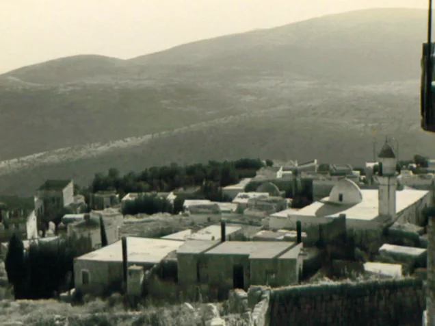
- The Red Mosque: built by al-Zahir Baybars in 1275 of polished red stone, with Mamluk muqarnas over its entrance. [2] [5]
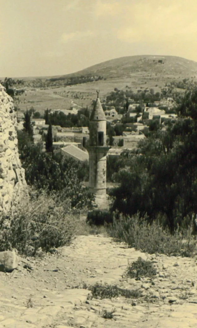
- The Market Mosque and the Sheikh Issa Mosque: known for their minarets. [1] [3]
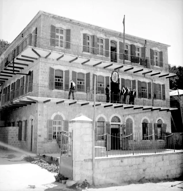
- The Ottoman Saraya: the city's most prominent landmark, where its old Arab quarters met. [14]
Springs, Valleys and "Gazelle Bread"
Water was scarce in Safad, so on the eve of 1948 its houses had more than 3,000 cisterns to collect rainwater. [8] Its springs included Ain al-Afiya at the northeastern entrance, Ain al-Hamra, the springs of Wadi al-Zarqa, and Ain al-Tujjar in the market, whose basins were built in Ottoman times. [4]
Around the city lay valleys, each with its own story: Wadi al-Tawahin (the Valley of the Mills); Wadi al-Laymun, famous for the sweet lemons sold in Tiberias; and Wadi al-Rayhan, where women gathered basil and myrtle for wreaths on graves. [4] Among the wild plants of its countryside were thyme, sage and "khubz al-ghazal" (gazelle bread), which became a symbol of the city. [4] The district's lands were known for almonds, olives and grapes, and the Hasbani, Banias, Dan and Bureighith rivers ran through them toward the Jordan. [2]
Mills, Builders and the Summer Resort
- Water mills: Wadi al-Tawahin had more than thirty water-powered grain mills, seven of which remained by the end of Ottoman rule. [4]
- Building and stone: Safad's builders, called "mi'marjiyya," were famous; they worked in Acre, Haifa, Sidon and Tyre, and built minarets in Galilee, Jabal Amil, the Golan and Hauran. [8]
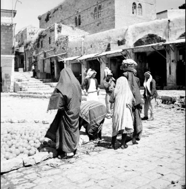
- Trade and the market: Safad was the administrative and economic center of Upper Galilee; people from the district's villages and from parts of Jabal Amil and southern Lebanon came to its market, and its people were known as skilled traders. [5] [15]
- Farming and dairy: the city relied on almond, olive and grape orchards on its lands, and on dairy from nearby villages, especially Akbara, whose milk and milk products households stored for the winter. [2] [16]
- The summer resort: Safad was Palestine's summer resort, as Tiberias was its winter resort; tuberculosis patients came for its air, and it had a tuberculosis sanatorium before the Nakba. [3] [4]
Read also: Palestinian Industries Before the Nakba.
Winter and Daily Life
Winter in Safad was harsh: snow sometimes lasted forty days or more during "al-Murba'aniyya," the coldest stretch between December 21 and January 31, cold kept people in their homes for weeks, and the city's workers were idle for at least three months. [16] Houses were heated with oak wood, and the people of Safad dated their years by winter events, speaking of "the year of the seven snows" and "the year of the hail." [16]
Houses were built to withstand the cold, with walls more than half a meter thick and sometimes a full meter, and roofs of packed earth and straw on poplar beams, later replaced by stone vaults. [8] The city's streets and stairways were paved with smooth white stone, and only its entrance road was asphalted, in the early 20th century. [8]
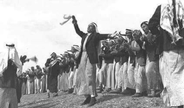
The people of Safad were known for their courage, their wariness of strangers and their skill in trade [5], and they had carried arms ever since Ibrahim Pasha let them keep their weapons after his 1834 campaign, to protect themselves from wolves and hyenas. [4] At weddings, the sahja, one of Galilee's best-known folk performances, brought together the young men of the quarters.
Schools and the Hospital
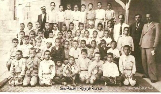
Safad had an Ottoman Rushdiyya school from the 19th century. In the 1942/1943 school year, 67% of the city's school-age boys and 31% of its school-age girls were enrolled, and about 2,000 students attended its schools in autumn 1947. [10] Its schools included Safad Secondary School and the Zawiya school in Harat al-Sawawin, where the historian Mahmoud al-Abidi, author of Safad in History, taught after his transfer to Safad in 1933. [5]
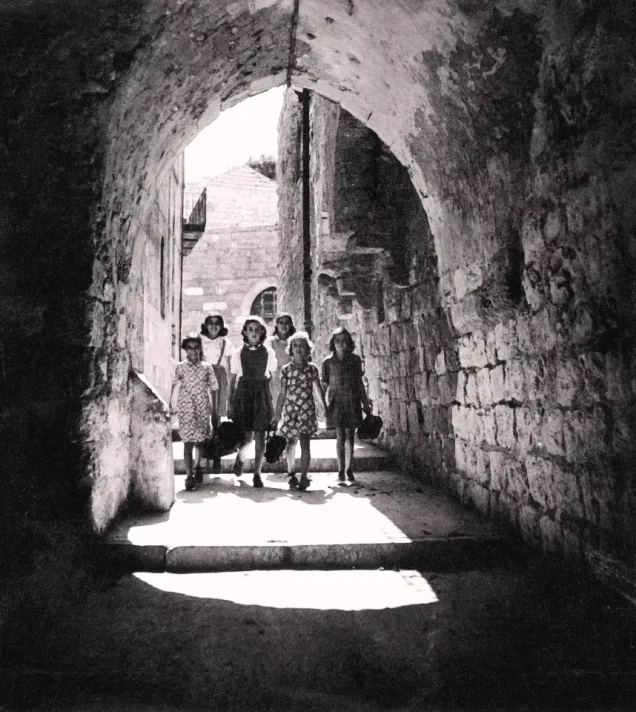
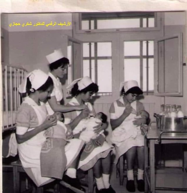
The city also had a government hospital, whose nursery appears in a 1944 photograph. [1]
Read: Education in Palestine Before the Nakba.
Safad in Palestine's Revolts (1929–1939)
Safad took part in the Buraq Revolt of 1929, after which the British arrested more than 400 of its people, and Safad's son Fuad Hijazi was the first of the revolt's three martyrs to be executed, on June 17, 1930, together with Mohammad Jamjoum and Ata al-Zeer. [5] [9] Under the Mandate, sports clubs and secret political associations opposing the British and Zionist presence were founded in Safad. [3]
With the Great Revolt, a strike was declared in Safad on April 15, 1936 [5], and the city and its villages became a field for the rebels:
- June 21, 1936: rebels led by Abdullah al-Sha'ir and Abdullah al-Asbah of al-Ja'una attacked British and Zionist forces near Jubb Yusuf, between Safad and Tiberias, killing and wounding several soldiers. [16]
- July 13, 1936: Mohammad Shahada al-Nabulsi was killed in a clash with British forces in Wadi al-Tawahin. [17]
- "The Nights of Oil," January 1937: a young man, Mohammad Said Zahra, struck the driver of a British military vehicle with a stone-packed snowball and took his rifle. The British cordoned off the Kurdish Quarter, searched its houses and poured oil over its stored food until it ran through the alleys, but never found out who did it. [16]
- 1937: the British hanged Ahmad Nadim al-Nahawi of Safad in the Jerusalem Citadel prison. [17]
- June 1938: rebels blocked the Tiberias–Safad road with stones at Jurn Halawa and attacked a British patrol, and in the battle that followed Rashid al-Sha'ir, brother of the commander Abdullah al-Sha'ir, was killed. [16]
The rebels used Safad's winter to their advantage, moving under rain, fog and thunder and hiding in the caves of the village of Dallata, while snow revealed their footprints, so shepherds drove their flocks over the tracks to erase them. [16] The rebel Fuad al-Sa'di was killed after being betrayed in Wadi al-Tawahin. [16]
Spring 1948: The Besieged City
The Arabs lived in the east of the city, with no Arab villages behind them for protection, while the Jewish quarter in the west was close to the villages of Ein al-Zeitun and Biriyya and housed the Haganah's headquarters. [7] In January 1948 the Arab Liberation Army entered Palestine under Adib al-Shishakli, who set up his headquarters outside the city, in Safsaf, which angered the people of Safad. [6]
On April 16, 1948 the British suddenly withdrew from Safad, and the Arabs took control of the citadel, the police station and Mount Canaan. [6] [7] On April 18, Khalil Ibrahim al-Sheikh Ahmad was killed in a clash at the police headquarters, known as "the Red Building." [17] But the surrounding villages were falling one after another. On May 1 the Palmach attacked Ein al-Zeitun after heavy shelling, and it fell when its defenders ran out of ammunition. A massacre followed: the attackers tied up more than 37 men in the mosque and then executed them, and about 70 bodies were found the next day. [7] They then demolished most of the houses of Ein al-Zeitun and Biriyya. [6]
These attacks were part of "Operation Yiftach" (April 15 – May 25, 1948), commanded by Yigal Allon, which aimed to seize eastern Galilee before the end of the Mandate and included a "whispering campaign" to frighten residents into leaving. [11]
Safad sent a delegation led by Zaki Qaddura to Damascus to ask for weapons; President Shukri al-Quwatli replied: "The eye sees, but the hand is short." The delegation then went to King Abdullah, who sent about 130 volunteers. [6] Read about Zionist massacres on our site.
The Fall of Safad
Aref al-Aref estimated the armed Arab defenders at fewer than 600, while the historian Mustafa al-Abbasi counts about 690 Arab fighters in early May, 444 of them from the city, against 550–600 Haganah and Palmach fighters. [6] Al-Shishakli and Sari al-Fnaish left Safad on May 9, handing command to the officer Juma'an. [6]
On May 6 the defenders repelled a Palmach attack on the citadel and the police station. [7] On the evening of May 9 an attack began on three axes, and fighting continued until the early hours of May 10, when the defenders ran out of ammunition. [7] Juma'an ordered a withdrawal, and the city fell on the night of May 10–11, 1948. [6] [11]
For the full details of the battle, read: The Battle of Safad in the Nakba section of our site.
The Night of Departure
The people of Safad left on a rainy night, unusual for May, through Wadi al-Tawahin, leaving behind their houses, mills and quarters. [4] [6] It is told that the poet Sheikh Salim al-Khada wept and mourned his city as he left it. [6]
Most of Safad's people took refuge in Syria and Lebanon, a few in Jordan, and only one or two families remained in Palestine. Most of the city's families settled in Damascus, while people from the district's villages lived in refugee camps, the best known being Yarmouk camp, through whose center runs "Safad Street." [13]
The Depopulated Villages of Safad District
Seventy-seven villages were depopulated in Safad district, the highest number of any district of Palestine on our site. [1] Most fell in the spring of 1948 during Operation Yiftach, and the rest in "Operation Hiram" in late October 1948. [11] [12] Here are brief profiles of the most prominent; each village has a detailed page in the depopulated villages section of our site: [1]
Hula Valley villages: March–April 1948
- al-Husayniyya: on a hill at the southwestern corner of the Hula Valley, about 11 km northeast of Safad. The Palmach attacked it on March 16–17, 1948, killing more than 30 of its people; the rest were displaced on April 21, and only rubble remains.
- Tulayl: on the southwestern shore of Lake Hula, about 14.5 km northeast of Safad; it had 340 inhabitants together with al-Husayniyya. It was depopulated in late April 1948, and the settlement of "Hulata" stands on its land.
- Madahil: on the northeastern edge of the Hula Valley, about 30 km from Safad. It was depopulated in late April 1948 under shelling and in fear of attack, and its houses have disappeared.
Villages of the city and Mount Canaan: May 1948
- Ein al-Zeitun: about a kilometer north of Safad, with 820 inhabitants in 1945. The Palmach occupied it on May 1, 1948 and committed a massacre there; its houses were blown up on May 2–3, leaving ruins, olive trees and cactus.
- Biriyya: on a mountain about a kilometer northeast of Safad, some 900 meters high, with 240 inhabitants. It was occupied on May 1, 1948 in preparation for the attack on Safad, and most of its houses were demolished.
- Mughr al-Khayt: on the northeastern slope of Mount Canaan, about 4 km from Safad, with 490 inhabitants. It was depopulated on May 2, 1948 after mortar shelling, and the settlement of "Hatzor HaGlilit" stands on its land.
- Qabba'a: on the northeastern slope of Mount Canaan, about 6 km from Safad. It was shelled on the night of May 2, 1948 and its people were displaced in May.
- al-Ja'una: on the eastern slope of Mount Canaan, about 5 km east of Safad, with 1,150 inhabitants. Most of its people were displaced in early May 1948, and those who remained were expelled on June 5, 1949.
- Akbara: about two kilometers south of Safad, with 390 inhabitants, known for its dairy. The Palmach attacked it on May 9, 1948; a small group of defenders resisted and then withdrew.
- Fir'im: northeast of Safad, with 740 inhabitants. It was depopulated on May 26, 1948.
- Taytaba: on a volcanic hill about 5 km north of Safad, with 530 inhabitants. It was depopulated in May 1948.
- Qaddita: about 5 km northwest of Safad, with 240 inhabitants. It was depopulated after the fall of Safad in May 1948.
Villages of the Hula Valley and the upper Galilee: May 1948
- al-Sanbariyya: at the northern edge of the Hula Valley near the Hasbani River, with 130 inhabitants. It was depopulated on May 1, 1948 and its houses were demolished.
- al-Muftakhira: in the central eastern Hula Valley, with 350 inhabitants together with Khirbat al-Burjiyyat. It was depopulated in two waves, on May 1 and 16, 1948.
- al-Hamra: on the lower Golan slopes overlooking the Hula Valley. It was depopulated on May 1, 1948, and its land became fenced pasture.
- Khiyam al-Walid: on a hill at the eastern edge of the Hula Valley near the Syrian border, with 280 inhabitants. It was depopulated in May 1948.
- Jahula: in the Galilee foothills overlooking the Hula Valley, with 420 inhabitants. It was depopulated in May 1948, and only its stone terraces and its spring remain.
- Abil al-Qamh: about a kilometer from the Lebanese border, with 330 inhabitants. It was depopulated on May 10, 1948.
- al-Khalisa: at the northwestern edge of the Hula Valley, about 28 km northeast of Safad, and one of the district's largest villages, with 1,840 inhabitants. It was depopulated on May 11, 1948, and the settlement of "Kiryat Shmona" was built on its site in 1950.
- al-Zuq al-Tahtani: near the Lebanese border, with 1,050 inhabitants. Its people left on May 11, 1948 after the fall of Safad.
- al-Buwayziyya: on the western edge of the Hula Valley, with 510 inhabitants together with the village of al-Mays. It was occupied on May 11, 1948 after the fall of al-Khalisa.
- al-Shawka al-Tahta: in the northeastern Hula Valley, with 200 inhabitants together with Mughr Shab'a. It was depopulated on May 14, 1948, and the ruins of its houses remain.
- al-Na'ima: in the northwestern Hula Valley, with 1,030 Arab inhabitants. It was depopulated on May 14, 1948.
- Qaytiyya: between the Dan and Hasbani rivers, with 940 inhabitants. Most of its people left on May 19, 1948, and the rest were expelled on June 5, 1949.
- al-Zuq al-Fawqani: near the Lebanese border in the far north of the district, with 160 inhabitants. It was depopulated on May 21, 1948.
- Lazzaza: in the northern Hula Valley near the Hasbani River, with 230 inhabitants. It was depopulated on May 21, 1948.
- al-Manshiyya: at the northern end of the Hula Valley. It was depopulated on May 24, 1948.
- al-Zawiya: in the western half of the Hula Valley, with 760 inhabitants. It was depopulated on May 24, 1948 after a direct attack.
- al-Khisas: in the northern Hula Valley near the Hasbani, with 470 Arab inhabitants. A night raid on December 18, 1947 killed 10–12 civilians, including children, and most of its people were displaced on May 25, 1948.
- al-Mansura: near the western bank of the Banias River, with 360 inhabitants. It was depopulated on May 25, 1948, and its site became a fish farm.
- al-Dawwara: in the northern Hula Valley, with 700 Arab inhabitants. It was depopulated on May 25, 1948.
- al-Salihiyya: in the Hula Valley, with 1,520 inhabitants. It was depopulated on May 25, 1948.
- al-Abisiyya: in the northeastern Hula Valley near the Banias River, with 830 inhabitants. It was depopulated in late May 1948.
- Ghuraba: on the lower Golan slopes overlooking the Hula Valley, with 220 inhabitants. It was depopulated in May 1948.
- al-Nabi Yusha': on hills overlooking the Hula Valley, about 17 km northeast of Safad. Its police station held out against attacks that began on April 17 until it fell on the night of May 16–17, 1948.
Upper Galilee villages: Operation Hiram, October 1948
- Safsaf: about 7 km northwest of Safad, with 910 inhabitants, and headquarters of the Arab Liberation Army's second battalion. It was occupied at dawn on October 29, 1948, and a massacre was committed there in which dozens of men were killed.
- Sa'sa': about 12 km northwest of Safad near the Lebanese border, with 1,130 inhabitants. Houses were blown up in a raid on February 14–15, 1948, and it was occupied on October 30, 1948.
- Mirun: about 5 km west of Safad, with 290 inhabitants. Some of its people left after the fall of Safad, and it was finally depopulated on October 29, 1948.
- Alma: about 10 km north of Safad, with 950 inhabitants. It was occupied on October 30, 1948.
- al-Ras al-Ahmar: about 8.5 km north of Safad, with 620 inhabitants. It was depopulated on October 30, 1948.
- al-Malikiyya: about 15 km north of Safad near the Lebanese border, with 360 inhabitants. It changed hands in May 1948 and was finally occupied on October 31, 1948.
- Qadas: about 17 km northeast of Safad near the Lebanese border. It was attacked on May 14–15, 1948 and finally occupied in late October 1948.
- Kafr Bir'im: about 11.5 km northwest of Safad, with 710 inhabitants. It surrendered in early November 1948 and its people were expelled "temporarily"; despite a 1952 court ruling upholding their right to return, they were barred from it, and the village was blown up in 1953.
The full list of the district's 77 villages, with a page for each, is on our Safad district page.
Safad After the Nakba
- A city without its people: Safad today has about 28,000 inhabitants, most of them Jewish, after the expulsion of its Arab population. [2]
- The quarters: the names of the Arab quarters, such as al-Wata, al-Akrad and al-Sawawin, were replaced with Jewish religious names; part of them became the tourist "Artists' Quarter," and many houses were turned into hotels and guesthouses. [14]
- What remains: about half of Safad's old houses still stand, and many bear Arabic inscriptions over their doorways that bear witness to their owners. [14]
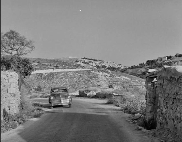
Read more on our site: Tiberias and its depopulated villages, Acre and its depopulated villages and Fishing Before the Nakba.
Conclusion
Safad was the citadel of Upper Galilee and the bride of the north: a city of white stone, water mills and springs, a summer resort for all of Palestine, and a city that took part in every one of Palestine's revolts. On a rainy night in May 1948 its people left through Wadi al-Tawahin, followed by the seventy-seven villages of its district. Yet Safad lives on in Damascus, in Yarmouk camp and in the memory of its sons and daughters, and the Arabic inscriptions over the doors of its houses still wait for their owners.
Frequently Asked Questions About Safad Before the Nakba
When did Safad fall in 1948?
Safad fell on the night of May 10–11, 1948, after an attack that began on the evening of May 9 as part of Operation Yiftach, days before the end of the British Mandate.
What was Safad's population before the Nakba?
On the eve of the Nakba it had about 12,000 inhabitants, including about 2,000 Jews, while Safad district had 53,620 inhabitants in 1945.
What were Safad's best-known Arab quarters?
They included the Kurdish Quarter, the oldest, as well as al-Sawawin, al-Wata (home to the Red Mosque), al-Suq, al-Shaghur and al-Jura.
What was the Ein al-Zeitun massacre?
A massacre in the village of Ein al-Zeitun near Safad in May 1948, when the attackers tied up dozens of the village's men and then executed them; about 70 bodies were found the next day.
Why was Safad called Palestine's summer resort?
Because of its altitude of about 800 meters and its mild summer air, people went there in summer as they went to Tiberias in winter, and tuberculosis patients came there to recover.
How many villages were depopulated in Safad district?
Seventy-seven villages in Safad district were depopulated in 1948, including Ein al-Zeitun, Biriyya, al-Ja'una, Safsaf, Sa'sa', Kafr Bir'im and al-Khalisa.
Where did Safad's people go after the Nakba?
Most took refuge in Syria and Lebanon, and many settled in Damascus and Yarmouk camp, where one of the main streets is named "Safad Street."
Sources and References
Arabic-language sources are listed with translated titles.
- "Safad," Depopulated Palestinian Villages section, Palestinina (Arabic).
- "Safad," Encyclopedia, Al Jazeera Net, 2014 (Arabic).
- Abdelkader Ben Masoud, "Dating Back to the 14th Century BCE: The Palestinian City of Safad," Arabi Post, January 12, 2024 (Arabic).
- Ali Habib Allah, "Gazelle Bread: From the Memory of Safad's Countryside (1/4)," Arab48, November 15, 2021 (Arabic).
- Ali Habib Allah, "Safad: From People's Memory and Founding Tales (2/4)," Arab48, November 29, 2021 (Arabic).
- Ali Habib Allah, "Safad: The Fall of the City (4/4)," Arab48, January 16, 2022 (Arabic).
- Yazid Suleiman, "70 Years Since the Nakba: The Occupation of Safad (15)," Arab48, April 17, 2018 (Arabic).
- Ali Habib Allah, "From the Memory of Building and Builders in Safad," Metras, September 10, 2022 (Arabic).
- "The Buraq Revolt: The First Uprising Against the Judaization of Jerusalem," Encyclopedia, Al Jazeera Net, August 10, 2022 (Arabic).
- "Education in Palestine Before the Nakba," Palestinina (Arabic).
- "Operation Yiftach," Interactive Encyclopedia of the Palestine Question, Institute for Palestine Studies.
- "Operation Hiram," Interactive Encyclopedia of the Palestine Question, Institute for Palestine Studies.
- Ali Badwan, "Yarmouk Camp and Safad Street," Diwan al-Arab, May 9, 2020 (Arabic).
- Yamen Nobani, "Push the Door Open and See How Much They Changed Safad," Ultra Palestine, September 15, 2019 (Arabic).
- Mustafa al-Abbasi, Safad Under the British Mandate, 1917–1948: A Social and Political Study, Muwatin – The Palestinian Institute for the Study of Democracy, 2005 (Arabic).
- Ali Habib Allah, "Safad: Nights of Cold and Gunpowder (3/4)," Arab48, December 15, 2021 (Arabic).
- "Martyrs of the 1936–1939 Revolt," Palestinian National Information Center – WAFA (Arabic).
More from the archive
 Download Our Palestine App
The whole archive in the palm of your hand: depopulated villages, the Nakba, the massacres and Al-Aqsa — free, with no ads to erase the story.
Comments
No comments yet — be the first to write one.
Add your comment
Name and email are optional. Comments appear after review.