Hebraizing Palestine's Map: How Village Names Were Erased
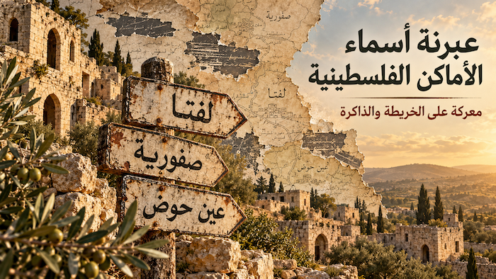
After the Nakba of 1948, the Zionist occupation did not stop at expelling some 750,000 Palestinians and destroying hundreds of villages. It began a second battle, quieter and longer-lasting: the battle over names. A demolished village lives on in its people's speech and on the maps, so its name had to be erased too.
In 1948, fewer than 5% of the place names in the British Mandate gazetteer were Hebrew. Within a single decade, a government committee of the Israeli occupation state had proposed some 3,000 new Hebrew names. This is the story of the Hebraization of the map: how Palestine was rewritten in another language.
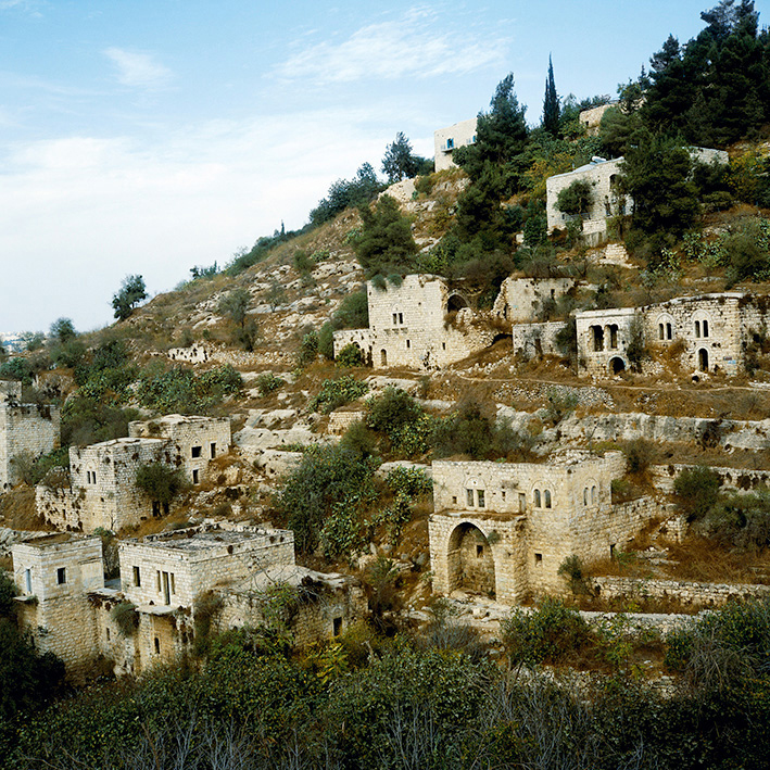
Source: Wikimedia Commons — Benyamin Reich — CC BY-SA 4.0.
What is the Hebraization of Palestinian place names?
Hebraization is the replacement of the Arabic names of Palestine's towns, villages, mountains, valleys and springs with Hebrew ones. It began on a limited scale before the Nakba, and after the occupation of Palestine in 1948 it became official policy, carried out by government committees whose decisions bind every state institution.
The goal was never linguistic. A name is a witness: it says that someone lived here, farmed here, and named this place before anyone else came. Erasing the name erases the witness.
"For reasons of state": Ben-Gurion's order
In July 1949, just months after the occupation of the Naqab (Negev), the occupation's prime minister David Ben-Gurion set up the "Negev Names Committee." It held its first meeting on 18 July 1949.
Ben-Gurion wrote to the committee's chair a sentence that sums up the whole project: "We are obliged to remove the Arabic names for reasons of state," according to Israeli historian Meron Benvenisti in his book Sacred Landscape: The Buried History of the Holy Land since 1948.
The committee's first task was to find Hebrew names for every place in the Naqab: mountains, valleys, springs and roads. The work then extended to "the whole territory of the state," according to Wikipedia.
The committees of erasure: from the JNF to the Government Names Committee
Hebraization was not a single decision but institutional work built up through three committees:
| Committee | Founded | What it did |
|---|---|---|
| Jewish National Fund (Keren Kayemet) Naming Committee | 1925 | About 400 names for Jewish settlements by 1948, then 200 more between May 1948 and March 1951 |
| Negev Names Committee | 1949 | Reviewed about 2,500 proposals, chose 533 new names, and finished on 20 March 1950 |
| Government Names Committee | 1951 (merging the two) | Proposed about 3,000 names over nine years to 1958; its decisions bind state institutions |
Source: Meron Benvenisti, Sacred Landscape.
The committees ran into a problem: the Bible offered only 40 usable names for the entire Naqab. For rivers and streams, the Bible and Jewish, Greek and Roman sources together named only about 35, while the maps needed around 900. The solution lay in the Arabic name itself: take it, alter it, and present it again as Hebrew.
Four ways to steal a name
The committees used specific techniques to turn Arabic names into Hebrew ones. Ironically, at least 333 of the 533 Negev names were not authentically Hebrew at all, but translations of Arabic names or Hebrew names chosen because they sounded like the Arabic:
| Method | Arabic name | New Hebrew name |
|---|---|---|
| Translation | Najmat al-Subh ("morning star") | Ayelet HaShahar |
| Distorted translation | Jabal Kharuf ("sheep mountain") | Har Harif ("spicy mountain") |
| Sound-alike | Tel Abu Hurayra | Tel Harar |
| Sound-alike | Ein al-Tina ("fig spring") | Ein Uzi (a Hebrew personal name) |
| Adaptation | Bir al-Harami | Be'er Hermesh |
| Adaptation | Yibna | Yavne |
| Adaptation | Yafa / Akka | Yafo / Akko |
Where there was no ancient name and no Arabic name to adapt, the committees invented new "symbolic" names, many of them tied to the Zionist movement or to the battles of 1948.
Israeli researcher Noga Kadman points to a striking example: a settlement was named Kfar Daniel, which the Names Committee attributed to Zionist leader Daniel Frisch. Yet it is almost identical to the name of the destroyed Palestinian village of Daniyal on the same site, according to +972 Magazine.
Source: Wikimedia Commons — Justin McIntosh — CC BY 2.0.
The new map: "harus" over the destroyed villages
In the 1950s, the occupation state's Survey Department printed the new Hebrew names over the British Mandate maps themselves. Over the destroyed Palestinian villages, a single Hebrew word was written: "harus," meaning "destroyed."
The head of the Survey Department at the time, Yosef Elster, said the aim was "a current map," not a historical one. Ruins with no visible remains were therefore dropped from the maps, according to Benvenisti. Hundreds of Palestinian villages thus vanished from the official map, as if they had never existed.
Settlements on top of depopulated villages
The Israeli occupation built many of its settlements on or near the lands of depopulated villages, and gave them Hebrew names that hide what lies beneath. Examples documented by Kadman in her book Erased from Space and Consciousness include:
- Mi'ar: the settlement of Ya'ad was built on it in 1974. Most of its residents opposed putting up a sign explaining the village's history.
- al-Kabri: a neighbouring settlement's lexicon praises "the orchards of Kabri" without mentioning the Palestinians who planted them.
- Jarisha: its mill in Tel Aviv's HaYarkon Park is attributed to the "Ottoman period," with no mention of the villagers.
Kadman shows that the Jewish National Fund and the Nature and Parks Authority present many depopulated village sites as nature reserves and parks: the ruins of homes are covered with trees, and the name is covered with a Hebrew sign.
One of the best-known examples is the Galilee village of Saffuriya, which became "Tzippori." It will be the subject of a separate article.
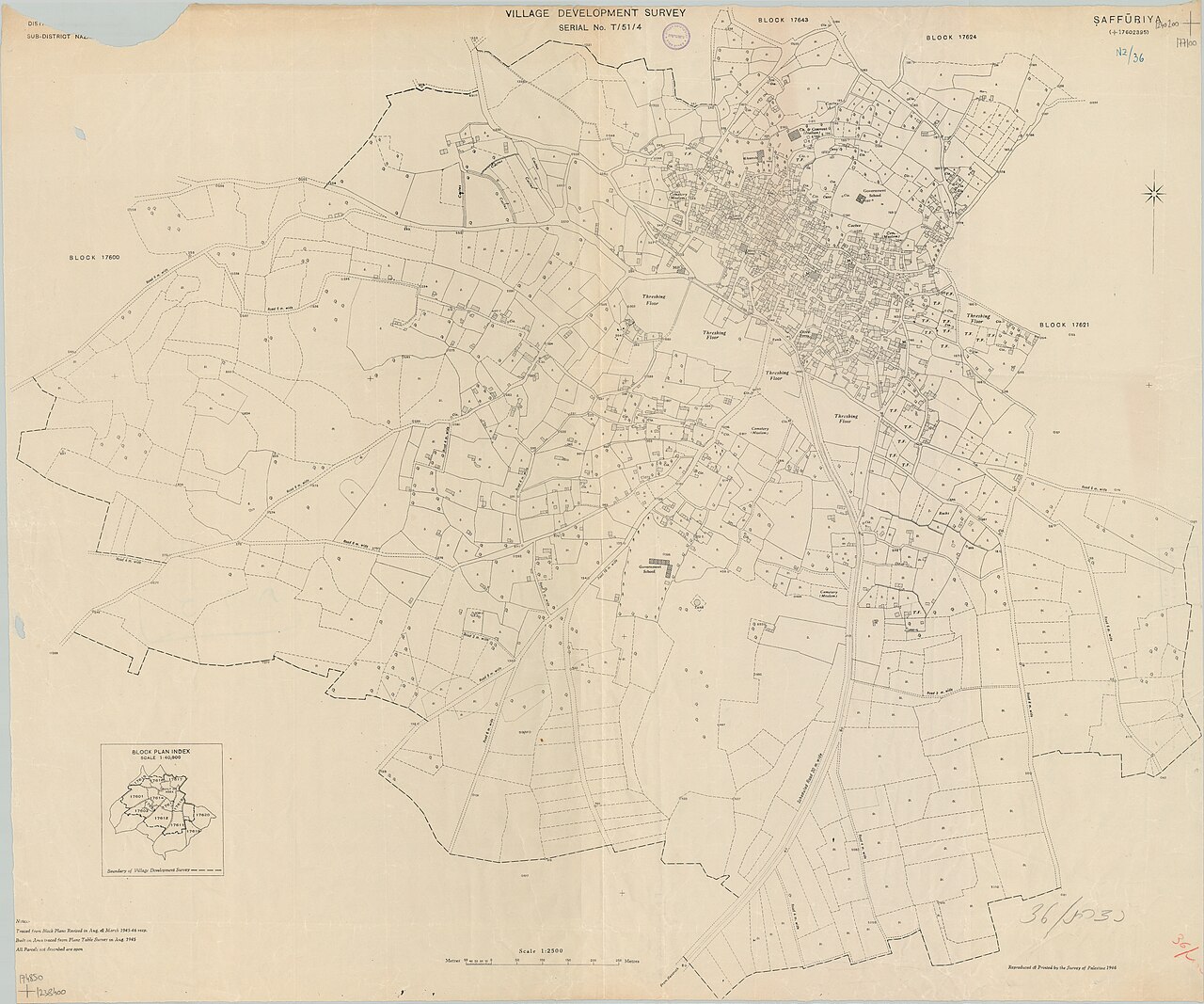
Source: Wikimedia Commons — Survey of Palestine — Public domain.
From Umm al-Rashrash to Eilat: Palestinian towns under new names
Hebraization was not limited to small villages and valleys. Some of the best-known towns in the occupation state today stand on Palestinian places with Arabic names that were removed after the Nakba.
Umm al-Rashrash: from a Red Sea police post to "Eilat"
Umm al-Rashrash was a British Mandate-era police post on the shore of the Gulf of Aqaba, made up of five mud huts. Occupation forces took it without a fight on 10 March 1949 in Operation Uvda ("fact," as in fait accompli), the last operation of the 1948 war. The same year, the Negev Names Committee named it "Eilat," after the biblical town of Elath, even though ancient Elath is thought to lie in present-day Jordan, according to Wikipedia and Zochrot.
al-Majdal: from expulsion to "Ashkelon"
al-Majdal, or Majdal Asqalan, was a Palestinian town of about 10,000 people on the eve of the Nakba. Occupation forces captured it in early November 1948, and about 2,700 Palestinians remained. On 17 August 1950, the deportation of those who remained to the Gaza Strip began by truck, until by October 1950 only about twenty families were left.
The town's name then changed four times in four years: "Migdal Gaza" in 1949, then "Migdal Gad," then "Migdal Ashkelon," and finally "Ashkelon" in 1953, according to Wikipedia.
Ein Hawd: the farming village that became an "artists' village"
The people of Ein Hawd, near Haifa, were expelled in July 1948. In the early 1950s, Romanian-Israeli artist Marcel Janco turned it into an artists' colony named "Ein Hod," whose artists still live in the villagers' stone houses today. Some of the original families rebuilt their homes on a nearby hillside overlooking their village, according to Middle East Eye.
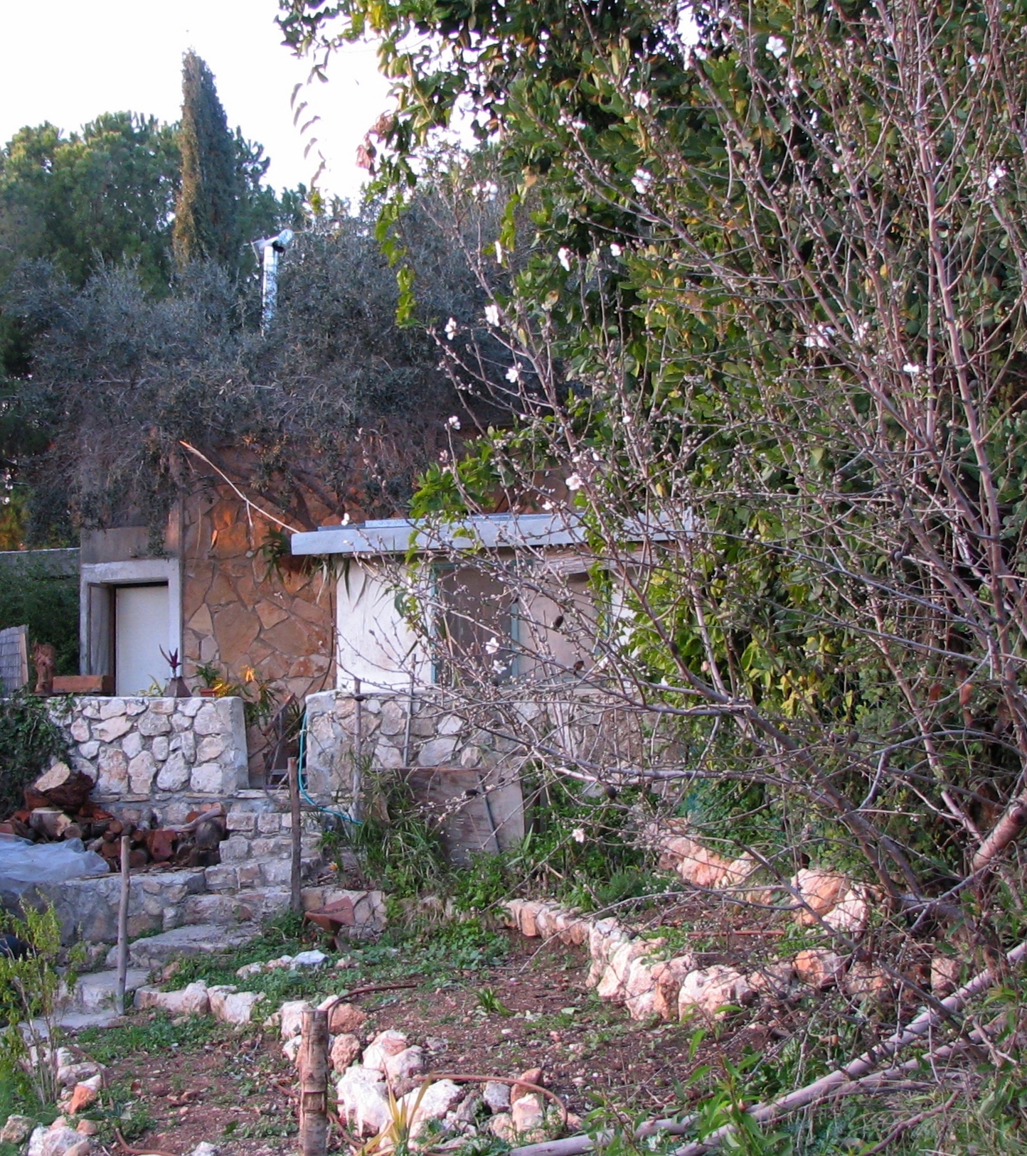
Source: Wikimedia Commons — Gilabrand — CC BY 3.0.
After the 1967 occupation: the West Bank in biblical names
After the occupation of the West Bank in 1967, the Hebraization policy moved east. The first thing to change was the name of the West Bank itself: occupation institutions officially call it "Judea and Samaria," a biblical name that presents occupied land as a natural part of the "Land of Israel."
Many settlements were given biblical names that link them to a claimed history and skip over the Palestinian present. The settlement of Shilo, established in 1978, is named after biblical Shiloh, and is surrounded by living Palestinian villages: Sinjil, Turmus Ayya and Qaryut, according to Wikipedia.
In this way a living Arabic name is surrounded by a biblical one, presented to the world as a "return to origins," while the people of the land are still there.
Villages without a name on the map: al-Araqib and others
If Hebraization replaces one name with another, the Naqab shows another face of erasure: Palestinian villages that exist and are inhabited, but whose existence the occupation state does not recognise at all.
There are about 35 unrecognised Bedouin villages in the Naqab. The Israeli authorities refuse to connect them to water and electricity grids or to provide health, education or basic infrastructure, according to +972 Magazine.
The best known is al-Araqib. The occupation first demolished it completely on 27 July 2010. Its people rebuilt, and it was demolished again, time after time. By January 2025 it had been demolished 235 times in 15 years, according to Al Jazeera Net. Its residents say they were first displaced in 1953.
Al-Araqib is the final stage of erasure: before a village's name is changed, the village itself is wiped from the map and the law, and then from the land.
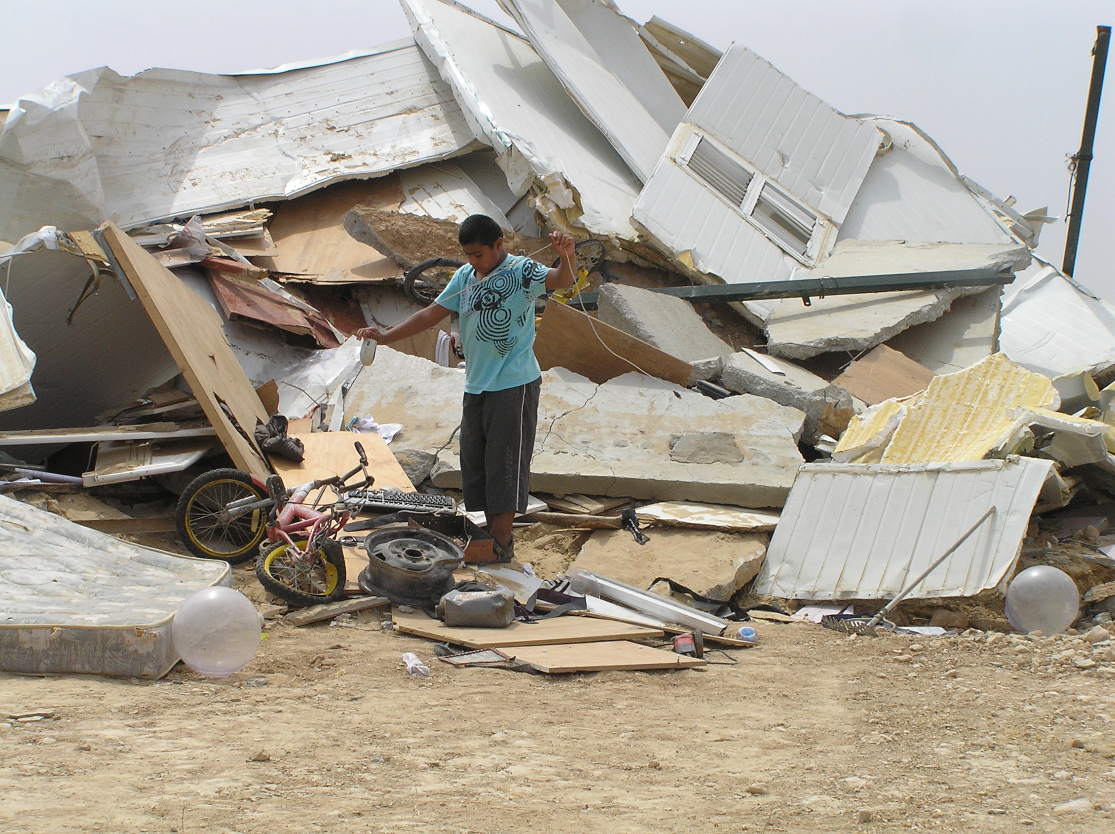
Source: Wikimedia Commons — Emanuel Yellin — Public domain.
Hebraization continues: Jerusalem and road signs
Hebraization did not end in the 1950s. Palestinian scholar Prof. Mustafa Kabha, director of the Beit al-Dhakira heritage institution in Nazareth, estimates that the occupation authorities have renamed some 80,000 places since the Nakba, including towns, valleys, mountains, streets and buildings, according to Arabi Post.
Jerusalem: 22,000 names
In Jerusalem alone, specialists estimate the number of renamed places and streets at about 22,000. Examples include:
- Bab al-Asbat road became "Mota" street, after officer Mordechai Gur, who led the occupation of Jerusalem in 1967.
- Bab al-Zahra street was named after the founder of the Israel Antiquities Authority.
- The road between Bab al-Khalil and Bab al-Amud became "Paratroopers Road."
- The Mount of Olives became "Har HaMishha."
- Five alleys in Batn al-Hawa in Silwan were named after rabbis.
Road signs: the disappearance of "al-Quds"
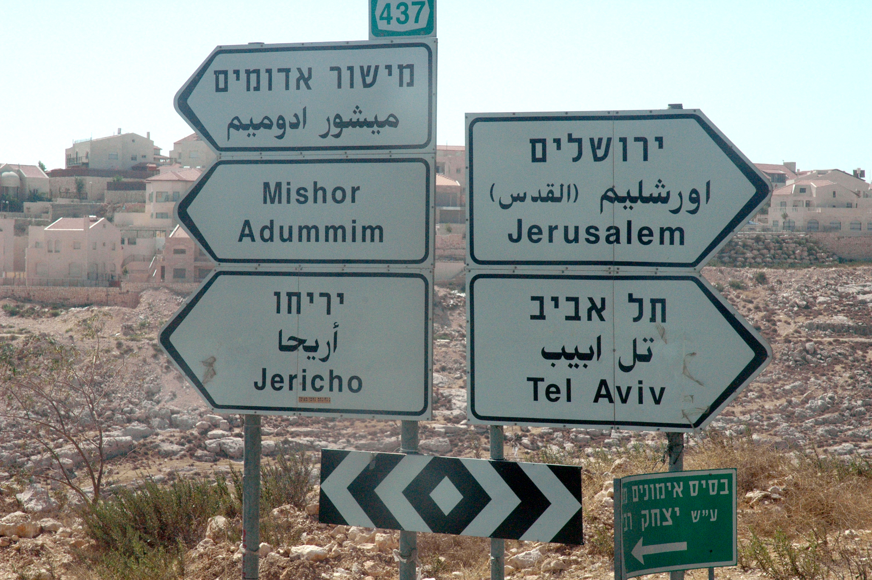
Palestinian writer Umar al-Ghubari notes that signs on Highway 1 to Jerusalem now omit the Arabic name "al-Quds," which used to appear in parentheses next to "Urshalim," according to +972 Magazine. Even where a sign carries an Arabic name, only the Hebrew name is used in official documents.
The "Yerushalayim in Arabic letters" plan
The occupation government went further. In 2009, Israeli Transport Minister Yisrael Katz proposed standardising place names on signs to match the Hebrew, even in Arabic and English. Under his plan, the Arabic name "al-Quds" on signs would be replaced with "Yerushalayim" written in Arabic letters.
Katz argued that the issue should rest on the Zionist outlook and the narrative of the "Jewish democratic state." MK Ahmad Tibi replied: "Al-Quds will remain al-Quds," according to Ynet.
From the map to the law: the 2018 Nation-State Law
In July 2018 the Knesset passed the "Basic Law: Israel – the Nation-State of the Jewish People," known as the Nation-State Law. In Article 4, it made Hebrew "the language of the state" on its own and gave Arabic a "special status," according to the Israel Law Review.
Arabic had been regarded by many jurists and courts as an official language on the basis of Article 82 of the 1922 King's Order in Council from the British Mandate. The new law was widely seen as a downgrade, from an official language to one with "special status." The same law also declared that the state views "the development of Jewish settlement as a national value."
In protest at the law, one Arab lawmaker submitted his resignation written in Arabic. The Knesset speaker refused to sign it, saying he could not sign a letter he could not read, according to Language Magazine.
The circle was thus complete: Hebraization began by changing place names on maps after the Nakba, and ended by lowering the status of the Arabic language itself in the occupation state's basic law.
How Palestinians resist the erasure of names
In the face of the Hebraization of the map, Palestinians preserve the names of their villages in many ways:
- In the camps: refugees name their neighbourhoods and quarters after their original villages.
- In family memory: Palestinians still identify themselves by their grandparents' village, even when born in exile.
- In documentation: institutions such as Beit al-Dhakira document the original names, as does the Our Palestine encyclopedia's section on depopulated villages.
- In marches: every year, Palestinians inside the lands occupied in 1948 hold Return Marches to depopulated villages, carrying signs with their Arabic names.
The Hebraization of the map is not a linguistic detail. It is the quiet continuation of the Nakba: someone expelled from their land may one day return, but someone whose name is erased is meant never to have existed. That is why preserving a village's name is preserving the right to return to it.
Frequently asked questions about the Hebraization of Palestinian village names
What does the Hebraization of Palestinian names mean?
It is a policy pursued by the Zionist occupation after the Nakba to replace the Arabic names of Palestine's towns, villages, mountains and valleys with Hebrew ones, through official government committees.
When did the Hebraization of the Palestinian map begin?
It began on a limited scale in 1925 with the Jewish National Fund's naming committee, and became official policy after the Nakba, when Ben-Gurion set up the Negev Names Committee in July 1949.
What did Ben-Gurion say about Arabic names?
He wrote to the chair of the Negev Names Committee: "We are obliged to remove the Arabic names for reasons of state."
How many Arabic names has the Israeli occupation changed?
The Government Names Committee proposed about 3,000 Hebrew names between 1949 and 1958 alone. Prof. Mustafa Kabha estimates that some 80,000 places have been renamed since the Nakba, about 22,000 of them in Jerusalem.
What are examples of renamed Palestinian towns?
Yafa became "Yafo," Akka became "Akko," Yibna became "Yavne," and Jerusalem appears as "Urshalim" on road signs after its Arabic name was removed.
What is the Palestinian name of Eilat?
Umm al-Rashrash. It was a police post on the Gulf of Aqaba captured by Israeli forces on 10 March 1949, and the Negev Names Committee named it "Eilat" the same year.
What is the original name of Ashkelon?
al-Majdal, or Majdal Asqalan. The occupation deported its remaining people to Gaza in 1950, and its name changed several times until it became "Ashkelon" in 1953.
How did the Nation-State Law affect the Arabic language?
The 2018 Nation-State Law made Hebrew "the language of the state" alone and gave Arabic a "special status," widely seen as a downgrade from its official status dating back to the British Mandate.
How many times has the occupation demolished al-Araqib?
235 times by January 2025, since its first complete demolition on 27 July 2010. It is one of about 35 unrecognised villages in the Naqab.
What does "harus" mean on Israeli maps?
It means "destroyed" in Hebrew. It was written over Palestinian villages destroyed in the Nakba on 1950s maps, before many of them were removed from the maps entirely.
Read more on Our Palestine
- Depopulated Palestinian villages and towns
- The Palestinian Nakba
- Palestine before the Nakba
- All Palestinian heritage articles on Our Palestine
Sources
- Sacred Landscape: The Buried History of the Holy Land since 1948, Meron Benvenisti, Chapter 1, University of California Press
- Government Naming Committee, Wikipedia
- (Re)naming the landscape: The formation of the Hebrew map of Israel 1949-1960, Maoz Azaryahu and Arnon Golan, Journal of Historical Geography, 2001
- How we learned to forget the villages we destroyed, review of Noga Kadman's book, +972 Magazine, 3 October 2016
- How Israel erases Arabic from the public landscape, Umar al-Ghubari, +972 Magazine, 22 November 2015
- It changed the names of 80,000 places since the Nakba: why does "Israel" rename streets in Palestine? (Arabic), Ali Ibrahim, Arabi Post, 8 October 2021
- Eilat, Wikipedia
- Umm al-Rashrash, Zochrot
- Ashkelon, Wikipedia
- Ein Hod: the ethnically cleansed Palestinian village that became an Israeli artists' colony, Samah Watad, Middle East Eye, 14 May 2026
- Shilo (Israeli settlement), Wikipedia
- This Bedouin village has been demolished by Israel 120 times, +972 Magazine, 29 October 2017
- For the 235th time, Israel demolishes the Arab village of al-Araqib in the Naqab (Arabic), Al Jazeera Net, 28 January 2025
- Gov't to transcribe al-Quds to Yerushalayim?, Ynet, 3 July 2011
- The Nation State Law and the Arabic Language in Israel, Mohammed S. Wattad, Israel Law Review, 2021
- Arabic downgraded in Israel, Language Magazine, 14 August 2018
More from the archive
 Palestinian heritage
The Dead Sea Scrolls: How the Israeli Occupation Seized a Palestinian Treasure Found on the Eve of the Nakba
 Palestinian heritage
Gaza's Heritage Under Genocide: The Great Omari Mosque, Pasha's Palace and Central Archives
 Palestinian heritage
The Jaffa Orange: How Palestine's Orange Became an Israeli "Jaffa" Brand
 Download Our Palestine App
The whole archive in the palm of your hand: depopulated villages, the Nakba, the massacres and Al-Aqsa — free, with no ads to erase the story.
Comments
No comments yet — be the first to write one.
Add your comment
Name and email are optional. Comments appear after review.