
The depopulated village of al-Manshiyya (Acre) / District of Akka (Acre)

Subdistrict: Acre Subdistrict
Estimated Palestinian population of al-Manshiyya in 1948: Approximately 940
Date of occupation and depopulation: 14 May 1948
Military operation and unit: Operation Ben-Ami; Carmeli Brigade
Israeli settlements established on al-Manshiyya’s lands before 1948: None
Israeli settlements and neighbourhoods established on or expanded over al-Manshiyya’s lands after 1948: Shomrat, Bustan HaGalil and the eastern neighbourhoods of Acre, including Neve Aviv, Moriah and Ben-Gurion. Local accounts also associate other adjoining neighbourhoods with the former village lands, although their precise boundaries require cadastral verification.
Al-Manshiyya, Acre
Al-Manshiyya was a Palestinian village in the Acre Subdistrict. It was situated approximately 2–3 kilometres northeast of Acre on a sandstone plateau in the northwestern section of the Acre Plain. The variation in the reported distance reflects differences between measurements from the village site and from the administrative centre of Acre.
The village stood about 2 kilometres north of the al-Na'amin River. Approximately half a kilometre to the west ran the al-Basha Canal, which carried water from the springs of al-Kabri to Acre.
A short secondary road connected al-Manshiyya with the coastal highway leading to Acre. Its proximity to the city enabled residents to benefit from Acre’s transportation network, markets and other public services.
Boundaries and Neighbouring Villages
Al-Manshiyya was surrounded by the following Palestinian villages and towns:
- North: al-Sumayriyya.
- Southwest: Acre.
- East: Makr.
- Northeast: Kafr Yasif.
History and Architectural Character
Local tradition maintained that al-Manshiyya was established after the Crusader period and that the Mamluks brought its early inhabitants from North Africa to repopulate an area affected by warfare and epidemics. This account remains a local historical tradition rather than a conclusively documented chronology.
The village does not appear in the Ottoman tax registers of 1596, indicating either that it did not exist as an independent taxable settlement at that time or that it had temporarily declined. By the late nineteenth century, al-Manshiyya was once again inhabited.
Contemporary surveys described it as a village on a plain surrounded by cultivable land. Its houses were built of stone and mud, and its population was estimated at approximately 150.
By the early twentieth century, al-Manshiyya had developed a broadly square plan. Houses made of stone, cement and mud were grouped closely together. The village’s Palestinian population was entirely Muslim.
Al-Manshiyya contained a mosque known as the Abu Ataba Mosque, an Islamic orphanage and the Shrine of Baha' Allah. Baha' Allah, the founder of the Baha'i faith, died near Acre in 1892, and his shrine and the surrounding gardens became an important Baha'i religious site.
Economy of al-Manshiyya
The village economy was based primarily on agriculture, particularly cereal cultivation, as well as animal husbandry. Citrus fruit, bananas and orchard crops were also cultivated.
In 1944/45, 253 dunams of Palestinian-owned land were devoted to citrus and bananas, 10,818 dunams to cereal cultivation, and 619 dunams were irrigated or used for orchards. Jewish-owned land included 1,793 dunams used for cereals and 2 dunams of irrigated land or orchards. A further 5 dunams of public land were allocated to cereals.
Land Ownership in al-Manshiyya, 1944/45
| Ownership category | Area (dunams)* |
|---|---|
| Palestinian ownership | 12,522 |
| Jewish ownership | 1,895 |
| Public land | 469 |
| Total | 14,886 |
* One dunam equals approximately 1,000 square metres.
Land Use in al-Manshiyya, 1944/45
| Land-use category | Palestinian ownership (dunams)* | Jewish ownership (dunams)* | Public land (dunams)* | Total (dunams)* |
|---|---|---|---|---|
| Citrus and banana cultivation | 253 | 0 | 0 | 253 |
| Irrigated land and orchards | 619 | 2 | 0 | 621 |
| Olive cultivation, included within the broader agricultural classifications | 2 | 0 | 0 | 2 |
| Cereal cultivation | 10,818 | 1,793 | 5 | 12,616 |
| Built-up area | 27 | 0 | 0 | 27 |
| Cultivable land | 11,690 | 1,795 | 5 | 13,490 |
| Uncultivated land | 805 | 100 | 464 | 1,369 |
* One dunam equals approximately 1,000 square metres.
Population of al-Manshiyya
The British Mandate census of 1922 recorded 371 Palestinian residents in al-Manshiyya, all of whom were Muslims. By 1931, the population had increased to 460 residents living in 132 houses.
The 1945 Village Statistics gave a combined total of 1,080 people for the relevant statistical area: 810 Palestinian Muslims and 270 Jewish residents. The figure of 810 therefore represents al-Manshiyya’s documented Palestinian population, while the combined total should not be presented as though all 1,080 people were Palestinian villagers.
Al-Manshiyya’s Palestinian population immediately before its depopulation in 1948 has been retrospectively estimated at approximately 940. Because no new official census was conducted that year, this figure should be treated as a demographic projection.
Palestine Remembered estimated the number of refugees from al-Manshiyya and their descendants at approximately 5,770 in 1998. This was a retrospective estimate rather than a census of a single resident population.
Historical Population of al-Manshiyya
| Year | Recorded or estimated population | Notes |
|---|---|---|
| Late nineteenth century | Approximately 150 | Contemporary survey estimate. |
| 1922 | 371 Palestinians | Recorded in the British Mandate census; all residents were Muslims. |
| 1931 | 460 Palestinians | Recorded in the British Mandate census; the population lived in 132 houses. |
| 1945 | 810 Palestinians | The statistical area’s combined total was 1,080, including 270 Jewish residents. |
| 1948 | Approximately 940 Palestinians | Projected estimate rather than a new official census. |
| 1998 | Approximately 5,770 refugees and descendants | A retrospective estimate published by Palestine Remembered. |
Number of Houses in al-Manshiyya
| Year | Number of houses | Status of figure |
|---|---|---|
| 1931 | 132 | Recorded in the British Mandate census. |
| 1948 | Approximately 269 | Later estimate; no comparable official village housing census was conducted in 1948. |
Occupation and Depopulation of al-Manshiyya
Al-Manshiyya was first drawn directly into the fighting on 6 February 1948. According to the Palestinian newspaper Filastin, an armed Zionist force equipped with automatic weapons and Sten guns entered or attacked the village. The newspaper reported that the village defenders forced the attackers to withdraw and did not report any casualties.
The available evidence indicates that al-Manshiyya was occupied by the Carmeli Brigade on 14 May 1948, during the opening stage of Operation Ben-Ami. The operation, which began on 13–14 May, sought to seize Acre and the Palestinian coastal villages extending northwards towards the Lebanese border.
The surviving evidence does not provide a complete account of what happened to every resident during the attack. However, al-Manshiyya’s Palestinian population was displaced, and the destruction of the village began shortly after its occupation. Palestinian academic sources confirm that the village had been largely destroyed by June 1948.
Residents of al-Manshiyya after the Nakba
Accounts preserved by residents and their descendants indicate that some displaced families remained within Palestine, particularly in Makr, al-Judayda, Kafr Yasif and Tarshiha.
Other residents became refugees outside Palestine, including in Ayn al-Hilwa refugee camp in Lebanon, al-Yarmouk refugee camp in Syria and Iraq. The distribution of the displaced population varied between families, and no single comprehensive post-1948 register covering all former residents has been identified.
Archaeological and Historical Sites
Five graves were excavated in al-Manshiyya in 1955–56, the earliest of which was dated to approximately the thirteenth century BCE.
About 1 kilometre south of the village stood Tall al-Fukhkhar, meaning “the mound of pottery,” where remains associated with ancient Akka were uncovered. Archaeological research indicates that a small agricultural settlement existed near the tell by the fourth millennium BCE. The site later developed and was associated with Akka during the Greek and Roman periods.
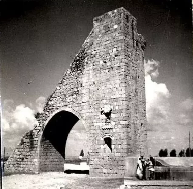
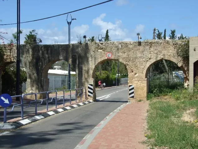
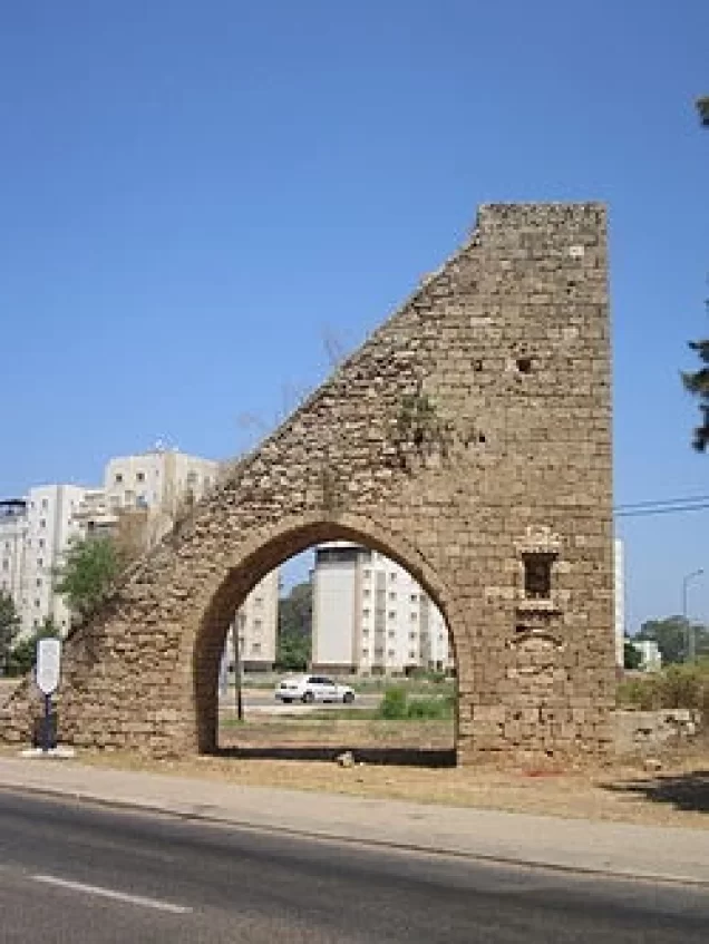
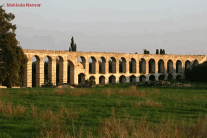
Parts of the al-Basha Canal, constructed from stone blocks to carry water from the al-Kabri springs to Acre, remain visible, although the canal is no longer operational. Remains of an associated aqueduct also survive.
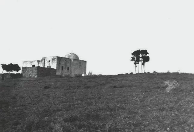
The Shrine of Baha' Allah and the surrounding Bahji gardens remain near the former village site. The shrine is a domed structure with a framed arched entrance and several graves in its adjoining grounds.
Local accounts identify Qasr Baydun and several surviving stone houses as structures associated with al-Manshiyya. One house is reportedly situated above the village well, while another, associated with Khadra Saqr, stands on what is now called Ahad Ha'Am Street. Their precise original ownership and present use require confirmation through property records.
Israeli Settlements and Construction on al-Manshiyya’s Lands
Shomrat and Bustan HaGalil were established in 1948 on al-Manshiyya’s lands north of the village site. Shomrat had initially been founded elsewhere under the name HaYotzerim before being moved to its present location in May 1948.
After the Nakba, the village site and parts of its land were incorporated into the expanding city of Acre. New residential districts were constructed in the area, including neighbourhoods identified locally as Neve Aviv, Moriah, Ben-Gurion and Neve Alon.
Local accounts state that the Western Galilee College was established in 1972 on or near the remains of the village. The exact relationship between the college grounds and the historical cadastral boundaries of al-Manshiyya requires verification through detailed land maps.
A public garden named after Lily Sharon was later established near the southern section of the former village area. This is a modern landmark and not part of the village’s pre-Nakba history.
Al-Manshiyya Today
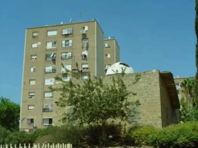
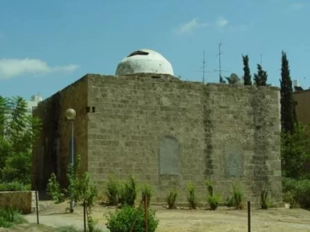
The Baha'i shrine, the village mosque, the former Islamic orphanage and several Palestinian houses survived the destruction of al-Manshiyya. Most of the remaining village buildings were demolished.
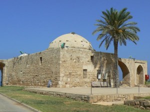
The mosque is a stone structure with a dome and vaulted ceilings. Sources differ regarding its use and condition at different times. Walid Khalidi’s field survey reported that it had been converted into a private residence, while later local Palestinian accounts describe it as closed and record damage, attempted arson and threats of demolition. These accounts may reflect changes in the building’s condition over time.
The former Islamic orphanage also survived and was reported to have been used as a residence. The village cemetery remains visible. It contains an eighteenth-century gravestone bearing an Ottoman Turkish inscription.
Some local residents believe that the gravestone may be connected with Zahir al-Umar al-Zaydani, the eighteenth-century ruler of Acre and much of Galilee, who died in 1775. This identification has not been conclusively established and should therefore be presented as a local attribution rather than a confirmed archaeological fact.
A Baha'i cemetery containing a building with a grey dome lies near the main cemetery. The shrine or maqam of Abu Ataba also survives opposite the cemetery. Local accounts report that it was later inhabited by a displaced Palestinian family originating from Kuwaykat.
Sources
- Interactive Encyclopedia of the Palestine Question (PalQuest), “al-Manshiyya—Acre”.
- Interactive Encyclopedia of the Palestine Question (PalQuest), “Operation Ben-Ami”.
- Palestine Remembered, “al-Manshiyya—Acre”.
- Our Palestine, “The Depopulated Village of al-Manshiyya—Acre”.
- Walid Khalidi, ed., All That Remains: The Palestinian Villages Occupied and Depopulated by Israel in 1948, Institute for Palestine Studies, 1992.
- Nafez Nazzal, The Palestinian Exodus from Galilee, 1948, Institute for Palestine Studies, 1978.
- Government of Palestine, Census of Palestine, 1922.
- Government of Palestine, Census of Palestine, 1931.
- Government of Palestine, Department of Statistics, Village Statistics, April 1945.
- Filastin newspaper, 7 February 1948.
Photo gallery




Photos from the village's people
Photos sent in by visitors and published after review.
Add a photo of this village
Log in to add photos of this village.
Other villages from Akka (Acre)
 Download Our Palestine App
The whole archive in the palm of your hand: depopulated villages, the Nakba, the massacres and Al-Aqsa — free, with no ads to erase the story.
Download Our Palestine App
The whole archive in the palm of your hand: depopulated villages, the Nakba, the massacres and Al-Aqsa — free, with no ads to erase the story.



Comments
No comments yet — be the first to write one.
Add your comment
Name and email are optional. Comments appear after review.