
The depopulated village of Al-Shaykh Muwannis / District of Jaffa
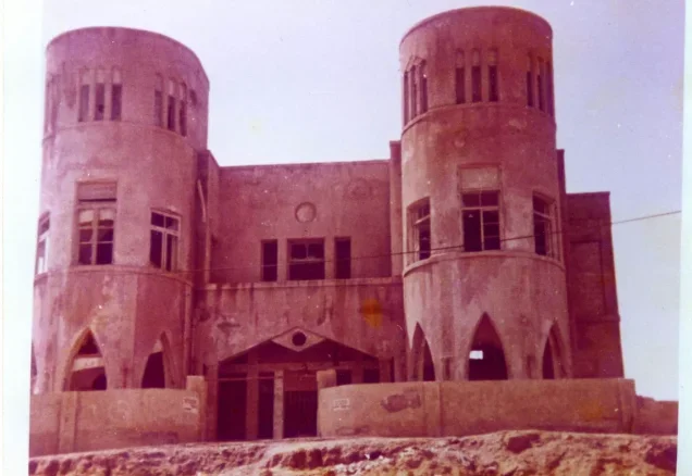
Subdistrict: Jaffa
Estimated population in 1948: approximately 2,239
Date of occupation and depopulation: 30 March 1948
Settlement established before 1948 on land associated with the village: Tel Barukh, now part of Tel Aviv. Sources differ regarding the precise historical boundaries and attribution of this land.
Al-Shaykh Muwannis was a Palestinian village depopulated during the Nakba. It was located in the Jaffa Subdistrict, approximately 8.5 kilometres from the centre of Jaffa, about 2.5 kilometres from the Mediterranean coast, and 800 metres north of the al-'Awja River.
- The village stood on a sandstone hill on the central coastal plain, approximately 2.5 kilometres from the Mediterranean coast and 800 metres north of the al-'Awja River.
- It appears to have been named after a local religious figure, al-Shaykh Muwannis, whose tomb-shrine, or maqam, stood in the village.
- Its built-up area followed a broadly square layout.
- The villagers initially built their houses from adobe brick. As income from citrus cultivation and exports increased, residents began constructing new houses from stone and cement.
- Al-Shaykh Muwannis had two elementary schools: a boys’ school, opened in 1932, and a girls’ school, opened in 1943.
Boundaries of al-Shaykh Muwannis
Al-Shaykh Muwannis was bordered by the following villages and geographical features:
- North: Ijlil al-Qibliyya.
- West: the Mediterranean Sea.
- South: al-Jammasin al-Gharbi.
- Southeast: Jarisha.
- East: al-Jammasin al-Sharqi.
- Northeast: al-Sawalima.

Land of al-Shaykh Muwannis
The registered lands of al-Shaykh Muwannis covered 15,972 dunams. According to the 1945 Village Statistics, 11,456 dunams were under Palestinian ownership, 3,545 dunams were under Jewish ownership, and 971 dunams were classified as public land. Cultivable land totalled 14,514 dunams, while the village’s built-up area covered 41 dunams.
Land Ownership in al-Shaykh Muwannis
| Ownership category | Land area (dunams)* |
|---|---|
| Palestinian ownership | 11,456 |
| Jewish ownership | 3,545 |
| Public land | 971 |
| Total | 15,972 |
* One dunam equals approximately 1,000 square metres.
Land Use in al-Shaykh Muwannis in 1945
| Land-use category | Palestinian ownership (dunams)* | Jewish ownership (dunams)* | Public land (dunams)* | Total (dunams)* |
|---|---|---|---|---|
| Citrus and banana cultivation | 3,749 | 690 | 0 | 4,439 |
| Irrigated land and orchards | 69 | 18 | 0 | 87 |
| Cereal cultivation | 7,165 | 2,803 | 20 | 9,988 |
| Built-up area | 41 | 0 | 0 | 41 |
| Cultivable land | 10,983 | 3,511 | 20 | 14,514 |
| Uncultivated land | 432 | 34 | 951 | 1,417 |
* One dunam equals approximately 1,000 square metres.
Architecture of al-Shaykh Muwannis
The village had a broadly square layout. Its earliest houses were generally built of adobe brick. As the villagers’ income from citrus cultivation and exports increased, residents began constructing newer houses from stone and cement.
Population of al-Shaykh Muwannis
A nineteenth-century estimate recorded approximately 315 inhabitants in 1879. Under the British Mandate, the 1922 census counted 664 residents, all of them Muslims. By the 1931 census, the population had risen to 1,154 people living in 273 houses. The 1945 Village Statistics estimated the population at 1,930 Palestinian Arabs, all recorded as Muslims.
Population Figures for al-Shaykh Muwannis
| Year | Population* |
|---|---|
| 1922 | 664 |
| 1931 | 1,154 |
| 1945 | 1,930 |
| 1948 estimate | Approximately 2,239 |
| Estimated refugee population in 1998 | 13,749 |
* The figures for 1922 and 1931 are census results, while the 1945 figure is an official British Mandate estimate. The figures for 1948 and 1998 are later demographic estimates rather than contemporary census counts. Estimates vary between sources.
Number of Houses in al-Shaykh Muwannis
| Year | Number of houses |
|---|---|
| 1931 | 273 |
| 1948 estimate | 529 |
* The 1931 figure comes from the British Mandate census. The 1948 figure is a later estimate rather than an official census count.
Economic Life in al-Shaykh Muwannis
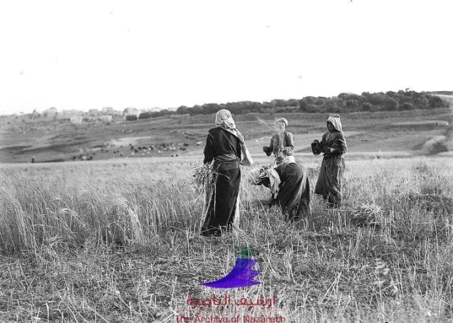
Agriculture formed the principal basis of the village economy, particularly citrus cultivation and related occupations. In 1944/45, 3,749 dunams under Palestinian ownership were devoted to citrus fruits and bananas, 7,165 dunams were used for cereal cultivation, and 69 dunams were irrigated or planted with orchards.
Across all ownership categories, citrus and banana cultivation covered 4,439 dunams, while cereal cultivation covered 9,988 dunams. Irrigation water was drawn from the al-'Awja River and numerous artesian wells.
Education in al-Shaykh Muwannis
Al-Shaykh Muwannis had two elementary schools: one for boys and another for girls. The boys’ school opened in 1932, while the girls’ school opened in 1943. Records cited by the Interactive Encyclopedia of the Palestine Question indicate that 232 boys were enrolled in 1941 and 56 girls in 1943.
The boys’ school acquired 36 dunams of land and an artesian well. It also functioned as a centre for agricultural and vocational training.
Occupation and Depopulation of al-Shaykh Muwannis
Al-Shaykh Muwannis was depopulated during the Nakba, before the end of the British Mandate on 15 May 1948. Its proximity to Tel Aviv, together with that of the neighbouring village of Abu Kishk, exposed the area to military pressure and attacks during the Zionist campaign that preceded Israel’s occupation of large parts of Palestine.
The village’s depopulation unfolded gradually rather than through a single documented battle. Village representatives had previously reached a non-aggression arrangement with the Haganah. Nevertheless, on 12 March 1948, members of the Irgun or Lehi abducted five village notables. A contemporary Israeli intelligence report later identified the abduction as an important factor in the flight of Palestinians from al-Shaykh Muwannis and other villages in the central coastal region.
The abducted men were subsequently transferred to the Haganah and returned to the village on 23 March. By that time, however, fear generated by the abduction, together with restrictions on movement, intimidation, looting, and armed attacks, had contributed to the departure of much of the population.
The depopulation continued during the second half of March and was effectively complete by 30 March 1948. This date is therefore commonly recorded as the date of the village’s occupation and depopulation.
Palestinian historian 'Arif al-'Arif later noted that Zionist forces had gained control of the coastal area extending between Haifa and Tel Aviv by the end of the British Mandate. The occupation and depopulation of al-Shaykh Muwannis formed part of the broader displacement of the Palestinian population during the Nakba and Israel’s occupation of Palestine.
Al-Shaykh Muwannis Today
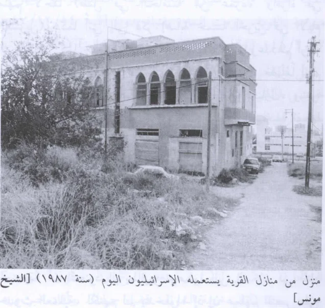
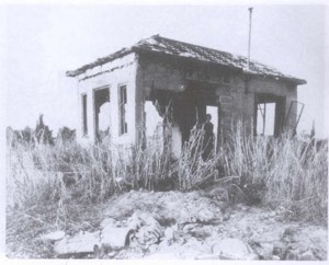
A number of houses displaying varied architectural features remained standing after the village’s depopulation and were subsequently occupied by Jewish families. One surviving structure is a two-storey cement house with a single-storey annex, rectangular doors and windows, and flat roofs.
Another surviving building is a symmetrical two-storey house divided into two residential units. Its upper floor has two front porches, each framed by five lancet arches.
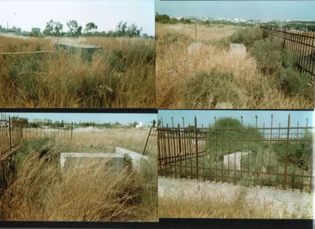
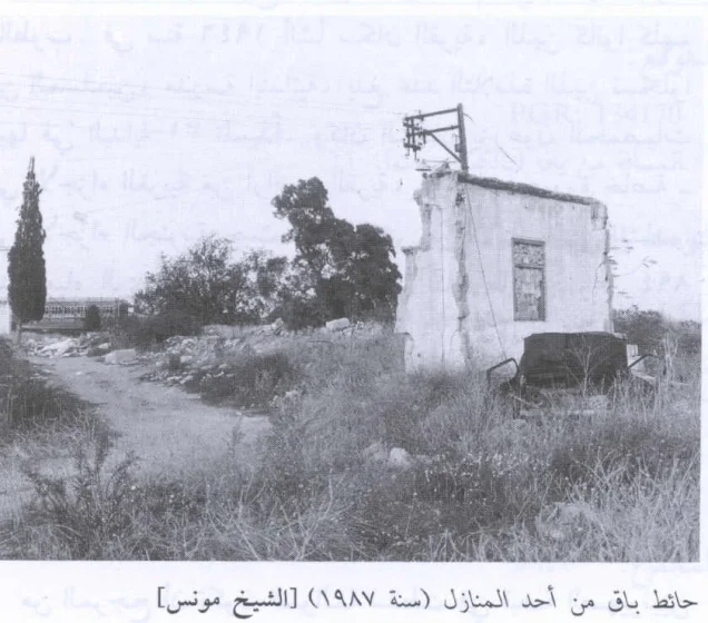
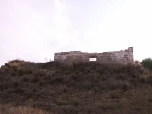
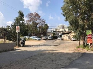
Other parts of the village were demolished, leaving isolated walls and building debris. The former cemetery became neglected and fenced. The village lands were incorporated into the municipal area of Tel Aviv and were largely covered by urban development and construction. Tel Aviv University occupies part of the historical village site and its surrounding land.
Sources and References
- Institute for Palestine Studies and PalQuest, “al-Shaykh Muwannis.” Consulted for the village’s location, population, land ownership, land use, educational institutions, economy, depopulation, and remaining structures.
- PalQuest, “Israeli Intelligence Report on the Depopulation of Palestine, 30 June 1948.” Consulted regarding the effect of the abduction of five village notables on the displacement of Palestinians from al-Shaykh Muwannis and the surrounding area.
- Government of Palestine, Department of Statistics, Village Statistics, April 1945. The population, land ownership, and land-use figures are also reproduced in Sami Hadawi, Village Statistics 1945: A Classification of Land and Area Ownership in Palestine.
- Government of Palestine, Census of Palestine, 1922, and Census of Palestine, 1931. These British Mandate records provide the official census figures and the recorded number of occupied houses.
- Marom, Roy, “Al-Sheikh Muwannis: Transformations in the Arab Countryside between the Mountainous Interior and the City of Jaffa.” Cathedra, no. 183, 2023.
- Palestine Remembered, “al-Shaykh Muwannis, Jaffa Subdistrict.” Consulted for supplementary village documentation and later demographic estimates.
Photo gallery






Photos from the village's people
Photos sent in by visitors and published after review.
Add a photo of this village
Log in to add photos of this village.
Other villages from Jaffa
 Download Our Palestine App
The whole archive in the palm of your hand: depopulated villages, the Nakba, the massacres and Al-Aqsa — free, with no ads to erase the story.
Download Our Palestine App
The whole archive in the palm of your hand: depopulated villages, the Nakba, the massacres and Al-Aqsa — free, with no ads to erase the story.



Comments
No comments yet — be the first to write one.
Add your comment
Name and email are optional. Comments appear after review.