
The depopulated village of Al-'Abbasiyya (Yahudiyya) / District of Jaffa
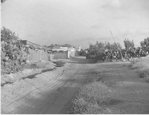
Al-'Abbasiyya (Yahudiyya)
About the depopulated village of Al-'Abbasiyya (Yahudiyya)
- District
- Jaffa
- Date Al-'Abbasiyya (Yahudiyya) was occupied
- 10 July 1948
- Population in 1948
- 6,554
- Military operation
- Operation Dani
- Brigade that carried it out
- Home Guard
- Distance from the governorate centre
- 13 km east of Jaffa
- Elevation above sea level
- 50 m
- Cause of displacement
- Direct military assault by Zionist forces (the Irgun); Khalidi considers it probable that the inhabitants were expelled during the assault that began on the night of 3 May 1948
- Extent of destruction
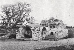
- On 13th of September 1948, the al-'Abbasiyya was mostly destroyed with the exception of the village mosque and al-Nabi Huda's shrine.
- Ethnic cleansing
- On May 3rd 1948, village inhabitants were ethnically cleansed soon after the attack on the village by the Irgun terror gang.
- Settlements built on the built-up area of Al-'Abbasiyya (Yahudiyya) after 1948
- Yehud, established on the village site in 1948; Magshimim, built east of the site in 1949; and Ganne Yehuda (1951), Ganne Tiqwa (1953) and Savyon (1954). All were established on lands belonging to al-'Abbasiyya, as was Ben-Gurion airport
Hover a dot to read the village name, or click to open its card.
Borders of the depopulated village of Al-'Abbasiyya (Yahudiyya)
al-'Abbasiyya: A Depopulated Palestinian Village in the Jaffa District
al-'Abbasiyya, formerly known as al-Yahudiyya, was a Palestinian village in the Jaffa District. It stood on flat terrain on the central coastal plain approximately 13 kilometres east of Jaffa, at an average elevation of about 50 metres above sea level. The 1944/1945 statistical unit recorded 5,650 Arabs and 150 Jews, for a total population of 5,800. Irgun forces first occupied the village on 4 May 1948 after an assault that began the previous night, and most of the Palestinian population was probably displaced during this stage. Arab forces regained the village in June, before Israeli forces finally occupied it on 10 July 1948 during Operation Dani.
- Subdistrict
- Jaffa
- Distance from district center
- 13 km east of Jaffa
- Average Elevation
- 50 m above sea level
- Population in 1931
- 3,258
- Number of Houses in 1931
- 772
- Population in 1944/1945
- 5,650 – Arab population; the same statistical unit also recorded 150 Jews (total 5,800)
- Estimated Population in 1948
- About 6,554 – a later demographic estimate, not an official census
- Total Land Area in 1945
- 20,540 dunams
- Attack and Depopulation
- The Irgun attacked the village on 13 December 1947, killing seven people and seriously wounding seven others, two of whom later died; it then occupied the village on 4 May 1948 after an assault that began on the night of 3 May, during which the inhabitants were probably expelled. After Arab forces regained the village on the eve of the first truce (11 June 1948), Israeli occupation forces finally captured it on 10 July 1948 during Operation Dani.
- Final Israeli Control
- 10 July 1948, during Operation Dani; the Irgun had first occupied the village on 4 May 1948 and was forced to withdraw from it on the eve of the first truce (11 June 1948)
- Military Operation
- Operation Dani (final occupation); PalQuest also lists the village among those affected by Operation Hametz (24 April – 13 May 1948), during which the Alexandroni Brigade took control of the area around the village before the Irgun occupied it on 4 May 1948
- Military Unit
- The Irgun (the attack of 13 December 1947 and the first occupation on 4 May 1948); units of the Israeli Home Guard (the final occupation on 10 July 1948); the Haganah's Alexandroni Brigade had taken control of the area around the village in late April 1948
- Cause of Depopulation
- Direct military assault by Zionist forces (the Irgun); Khalidi considers it probable that the inhabitants were expelled during the assault that began on the night of 3 May 1948
- Settlements Documented on Village Lands
- Yehud, established on the village site in 1948; Magshimim, built east of the site in 1949; and Ganne Yehuda (1951), Ganne Tiqwa (1953) and Savyon (1954). All were established on lands belonging to al-'Abbasiyya, as was Ben-Gurion airport
Location
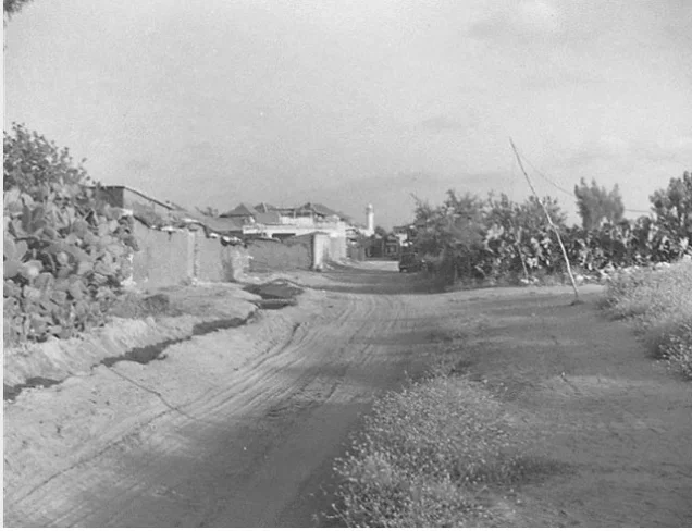
al-'Abbasiyya stood on flat terrain on the central coastal plain approximately 13 kilometres east of Jaffa and at an average elevation of about 50 metres above sea level.
Major roads linked it with Jaffa, Lydda, and Ramla, while the Jaffa–Lydda railway passed immediately south of the village.
Lydda airport stood approximately 4 kilometres to the south, giving al-'Abbasiyya an important position within the transportation network between Jaffa, Lydda, and Ramla.
Name and Historical Background
Until 1932, the village was known as al-Yahudiyya.
Walid Khalidi and PalQuest associate the village site with a settlement called Yehud in ancient sources and record a form of the name Iudaea during the Roman period, followed by al-Yahudiyya in a later period.
Because the exact identification of the modern village with ancient settlements requires specialized archaeological and historical study, this association is presented as a historical identification found in the reference sources rather than as an independently established archaeological certainty.
In 1596, the village belonged to the nahiya of Ramla in the Gaza district and had an estimated population of approximately 693.
The inhabitants paid taxes on wheat, barley, fruit, sesame, goats, beehives, and other forms of production.
In the mid-eighteenth century, the Sufi traveller al-Bakri al-Siddiqi visited the village and recorded the shrine of al-Nabi Huda.
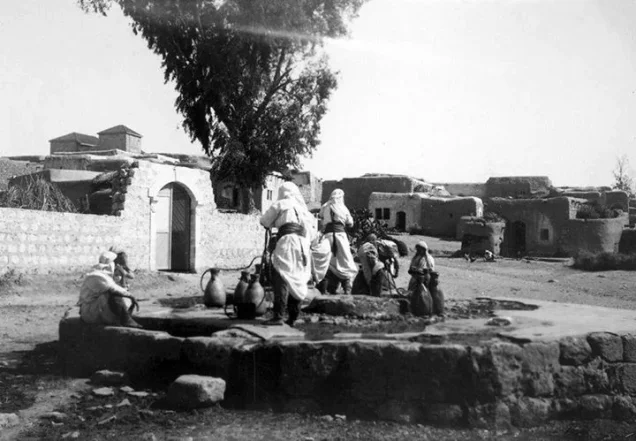
By the late nineteenth century, the population was estimated at between 800 and 1,000. The village was built largely of adobe and surrounded by palm trees, with water obtained from a nearby pond.
The Renaming of the Village
In 1932, the inhabitants changed the village's name from al-Yahudiyya to al-'Abbasiyya.
The new name primarily commemorated Shaykh al-'Abbas, who was buried in the village, while also alluding to the Abbasid dynasty.
At that time the overwhelming majority of the population was Muslim, with a small Christian minority.
Mosques and Shrines
al-'Abbasiyya had two mosques.
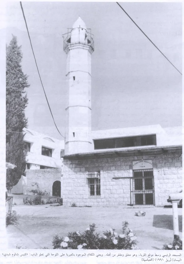
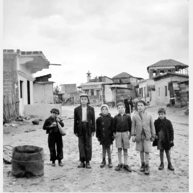
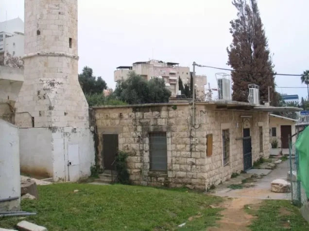
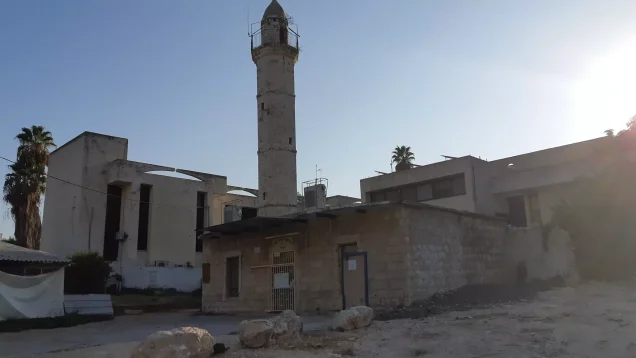
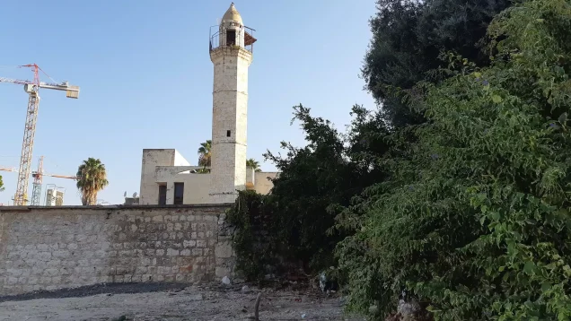
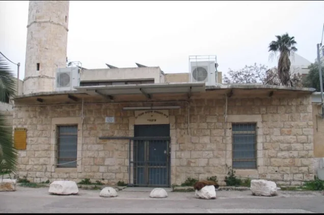
The main mosque was built of stone and had a minaret approximately 21 metres high. It originally stood near the centre of the village before later expansion surrounded it.
A second, smaller mosque stood in the northwestern part of the village.
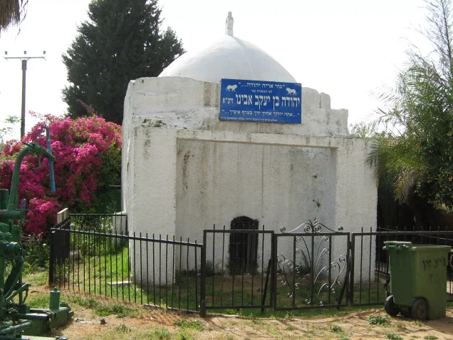
Shrine of al-Nabi Huda
The shrine of al-Nabi Huda was one of the principal religious landmarks of al-'Abbasiyya and was recorded in historical writing dating to the eighteenth century.
The stone, domed shrine survived the Nakba according to the field documentation relied upon by Walid Khalidi.
Population
The 1922 census recorded 2,437 inhabitants in al-'Abbasiyya.
By the 1931 census, the population had risen to 3,258 people living in 772 houses.
The 1944/1945 statistical unit recorded a total population of 5,800, including 5,650 Arabs and 150 Jews.
The Arab population of the village should therefore be distinguished from the total statistical-unit population.
The figure of approximately 6,554 inhabitants in 1948 is a later estimate rather than an official British Mandate census figure, and Palestine Remembered presents it as including 150 Jews.
Palestine Remembered estimates the number of Palestinian refugees and their descendants at approximately 40,249 in 1998.
Population of al-'Abbasiyya
- 1596About 693Historical estimate based on Ottoman records
- Late nineteenth centuryAbout 800–1,000Historical estimate
- 19222,437Official census
- 19313,258Official census; 772 houses
- 1944/19455,8005,650 Arabs and 150 Jews in the statistical unit
- 1948About 6,554Later estimate including 150 Jews
- 199840,249Estimate of Palestinian refugees and their descendants
Number of Houses
The 1931 census recorded 772 houses in al-'Abbasiyya.
The estimate of approximately 1,553 houses in 1948 is a later figure rather than an official census count.
Education
al-'Abbasiyya had two schools, one for boys and another for girls.
The boys' school was established in 1919 and became a junior high school in 1941.
It had fourteen teachers and an enrollment of 293 pupils, making it one of the largest village schools in the Jaffa subdistrict.
Approximately 27 dunams of land were attached to the school for agricultural training.
The girls' school opened in 1943 with an initial enrollment of 101 pupils.
al-Nadi al-'Abbasi and the Local Council
The inhabitants established a social and cultural club known as al-Nadi al-'Abbasi.
The club maintained a library and sponsored a football team.
A local council was established in 1945, with village residents appointed to serve on it. Its responsibilities included improving social services and paving local roads.
Economic Life
Agriculture formed the principal basis of al-'Abbasiyya's economy, particularly citrus, bananas, cereals, and orchards.
Numerous artesian wells supplied irrigation water.
Some villagers also wove mats from papyrus brought from the marshes of Lake al-Hula.
During World War II, villagers began raising Holstein cattle.
A weekly Saturday market attracted residents from nearby villages to trade agricultural products, animals, and textiles.
Land Ownership
According to the 1944/1945 statistics, al-'Abbasiyya had a total land area of 20,540 dunams.
Arab ownership amounted to 17,499 dunams, Jewish ownership to 1,135 dunams, while 1,906 dunams were classified as public land.
Land Ownership in al-'Abbasiyya in 1944/1945
- Arab ownership17,499 dunums85%
- Jewish ownership1,135 dunums6%
- Public land1,906 dunums9%
Land Use
The detailed statistics show that some later tables combined public land with Arab-owned land.
Citrus and banana cultivation covered 4,099 dunams: 3,879 Arab-owned and 220 Jewish-owned.
A further 1,019 Arab-owned dunams were irrigated or used for plantations.
Cereals covered 14,465 dunams: 12,348 Arab-owned dunams, 915 Jewish-owned dunams, and 1,202 dunams of public land.
The built-up area covered 101 Arab-owned dunams.
Uncultivable land covered 856 dunams: 152 Arab-owned dunams and 704 dunams of public land.
Palestine Remembered records approximately 450 dunams planted with olive trees. This represents a crop category within cultivated land and should not be added separately to the overall land-use total.
Land Use in al-'Abbasiyya in 1944/1945, in Dunams
- Arab
- Jewish
- Public
- Citrus and bananas4,099 dunums
- Irrigated and plantation land1,019 dunums
- Cereals14,465 dunums
- Built-up area101 dunums
- Uncultivable land856 dunums
Attacks Before the Occupation
al-'Abbasiyya was subjected to repeated attacks beginning in late 1947.
On 13 December 1947, an Irgun force attacked the village. According to the account transmitted by Walid Khalidi and PalQuest, attackers entered in several vehicles, planted explosives near houses, and used firearms and hand grenades.
Reports cited by the source stated that seven Palestinians were initially killed and that two of the seriously wounded later died.
The village was subjected to another Zionist attack on 24 February 1948.
Operation Hametz
Operation Hametz began on 24 April 1948 and continued until 13 May.
Its immediate objective was to occupy the major Palestinian villages east and south of Jaffa, isolate the city from its hinterland, and facilitate its capture.
The operation involved the Alexandroni, Kiryati, and Giv'ati Brigades.
al-'Abbasiyya was among the affected villages, alongside Salama, al-Khayriyya, Saqiya, Kafr 'Ana, al-Safiriyya, Yazur, Bayt Dajan, and others.
In late April, the Alexandroni Brigade gained control of the area surrounding al-'Abbasiyya during Operation Hametz.
Alexandroni, however, was not the formation that directly occupied the village itself in the following stage; the direct assault that captured al-'Abbasiyya on 4 May was carried out by the Irgun.
The First Occupation and Depopulation in May 1948
The Irgun assault on al-'Abbasiyya began on the night of 3 May 1948, and the village was occupied on 4 May.
Irgun forces held the village for approximately five weeks.
Walid Khalidi and PalQuest consider it likely that most of the Palestinian inhabitants were expelled or fled during the assault beginning on 3 May.
Thus, 4 May represents the village's first occupation and the principal stage of its depopulation.
Information derived from the History of the Haganah or Israeli historians is cited here only as transmitted through Walid Khalidi and PalQuest and not through direct reliance on the original Israeli sources.
The Arab Recapture in June
On the eve of the first truce on 11 June 1948, Arab forces launched a counterattack and forced Irgun units to withdraw from al-'Abbasiyya.
Intermittent fighting continued around the village during the first days of the truce.
al-'Abbasiyya then remained in Arab hands for approximately one month.
Operation Dani and the Final Occupation
Operation Dani was conducted from 9 to 18 July 1948 and sought to expand Israeli control between the coastal area and Jerusalem and to capture Lydda, Ramla, and their surrounding region.
al-'Abbasiyya was among the villages affected by the operation.
On 10 July 1948, units of the Israeli Home Guard attacked and recaptured al-'Abbasiyya.
PalQuest records that the village fell during this stage with practically no fighting, as several villages east of Jaffa were seized in coordination with the offensive against Lydda and Ramla.
This date represents the final Israeli occupation of the village.
The two key dates should therefore be distinguished: 4 May 1948, the first Irgun occupation and principal depopulation, and 10 July 1948, the final occupation during Operation Dani.
Occupation and Depopulation Chronology
- 13 December 1947
First attack on the village
The Irgun infiltrated the village in four vehicles, set off explosive charges near several houses and left, according to the History of the Haganah as cited by Khalidi. The New York Times put the dead at seven and the seriously wounded at seven others, two of whom later died (a five-year-old child and a twenty-year-old woman), and reported that the twenty-four attackers were disguised as British soldiers.
- 24 February 1948
Second attack
A Zionist force struck at the village, according to an official British communiqué quoted by Filastin. Khalidi also reports, without a separate date, that two villagers were killed when a car belonging to the Jewish Settlement Police sped through the village and hurled a grenade at passers-by.
- 29 April 1948
Beginning of the military operation
Four days after the Irgun's frontal attack on Jaffa (25 April), the Haganah carried out Operation Hametz, which aimed to occupy the villages east and south of Jaffa in order to isolate the city, and the Haganah's Alexandroni Brigade took control of the area around al-'Abbasiyya.
- 3–4 May 1948
Temporary occupation (first occupation)
The Irgun occupied the village on 4 May as part of the general Haganah plan to expel Palestinian villagers from the coastal area between Tel Aviv and the settlement of Zikhron Ya'aqov, according to Khalidi. The New York Times reported that the attack began on the night of 3 May and that its first phase was over by about 6:00 a.m. the following morning; according to the History of the Haganah, the Irgun held the village for five weeks.
- Probably 3–4 May 1948
Expulsion of the inhabitants
Khalidi considers it probable that the village's inhabitants were expelled during the assault that began on the night of 3 May 1948.
- Eve of the first truce (11 June 1948)
Withdrawal of the attacking force
Irgun units were forced to withdraw from the village after an Arab counterattack on the eve of the first truce, according to Khalidi, and the village then remained in Arab hands for about a month.
- After 11 June 1948, in the first days of the first truce
Attack by Israeli forces stationed in Kafr 'Ana
Israeli occupation forces stationed in the neighbouring village of Kafr 'Ana attacked al-'Abbasiyya, and the fighting around the village continued 'spasmodically' for a couple of days into the truce, according to the New York Times correspondent as cited by Khalidi.
- 9 July 1948
Beginning of the military operation
After the first truce expired, Operation Dani began; its first stage (9–12 July) aimed to capture Lydda, Ramla and the villages in the attacking forces' path, and PalQuest lists al-'Abbasiyya among the villages it affected.
- 10 July 1948
Final occupation
Units of the Israeli Home Guard recaptured the village, along with a cluster of villages east of Jaffa, and it fell 'practically without any fighting', according to the History of the Haganah as cited by Khalidi. The same offensive took six neighbouring villages, and a New York Times report described it as an 'enveloping action' coordinated with the attack against Ramla and Lydda.
- 13 September 1948
Request to destroy the village
Israeli Prime Minister David Ben-Gurion asked his cabinet for permission to destroy the village, in the name of the Central Front commander Zvi Ayalon and on the grounds that there was insufficient manpower to occupy the area completely. Morris, as cited by Khalidi, does not clarify whether the request was implemented in full, and indirect evidence indicates that it was not.
- Late September 1948 (ten days after the destruction request)
Recommendation to settle Jewish immigrants in the village
The Israeli Military Government recommended settling Jewish immigrants in the village, probably in the houses that were still standing, according to Khalidi.
- 1948
Settlement on village lands
The settlement of Yehud was established on the village site.
- 1949
Settlement on village lands
The settlement of Magshimim was built east of the village site.
- 1951–1954
Settlements on village lands
Ganne Yehuda was built in 1951, Ganne Tiqwa in 1953 and Savyon in 1954, on lands belonging to al-'Abbasiyya.
Destruction of the Village
On 13 September 1948, approval was requested from the Israeli government for the destruction of al-'Abbasiyya.
Indirect evidence transmitted by Walid Khalidi suggests that the village was not entirely demolished at that stage, since approximately ten days later the military government recommended settling Jewish immigrants in houses that apparently remained standing.
As a result, portions of the village's built environment survived the Nakba, even though much of al-'Abbasiyya was later destroyed or transformed.
Israeli Settlements on al-'Abbasiyya's Lands
Yehud
Yehud was established on the al-'Abbasiyya village site in 1948.
Magshimim
Magshimim was established east of the village site in 1949.
Ganne Yehuda
Ganne Yehuda was established on al-'Abbasiyya's lands in 1951.
Ganne Tiqwa
Ganne Tiqwa was established on village lands in 1953.
Savyon
Savyon was established on al-'Abbasiyya's lands in 1954.
Ben-Gurion Airport
Walid Khalidi and PalQuest also state that portions of Ben-Gurion Airport, formerly Lydda Airport, were established on lands belonging to al-'Abbasiyya.
- 1948Yehud
Established on the village site
- 1949Magshimim
Established east of the site on village land
- 1951Ganne Yehuda
Established on al-'Abbasiyya's lands
- 1953Ganne Tiqwa
Established on al-'Abbasiyya's lands
- 1954Savyon
Established on al-'Abbasiyya's lands
- Later expansionBen-Gurion Airport
Parts of the airport occupy land belonging to al-'Abbasiyya
al-'Abbasiyya After the Nakba
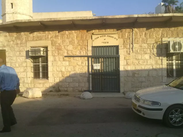
According to the field documentation relied upon by Walid Khalidi, the main mosque and the shrine of al-Nabi Huda survived.
The mosque was deserted and cracking in several places at the time of documentation, while the stone, domed shrine remained standing.
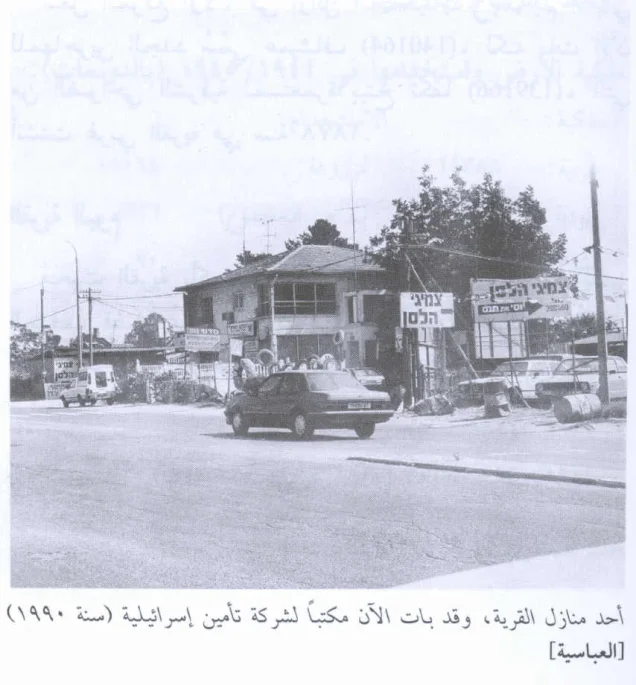
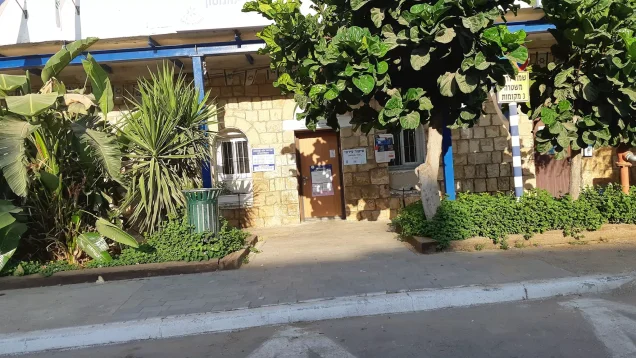
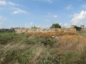
A number of Palestinian houses also survived and were used either as residences or for commercial and other purposes.
The surviving structures included concrete houses with sloping or tiled roofs and rectangular doors and windows.
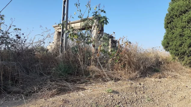
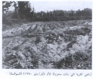
Construction covered part of the former village lands, while other areas remained neglected and became overgrown with pine and Christ's-thorn trees.
Khalidi's description reflects the condition of the site during his field documentation and should not necessarily be interpreted as a comprehensive survey updated to 2026.
Sources
- PalQuest – Interactive Encyclopedia of the Palestine Question: al-'Abbasiyya.
- PalQuest: العباسية.
- PalQuest: Operation Hametz.
- PalQuest: Operation Dani.
- Palestine Remembered: al-'Abbasiyya, Jaffa District.
- Walid Khalidi, All That Remains, entry on al-'Abbasiyya.
- Government of Palestine, censuses of 1922 and 1931.
- Government of Palestine, Department of Statistics, Village Statistics, 1945.
Photo gallery

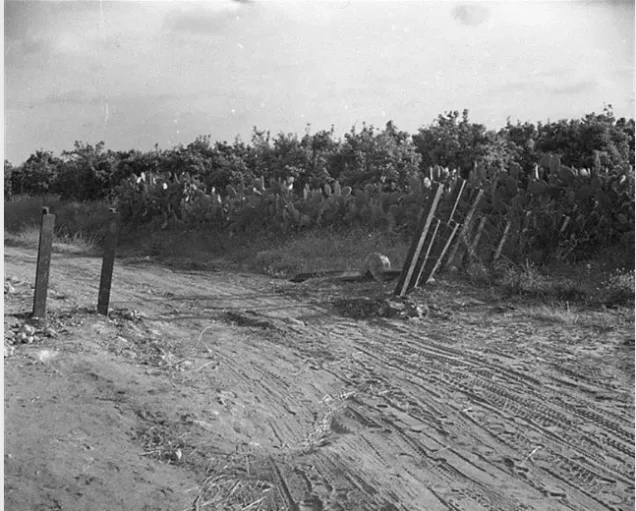
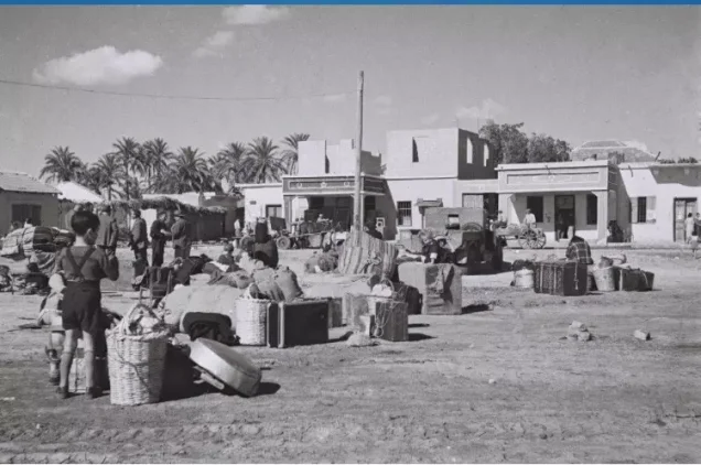
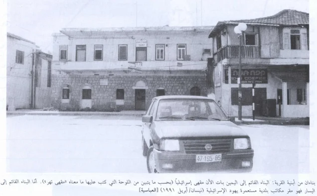
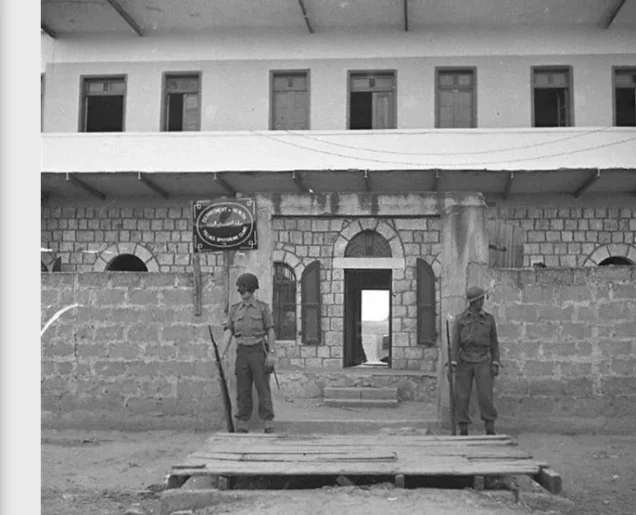
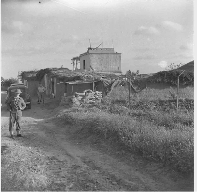
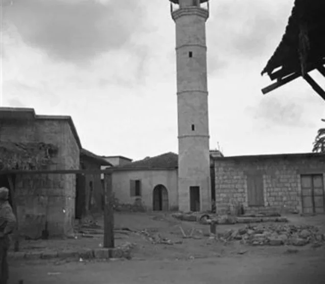
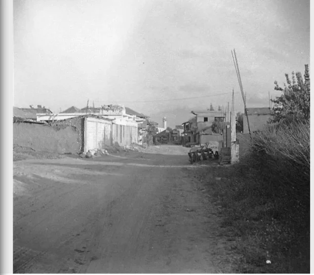





Photos from the village's people
Photos sent in by visitors and published after review.
Add a photo of this village
Log in to add photos of this village.
Other villages from Jaffa
More from the archive
 Download Our Palestine App
The whole archive in the palm of your hand: depopulated villages, the Nakba, the massacres and Al-Aqsa — free, with no ads to erase the story.
Download Our Palestine App
The whole archive in the palm of your hand: depopulated villages, the Nakba, the massacres and Al-Aqsa — free, with no ads to erase the story.



Comments
No comments yet — be the first to write one.
Add your comment
Name and email are optional. Comments appear after review.