
The depopulated village of Al-Samra / District of Tiberias
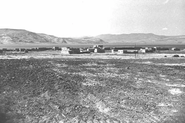
Al-Samra
About the depopulated village of Al-Samra
- District
- Tiberias
- Date Al-Samra was occupied
- 21 April 1948
- Population in 1948
- 340
- Distance from the governorate centre
- 10 (km) Southeast of Tiberias
- Elevation above sea level
- 200 m
- Cause of displacement
- Influence of fall of, or exoduce from, neighboring town
- Extent of destruction
- al-Samra was completely obliterated. Not even house rubble left behind.
- Ethnic cleansing
- On April 21st, 1948, al-Samra inhabitants were mostly ethnically cleansed, and between 1949-1956 it was completely cleansed.
Hover a dot to read the village name, or click to open its card.
Borders of the depopulated village of Al-Samra
al-Samra: A Depopulated Palestinian Village in the Tiberias District
al-Samra, also known as Khirbat al-Samra, was a Palestinian village in the Tiberias District. It stood on the southeastern shore of Lake Tiberias, approximately 10 km southeast of Tiberias and about 200 metres below sea level. The displacement of its Palestinian inhabitants began on 21 April 1948 following the fall of Tiberias during the Nakba and the occupation of Palestine in 1948, although some residents remained in the area. After al-Samra became part of the Demilitarized Zone created under the 1949 Syria–Israel Armistice Agreement, pressure on the remaining Palestinian population continued until the last residents were removed by 1956.
Location of al-Samra
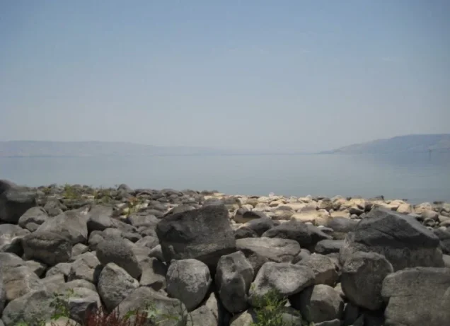
al-Samra stood on flat terrain along the southeastern shore of Lake Tiberias.
The village was approximately 10 km southeast of Tiberias and had an average elevation of about 200 metres below sea level.
It lay approximately 3 km from the Syrian–Palestinian border, with the Golan Heights overlooking it from the east.
A secondary road connected the village with nearby Samakh.
al-Samra had a rectangular layout extending north–south along the lakeshore.
al-Samra before the Nakba
In the early nineteenth century, Swiss traveller Johann Ludwig Burckhardt referred to the village's ancient buildings and described al-Samra as the only inhabited village on the eastern side of Lake Tiberias.
The American biblical scholar Edward Robinson was likewise informed that al-Samra stood on the eastern shore of the lake.
Most inhabitants were Muslim and worshipped in a mosque located in the village centre.
The houses were built of stone or adobe.
Education in al-Samra
The principal approved sources used for this article do not provide sufficiently documented information concerning an independent school in al-Samra before the Nakba.
No unverified educational details are therefore added.
Economic Life in al-Samra
Agriculture was the principal source of livelihood.
Most cultivable land was devoted to cereals, with smaller areas used for citrus, irrigated agriculture, and plantations.
According to the detailed 1944/45 statistics, 8,536 dunums were devoted to cereals: 6,828 Palestinian dunums and 1,708 dunums in the category “Transferred to Zionists.”
A further 30 Palestinian dunums were devoted to citrus and bananas, while 21 dunums were irrigated or used for plantations.
Khalidi's narrative text gives 6,825 dunums for Palestinian cereal cultivation, while PalQuest's detailed statistical table gives 6,828. This article uses the detailed table because its figures reconcile exactly with the ownership totals.
Although fishing, livestock raising, and local trade would be consistent with the wider economy of the Lake Tiberias region, the principal village sources used here do not provide sufficiently specific evidence to quantify or characterize those activities in al-Samra itself.
Land Ownership in al-Samra
The total registered land area of al-Samra was 12,563 dunums in the 1944/45 statistics.
PalQuest notes that these land figures include Kafr Harib.
Land ownership in al-Samra, 1944/45, using the terminology of Palestine Remembered
- Palestinian6,912 dunums55%
- Transferred to Zionists1,708 dunums14%
- Communal3,943 dunums31%
Land Use in al-Samra, 1944/45
Land use in al-Samra, with ownership categories separated according to PalQuest's detailed statistics
- Palestinian
- Transferred to Zionists
- Communal/Public
- Citrus and bananas30 dunums
- Plantations and irrigable land21 dunums
- Cereals8,536 dunums
- Built-up area23 dunums
- Non-cultivable land3,953 dunums
A total of 8,587 dunums, approximately 68 percent of the registered land, was cultivated or cultivable: 6,879 Palestinian dunums and 1,708 dunums in the category “Transferred to Zionists.”
Built-up and non-cultivable land together amounted to 3,976 dunums, approximately 32 percent of the total.
Palestine Remembered presents 3,953 dunums of non-arable land in its Palestinian column. PalQuest's detailed table shows that only 10 dunums were Arab land, while 3,943 dunums were public land. The communal/public category is therefore separated above.
Population of al-Samra
Population of al-Samra in selected years
- 1922157Official British Mandate census
- 1931237Official British Mandate census
- 1944/45290Official statistics
- 1948336Later estimate published by Palestine Remembered
- Estimated refugees in 19982,066Later estimate published by Palestine Remembered
Number of Houses in al-Samra
Number of houses in al-Samra
- 193150Official British Mandate census figure
- 194870Later estimate published by Palestine Remembered
Archaeological Remains in al-Samra
The village contained remains indicating ancient occupation, including building foundations and Roman burial grounds at its edge.
Nearby archaeological sites identified by Khalidi/PalQuest included Khirbat al-Tawafiq and Khirbat Duwayraban.
The names Khirbat al-Sharira and Khirbat al-Duwayriyan found in some secondary material are not the names used in the principal Khalidi/PalQuest entry and are therefore not adopted here.
Approximately 1.5 km east of the village stood an Ottoman memorial to two Ottoman aviators whose aircraft crashed near Lake Tiberias during a flight from Istanbul toward Egypt.
Khalidi/PalQuest dates the accident to 1913. Turkish aviation records, however, date the crash that killed Fethi Bey and Sadık Bey to 27 February 1914. The 1914 date is therefore used here while noting the discrepancy.
Initial Evacuation after the Fall of Tiberias
Khalidi's entry does not describe a separate battle in which al-Samra was militarily captured on 21 April 1948.
Rather, Khalidi cites Israeli historian Benny Morris as stating that the village was evacuated on that date as a consequence of the fall of Tiberias, which had been captured by the Haganah on 18 April.
It is therefore more accurate to describe 21 April as the date of al-Samra's initial evacuation or depopulation rather than as a confirmed village-specific battle or occupation date.
The evacuation was not complete, since some Palestinian residents remained in the village or surrounding area after April 1948.
Morris is not used independently here; his account is included only because it is reproduced in Khalidi's approved Palestinian reference.
The Demilitarized Zone and the Final Displacement of al-Samra's Residents
al-Samra subsequently lay within the Demilitarized Zone along the Palestine–Syria frontier.
The Syria–Israel General Armistice Agreement was signed on 20 July 1949. It established demilitarized areas, excluded military forces from them, and provided for the gradual restoration of normal civilian life.
Khalidi nevertheless records that the residents of al-Samra and other Palestinian villages in the Demilitarized Zone were subjected between 1949 and 1956 to a concerted campaign designed to induce their departure.
The account states that Israeli authorities used a combination of economic and police pressure until all remaining Palestinian villagers in these areas had been removed by 1956.
Most of al-Samra's displaced inhabitants became refugees in Syria, while others later reached the Palestinian village of Sha'b near Acre.
The depopulation of al-Samra should therefore not be understood as a single event completed in April 1948. It began with displacement following the fall of Tiberias and continued with the removal of those who remained during the following years.
- Fall of Tiberias: 18 April 1948.
- Initial evacuation of al-Samra according to the account reproduced by Khalidi: 21 April 1948.
- Separate village battle or occupying military unit on 21 April: not established in the principal source.
- Syria–Israel General Armistice Agreement: 20 July 1949.
- Post-armistice status: part of the Demilitarized Zone.
- Final removal of remaining Palestinian residents: between 1949 and 1956.
- Main destination of the refugees: Syria.
- Other displaced villagers later reached Sha'b near Acre.
Israeli Settlement on al-Samra's Lands
Khalidi/PalQuest identifies Ha-'On in the section dealing with settlements associated with al-Samra's village lands.
- Ha-'On: established in 1949 north of the former village site.
The 1948 foundation date given in the original draft is therefore incorrect; the principal source gives 1949.
al-Samra Today
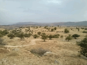
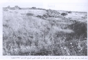
According to the field description published by Walid Khalidi in All That Remains, nothing remained of al-Samra's village houses.
A tourist resort consisting of cabins and small houses had been established on part of the former village site, while trees covered other sections.
The surrounding lands were being cultivated.
Palestine Remembered contains later user-contributed material, including photographs from 2025 and an image dated January 2026 that its contributor identifies as al-Samra's mosque, together with other images said to show limited surviving structural remains.
The possible survival of a mosque or isolated structural remains does not necessarily contradict Khalidi's statement that the village houses had disappeared, but it does indicate the value of more recent field verification.
These later photographs and captions are individual user contributions rather than a comprehensive independent archaeological or field survey. The principal description therefore continues to rely on Khalidi's historical field research, and the approved sources used here do not provide a sufficiently systematic independent survey to verify the precise condition of every part of al-Samra in 2026.
Sources
- PalQuestPalQuest – Interactive Encyclopedia of the Palestine Question: al-Samra
- PalQuestPalQuest – Syria–Israel General Armistice Agreement, 20 July 1949
- Palestine RememberedPalestine Remembered – al-Samra, Tiberias District
- Palestine RememberedPalestine Remembered – al-Samra entry from All That Remains
- Institute for Palestine StudiesInstitute for Palestine Studies – All That Remains, Walid Khalidi
Photo gallery
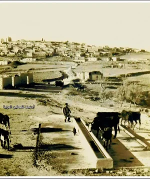
Photos from the village's people
Photos sent in by visitors and published after review.
Add a photo of this village
Log in to add photos of this village.


More from the archive

 Download Our Palestine App
The whole archive in the palm of your hand: depopulated villages, the Nakba, the massacres and Al-Aqsa — free, with no ads to erase the story.
Download Our Palestine App
The whole archive in the palm of your hand: depopulated villages, the Nakba, the massacres and Al-Aqsa — free, with no ads to erase the story.



Comments
No comments yet — be the first to write one.
Add your comment
Name and email are optional. Comments appear after review.