
The depopulated village of Wadi al-Hamam / District of Tiberias

Wadi al-Hamam
About the depopulated village of Wadi al-Hamam
- District
- Tiberias
- Date Wadi al-Hamam was occupied
- 22 April 1948
- Elevation above sea level
- 98 m
Hover a dot to read the village name, or click to open its card.
Borders of the depopulated village of Wadi al-Hamam
Wadi al-Hamam: A Depopulated Palestinian Village in the Tiberias District
Wadi al-Hamam, also known as Khirbat Wadi al-Hamam, was a Palestinian village in the Tiberias District. It stood on the northern bank of the wadi bearing the same name, approximately 5.5 km from Tiberias and about 3 km west of the shore of Lake Tiberias, at an average elevation of 98 metres above sea level. Its inhabitants were displaced during the Nakba and the occupation of Palestine in 1948, although the principal sources do not provide a detailed documented account of the military action that directly led to the village's depopulation.
Location of Wadi al-Hamam
The village stood on the northern bank of Wadi al-Hamam, from which it took its name, in the area between Lake Tiberias and the hills to the west.
It was approximately 5.5 km from Tiberias and had an average elevation of about 98 metres above sea level.
The village site lay approximately 3 km west of the shore of Lake Tiberias.
A dirt road linked Wadi al-Hamam with a highway leading to the Palestinian village of al-Majdal on the lakeshore.
Nearby Palestinian localities included al-Majdal, Hittin, Ghuwayr Abu Shusha, and Khirbat al-Wa'ra al-Sawda'.
The Name Wadi al-Hamam
The village took its name from the wadi on whose northern bank it stood. Wadi al-Hamam literally means “Valley of the Pigeons.”
PalQuest also identifies the locality as Khirbat Wadi al-Hamam.
Palestine Remembered gives another historical name, Khirbat al-Wardiyyat. Khalidi's principal entry does not provide a detailed explanation of this alternate name, so it is recorded here as a source-specific variant rather than as a definitively established original name.
Wadi al-Hamam before the Nakba
A small fort stood near the village and was known as Qal'at al-Hamam or Qal'at Ibn Ma'ni.
The English traveller Richard Pococke visited the wadi in 1737, and Johann Ludwig Burckhardt visited approximately a century later.
Both travellers described the fort but did not mention a settled village at the location.
Later sources reported that Bedouin communities settled near the wadi, eventually forming the Palestinian settlement known as Wadi al-Hamam.
Qal'at al-Hamam
Qal'at al-Hamam, also known as Qal'at Ibn Ma'ni, is the most prominent historical landmark mentioned in the principal sources associated with the village.
The fort stood in the rocky terrain surrounding the wadi and was noted by European travellers from at least the eighteenth century.
Khalidi's PalQuest entry does not provide a precise construction date or a detailed archaeological chronology for the fortress. No unsupported date or historical attribution is therefore added here.
Population of Wadi al-Hamam
Khalidi's account states that Bedouin communities eventually settled near the wadi and formed the Palestinian village community.
The principal approved sources used here, however, do not provide verified population figures for Wadi al-Hamam in the 1922 or 1931 censuses or the 1944/45 village statistics.
Palestine Remembered's main village page likewise does not provide a detailed population table that can be independently reconciled with official Mandate statistics.
No unsupported population estimate is therefore included.
Number of Houses in Wadi al-Hamam
The principal sources used here do not provide a verified official figure for the number of houses in Wadi al-Hamam in 1931 or immediately before the Nakba.
No later estimate is presented as an official figure.
Education and Public Services
The principal approved sources do not provide sufficiently documented information concerning an independent village school, mosque, or other specific public institutions in Wadi al-Hamam before the Nakba.
No unverified information about education or public services is therefore added.
Economic Life in Wadi al-Hamam
The approved sources used here do not provide detailed 1944/45 tables for land ownership or agricultural land use in Wadi al-Hamam.
Khalidi's later field description states that some of the surrounding land was cultivated while other parts were used as pasture, consistent with the rural and pastoral character of the area.
The available sources do not permit reliable figures to be given for cultivated acreage, specific crops, or livestock ownership before 1948.
Land Ownership in Wadi al-Hamam
Neither PalQuest nor Palestine Remembered's principal Wadi al-Hamam file provides a verified 1944/45 land-ownership table for the village.
It is therefore not possible to construct a reliable “Palestinian / Transferred to Zionists / Communal” ownership table without introducing unverified figures.
The appropriate entry for this category is consequently that the information is unavailable in the principal approved sources.
Land Use in Wadi al-Hamam
Verified figures are likewise unavailable for cereal cultivation, plantations and irrigable land, built-up area, or non-cultivable land.
No 1944/45 land-use table is therefore presented rather than filling these categories with figures that cannot be verified from the approved sources.
Occupation and Depopulation of Wadi al-Hamam during the Nakba
The circumstances of Wadi al-Hamam's depopulation are among the least well documented aspects of the village's history.
Khalidi's All That Remains entry and PalQuest do not identify a military unit responsible for occupying the village, a named military operation, or a detailed account of an assault and the departure of the inhabitants.
Palestine Remembered lists 22 April 1948 as the occupation or depopulation date. A published list by the Palestinian Ministry of Foreign Affairs and Expatriates likewise lists Khirbat Wadi al-Hamam as having been depopulated on 22 April.
This date came four days after the fall of Tiberias on 18 April 1948, during a period in which a number of Palestinian communities around the city were being emptied.
However, because Khalidi's principal entry contains no detailed military account, 22 April should not be presented as the date of a documented independent battle at Wadi al-Hamam, nor can a specific military unit be identified with confidence.
The most careful formulation is therefore that Wadi al-Hamam's inhabitants were displaced during the Nakba in April 1948; Palestinian sources list 22 April as the date of depopulation, while the precise military circumstances remain insufficiently documented.
- Date listed by Palestine Remembered: 22 April 1948.
- The same date appears in a Palestinian Ministry of Foreign Affairs list of depopulated villages.
- Military operation: not identified in Khalidi/PalQuest.
- Village-specific occupying unit: not documented in the principal approved sources.
- Details of the assault: unavailable in Khalidi's village entry.
- Fate of the inhabitants: displaced during the Nakba.
Israeli Settlements on the Lands of Wadi al-Hamam
Walid Khalidi and PalQuest explicitly state that no Israeli settlement was established on the lands of the original Palestinian village.
A new locality bearing the same name, Wadi al-Hamam, was later established near the original site and populated by internally displaced Palestinians from villages in the al-Hula region, particularly al-Muftakhira in the Safad District.
Khalidi notes that these internally displaced Palestinian residents did not own the surrounding lands despite living in the nearby locality bearing the same name.
Wadi al-Hamam Today
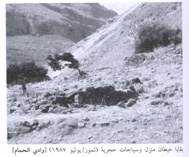
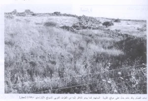
According to the field description published by Walid Khalidi in All That Remains, only house debris and remnants of collapsed walls remained from the original Palestinian village.
Wild grasses, thorny vegetation, and scattered trees covered much of the site.
Some of the surrounding land was cultivated, while other areas were used for grazing.
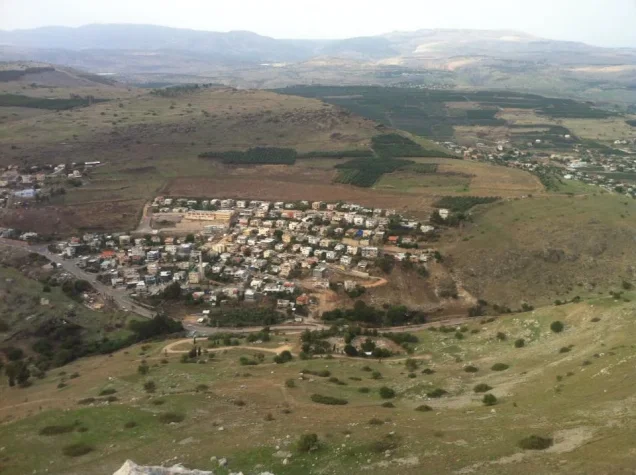
A newer Palestinian locality bearing the name Wadi al-Hamam stood nearby and was inhabited by internally displaced Palestinians from villages of the al-Hula region, especially al-Muftakhira.
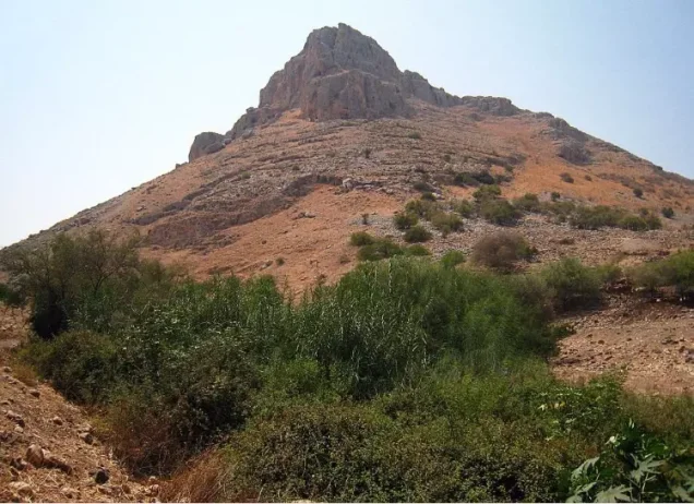
Palestine Remembered contains later user-contributed photographic documentation, including visits and photographs from 2022 and 2023 showing Wadi al-Hamam, Mount Arbel, parts of the former village site, and the surrounding landscape.
These photographs are useful for understanding the later landscape but are individual contributions rather than a systematic independent field or archaeological survey of the original Palestinian village remains.
The principal description above therefore relies on Khalidi's field research published in 1992. The approved sources used here do not provide a sufficiently comprehensive and independent contemporary survey to verify the precise condition of every part of the original Wadi al-Hamam village site in 2026.
Sources
- PalQuestPalQuest – Interactive Encyclopedia of the Palestine Question: Wadi al-Hamam
- Palestine RememberedPalestine Remembered – Wadi al-Hamam, Tiberias District
- Palestine RememberedPalestine Remembered – Wadi al-Hamam entry from All That Remains
- Institute for Palestine StudiesInstitute for Palestine Studies – All That Remains, Walid Khalidi
Photo gallery


Photos from the village's people
Photos sent in by visitors and published after review.
Add a photo of this village
Log in to add photos of this village.
Other villages from Tiberias

More from the archive


 Download Our Palestine App
The whole archive in the palm of your hand: depopulated villages, the Nakba, the massacres and Al-Aqsa — free, with no ads to erase the story.
Download Our Palestine App
The whole archive in the palm of your hand: depopulated villages, the Nakba, the massacres and Al-Aqsa — free, with no ads to erase the story.



Comments
No comments yet — be the first to write one.
Add your comment
Name and email are optional. Comments appear after review.