
The depopulated village of Ma'dhar / District of Tiberias
About the depopulated village of Ma'dhar
- District
- Tiberias
- Date Ma'dhar was occupied
- 12 May 1948
- Population in 1948
- 560
- Military operation
- Operation Gideon
- Brigade that carried it out
- Golani Brigade
- Distance from the governorate centre
- 12.5 (km) Southwest of Tiberias
- Elevation above sea level
- 200 m
- Cause of displacement
- Abandonment based on Arab orders
- Extent of destruction
- The village has been completely defaced, and only house rubble left behind.
- Ethnic cleansing
- Ma'dhar inhabitants were completely ethnically cleansed.
Hover a dot to read the village name, or click to open its card.
Borders of the depopulated village of Ma'dhar
Ma'dhar – Depopulated Palestinian Village of the Tiberias Subdistrict
Ma'dhar was a Palestinian village in the Tiberias Subdistrict, situated on elevated, level ground in eastern Lower Galilee. It lay approximately 12.5 km southwest of Tiberias and about 6 km northeast of Mount Tabor, at an average elevation of approximately 200 metres above sea level.
Agriculture and livestock raising formed the basis of village life before the Nakba. Ma'dhar had an official population of 480 in 1944/45, while its registered lands covered 11,666 dunums.
Location of Ma'dhar
Ma'dhar stood on elevated, relatively level terrain in eastern Lower Galilee. PalQuest records a distance of approximately 12.5 km from Tiberias. The Palestinian Encyclopedia gives a road distance of about 22 km, including approximately 2 km of unpaved road; the difference reflects road distance rather than a contradiction in the village's location.
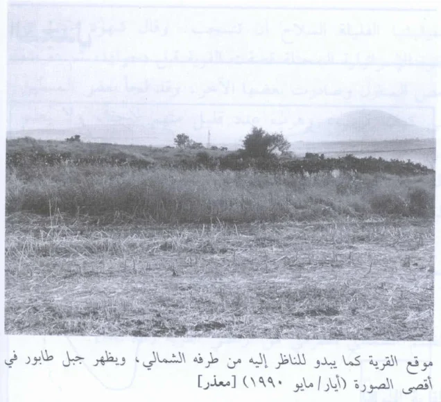
The village lay about 6 km northeast of Mount Tabor. A dirt road connected it with Kafr Kama to the northwest, where it joined the main road leading toward Samakh at the southern end of Lake Tiberias.
Several wadis originated in the village lands and ultimately drained toward Wadi al-Bira, part of the Jordan River drainage system. The Palestinian Encyclopedia identifies Wadi al-Maghara as forming part of the boundary between Ma'dhar and the lands of Hadatha to the southeast.
Ma'dhar Through History
During the Crusader period, the locality was known as Kapharmater. Walid Khalidi also records the existence of a Crusader fort known as Casel de Cherio.
In 1596, Ma'dhar was a village in the nahiya of Tiberias within the Ottoman district of Safad. Its population was estimated at approximately 94, and villagers paid taxes on wheat, barley, cotton, goats, beehives, fruit orchards, and other forms of production.
In the late nineteenth century, the village was described as consisting of houses constructed from basalt and other stone in an agricultural plain, with an estimated population of approximately 250.
Village Layout and Houses
Ma'dhar had no rigidly regular plan. Houses were scattered in different directions around a more densely built centre in the southern part of the village, while the general axis of settlement extended from northeast to southwest.
Homes were constructed from stone, adobe, and cement. Some roofs were made from timber or reeds and covered with a layer of mud.
Population of Ma'dhar
- 1596Approx. 94Estimate derived from Ottoman fiscal records rather than a modern census.
- Late 19th centuryApprox. 250Contemporary estimate recorded in a nineteenth-century survey.
- 1922347Official British Mandate census; the inhabitants were Muslims.
- 1931359Official British Mandate census.
- 1944/45480Official Government of Palestine statistics.
- 1948557Later estimate published by Palestine Remembered, not an official census.
- 19983,419 refugeesLater estimate of the refugee population and descendants published by Palestine Remembered.
Number of Houses
- 193191Official census.
- 1948141Later Palestine Remembered estimate, not an official count.
Land Ownership in Ma'dhar
The official 1944/45 statistics recorded a total village land area of 11,666 dunums. Using the ownership terminology employed by Palestine Remembered, the distribution was:
- Palestinian6,045 dunums52%
- Transferred to Zionists5,287 dunums45%
- Communal/Public334 dunums3%
The Palestinian Encyclopedia gives a total of 11,616 dunums, but that figure does not match the detailed ownership figures or the PalQuest table. The internally consistent official total of 11,666 dunums is therefore used here.
Land Use in 1944/45
The following table preserves the official Arab / Jewish / Public categories and corrects the simplified presentation in which Public non-cultivable land can appear combined with Arab land:
- Arab
- Jewish
- Public
- Cereals10,766 dunums
- Plantations and Irrigable Land498 dunums
- Built-up Area63 dunums
- Non-Cultivable Land339 dunums
A total of 11,264 dunums was therefore classified as cultivated or cultivable, consisting of 5,977 Arab dunums and 5,287 Jewish dunums. Built-up and non-cultivable land totalled 402 dunums.
Khalidi also records 30 dunums planted with olive trees. This figure represents a component of the agricultural land above and should not be added again to the village's total land area.
Economic Life in Ma'dhar
Agriculture and livestock raising were the principal sources of livelihood. Grain and vegetables were among the main crops, while fruit trees were cultivated on lands north, west, and south of the village.
In 1944/45, 5,479 dunums of Arab land were devoted to cereals and 498 dunums to plantations and irrigable cultivation. A further 5,287 dunums classified as Jewish land were used for cereals.
Water Resources
Several small streams flowed from springs in and around the village toward Wadi al-Bira, which formed part of the drainage system leading toward the Jordan River.
For domestic use, villagers obtained water from wells and from two springs, one east and one west of the village. The Palestinian Encyclopedia also identifies 'Ayn al-Jawabi to the north and 'Ayn Zamura to the west.
Education
Ma'dhar had a school founded during the Ottoman period. It was closed during the British Mandate. The principal sources reviewed do not provide a sufficiently documented foundation year or reliable enrolment figures, so no unsupported figures are added.
The Mosque
The inhabitants of Ma'dhar were Muslims and maintained a village mosque. The sources also record the ruins of an old church and an associated burial ground at the archaeological site. The ruined church should not be confused with an operating Christian institution serving the village population immediately before the Nakba.
Archaeological Remains
Ma'dhar stood over remains associated with earlier Crusader and Ottoman settlement. These included the ruins of a church and burial ground. Khirbat Sara, southwest of Ma'dhar, was another archaeological site containing structural remains, cisterns, and other features.
Occupation and Depopulation of Ma'dhar
Walid Khalidi records conflicting accounts concerning the timing of Ma'dhar's depopulation. According to an Israeli report discussed by Khalidi through historian Benny Morris, the Arab Higher Committee allegedly ordered the inhabitants of Ma'dhar, Sirin, 'Awlam, and Hadatha to leave their villages on 6 April 1948. Khalidi considers this claim unlikely.
A different Israeli account, from the History of the Haganah and relayed by Khalidi, states that units of the Golani Brigade overran the same four villages on 12 May 1948 during an operation intended to consolidate control over the Baysan Valley. That account adds that the inhabitants left out of fear of the attacking forces.
Because of this contradiction, 6 April should not be presented as a securely established date of depopulation, nor should the claim that the villagers left on Arab orders be treated as established fact. The stronger date in Khalidi's detailed narrative for the military occupation of Ma'dhar is 12 May 1948, while recognizing that this information itself comes from an Israeli account transmitted and critically discussed in a Palestinian source.
Operation Gideon and the Military Unit
Palestine Remembered classifies the occupation of Ma'dhar under Operation Gideon and identifies the Golani Brigade as the attacking force. Operation Gideon was carried out by the Golani Brigade between 10 and 15 May 1948 with the objective of occupying the Baysan Valley and displacing its Palestinian population.
This chronology and operational objective closely match Khalidi's account of Golani units occupying Ma'dhar on 12 May during a campaign aimed at consolidating control over the Baysan Valley. However, the PalQuest village entry for Ma'dhar does not itself explicitly name Operation Gideon. The association is therefore strong and consistent with the available chronology, but this documentary qualification should be retained.
The attribution to the Golani Brigade is more directly supported by the History of the Haganah account relayed by Khalidi, which identifies Golani units as the forces that took Ma'dhar, Sirin, 'Awlam, and Hadatha on 12 May.
Occupation Chronology
- 6 April 1948
Claimed early evacuation
An Israeli report later cited in the sources claims that the Arab Higher Committee ordered Ma'dhar and three neighboring villages evacuated. Khalidi considers this claim unlikely, so it is not treated as a confirmed depopulation date.
- 10 May 1948
Beginning of Operation Gideon
The Golani Brigade began Operation Gideon in the Baysan Valley; the operation continued through 15 May.
- 12 May 1948
Occupation of Ma'dhar
According to the History of the Haganah account relayed by Khalidi, Golani Brigade units overran Ma'dhar, Sirin, 'Awlam, and Hadatha on this date.
- During the May 1948 assault
Depopulation
The same account states that the inhabitants left in fear of the attacking forces. The principal sources reviewed do not provide a complete independent account of the destinations of all villagers.
Israeli Settlements on Ma'dhar Village Lands
Kefar Qish was established in 1946 on Ma'dhar village land south of the village site. It therefore predates the Nakba and the 1948 occupation of the village.
Sharona, established in 1938, lies north of the village site, while Shadmot Devora, established in 1939, lies to the west. Khalidi explicitly distinguishes both as nearby settlements that were not established on Ma'dhar village land.
Ma'dhar Today
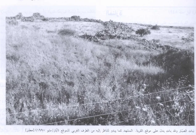
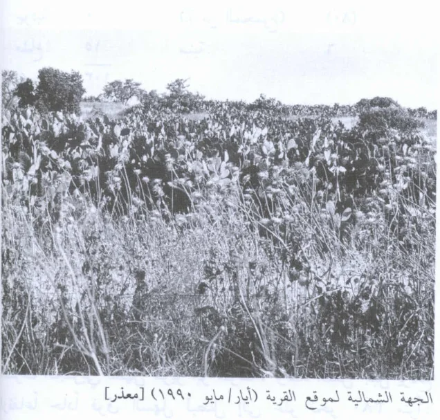
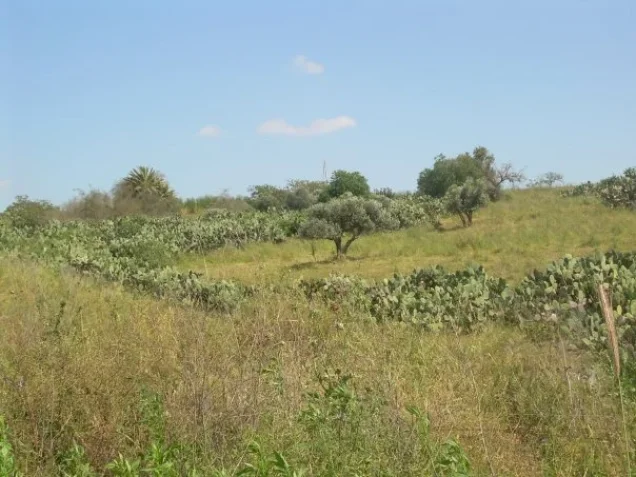
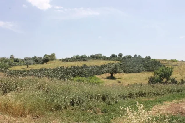
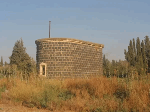
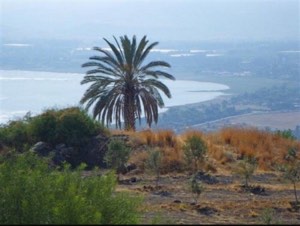
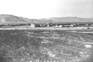
According to Walid Khalidi's field documentation, accompanied by photographs dated May 1990, the village site was fenced and used as a grazing area. A large cluster of cactus grew among the rubble of the houses, while a well capped with a pump remained in the centre of the site.
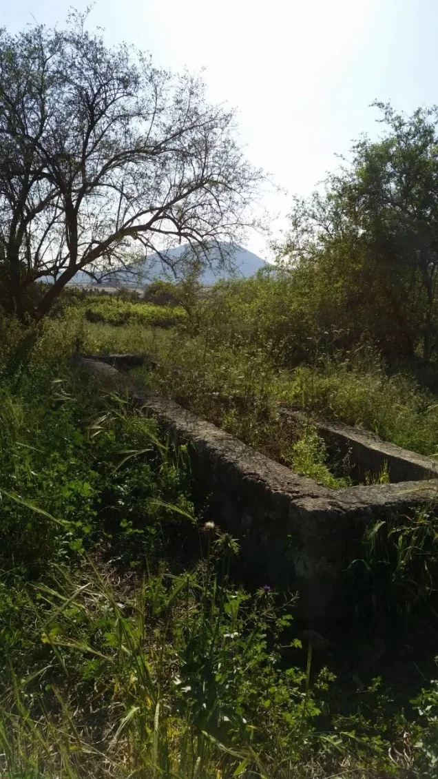
Approximately 20 metres west of the well stood a drinking trough for livestock. Eucalyptus, doum palm, and chinaberry trees also grew on the site.
Palestine Remembered contains later community documentation labelled with dates including 2006 and 2015, as well as more recent material. These contributions are useful forms of later community documentation, but they should not be treated collectively as an independent and comprehensive field survey of the entire village site in 2026. The 1990 documentation remains the clearly dated systematic field description associated with Khalidi's work.
Sources
- PalQuest – Ma'dhar
- PalQuest – Operation Gideon
- Palestine Remembered – Ma'dhar, Tiberias
- Palestine Remembered – Ma'dhar entry from Walid Khalidi's All That Remains
- Palestinian Encyclopedia – Ma'dhar
- Government of Palestine Village Statistics 1944/45 – digital reference hosted by Palestine Remembered
- Institute for Palestine Studies – Walid Khalidi and his historical scholarship
Photo gallery
Photos from the village's people
Photos sent in by visitors and published after review.
Add a photo of this village
Log in to add photos of this village.

More from the archive


 Download Our Palestine App
The whole archive in the palm of your hand: depopulated villages, the Nakba, the massacres and Al-Aqsa — free, with no ads to erase the story.
Download Our Palestine App
The whole archive in the palm of your hand: depopulated villages, the Nakba, the massacres and Al-Aqsa — free, with no ads to erase the story.



Comments
No comments yet — be the first to write one.
Add your comment
Name and email are optional. Comments appear after review.