
The depopulated village of Umm 'Ajra / District of Baysan

Umm 'Ajra
About the depopulated village of Umm 'Ajra
- District
- Baysan
- Date Umm 'Ajra was occupied
- 31 May 1948
- Population in 1948
- 300
- Military operation
- Operation Gideon
- Brigade that carried it out
- Golani Brigade
- Extent of destruction
- Umm 'Ajra was completely destroyed and defaced.
- Ethnic cleansing
- Umm 'Ajra inhabitants were completely ethnically cleansed.
- Settlements built on the built-up area of Umm 'Ajra after 1948
- Havat Shif'a
Hover a dot to read the village name, or click to open its card.
Borders of the depopulated village of Umm 'Ajra
Umm 'Ajra – Depopulated Palestinian Village of the Baysan District
Umm 'Ajra was a depopulated Palestinian village in the Baysan District. It stood on generally level ground approximately 4 kilometers south of Baysan, sloping gradually eastward toward the Jordan Valley. Its average elevation was about 225 meters below sea level.
The village was distinguished by its numerous springs, fertile agricultural land, and a settlement pattern combining permanent houses with tents clustered around water sources and scattered among the surrounding fields.
The precise date of its depopulation in 1948 remains problematic in the Palestinian sources reviewed. Several sources index 31 May 1948, while others give 1 May. Walid Khalidi's PalQuest entry does not provide a village-specific military narrative capable of resolving the discrepancy. This article therefore states that Umm 'Ajra was depopulated during May 1948 amid the collapse of the Baysan Valley, while preserving the disagreement over the exact date.
Location and Geography
Umm 'Ajra stood in the southern part of the Baysan plain approximately 4 kilometers south of Baysan, slightly east of due south.
The village occupied generally flat terrain that descended gradually eastward and overlooked a large portion of the Jordan Valley from all directions except the west.
Its average elevation was approximately 225 meters below sea level.
A secondary road connected Umm 'Ajra with the main route to Baysan, while other secondary roads and dirt tracks linked it with neighboring rural communities.
Supporting Palestinian documentation places al-Ghazzawiyya to the north, Baysan to the northwest, Farwana to the west, 'Arab al-'Arida to the south, and Masil al-Jizl, associated with 'Arab al-Zinati, to the east.
Name
The principal Palestinian sources reviewed do not provide a sufficiently documented historical or linguistic explanation for the name Umm 'Ajra.
No specific personal, tribal, or geographical derivation is therefore presented as established fact without stronger historical evidence.
Built Environment
Umm 'Ajra's settlement pattern consisted of both permanent houses and tents.
Most dwellings were clustered near the village's western edge around its springs.
Other houses and tents were scattered across agricultural land east of the principal settlement area.
This pattern reflected the close relationship between the inhabitants, their cultivated fields, water resources, and lingering rural and semi-pastoral forms of settlement.
Population and Houses
The inhabitants of Umm 'Ajra were Muslims.
- 192286Official Census of Palestine: 41 males and 45 females, all Muslims
- 1931242Official census; all inhabitants were Muslims
- 1945260Official statistics; all inhabitants were Palestinian Arab Muslims
- 1948About 300–302Later demographic estimates, not an official Mandate census
- 1998About 1,852 refugees and descendantsLater estimate published by Palestine Remembered
The official 1931 census recorded 48 houses in Umm 'Ajra.
The estimate of approximately 59 houses for 1948 is a later calculation rather than an official Government of Palestine census figure.
Services and Education
Umm 'Ajra was not a major service center. Its inhabitants relied on nearby Baysan for a range of daily services and supplies.
Baysan's markets also provided the principal outlet for the village's agricultural and livestock products.
Walid Khalidi and PalQuest do not provide clear village-specific documentation of an independent formal school or specifically identified mosque in Umm 'Ajra. Neither is therefore added without stronger evidence.
Water Resources
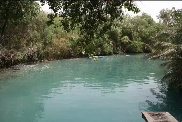
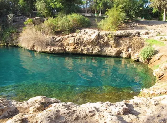
Springs were central to the settlement pattern and economy of Umm 'Ajra. Most houses and tents clustered around water sources in the western part of the village.
Supporting Palestinian documentation identifies 'Ayn Nasr, west of the village, as one of the principal springs and also records springs within the main residential area.
Additional springs were associated with the vicinity of Khirbat Hajj Makka and Khirbat Sursuq.
The water was used for domestic purposes and for irrigating date palms, vegetables, and other crops.
Economic Life and Agriculture
The economy of Umm 'Ajra depended on agriculture and livestock raising, benefiting from the fertility of the Baysan Valley and the availability of water.
Cereals were the principal crop. Palestinian documentation also records vegetables, date palms, bananas, and other fruit crops in the area.
Some land, particularly near the foot of the western edge of the valley, was used for grazing.
Baysan served as the principal market for the village's agricultural and livestock products.
Land Ownership, 1944/45
The official total land area of Umm 'Ajra was 6,443 dunams.
- Arab2,708 dunums42%
- Jewish1,218 dunums19%
- Public2,517 dunums39%
The figures balance exactly: 2,708 + 1,218 + 2,517 = 6,443 dunams.
Some later Palestinian sources display a total of 6,643 dunams, but this does not reconcile with the official ownership table. The official total of 6,443 dunams is therefore used here.
Palestine Remembered presents the same ownership figures using its simplified terminology: 2,708 dunams “Palestinian,” 1,218 dunams “Transferred to Zionists,” and 2,517 dunams “Communal/Public.”
The phrase “Transferred to Zionists” should be preserved when reproducing that source's terminology rather than automatically replacing it with the official “Jewish” category.
Land Use, 1944/45
- Arab
- Jewish
- Public
- Cereals6,240 dunums
- Total cultivable/cultivated land6,240 dunums
- Non-cultivable land203 dunums
The official table balances exactly: 6,240 dunams of cultivable or cultivated land plus 203 dunams of non-cultivable land equal the total village area of 6,443 dunams.
PalQuest's displayed official table does not provide a separate built-up acreage, so no unsupported built-up figure is added.
Palestine Remembered's simplified land-use display requires careful interpretation. It lists 5,022 cereal dunams as “Palestinian,” but the official table shows that this combines 2,688 Arab dunams with 2,334 Public dunams.
Likewise, its 203-dunam non-arable figure combines 20 Arab dunams and 183 Public dunams. Public land is therefore kept separate in the table above.
Pre-Nakba Land Dispute near Baysan
The Baysan area witnessed a serious land dispute during the Mandate period.
In connection with land near Baysan that had been proposed for transfer to the Jewish National Fund, Zionist settlers took possession of approximately 3,000 dunams by occupying and developing portions of the area.
In response, villagers from Umm 'Ajra cultivated approximately 600 dunams and asserted a claim to them, although the available account states that they did not possess title deeds establishing formal ownership.
The dispute remained unresolved as of May 1947.
The 600 dunams mentioned in this dispute are not added to Umm 'Ajra's official 6,443-dunam total because the source treats them as disputed land near Baysan rather than as an additional registered village-land category.
Archaeological Sites
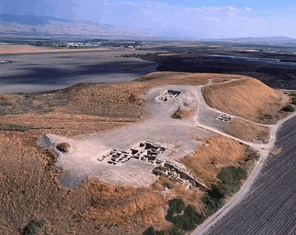
Several archaeological mounds and khirbas stood on Umm 'Ajra's lands.
Walid Khalidi specifically identifies:
- Tall al-Shaykh al-Simad, a double mound.
- Khirbat Hajj Makka.
- Khirbat Sursuq.
The principal source does not provide sufficient archaeological dating to assign all of these sites securely to a specific historical period.
Operation Gideon
The Golani Brigade carried out Operation Gideon in the Baysan Valley between 10 and 15 May 1948.
The operation aimed to capture Baysan and expel the Palestinian inhabitants of the valley and surrounding communities.
PalQuest notes only that Irgun participation in the wider operation is possible, based on an Irgun announcement on 14 May claiming the capture of five Arab villages in the north. This does not establish an Irgun attack on Umm 'Ajra itself.
When Was Umm 'Ajra Occupied?
The exact date on which Umm 'Ajra was occupied and depopulated is not securely resolved by the Palestinian sources reviewed.
Palestine Remembered indexes 31 May 1948, and the Palestinian Villages Encyclopedia also displays 31 May in its page header.
However, the same Palestinian Villages Encyclopedia states elsewhere on the page that the village was occupied on 1 May 1948, a date also used by Falastinuna.
Walid Khalidi's PalQuest entry for Umm 'Ajra does not provide a detailed military narrative capable of resolving the contradiction.
The chronological problem is significant because Operation Gideon itself lasted only from 10 to 15 May: 1 May precedes the operation, while 31 May falls more than two weeks after it ended.
It is therefore inaccurate to state without qualification that Umm 'Ajra was captured on 31 May “during Operation Gideon.”
The safest reconstruction is that Umm 'Ajra was depopulated during May 1948 amid the collapse of the Baysan Valley; several Palestinian sources index 31 May, while another tradition gives 1 May, and the principal village source does not establish the precise final date.
Military Unit
Palestine Remembered associates Umm 'Ajra with the Golani Brigade and Operation Gideon.
Because the occupation date is disputed and Khalidi's village entry contains no detailed village-specific military account, a particular battalion or village-level attacking unit cannot be assigned with confidence.
The Golani Brigade unquestionably carried out the broader Operation Gideon campaign in the Baysan Valley, so Umm 'Ajra may safely be placed in the broader context of Golani's military conquest of the area, while preserving the village-level attribution caveat.
Irgun should not be listed as a confirmed attacking unit at Umm 'Ajra, since PalQuest describes its participation in Operation Gideon generally as only possible.
Occupation Chronology
- 1 May 1948
Early occupation date in some sources
Used by Falastinuna and repeated in part of the Palestinian Villages Encyclopedia, but it predates Operation Gideon and is not confirmed by Khalidi's village entry.
- 10 May 1948
Beginning of Operation Gideon
The Golani Brigade launched its campaign to conquer the Baysan Valley and displace its Palestinian inhabitants.
- 10–15 May 1948
Capture of Baysan and surrounding communities
Numerous Palestinian communities in the valley collapsed or were depopulated during the operation.
- 15 May 1948
Official end of Operation Gideon
PalQuest's formal end date for the operation.
- 31 May 1948
Depopulation date indexed by several sources
Used by Palestine Remembered and in the header of the Palestinian Villages Encyclopedia, but it falls after Operation Gideon's official end and should not be described as part of the operation without qualification.
- After depopulation; exact date not documented
Destruction of the village
The village dwellings were removed and the land was subsequently converted to cultivated fields.
Israeli Settlements on Village Lands
The farm of Shif'a stands on the lands of Umm 'Ajra.
According to Walid Khalidi and PalQuest, Shif'a was built in the 1950s, rather than in 1948 as claimed by some later secondary sources.
Three other Israeli settlements were established near the village but not on Umm 'Ajra's lands:
- Avuqa, established in 1941, to the north.
- 'En ha-Natziv, established in 1946, near the western side of the site.
- Kefar Ruppin, established in 1938, near the eastern side.
These three neighboring settlements should therefore not be listed as settlements established on Umm 'Ajra village land.
Umm 'Ajra Today
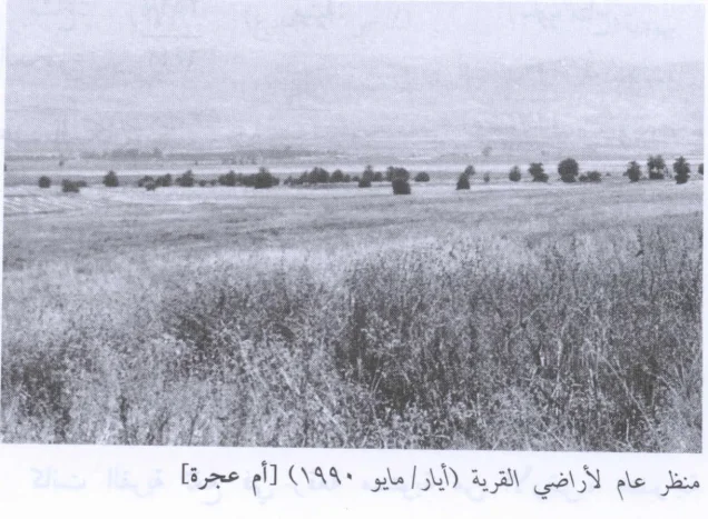
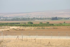
According to the field description published in Walid Khalidi's All That Remains, the village site and surrounding lands had become cultivated fields.
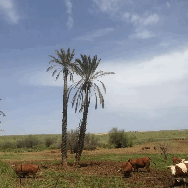
Remnants of date palm trees remained scattered across the northern part of the site.
PalQuest includes a general field photograph of the village lands taken by Hasan Hawari in May 1990.
This description should not be treated as a comprehensive field verification of conditions in 2026. Fieldwork for All That Remains was conducted between 1987 and 1990 and therefore documents the state of the site during that survey period.
Sources
- PalQuest – Interactive Encyclopedia of the Palestine Question: Umm 'Ajra
- PalQuest – Operation Gideon
- PalQuest – Ma'lul; for the pre-Nakba land dispute involving villagers from Umm 'Ajra
- Palestine Remembered – Umm 'Ajra, Baysan District
- Palestine Remembered – Biladuna Filastin: Umm 'Ajra
- Palestinian Villages Encyclopedia – Umm 'Ajra; used comparatively for the conflicting occupation dates
- Falastinuna – Umm 'Ajra; supporting Palestinian documentation on water, boundaries, and the 1 May chronology
- Government of Palestine – Census of Palestine 1922: Umm 'Ajra, 86 inhabitants
- Institute for Palestine Studies – Walid Khalidi, All That Remains
- PalQuest – All That Remains: Methodology
Photo gallery


Photos from the village's people
Photos sent in by visitors and published after review.
Add a photo of this village
Log in to add photos of this village.
More from the archive

 Download Our Palestine App
The whole archive in the palm of your hand: depopulated villages, the Nakba, the massacres and Al-Aqsa — free, with no ads to erase the story.
Download Our Palestine App
The whole archive in the palm of your hand: depopulated villages, the Nakba, the massacres and Al-Aqsa — free, with no ads to erase the story.



Comments
No comments yet — be the first to write one.
Add your comment
Name and email are optional. Comments appear after review.