
The depopulated village of Tall al-Shawk / District of Baysan

Tall al-Shawk
About the depopulated village of Tall al-Shawk
- District
- Baysan
- Date Tall al-Shawk was occupied
- 12 May 1948
- Population in 1948
- 140
- Military operation
- Operation Gideon
- Brigade that carried it out
- Golani Brigade
- Distance from the governorate centre
- 5 (km) West of Baysan
- Elevation above sea level
- -100 (m)
- Cause of displacement
- Influence of fall of, or exoduce from, neighboring town
- Extent of destruction
- The village was completely obliterated.
- Ethnic cleansing
- Tall al-Shawk inhabitants were completely ethnically cleansed.
Hover a dot to read the village name, or click to open its card.
Borders of the depopulated village of Tall al-Shawk
Tall al-Shawk – Depopulated Palestinian Village in Baysan Subdistrict
Tall al-Shawk was a Palestinian village in the Baysan subdistrict of Galilee. It lay approximately 5 kilometers west of the town of Baysan on flat terrain that gradually descended northeastward near the eastern foothills of the al-Faqqu'a Mountains, also known as the Jilbu' Hills. Its average elevation was approximately 100 meters below sea level.
The village had a population of 120 in the official 1944/45 statistics and a registered land area of 3,685 dunums. Its location was relatively rich in water: 'Ayn al-Jawsaq flowed nearby, while a dam and water-powered grain mill stood west of the village.
Palestine Remembered dates the depopulation of Tall al-Shawk to 12 May 1948 and associates it with Operation Gideon and the Haganah's Golani Brigade. This chronology is consistent with the fall of Baysan on the same day, although Walid Khalidi's village-specific entry does not provide an independent detailed narrative of the attack on Tall al-Shawk itself.
Key Facts about Tall al-Shawk
| Field | Information |
|---|---|
| Name | Tall al-Shawk |
| Subdistrict | Baysan |
| Status | Depopulated Palestinian village |
| Distance from Baysan | Approximately 5 km west |
| Average elevation | Approximately 100 m below sea level |
| Population, 1944/45 | 120 – official statistics |
| Registered land area | 3,685 dunums |
| Reported occupation/depopulation date | 12 May 1948 according to Palestine Remembered |
| Military operation | Operation Gideon according to Palestine Remembered, consistent with the broader Baysan Valley campaign |
| Military unit | Golani Brigade according to Palestine Remembered; Khalidi's village entry does not independently identify the unit that entered Tall al-Shawk |
| Cause of depopulation | Influence of the fall or exodus of a neighboring town, according to Palestine Remembered; chronologically associated with the fall of Baysan |
| Extent of destruction | The village was effectively obliterated; Khalidi's field description found no remaining village structures |
| Israeli settlements established on village lands | None documented |
Location of Tall al-Shawk
Tall al-Shawk was located approximately 5 kilometers west of Baysan on level ground that sloped gradually toward the northeast near the eastern foothills of the al-Faqqu'a or Jilbu' Hills.
The Jamma'in River lay to the north of the village, while Wadi al-Jawsaq was to the south. A secondary road connected Tall al-Shawk directly with Baysan, and dirt tracks linked it with neighboring Palestinian communities.
Nearby villages and localities included al-Sakhina, al-Ashrafiyya, and Khirbat al-Jawfa, while the town of Baysan lay to the east.
The Name Tall al-Shawk
The Arabic name “Tall al-Shawk” refers to the village's physical setting on a mound or tell where traces of earlier structures were visible. Literally, the name can be understood as “the mound of thorns.”
The principal sources used here do not provide a documented alternative historical explanation for the name, and no unsupported etymology has therefore been added.
Tall al-Shawk before the Nakba
The village had a rectangular layout, and all of its inhabitants were Muslims. Its location benefited from nearby water resources and agricultural land.
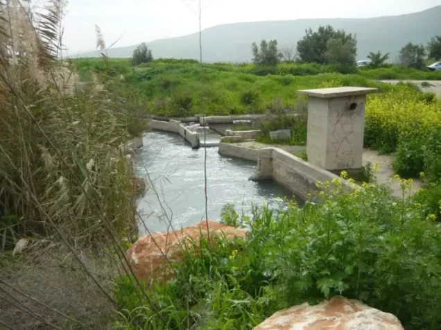
'Ayn al-Jawsaq emerged approximately half a kilometer south of the village site. About 200 meters west of the village stood a dam equipped with a water-powered mill.
The secondary road to Baysan gave the villagers direct access to the subdistrict capital, its markets, and its services.
Population of Tall al-Shawk
- 192258Official British Mandate census; all Muslims
- 193141Official British Mandate census; all Muslims
- 1944/45120Official statistics; all classified as Arab
- 1948139Later estimate reported by Palestine Remembered, not an official census
- 1998855 refugeesLater estimate of refugees and descendants reported by Palestine Remembered
The population fell from 58 in 1922 to 41 in 1931 before rising to 120 in the 1944/45 statistics.
Number of Houses
- 193111Official 1931 census figure
- 194837Later estimate reported by Palestine Remembered, not an official census count
Land Ownership in Tall al-Shawk
The total registered area of Tall al-Shawk in the 1944/45 statistics was 3,685 dunums. Using the terminology employed in Palestine Remembered's simplified ownership table:
- Palestinian65 dunums2%
- Transferred to Zionists3,116 dunums85%
- Communal/Public504 dunums14%
The figures are internally consistent: 65 + 3,116 + 504 = 3,685 dunums.
The official Village Statistics use the original categories Arab / Jewish / Public and record the same distribution: 65 Arab dunums, 3,116 Jewish dunums, and 504 Public dunums.
Land Use in 1944/45
The official statistics show that most of the land within Tall al-Shawk's registered boundaries was recorded in the Jewish category, while only a small portion of Arab land remained under agricultural use.
- Arab
- Jewish
- Public
- Cereals3,085 dunums
- Plantations and irrigable land54 dunums
- Citrus and bananas24 dunums
- Non-cultivable land522 dunums
The table balances correctly: 3,085 + 54 + 24 + 522 = 3,685 dunums.
The entire 522 dunums of non-cultivable land should not be described as Palestinian land. The official breakdown consists of 18 Arab dunums and 504 Public dunums.
Economic Life in Tall al-Shawk
The inhabitants of Tall al-Shawk depended on agriculture, with nearby water resources supporting cereal cultivation and orchards. In 1944/45, 33 dunums of Arab land were devoted to cereals and 14 dunums were irrigated or used for plantations.
The larger agricultural area registered within the village boundaries was classified as Jewish land, including 3,052 dunums of cereals, 40 dunums of plantations and irrigable land, and 24 dunums of citrus and bananas.
The water-powered grain mill west of the village was also part of the local economic landscape and illustrates the practical use of the area's water resources.
Water Resources
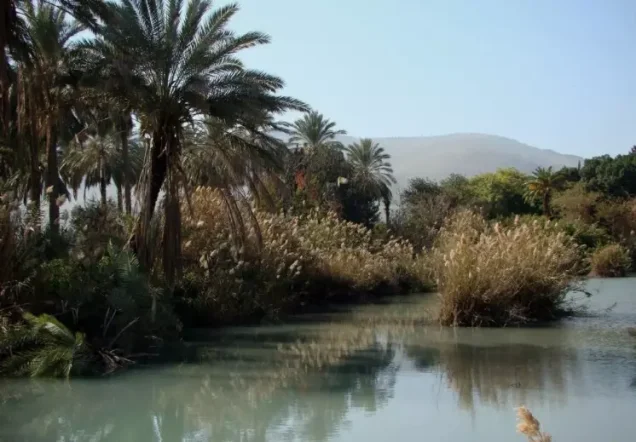
Water was a defining feature of Tall al-Shawk's location. The village stood between the Jamma'in River to the north and Wadi al-Jawsaq to the south, while 'Ayn al-Jawsaq emerged approximately half a kilometer south of the village.
A dam and water-powered grain mill stood about 200 meters west of the site, demonstrating the role of local water in agriculture, milling, and daily economic life.
Education and Institutions
The principal sources reviewed do not provide sufficient documented information about an independent school in Tall al-Shawk, its founding date, or student enrollment. No unsupported educational details have therefore been added.
The sources used here likewise do not provide sufficient documentation to identify a specific mosque or other religious institution within the village, although all recorded inhabitants were Muslims.
Archaeological Remains
Tall al-Shawk itself was built on a mound where traces of earlier structures could be seen, indicating that the site contained remains predating the modern Palestinian village.
Nearby Tall al-Shaykh Humud contained visible granite columns. These should be described simply as documented archaeological remains unless a specialist archaeological source establishes a more precise date or interpretation.
Operation Gideon
The Haganah carried out Operation Gideon between 10 and 15 May 1948 under the Golani Brigade. The campaign was directed at gaining control of the Baysan Valley and led to the depopulation of Palestinian communities throughout the area.
The town of Baysan fell on 12 May 1948 during this campaign. Several surrounding villages were captured during the same period, and some were demolished shortly after their occupation.
Palestine Remembered places Tall al-Shawk within Operation Gideon and attributes its occupation on 12 May to the Golani Brigade. This is geographically and chronologically consistent with the wider campaign, although Khalidi's village-specific entry does not independently identify the battalion or force that entered Tall al-Shawk itself.
Occupation and Depopulation of Tall al-Shawk
Palestine Remembered gives 12 May 1948 as the occupation date of Tall al-Shawk and associates the event with Operation Gideon and the Golani Brigade.
It classifies the cause of depopulation as the influence of the fall or exodus of a neighboring town. This is chronologically consistent with the fall of Baysan on 12 May and with the resulting collapse of the Palestinian civilian situation throughout the valley.
Walid Khalidi's entry, however, does not provide an independent detailed description of the hour of attack, combat inside the village, an expulsion order, or the precise manner in which Tall al-Shawk's inhabitants left. Such details should therefore not be reconstructed without evidence.
Palestine Remembered describes the complete removal of the villagers as ethnic cleansing. In directly descriptive terms supported by the sources, Tall al-Shawk became entirely depopulated of its Palestinian community during the campaign for control of the Baysan Valley, and its buildings were subsequently destroyed to the point that no village structures remained visible in Khalidi's later field documentation.
Occupation Chronology
- 10 May 1948
Beginning of Operation Gideon
The Golani Brigade began the wider campaign for control of the Baysan Valley.
- 10–12 May 1948
Advance around Baysan
Golani forces advanced through the valley and occupied Palestinian villages and positions around Baysan.
- 12 May 1948
Fall of Baysan
The subdistrict capital fell to the Golani Brigade, contributing to widespread displacement in the surrounding area.
- 12 May 1948 according to Palestine Remembered
Occupation/depopulation of Tall al-Shawk
The site attributes the event to Operation Gideon and the Golani Brigade and classifies the cause of flight as the influence of the fall or exodus of a nearby town.
- 15 May 1948
End of Operation Gideon
The principal campaign for control of the Baysan Valley concluded.
- Precise date not documented in the principal sources reviewed
Destruction
The village was ultimately obliterated, and Khalidi's later field survey found no visible remains of its buildings.
Israeli Settlements on Tall al-Shawk's Lands
Neither Walid Khalidi nor PalQuest identifies an Israeli settlement established directly on the lands of Tall al-Shawk.
Nir David lies nearby but was founded in 1936 under the name Tel 'Amal on lands traditionally belonging to the neighboring Palestinian village of al-Sakhina, not on Tall al-Shawk's lands.
| Settlement | Established | Relationship to Tall al-Shawk |
|---|---|---|
| Nir David | 1936 | Not established on Tall al-Shawk's lands; founded on neighboring al-Sakhina land, while its residents cultivated land near Wadi al-Jawsaq |
Tall al-Shawk Today
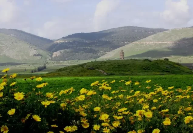
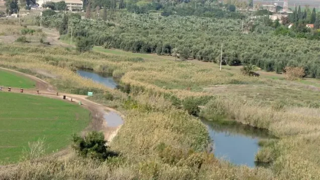
According to Walid Khalidi's field description, no visible trace of the village buildings remained. Wild grasses and thorns covered the site, an artificial canal crossed it, and two large eucalyptus trees stood prominently in the area.
Land near Wadi al-Jawsaq was cultivated by residents of Nir David, a settlement established before the Nakba on the lands of neighboring al-Sakhina.
PalQuest dates Hassan Hawari's field photograph of the Tall al-Shawk site to May 1990. Khalidi's description therefore documents conditions during the period of field research preceding the publication of All That Remains in 1992 and should not be treated as a comprehensive direct field verification of the site in 2026.
Sources
Photo gallery



Photos from the village's people
Photos sent in by visitors and published after review.
Add a photo of this village
Log in to add photos of this village.
Other villages from Baysan


More from the archive


 Download Our Palestine App
The whole archive in the palm of your hand: depopulated villages, the Nakba, the massacres and Al-Aqsa — free, with no ads to erase the story.
Download Our Palestine App
The whole archive in the palm of your hand: depopulated villages, the Nakba, the massacres and Al-Aqsa — free, with no ads to erase the story.



Comments
No comments yet — be the first to write one.
Add your comment
Name and email are optional. Comments appear after review.