
The depopulated village of Khirbat al-Kasair / District of Haifa
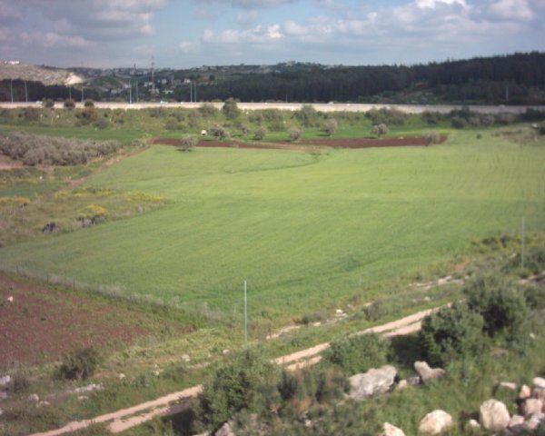
Khirbat al-Kasair
About the depopulated village of Khirbat al-Kasair
- District
- Haifa
- Date Khirbat al-Kasair was occupied
- 16 April 1948
- Population in 1948
- 340
- Military operation
- The Battle of Mishmar ha-'Emeq
- Brigade that carried it out
- The Carmeli Brigade
- Who defended the village
- Arab Liberation Army (headed by Fawzi al-Qawqgi) battalion made up of Syrian and Palestinian Druze volunteers.
- Distance from the governorate centre
- 13 (km) East of Haifa
- Elevation above sea level
- 100 m
- Cause of displacement
- Military assault by Zionist troops
- Extent of destruction
- The village has been completely destroyed, and only house walls and rubble left behind.
- Ethnic cleansing
- al-Kasayir, Khirbat inhabitants were completely ethnically cleansed.
Hover a dot to read the village name, or click to open its card.
Borders of the depopulated village of Khirbat al-Kasair
Khirbat al-Kasayir – Depopulated Palestinian Village in Haifa Subdistrict
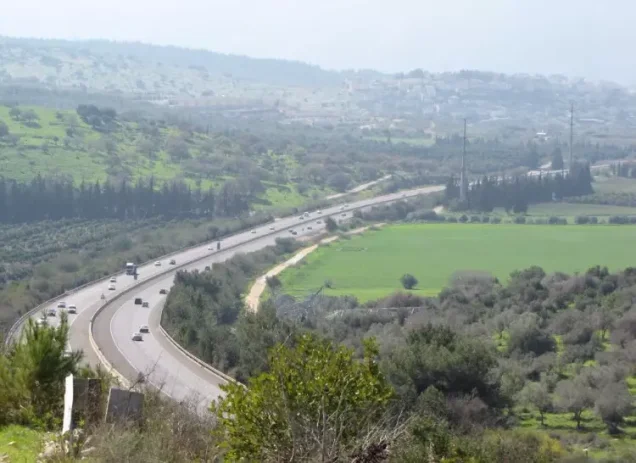
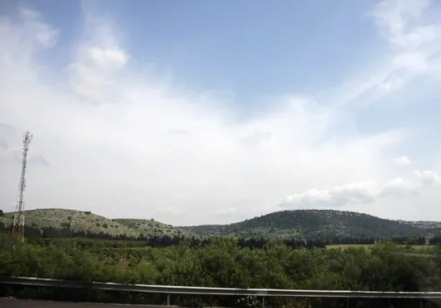
Khirbat al-Kasayir was a Palestinian village in the Haifa subdistrict, situated on one of the hills separating the Haifa Plain from Marj ibn 'Amir. It lay approximately 13 kilometers east of Haifa at an average elevation of about 100 meters above sea level and overlooked Mount Carmel to the west. A secondary road linked the village with the main road leading northwest toward Haifa.
Khirbat al-Kasayir had 290 Muslim inhabitants in the official 1945 statistics, where it was listed within the Shafa 'Amr Rural statistical unit. The 1931 census, however, combined Khirbat al-Kasayir with neighboring Hawsha, making it impossible to extract a reliable independent population or house count for Al-Kasayir from that census.
In April 1948, Khirbat al-Kasayir and Hawsha became the scene of intense fighting between the Haganah's Carmeli Brigade and forces of the Arab Liberation Army. A major assault took place on 16 April, but control of the area shifted through several stages and counterattacks. The date of the first capture can therefore be distinguished from the date of final, stabilized control, which Walid Khalidi does not establish precisely.
Key Facts about Khirbat al-Kasayir
| Field | Information |
|---|---|
| Name | Khirbat al-Kasayir |
| Subdistrict | Haifa |
| Status | Depopulated Palestinian village |
| Distance from Haifa | Approximately 13 km east |
| Average elevation | Approximately 100 m above sea level |
| Population in 1945 | 290 Muslims – official figure listed within Shafa 'Amr Rural |
| 1931 population | 202 for Hawsha and Khirbat al-Kasayir combined; not an independent Al-Kasayir figure |
| Houses in 1931 | 53 for Hawsha and Khirbat al-Kasayir combined |
| First documented Carmeli attack | 14 April 1948 – the attacking force was compelled to withdraw |
| First capture | 16 April 1948 |
| Final control | Precise date unclear in Walid Khalidi's account |
| Military context | Battle of Hawsha and al-Kasayir, linked to the fighting around Mishmar ha-'Emeq and Ramat Yohanan |
| Attacking unit | Haganah's Carmeli Brigade |
| Cause of depopulation | Military assault and the intensity of the fighting; Palestine Remembered classifies the cause as direct military assault |
| Extent of destruction | Most village structures were destroyed; rubble, wells, and limited structural remains survived in Khalidi's field documentation |
| Israeli settlements documented on village land | None listed by Khalidi; he states that former village lands became part of the Arab town of Shafa 'Amr |
Location of Khirbat al-Kasayir
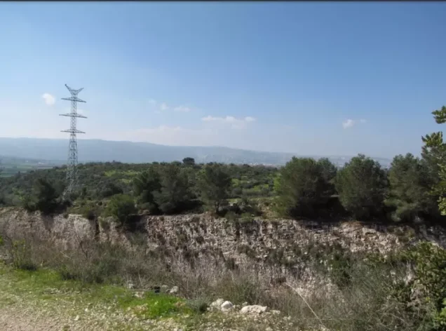
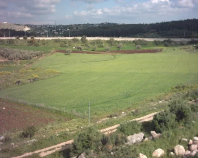
Khirbat al-Kasayir stood on low hills separating the Haifa Plain from Marj ibn 'Amir. It overlooked Mount Carmel to the west, a location that gave the area considerable geographical and military importance during the fighting of 1948.
Neighboring Hawsha lay to the east, separated from Khirbat al-Kasayir by a broad wadi. The village was also situated near Shafa 'Amr, Khirbat Sa'sa', and the Arab al-Khawalid area within the hill country between Haifa, Shafa 'Amr, and Marj ibn 'Amir.
Population and Origins
The inhabitants of Khirbat al-Kasayir were Muslims. Walid Khalidi records that they traced their origins to North Africa.
More detailed community traditions connect some village families with Maghrebi and Algerian migrants who reached Greater Syria during the nineteenth century. Khalidi's entry itself, however, states only the broader North African origin, so more specific explanations of migration and chronology should remain identified as local tradition unless independently documented.
Population of Khirbat al-Kasayir
The population record requires a clear distinction between independent figures for Al-Kasayir and statistics combining it with Hawsha.
- 1931202Official census figure for Hawsha and Khirbat al-Kasayir combined; not Al-Kasayir alone
- 1945290Official figure for Khirbat al-Kasayir, listed in the detailed breakdown of Shafa 'Amr Rural; all Muslims
The official 1945 Village Statistics placed Khirbat al-Kasayir within the Shafa 'Amr Rural unit but specified its population separately in the accompanying note as 290.
Some later secondary sources give an estimate of 340 inhabitants for 1948. That figure has not been included here because it was not sufficiently verified in the principal sources used for this article.
Number of Houses
The 1931 census recorded 53 houses for Hawsha and Khirbat al-Kasayir together. This figure cannot therefore be presented as the number of houses in Khirbat al-Kasayir alone.
The principal sources reviewed do not provide a separately verified 1948 house count for the village.
Land of Khirbat al-Kasayir
Neither Walid Khalidi's village entry nor PalQuest provides a separate land-ownership or land-use table for Khirbat al-Kasayir. In the 1945 statistics the village belonged to the broader Shafa 'Amr Rural statistical unit, which included numerous villages, hamlets, and tribal communities.
The aggregate land totals of Shafa 'Amr Rural cannot therefore be assigned to Khirbat al-Kasayir without an independent cadastral or statistical source separating the village. No unsupported village-specific land table has been constructed here.
Economic Life
Khalidi's entry for Khirbat al-Kasayir does not provide enough independent detail to reconstruct a documented table of crops or village agricultural acreage.
The surrounding rural environment and neighboring Hawsha were characterized by agriculture and livestock raising, but Hawsha's economic data should not automatically be transferred to Khirbat al-Kasayir. This article therefore describes Al-Kasayir only as part of the rural agricultural environment around Shafa 'Amr without assigning specific crops or acreages that are not independently documented.
The Shared Cemetery and Relationship with Hawsha
Khirbat al-Kasayir was closely connected with neighboring Hawsha. In his entry for Hawsha, Walid Khalidi records that the Muslim inhabitants of the two villages shared a cemetery.
The shared cemetery reflects the close geographical and social relationship between the two communities and also helps explain why their names appear together in some Mandate statistics and in accounts of the April 1948 fighting.
Archaeological Remains
Palestinian sources drawing on Mustafa Murad al-Dabbagh record building foundations, scattered stones, rock-cut cisterns, burial remains, and other rock-cut features in the Khirbat al-Kasayir area.
Khalidi's village entry does not provide a detailed archaeological chronology for these remains. They are therefore recorded here as visible archaeological features without assigning them to a specific historical period that the available evidence does not establish.
The Battle of Hawsha and al-Kasayir
Khirbat al-Kasayir became closely associated with the Battle of Hawsha and al-Kasayir in April 1948, part of the broader military struggle connected with Mishmar ha-'Emeq and Ramat Yohanan.
On 12 April 1948, a battalion of the Arab Liberation Army took positions in Khirbat al-Kasayir and Hawsha. According to the History of the Haganah as cited by Khalidi, the intention was to pressure nearby Jewish settlements and draw reinforcements away from Arab Liberation Army units fighting around Mishmar ha-'Emeq.
A later academic study by Adel Manna records that the Arab force included Druze fighters under Shakib Wahhab and identifies the battle of Hawsha and al-Kasayir on 16 April as an important engagement in the Shafa 'Amr area.
Occupation and Depopulation of Khirbat al-Kasayir
On 14 April 1948, a unit of the Haganah's Carmeli Brigade attacked Arab Liberation Army positions in Khirbat al-Kasayir and Hawsha but was forced to withdraw.
A second attack took place on 16 April. Carmeli forces initially captured the two villages. During the same day, an Arab Liberation Army force—described in the account cited by Khalidi as including Palestinian and Syrian Druze fighters—made repeated attempts to recapture them.
After intense fighting, Carmeli units were ordered to withdraw from Hawsha and entrench themselves at Khirbat al-Kasayir. Fighting continued before the Arab force abandoned further attempts to return to Al-Kasayir.
Khalidi nevertheless writes that the date on which Zionist forces subsequently returned to the village is unclear. It is therefore safest to describe 16 April as the date of the first clearly documented capture during the battle, while leaving the precise date of final stabilized control uncertain.
Khalidi considers it likely that the inhabitants left during this period because of the intensity of the fighting. Palestine Remembered classifies the cause of depopulation as direct military assault.
Casualties
The available sources differ over the number of people killed in the Battle of Hawsha and al-Kasayir. Khalidi reports that many Arabs were killed, including Druze fighters, but does not endorse a single final total.
The Palestinian Encyclopedia, citing 'Arif al-'Arif and Mustafa Murad al-Dabbagh, gives a figure of 35 Arab dead. Because casualty figures vary across accounts and the battle unfolded over several phases, the figure is retained as an attributed estimate rather than a universally established total.
Occupation Chronology
- 12 April 1948
Arab Liberation Army deployment
An ALA battalion took positions in Khirbat al-Kasayir and Hawsha during the fighting associated with Mishmar ha-'Emeq.
- 14 April 1948
First Carmeli attack
A Carmeli Brigade unit attacked the two villages but was forced to withdraw.
- 16 April 1948
Second attack and first capture
Carmeli forces captured Khirbat al-Kasayir and Hawsha at the beginning of the renewed assault.
- 16 April 1948
Counterattacks
Arab Liberation Army forces made repeated attempts to recapture the villages, producing intense fighting.
- 16 April 1948
Carmeli entrenchment at Al-Kasayir
Carmeli units withdrew from Hawsha and entrenched at Khirbat al-Kasayir during the later phase of the battle.
- Probably mid-April 1948
Population flight
Khalidi considers it likely that villagers left because of the fierce fighting; Palestine Remembered classifies the cause as direct military assault.
- Precise date unclear
Final control
Khalidi states that the date of the later Zionist return to the village is not clear, so the full chronology should not be reduced to a single date.
- Precise date not documented
Destruction
Most buildings were destroyed, leaving rubble, collapsed walls, wells, and limited structural remains.
Khirbat al-Kasayir and the Fall of Haifa
Walid Khalidi suggests that the attacks on Hawsha and Khirbat al-Kasayir may have facilitated the encirclement and occupation of Haifa during the following week. This should remain a qualified historical interpretation rather than being presented as the sole or direct cause of Haifa's fall.
Israeli Settlements and Village Lands
Walid Khalidi does not identify an independent Israeli settlement as having been established on the lands of Khirbat al-Kasayir. Instead, he states that lands formerly owned by the villagers became part of the Arab town of Shafa 'Amr.
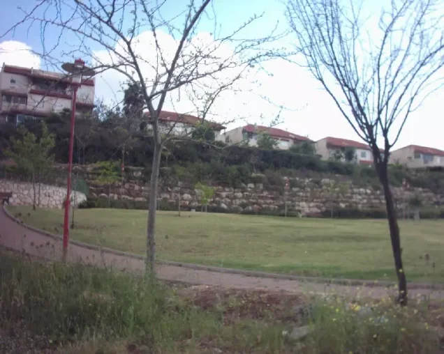
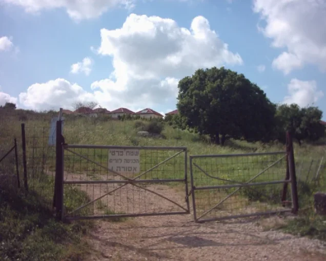
Palestine Remembered contains later community photographs from spring 2003 whose captions describe a locality called “Giv'at Ram” as being built on village land. This information appears in community documentation rather than in Khalidi's settlement section and has not been independently confirmed here through cadastral evidence.
Accordingly, “Giv'at Ram” is not listed in this article as a conclusively documented independent settlement on Khirbat al-Kasayir's lands, although the later community claim is preserved as a point requiring further map and land-record verification.
Khirbat al-Kasayir Today
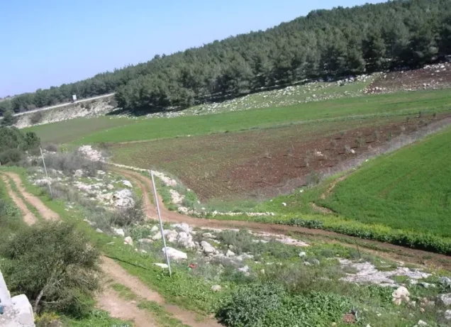
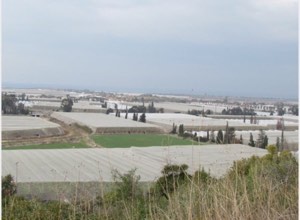
In Walid Khalidi's field description, the remains of demolished houses and collapsed cement walls were scattered across the site, some covered with soil. A well and the remains of a house with visible girders stood at the western corner, while another well lay at the eastern corner.
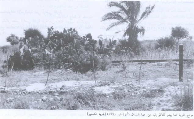
Cactus plants and palm, mulberry, olive, and fig trees grew throughout the area, which was fenced and being used as cattle pasture.
Palestine Remembered contains photographs associated with Khalidi's documentation dated 1987 and 1990. It also includes later community photographs from 2003 and photographs of a return march at Hawsha and Al-Kasayir labeled 2024. These later materials demonstrate continuing community documentation of the site but do not constitute a comprehensive independent field survey of all Khirbat al-Kasayir lands in 2026.
Sources
- PalQuest – Interactive Encyclopedia of the Palestine Question: Khirbat al-Kasayir
- PalQuest – Hawsha, for the combined 1931 census data and relationship between the two villages
- Palestine Remembered – Khirbat al-Kasayir, Haifa District
- Walid Khalidi – All That Remains: Khirbat al-Kasayir
- Government of Palestine – Village Statistics 1945
- Palestinian Encyclopedia – Hawsha and the Battle of Hawsha and al-Kasayir, citing 'Arif al-'Arif and Mustafa Murad al-Dabbagh
- Adel Manna – Nakba and Survival: The Story of Palestinians Who Remained in Haifa and the Galilee, 1948–1956
Photo gallery

Photos from the village's people
Photos sent in by visitors and published after review.
Add a photo of this village
Log in to add photos of this village.
Other villages from Haifa
More from the archive



 Download Our Palestine App
The whole archive in the palm of your hand: depopulated villages, the Nakba, the massacres and Al-Aqsa — free, with no ads to erase the story.
Download Our Palestine App
The whole archive in the palm of your hand: depopulated villages, the Nakba, the massacres and Al-Aqsa — free, with no ads to erase the story.



Comments
No comments yet — be the first to write one.
Add your comment
Name and email are optional. Comments appear after review.