
The depopulated village of al-Yajur / District of Haifa
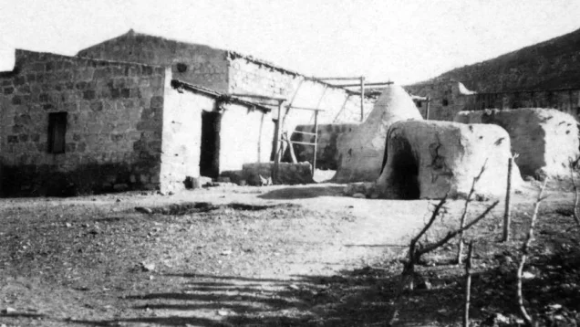
al-Yajur
About the depopulated village of al-Yajur
- District
- Haifa
- Date al-Yajur was occupied
- 24 April 1948
- Population in 1948
- 708
- Military operation
- Operation Bi'ur Hametz
- Brigade that carried it out
- The Carmeli Brigade، Haganah
- Distance from the governorate centre
- 9.5 (km) South East of Haifa
- Elevation above sea level
- 25 m
- Cause of displacement
- Military assault by Zionist troops
- Extent of destruction
- The village has been completely obliterated
- Ethnic cleansing
- Yajur inhabitants were completely ethnically cleansed.
- Settlements built on the land of al-Yajur before 1948
- Yagur
Hover a dot to read the village name, or click to open its card.
Borders of the depopulated village of al-Yajur
Yajur – A Depopulated Palestinian Village in the Haifa Subdistrict
Yajur, also written al-Yajur, was a Palestinian village in the Haifa Subdistrict, located on the lower slopes of Mount Carmel approximately 9.5 km southeast of Haifa, at an average elevation of about 25 meters above sea level.
The village faced northeast, while the main Haifa–Jenin road passed to its northwest. The history of Yajur's land during the late Ottoman and Mandate periods was profoundly affected by large-scale transfers of land ownership, part of which ultimately led to the establishment of the Zionist settlement of Yagur in 1922 on land traditionally belonging to the Palestinian village.
Haganah forces occupied Yajur immediately after the fall of Haifa in April 1948. Khalidi's account states that the villagers left on 24–25 April, while a contemporary newspaper report records the military occupation of the village on 24 April.
- Subdistrict
- Haifa
- Distance from Haifa
- Approximately 9.5 km southeast
- Elevation
- Approximately 25 m above sea level
- Physical setting
- Lower slopes of Mount Carmel, facing northeast
- Arab population, 1944/45
- 610
- Total land area
- 2,720 dunums
- Military occupation
- 24 April 1948
- Departure of inhabitants
- 24–25 April 1948
- Military force
- Haganah; the assault was probably connected with Carmeli Brigade activity during Operation Bi'ur Hametz
- Zionist settlement established on village land before 1948
- Yagur, founded in 1922
Location and Geography of Yajur
Yajur stood on the lower slopes of Mount Carmel, with its houses spreading along the hillside and facing northeast.
The main Haifa–Jenin road passed northwest of the village, providing access toward Haifa and the communities of the Jezreel Valley region.
The village stood at an average elevation of approximately 25 meters above sea level, while the land rose toward the higher slopes of Mount Carmel to the south and west.
Neighboring Villages
Local Palestinian maps and documentation place Yajur among the following localities, approximately:
- North and northwest: Balad al-Shaykh.
- Northeast: the Khirbat Sa'sa' area.
- East: Ibtin.
- Southeast: al-Jalama.
- South: 'Isfiya and the encampments of 'Arab al-Rumayhat.
- Southwest: the al-Damun / Khirbat al-Damun area.
- West: al-Tira, Haifa.
These are approximate geographical relationships derived from maps and local documentation rather than final cadastral boundaries.
Yajur and Land Ownership in the Late Ottoman Period
According to Walid Khalidi and PalQuest, Yajur was among a group of villages whose lands were sold by the Ottoman government in 1872 to two Lebanese merchants, Sursock and Salim al-Khuri.
The owners later sold land to Zionists, who established the settlement of Yagur in 1922 on lands traditionally belonging to the Palestinian village.
This account should not be simplified into a claim that the Palestinian peasants of Yajur themselves “sold their village.” The source describes a chain of land-title transfers beginning with an Ottoman government sale to absentee owners and followed by later transfers to Zionist purchasers.
The 1944/45 statistics also show that 344 dunums within the Yajur unit remained classified as Arab-owned land.
Built Form of Yajur
The houses of Yajur spread across the lower slopes of Mount Carmel. In the 1944/45 Village Statistics, 18 dunums were classified as built-up Arab land.
Early twentieth-century accounts also refer to a mosque in the village, while later community documentation identifies remains associated with the mosque site after the destruction of the village.
Population of Yajur
The official 1922 Census of Palestine recorded 202 inhabitants in Yajur, all Muslims.
The 1931 figures require special caution. The census recorded a total of 1,449 people living in 291 occupied houses, but this was an expanded statistical unit that included Arab Yajur, Nesher, Yagur-related facilities and settlement population, industrial sites, workers, stations, and other localities.
PalQuest identifies 580 Arabs within this total. The census breakdown commonly given for the unit was 554 Muslims and 26 Christians—580 Arabs in all—alongside 858 Jews and 11 persons recorded without religious classification.
In the 1944/45 Village Statistics, Yajur itself was separately recorded with 610 Arabs: 560 Muslims and 50 Christians.
Palestine Remembered later estimated the Palestinian population at 708 in 1948 and the number of refugees and their descendants at 4,345 in 1998. These are retrospective estimates rather than official British Mandate census counts.
- 1922202Official census; all Muslims
- 19311,449 totalExpanded statistical unit; 580 were Arabs, so the total does not represent the Palestinian village alone
- 1944/45610 ArabsOfficial statistics; 560 Muslims and 50 Christians
- 1948708Later Palestine Remembered estimate, not an official census
- 19984,345 refugeesLater estimate of refugees and their descendants
Number of Houses
- 1931291Figure for the expanded statistical unit including Yajur, Nesher, settlement and industrial facilities; not Arab Yajur alone
- 1948291Later figure shown by Palestine Remembered; because it exactly repeats the 1931 expanded-unit count, it should not be treated as an independent official village-house count
Education in Yajur
Khalidi does not record an established formal school in Yajur, and later Palestinian village documentation states that the village did not have a regular government school comparable to those operating in many other villages.
However, Palestine Remembered preserves official correspondence from 1942 between Yajur's mukhtars and leading residents and the Department of Education concerning the opening and formal registration of a village school. Additional registration-related correspondence survives from 1947.
The most careful conclusion is therefore that Yajur's inhabitants were actively seeking to establish and register a school during the final years of the Mandate, but the principal sources do not provide enough evidence for a stable government school with documented enrollment figures and a clear period of operation.
Land Ownership in Yajur
The total land area registered under Yajur in the 1944/45 Village Statistics was 2,720 dunums.
Palestine Remembered presents the simplified ownership categories as follows:
- Palestinian344 dunums13%
- Transferred to Zionists486 dunums18%
- Communal/Public1,890 dunums69%
The official Village Statistics use the original categories Arab, Jewish, and Public: 344 dunums were classified as Arab, 486 as Jewish, and 1,890 as public land.
Land Use in 1944/45
- Arab
- Jewish
- Public
- Cereals747 dunums
- Plantations and irrigable land57 dunums
- Built-up land18 dunums
- Non-cultivable land1,898 dunums
Cultivable land totaled 804 dunums: 318 Arab and 486 Jewish dunums.
The 1,898 dunums of non-cultivable land were not all Palestinian-owned. The detailed official breakdown is 8 Arab dunums and 1,890 public dunums.
Sources also record 42 dunums planted with olive trees. These were part of the 57 Arab dunums classified as plantations and irrigable land and should not be added separately to the cultivable total.
Economic Life
The Palestinian inhabitants of Yajur relied principally on agriculture and livestock raising.
In 1944/45, 261 Arab dunums were devoted to cereals and 57 dunums to plantations and irrigable cultivation, including 42 dunums of olive trees.
By the final years of the Mandate, the amount of agricultural land remaining in the Arab ownership category was relatively limited compared with the overall village land area, following decades of major land transfers.
Archaeological Remains
Khalidi states that Yajur was not securely identified with a known ancient historical site, but archaeological traces nevertheless indicated earlier settlement in the area.
These remains included fragments of glass, foundations of older buildings, and tombs containing stone sarcophagi.
Local Palestinian documentation also identifies an old site southwest of the village known as Khirbat 'Aqqara.
The Fall of Haifa and Pressure on the Surrounding Villages
Haifa fell on 22 April 1948. Immediately afterward, the Haganah expanded its military activity against Palestinian villages around the city.
Balad al-Shaykh, immediately northeast of Yajur, was subjected to a major assault. The fall of Haifa and the attack on Balad al-Shaykh directly affected the decision of Yajur's inhabitants, who feared that their village would face a similar attack.
Operation Bi'ur Hametz and Yajur
Operation Bi'ur Hametz was conducted from 22 to 24 April 1948 as part of the broader Operation Misparayim (“Scissors”), intended to consolidate Haganah control over Haifa and its hinterland following the city's fall.
The Carmeli Brigade carried out the largest share of the operation, as Haganah units moved through the surrounding area to occupy positions and villages and tighten military control.
Palestine Remembered classifies Yajur as possibly connected to Operation Bi'ur Hametz. PalQuest's operation page, however, does not list Yajur among its specifically named affected villages, while the village-specific Khalidi entry refers simply to the Haganah without naming a brigade.
The most precise formulation is therefore that Yajur was occupied during the Haganah campaign to secure Haifa's hinterland immediately after the city's fall, at the same time as Operation Bi'ur Hametz. Carmeli involvement is probable in the broader operational context but cannot be treated as a conclusively documented village-specific assault-unit attribution.
Occupation and Depopulation of Yajur
According to Khalidi, citing Israeli historian Benny Morris, the inhabitants left Yajur on 24 or 25 April 1948, approximately two days after the fall of Haifa.
The major Haganah assault on nearby Balad al-Shaykh was a direct factor in the villagers' decision not to wait for a similar attack on Yajur.
At the same time, the New York Times reported a direct military assault on Yajur and stated that the village was occupied on 24 April 1948 together with other localities commanding the eastern approaches to Haifa.
This article therefore distinguishes between the documented military occupation on 24 April and the villagers' departure across 24–25 April.
- 22 April 1948
Fall of Haifa
Followed by expanded Haganah operations throughout the city's hinterland
- 22–24 April 1948
Operation Bi'ur Hametz
Operation to consolidate control over Haifa's hinterland; Carmeli Brigade carried out most of it
- 24 April 1948
Occupation of Yajur
A contemporary newspaper report records direct military assault and occupation
- 24–25 April 1948
Departure of Yajur's inhabitants
Villagers left following the fall of Haifa, the attack on Balad al-Shaykh, and fear of a similar assault
- Haganah
Securely documented force
Connection with Carmeli and Operation Bi'ur Hametz is probable in the wider operational context but not conclusively documented at village-unit level by Khalidi
Zionist and Israeli Settlements on Yajur's Lands
Yagur: Established in 1922 on lands traditionally belonging to the Palestinian village, approximately a quarter-century before the Nakba.
Nesher: Established in 1925 north of Yajur. Khalidi identifies its original site as land formerly belonging to Balad al-Shaykh, so it should not be listed as a settlement originally founded on Yajur's lands.
Later local documentation indicates that the urban and industrial expansion of Nesher extended toward parts of Yajur's former lands, but this is distinct from the location of its original establishment.
Yajur Today
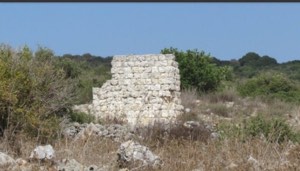
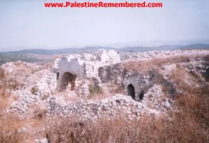
According to Walid Khalidi's field description in All That Remains, no clear traces of the village houses remained when he documented the site. Numerous fig trees and a smaller number of olive trees marked the former village area.
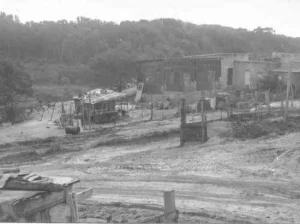
Cement factories occupied part of the surrounding land, while the settlement of Yagur used other portions of the former village lands for agriculture.
This description derives from fieldwork conducted before the publication of All That Remains in 1992 and should not be treated as direct field verification of conditions in 2026.
Later community documentation on Palestine Remembered and the Palestinian Villages Encyclopedia records or depicts surviving Palestinian house remains, the cemetery, structures associated with a pump and water reservoir, and the former mosque site. Some locally documented material is dated or published as recently as 2024.
This later material is valuable evidence of continued documentation of the site, but it is not a comprehensive independent archaeological or architectural survey conducted in 2026. It is therefore presented alongside Khalidi's earlier field description with the difference in date and evidentiary status made explicit.
Sources
- PalQuestPalQuest – Interactive Encyclopedia of the Palestine Question: Yajur
- PalQuestPalQuest – Operation Bi'ur Hametz
- Palestine RememberedPalestine Remembered – Yajur, Haifa
- Institute for Palestine StudiesInstitute for Palestine Studies – Walid Khalidi, All That Remains
- pcbs.gov.psGovernment of Palestine – Census of Palestine 1922
- fada.birzeit.eduBirzeit University Repository – Census of Palestine 1931
- maktabatsabil.comGovernment of Palestine – Village Statistics 1945: Haifa Sub-District, Population and Land Ownership
- palqura.comPalestinian Villages Encyclopedia – Yajur: local history, boundaries, education, and later documentation
Photo gallery


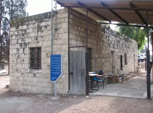
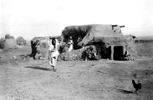
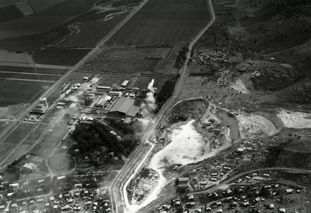
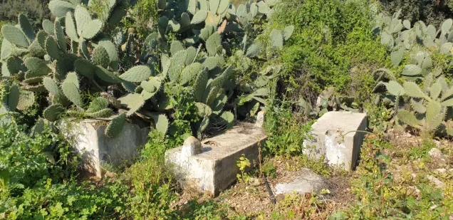
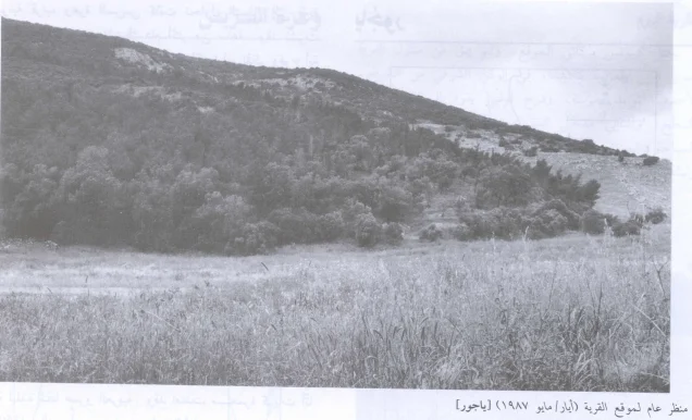

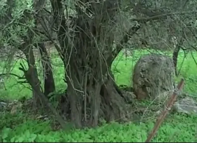

Photos from the village's people
Photos sent in by visitors and published after review.
Add a photo of this village
Log in to add photos of this village.
Other villages from Haifa

More from the archive


 Download Our Palestine App
The whole archive in the palm of your hand: depopulated villages, the Nakba, the massacres and Al-Aqsa — free, with no ads to erase the story.
Download Our Palestine App
The whole archive in the palm of your hand: depopulated villages, the Nakba, the massacres and Al-Aqsa — free, with no ads to erase the story.



Comments
No comments yet — be the first to write one.
Add your comment
Name and email are optional. Comments appear after review.