
The depopulated village of Al-Jalama (Haifa) / District of Haifa

Al-Jalama (Haifa)
About the depopulated village of Al-Jalama (Haifa)
- District
- Haifa
- Date Al-Jalama (Haifa) was occupied
- 01 May 1948
- Brigade that carried it out
- The Carmeli Brigade
- Distance from the governorate centre
- 14 (km) South East of Haifa
- Elevation above sea level
- 75 m
- Cause of displacement
- The village has been completely destroyed
- Extent of destruction
- The village has been completely destroyed
- Ethnic cleansing
- al-Jalama inhabitants were completely ethnically cleansed.
Hover a dot to read the village name, or click to open its card.
Al-Jalama – Depopulated Palestinian Village of the Haifa Subdistrict
Al-Jalama was a Palestinian village in the Haifa Subdistrict, situated on the northern slope of Mount Carmel approximately 2 km east of the Arab town of 'Isfiya. The main Haifa–Nazareth road passed roughly 100 metres north of the village.
Palestine Remembered places al-Jalama approximately 14 km southeast of Haifa and about 75 metres above sea level. During the British Mandate, it was classified in the Palestine Index Gazetteer as a hamlet rather than a large independent village.
The registered village land total was 7,713 dunums. The principal sources, however, do not provide reliable separate population figures for the village immediately before the Nakba or a documented breakdown of its land ownership and land use.
Al-Jalama of Haifa
Al-Jalama of the Haifa Subdistrict must not be confused with other Palestinian localities of the same or similar name, particularly al-Jalama in the Tulkarm Subdistrict and the village of Jalama north of Jenin.
The Haifa village stood on Mount Carmel near 'Isfiya, whereas the other localities had entirely different demographic, land, and historical records.
Location
Al-Jalama stood on the northern slope of Mount Carmel, approximately 2 km east of 'Isfiya. The Haifa–Nazareth highway passed about 100 metres north of the village, giving the locality a strategically significant position along an important inland route from Haifa.
Palestine Remembered gives a distance of approximately 14 km southeast of Haifa and an elevation of about 75 metres above sea level.
Immediately below al-Jalama stood Khirbat Asafna, an older archaeological settlement site associated with the locality.
The Settlement Before the Nakba
During the British Mandate, al-Jalama was classified as a hamlet in the Palestine Index Gazetteer.
This administrative status helps explain gaps in the surviving demographic record. Al-Jalama was not consistently tabulated as an independent population unit and was included with the larger 'Isfiya census unit in 1931.
Population of Al-Jalama
The principal sources do not provide a reliable separate official population figure for al-Jalama itself in either 1931 or 1944/45.
| Year | Figure | Nature of Figure / Notes |
|---|---|---|
| 1931 | 1,105 inhabitants | Official combined figure for 'Isfiya, Damun Farm, Shallala Farm, and al-Jalama; it is not a separate population figure for al-Jalama. |
| 1944/45 | Not separately available | Khalidi and PalQuest do not provide a securely documented independent population figure for al-Jalama. |
The 1931 census recorded 1,105 people in the combined unit that included al-Jalama, but the official table does not permit the number residing in al-Jalama itself to be extracted.
Figures belonging to 'Isfiya or other nearby localities are therefore not presented as population figures for al-Jalama, and no unsupported pre-Nakba estimate is created.
Number of Houses
The 1931 census recorded 251 occupied houses in the combined unit of 'Isfiya, Damun Farm, Shallala Farm, and al-Jalama.
This was not a separate house count for al-Jalama. Khalidi likewise records the number of houses in al-Jalama in 1931 as unavailable.
Village Lands
The total registered land area associated with al-Jalama in the 1944/45 data was 7,713 dunums.
The principal sources do not provide a reliable independent breakdown of this total into Arab, Jewish, and Public ownership categories. PalQuest displays the total while leaving the individual ownership fields blank, and Khalidi marks the ownership breakdown as unavailable.
The Arabic Palestine Remembered page also contains internally inconsistent numerical fields, so those values are not used to construct an artificial ownership table.
For this reason, no Palestinian / Transferred to Zionists / Communal-Public table is presented where the underlying source does not support one.
Land Use
The principal sources reviewed do not provide a reliable village-specific 1944/45 land-use table for al-Jalama.
Separate acreage figures for cereals, orchards, irrigated land, built-up land, and non-cultivable land therefore cannot be presented without going beyond what the available evidence supports.
Economic Life
Khalidi's village-specific entry does not provide sufficiently detailed documentation of the crops, crafts, markets, or commercial activities practiced by the inhabitants of al-Jalama immediately before the Nakba.
Because no independent village land-use table is available, agricultural patterns from 'Isfiya or neighboring villages are not transferred to al-Jalama without direct evidence.
Education, Water, and Public Services
The principal sources reviewed do not independently document a formal school, mosque, or other specific public institution in al-Jalama before 1948.
They likewise do not provide a securely documented village-specific water source for the final years before the Nakba. Information from neighboring communities is therefore not used to fill these gaps.
Khirbat Asafna and the Archaeology of Al-Jalama
Khirbat Asafna lay immediately below al-Jalama and represented an older settlement site in the same locality.
The University of Missouri, with support from the Corning Glass Company, conducted archaeological excavations there between 1964 and 1971. The excavations showed that the site had been occupied intermittently from the first through the fourth century CE.
The most important discovery was a glass-production facility whose output reached its peak during the fourth century CE. The excavation made al-Jalama and Khirbat Asafna particularly important for the study of ancient glass production in Palestine.
Occupation and Depopulation of Al-Jalama
Walid Khalidi does not establish a precise and independently verified date for the occupation of al-Jalama or the removal of its inhabitants.
Most villages around al-Jalama were taken shortly before or shortly after the fall of Haifa on 21–22 April 1948. The Haganah subsequently expanded its operations into the Palestinian rural hinterland surrounding the city.
According to the account reproduced by Khalidi, instructions issued to Haganah brigades within the framework of Plan Dalet assigned the Carmeli Brigade responsibility for controlling the road between Haifa and al-Jalama.
Khalidi considers it probable that control of the village was established during the final week of April or the first days of May 1948, when Zionist forces occupied a cluster of Palestinian villages in Haifa's hinterland.
He further states that the inhabitants may have been driven out during this period, but the available evidence does not establish the exact day or detailed circumstances of their removal.
The Carmeli Brigade and Plan Dalet
The clearest village-specific military connection is with the Carmeli Brigade, which was assigned responsibility under Plan Dalet for controlling the road between Haifa and al-Jalama.
The principal source does not identify a particular battalion as the unit that entered the village, nor does it assign al-Jalama to a separate named military operation.
The most precise formulation is therefore: military framework: Plan Dalet and the consolidation of control over the Haifa hinterland; documented general unit: Carmeli Brigade; village-specific battalion: not identified.
Al-Jalama should not automatically be attributed to Operation Bi'ur Hametz. Although that operation took place in the Haifa hinterland on 22–24 April, PalQuest's list of documented affected villages does not include al-Jalama.
Occupation Chronology
- 21–22 April 1948
Fall of Haifa
The fall of the city was followed by expanded Haganah operations throughout the Palestinian rural hinterland surrounding Haifa.
- Within Plan Dalet
Carmeli Brigade assignment
The Carmeli Brigade was assigned responsibility for controlling the road between Haifa and al-Jalama.
- Final week of April–early May 1948
Probable occupation period
Khalidi considers it probable that al-Jalama was taken during the consolidation of Zionist control over the Haifa hinterland.
- 1 May 1948
Palestine Remembered date
The database lists this as the occupation date, but Khalidi's detailed account does not independently establish this exact day.
- During the same period
Probable removal of the population
Khalidi states that the inhabitants may have been driven out in late April or early May, although the exact circumstances remain insufficiently documented.
Israeli Settlements on Al-Jalama Village Lands
Walid Khalidi and PalQuest identify no Israeli settlement established on al-Jalama village land.
The village site itself was subsequently used for military purposes, with a military camp occupying the area.
Al-Jalama Today
In the field description published by Walid Khalidi in All That Remains, a military camp occupied the former village area and eucalyptus trees covered the site.
Because of the site's military use and limited accessibility, Khalidi did not provide a detailed inventory of surviving Palestinian houses or structures inside the area.
This description derives from field research carried out before the publication of All That Remains in 1992 and does not constitute direct and comprehensive verification of the site's condition in 2026.
Sources
- PalQuest – Al-Jalama, Haifa
- Palestine Remembered – Al-Jalama, Haifa
- Palestine Remembered – Al-Jalama entry from Walid Khalidi's All That Remains
- PalQuest – Operation Bi'ur Hametz, used to verify that Al-Jalama is not independently listed among its affected villages
- Institute for Palestine Studies – Walid Khalidi, All That Remains
- Government of Palestine – Census of Palestine 1931
Photo gallery
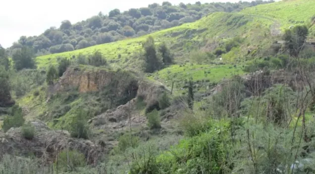
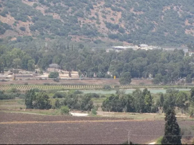
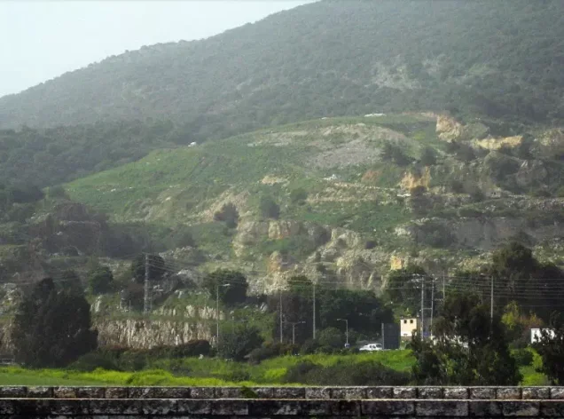

Photos from the village's people
Photos sent in by visitors and published after review.
Add a photo of this village
Log in to add photos of this village.
Other villages from Haifa

More from the archive


 Download Our Palestine App
The whole archive in the palm of your hand: depopulated villages, the Nakba, the massacres and Al-Aqsa — free, with no ads to erase the story.
Download Our Palestine App
The whole archive in the palm of your hand: depopulated villages, the Nakba, the massacres and Al-Aqsa — free, with no ads to erase the story.



Comments
No comments yet — be the first to write one.
Add your comment
Name and email are optional. Comments appear after review.