
The depopulated village of Al-Birwa / District of Akka (Acre)

About the depopulated village of Al-Birwa
- District
- Akka (Acre)
- Date Al-Birwa was occupied
- 11 June 1948
- Population in 1948
- 1,694
- Military operation
- Operation Dekel
- Brigade that carried it out
- First occupation (c. 11 June 1948): probably the Carmeli Brigade; Operation Dekel: Seventh Brigade and Carmeli First Battalion forces, which of them entered unspecified
- Who defended the village
- Local militia & Arab Liberation Army
- Distance from the governorate centre
- 10.5 km east of Acre
- Elevation above sea level
- 60 m
- Cause of displacement
- Direct military assault by Israeli occupation forces
- Extent of destruction
- al-Birwa was mostly destroyed with the exception of three houses, two shrines, and one of the village schools remain standing.
- Ethnic cleansing
- al-Birwa inhabitants were completely ethnically cleansed.
- Settlements built on the built-up area of Al-Birwa after 1948
- Yas'ur, a kibbutz inaugurated on the village site on 6 January 1949; Achihud, established in 1950 on the western part of village land
Hover a dot to read the village name, or click to open its card.
Borders of the depopulated village of Al-Birwa
al-Birwa: A Depopulated Palestinian Village in the Acre District
al-Birwa was a Palestinian village in the Acre District, situated on a rocky hill sloping toward the Acre Plain approximately 10.5 kilometres east of the city of Acre, at an average elevation of about 60 metres above sea level. Its population reached 1,460 in the 1944/1945 statistics. The village changed hands several times in June 1948 before Israeli control was firmly established in mid-July during Operation Dekel, after which its Palestinian inhabitants were permanently displaced during the Nakba and the occupation of Palestine in 1948.
- Subdistrict
- Acre
- Distance from district center
- 10.5 km east of Acre
- Average Elevation
- 60 m above sea level
- Population in 1931
- 996
- Number of Houses in 1931
- 224
- Population in 1944/1945
- 1,460 – 1,330 Muslims and 130 Christians
- Estimated Population in 1948
- About 1,694 – a later demographic estimate, not an official census
- Total Land Area in 1945
- 13,542 dunams
- Attack and Depopulation
- Israeli occupation forces occupied the village around 11 June 1948, on the eve of the first truce, and its inhabitants took refuge in neighbouring villages; the villagers recaptured it about thirteen days later, and it fell again on the evening of 24 June 1948 after a counterattack and the withdrawal of the Arab Liberation Army. It was not firmly captured until the first stage of Operation Dekel in mid-July 1948.
- Final Israeli Control
- Around mid-July 1948, in the first stage of Operation Dekel; by the beginning of the second truce on 18 July 1948 the village lay firmly behind Israeli lines. It had earlier been occupied around 11 June and again on the evening of 24 June 1948
- Military Operation
- Operation Dekel (final occupation); the first occupation in June 1948 came in the wake of Operation Ben-Ami
- Military Unit
- First occupation around 11 June 1948: probably the Carmeli Brigade, according to Khalidi; first stage of Operation Dekel: forces from the Seventh (Sheva') Brigade and the First Battalion of the Carmeli Brigade, the available sources not specifying which of them entered al-Birwa
- Cause of Depopulation
- Direct military assault by Israeli occupation forces
- Settlements Documented on Village Lands
- Yas'ur, a kibbutz inaugurated on the village site on 6 January 1949; Achihud, established in 1950 on the western part of village land
Location
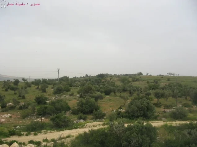
al-Birwa stood on a rocky hill that sloped westward toward the Acre Plain, a short distance southeast of the junction of two main roads, one leading to Acre and the other to Haifa.
The village had an average elevation of approximately 60 metres above sea level and lay about 10.5 kilometres east of Acre.
Its location near major roads and the Acre Plain connected the village with nearby towns and markets and supported its agricultural economy.
al-Birwa Through History
The Persian traveller Nasir Khusraw passed through al-Birwa in 1047 and referred to it by a name resembling Birwa, while the Crusaders knew the village as Broet.
In 1596, al-Birwa was a village in the nahiya of Acre in the Safad district, with an estimated population of approximately 121.
The inhabitants paid taxes on wheat, barley, fruit, goats, beehives, and other forms of agricultural production.
In the late nineteenth century, al-Birwa was described as a large village at the edge of the plain, with a well to the south and olive trees to the north. Its population was estimated at approximately 900.
Architecture
al-Birwa developed around the intersection of two roads. Its traditional houses were constructed of stone and mud and roofed with wood and mud.
During the British Mandate period, the village expanded considerably and cement roofs became increasingly common.
The village contained a mosque, a church, two schools, shops, and facilities connected with its agricultural economy.
The built-up area covered approximately 59 dunams in the 1944/1945 statistics.
Mahmoud Darwish and al-Birwa
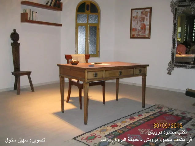
al-Birwa is widely known as the birthplace of Palestinian poet Mahmoud Darwish, who was born in the village on 13 March 1941.
Following the Nakba and the displacement of the village's inhabitants, his family took refuge in Lebanon for a period. When members of the family later returned to Palestine, they found that their village had been destroyed and that they could not return to their former home.
al-Birwa consequently remained an important element in Darwish's personal history and literary experience as the village of his birth and childhood displacement.
Population
al-Birwa had 807 inhabitants in the 1922 census.
In the 1931 census, the population increased to 996 people living in 224 houses. The official census recorded 904 Muslims and 92 Christians.
According to the 1944/1945 statistics, al-Birwa had 1,460 inhabitants, including 1,330 Muslims and 130 Christians.
The estimates of approximately 1,694 inhabitants for 1948 and 10,401 refugees and descendants in 1998 are later demographic estimates rather than official British Mandate censuses.
Population of al-Birwa
- 1596About 121Historical estimate based on Ottoman records
- Late nineteenth centuryAbout 900Historical estimate
- 1922807Official census
- 1931996904 Muslims and 92 Christians
- 1944/19451,4601,330 Muslims and 130 Christians
- 1948About 1,694Later estimate
- 199810,401Estimate of refugees and their descendants
Number of Houses
The 1931 census recorded 224 houses in al-Birwa.
The figure of approximately 380 houses for 1948 found in later tables is an estimate rather than an official census count.
Education and Public Facilities
al-Birwa had a mosque, a church, and two elementary schools.
The boys' school was established by the Ottoman authorities in 1882, while the girls' school was founded during the 1942/1943 school year.
The village also contained shops and three olive presses. Two were powered by animals, while the third was mechanized.
Land of al-Birwa
According to the 1944/1945 statistics, al-Birwa had a total land area of 13,542 dunams.
Arab ownership amounted to 12,939 dunams, Jewish ownership to 546 dunams, while 57 dunams were classified as public land.
Land Ownership in al-Birwa in 1944/1945
- Arab ownership12,939 dunums96%
- Jewish ownership546 dunums4%
- Public land57 dunums<1%
Agriculture and Economic Life
Agriculture formed the mainstay of al-Birwa's economy. Villagers cultivated wheat, barley, corn, sesame, watermelons, olives, and other fruit trees.
According to the 1944/1945 statistics, cereal cultivation covered 8,888 dunams in total, including 8,457 Arab-owned dunams and 431 Jewish-owned dunams.
Irrigated and plantation land covered 1,564 dunams, including 1,548 Arab-owned dunams and 16 Jewish-owned dunams.
Walid Khalidi and PalQuest state that approximately 1,500 dunams were planted with olive trees, while the Palestine Remembered statistical table gives a figure of 1,200 dunams. Because of this discrepancy, the two figures should be presented as differing published accounts rather than as a single agreed figure.
The village operated three olive presses, two powered by animals and one mechanized.
Land Use in al-Birwa in 1944/1945, in Dunams
- Arab
- Jewish
- Public
- Cereals8,888 dunums
- Irrigated and plantation land1,564 dunums
- Built-up area59 dunums
- Uncultivable land3,031 dunums
Archaeology
Tall Bir al-Gharbi stood immediately west of the village site.
Artifacts discovered at the tell have been dated to approximately 2300–900 BCE.
Walid Khalidi suggests that the tell may have served as a source of cut stone used in the construction of village buildings.
The Nakba and the First Occupation of al-Birwa
On the eve of the first truce in June 1948, Zionist forces sought to consolidate their positions in western Galilee by taking control of the hills overlooking the coastal plain.
Zionist forces entered al-Birwa on or around the morning of 11 June 1948, immediately before the first truce.
Walid Khalidi and PalQuest consider it probable that the advance was carried out by the Carmeli Brigade in the wake of Operation Ben-Ami, which had officially ended on 21 May.
The local defenders were few in number and poorly armed. After their ammunition was exhausted and the defenders began to withdraw, most of the inhabitants sought refuge in neighbouring villages, while approximately forty-five elderly people hid inside the village church with the priest.
Israeli military information is cited here only as transmitted through Walid Khalidi and PalQuest and not through direct reliance on Israeli sources.
The Villagers' Recapture of al-Birwa
The first occupation did not mark the end of the struggle for al-Birwa.
Approximately thirteen days after leaving, a large group of villagers decided to return in order to save and harvest their crops before they were lost.
According to testimonies collected by Palestinian historian Nafez Nazzal, more than ninety-six men armed with rifles assembled alongside approximately an equal number of unarmed men and women.
The villagers advanced toward al-Birwa from three directions, surprised the Zionist force, and compelled it to withdraw to a position approximately half a kilometre west of the village.
The villagers regained al-Birwa, harvested part of their crops, and remained there until approximately 24 June.
The Arab Liberation Army then assumed positions in the village while most villagers returned to their families in neighbouring communities.
That evening, Zionist forces launched a counterattack. The Arab Liberation Army withdrew and al-Birwa was captured for a second time.
Operation Dekel and the Final Occupation of al-Birwa
Operation Dekel
Operation Dekel began on the night of 8 July 1948 and continued until 18 July. Its objective was to expand Zionist control over western and Lower Galilee.
The Sheva' (Seventh), Carmeli, and Golani brigades participated in the operation as a whole.
During the first stage, which included an axis running from the Kabri area in the north through al-Birwa and toward Shafa 'Amr in the south, the attacking forces were drawn primarily from the Seventh Brigade and the First Battalion of the Carmeli Brigade.
Final Control
Although al-Birwa had been captured twice during June, control of the village was not yet fully consolidated.
Walid Khalidi and PalQuest state that the village was not firmly occupied until the first stage of Operation Dekel in mid-July 1948.
The military account transmitted through the Palestinian sources reports resistance by the Arab Liberation Army in the vicinity, but by the beginning of the second truce on 18 July 1948, al-Birwa lay securely behind Israeli lines.
The principal sources reviewed do not conclusively identify either the Seventh Brigade or the Carmeli Brigade as the single unit that directly entered al-Birwa during the final stage. This article therefore does not assign the final occupation to one brigade without additional evidence.
Occupation and Depopulation Chronology
- Around 11 June 1948
Temporary occupation
Israeli occupation forces, probably from the Carmeli Brigade, occupied al-Birwa and the positions overlooking it on the eve of the first truce, according to the History of the War of Independence as cited by Khalidi; eyewitnesses interviewed by Palestinian historian Nafez Nazzal said they entered the village on the morning of 11 June. The defenders withdrew after running out of ammunition and the villagers took refuge in neighbouring villages, while about forty-five elderly people hid in the church with the priest.
- June 1948 (until 24 June)
Villagers' recapture of the village and withdrawal of the occupying force
About thirteen days later, men armed with rifles, joined by an equal number of unarmed men and women, took the occupying force by surprise from three directions and forced it to withdraw about half a kilometre west of the village; they harvested their crops and remained in the village for two days, until 24 June, according to the villagers' account to Nafez Nazzal. Press reports at the time attributed the recapture to troops operating out of Nazareth.
- Evening of 24 June 1948
Second attack and renewed occupation of the village
The Arab Liberation Army took control of the village, and that same evening Israeli occupation forces launched a counterattack; the Arab Liberation Army withdrew and the village was captured a second time. The Israeli army announced on 25 June that its troops had clashed with Arab units at al-Birwa.
- 8 July 1948
Beginning of the military operation
Operation Dekel began on the night of 8 July; its first phase targeted a string of villages along an axis from al-Kabri in the north through al-Birwa to Shafa 'Amr in the south, with forces from the Seventh (Sheva') Brigade and the First Battalion of the Carmeli Brigade.
- Mid-July 1948
Final occupation
The village was not firmly captured until the first stage of Operation Dekel, after the end of the first truce, and the Haganah account cited by Khalidi indicates that the Arab Liberation Army put up a fight in its vicinity. By the beginning of the second truce on 18 July 1948, the village lay firmly behind Israeli lines.
- 20 August 1948
Plan for a settlement on the village site
A preliminary blueprint submitted by the Jewish National Fund to the Israeli government called for building a settlement on the village site.
- 6 January 1949
Settlement on village lands
Kibbutz Yas'ur was inaugurated on the village site, formally supplanting the village of al-Birwa.
- 1950
Settlement on village lands
The settlement of Achihud was established on the western part of village land.
Displacement of the Inhabitants
The inhabitants of al-Birwa were displaced in stages corresponding to the repeated changes of control during June and July 1948.
Many initially sought refuge in neighbouring Palestinian villages, while some remained for extended periods near al-Birwa and repeatedly attempted to return to their lands, harvest crops, and recover belongings.
Once Israeli control was consolidated in July, the inhabitants were prevented from re-establishing their village community and became refugees or internally displaced Palestinians.
Israeli Settlements on the Lands of al-Birwa
Yas'ur
On 20 August 1948, a plan was submitted for establishing a settlement on the al-Birwa village site.
On 6 January 1949, Kibbutz Yas'ur was inaugurated on the village site.
Ahihud
In 1950, the settlement of Ahihud was established on the western part of al-Birwa's lands.
- 1949Yas'ur
Established on the al-Birwa village site
- 1950Ahihud
Established on the western part of al-Birwa's lands
al-Birwa After the Nakba
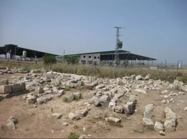
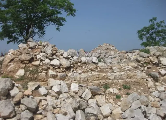
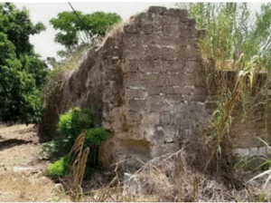
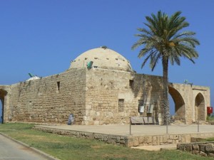
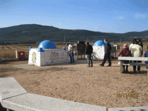
According to the field documentation relied upon by Walid Khalidi, three houses, two shrines, and one school remained at the site of al-Birwa.
One of the shrines was built of stone and covered by a gently curved dome.
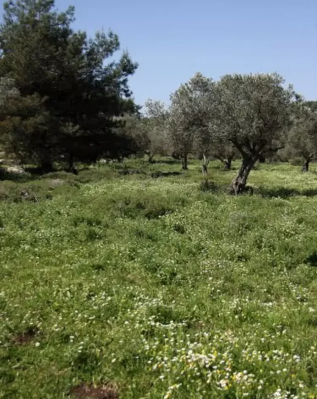
The surviving structures stood abandoned amid cactus plants, weeds, and fig, olive, and mulberry trees, while rubble from destroyed houses remained scattered throughout the vegetation.
Several neglected graves were also visible near the village site.
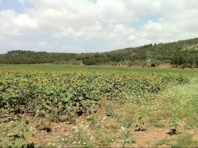
Residents of Ahihud cultivated parts of the site and surrounding village lands.
This description reflects the condition of the site during the period of field documentation relied upon by Walid Khalidi and should not necessarily be interpreted as a comprehensive survey updated to 2026.
Sources
- PalQuest – Interactive Encyclopedia of the Palestine Question: al-Birwa.
- PalQuest: al-Birwa.
- PalQuest: Operation Dekel.
- PalQuest: Operation Ben-Ami.
- PalQuest: Mahmoud Darwish.
- Palestine Remembered: al-Birwa, Acre District.
- Walid Khalidi, All That Remains: al-Birwa, as reproduced by Palestine Remembered.
- Walid Khalidi, All That Remains, entry on al-Birwa.
- Nafez Nazzal, The Palestinian Exodus from Galilee, 1948, Institute for Palestine Studies.
- Government of Palestine, censuses of 1922 and 1931.
- Government of Palestine, Department of Statistics, Village Statistics, 1945.
Photo gallery




Photos from the village's people
Photos sent in by visitors and published after review.
Add a photo of this village
Log in to add photos of this village.
Other villages from Akka (Acre)

More from the archive


 Download Our Palestine App
The whole archive in the palm of your hand: depopulated villages, the Nakba, the massacres and Al-Aqsa — free, with no ads to erase the story.
Download Our Palestine App
The whole archive in the palm of your hand: depopulated villages, the Nakba, the massacres and Al-Aqsa — free, with no ads to erase the story.



Comments
No comments yet — be the first to write one.
Add your comment
Name and email are optional. Comments appear after review.