Ramallah and al-Bireh before the Nakba: Life and Refuge
This article is part of the Palestine before the Nakba series.
Before the Nakba, Ramallah and al-Bireh were neighbouring towns in the central Palestinian highlands north of Jerusalem, each with its own old core and fields. Their people lived from vineyards, olives, grain and livestock; Ramallah also knew early schools, summer visitors and emigration to the Americas, while al-Bireh remained a farming town on the Jerusalem–Nablus road. [1][2]
Then came the Nakba. Zionist forces did not take the two towns in 1948, but they received thousands of families whose members those forces had killed and whom they drove out of Lydda, Ramla, Jaffa and their villages; Amari camp was set up on al-Bireh’s land and Jalazone camp north of Ramallah, and the names of the home towns and the right of return have stayed alive in both. [3][4][5]
Contents
- Ramallah and al-Bireh before the Nakba at a glance
- Location: two towns in the highlands
- The names
- The towns’ roots
- Population and homes
- Farming: vines, olives and livestock
- Crafts: from the loom to pottery
- Trade, the road and emigration
- Ramallah as a summer resort
- Education: from the Friends schools to a teachers’ college
- Health and medical care
- Women: work, learning and embroidery
- Food and weddings
- Under the British Mandate
- The Nakba: two towns receive the uprooted
- Amari and Jalazone camps
- From the Nakba to occupation: after 1967
- Timeline
- Frequently asked questions about Ramallah and al-Bireh before the Nakba
Ramallah and al-Bireh before the Nakba at a glance
| Item | Details |
|---|---|
| Location | Central highlands north of Jerusalem, on the Jerusalem–Nablus road |
| Population, 1945 | About 5,080 in Ramallah and about 2,920 in al-Bireh |
| Ramallah municipality | Formed in 1908 |
| Economy | Vineyards, olives, grain, livestock, crafts, trade and summer tourism |
| Education | Friends schools from 1869, the Rural Women’s Teacher Training College (1935), al-Bireh’s government schools |
| In the Nakba | Refugees received; Amari and Jalazone camps set up in 1949 |
| Occupation of the towns | June 1967 |
Population figures are for the two towns alone, not the district or surrounding villages. [6][7][8][4][5]
Location: two towns in the highlands
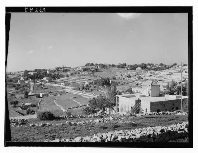
The two towns lie north of Jerusalem on the central highland ridge, near the watershed between the western slopes and the Jordan Valley. Winters are cold and wet and summers mild, and the land suits olives, vines, orchards and summer stays. [1]
Al-Bireh sat on the Jerusalem–Nablus axis, with Ramallah to its west; their built-up areas gradually merged, though each kept a history of its own. [1][9]
The names
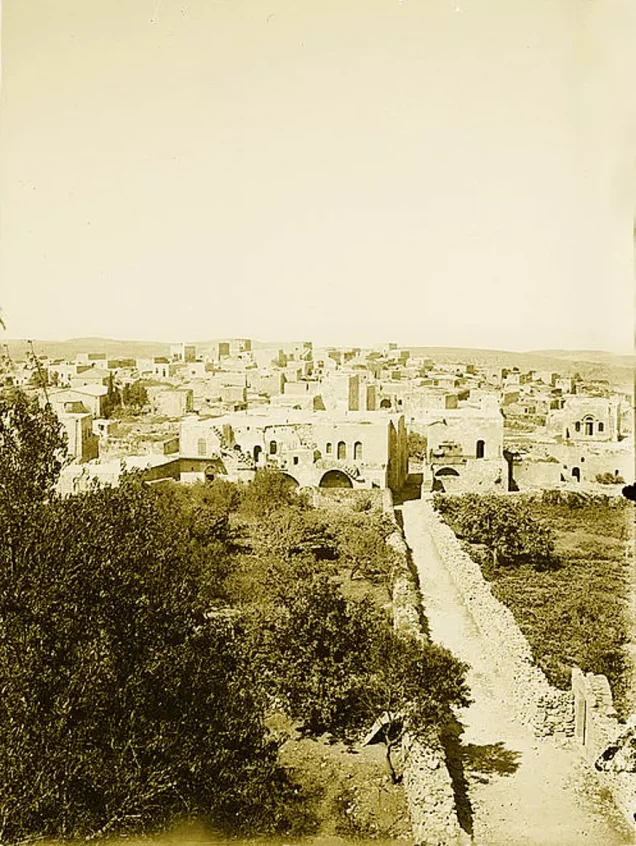
Ramallah Municipality explains that “Ram” is an Aramaic word for a high place, to which the word for God (Allah) was added. [10]
The name al-Bireh is commonly linked to wells and water, and local sources also derive it from “Birta,” meaning a fort or citadel. [9][11]
The towns’ roots
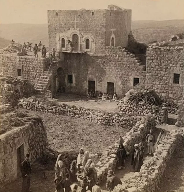
Local tradition ties the founding of modern Ramallah to Rashid al-Haddadin and his sons, who came from east of the Jordan and settled there in the sixteenth century. The town grew in the nineteenth century, and its municipal council was formed in 1908. [7]
Al-Bireh has a historic centre around its mosque, church remains and old houses, to which schools, a local council and shops added new layers in the late Ottoman and Mandate periods. [9][11]
Population and homes
In 1945 Ramallah had about 5,080 people and al-Bireh about 2,920, close to 8,000 for the two together. [6]
| Town | Population, 1945 |
|---|---|
| Ramallah | 5,080 |
| Al-Bireh | 2,920 |
| Total | 8,000 |
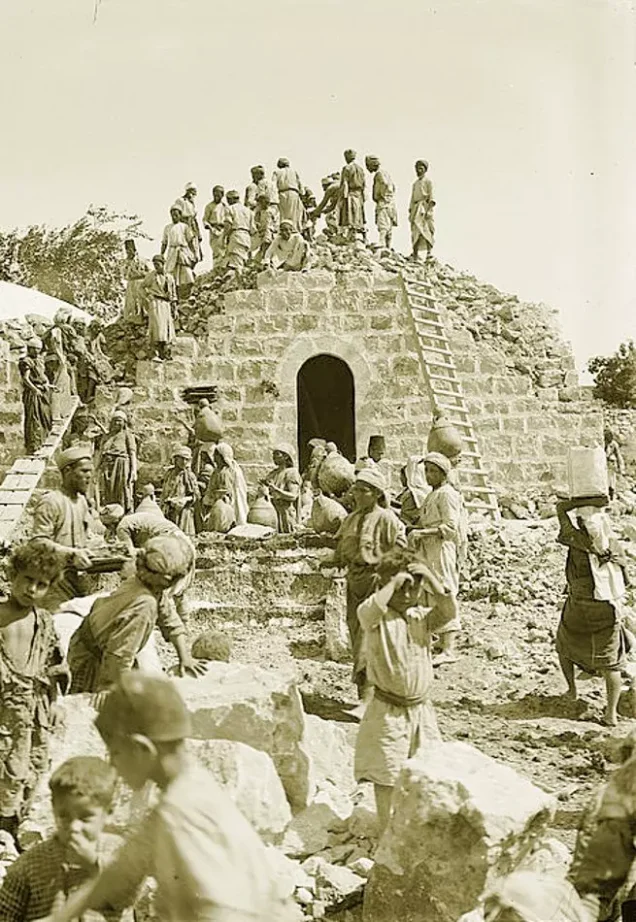
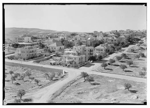
In Ramallah, courtyards, lanes and adjoining houses bear witness to the town’s rural roots, while detached houses with gardens and institutional buildings reflect a gradual move to town life. [12]
Farming: vines, olives and livestock
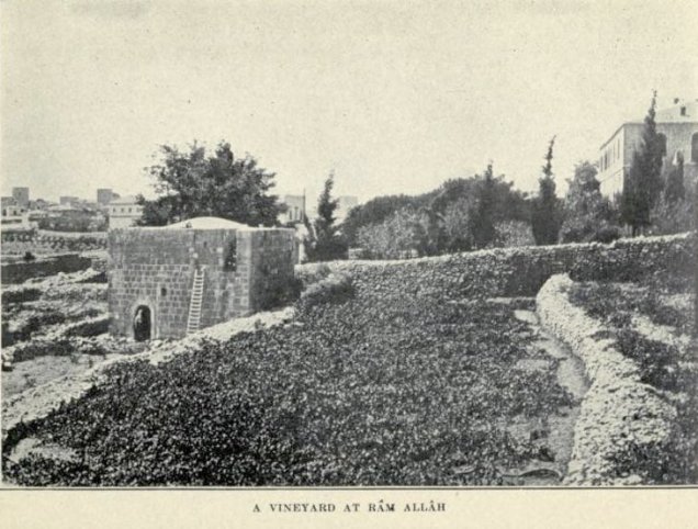
Archival photographs show vineyards on Ramallah’s stone terraces and olives being picked and pressed in the area. [13]
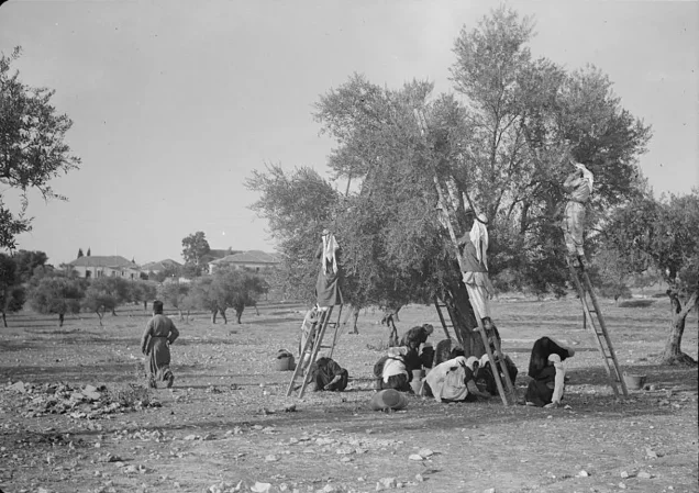
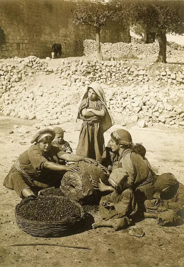
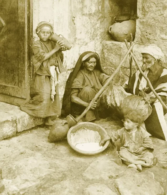
The researcher Samih Hammouda describes al-Bireh’s Mandate-era economy as resting largely on crops and livestock, with traditional crafts such as smithing and carpentry and shops for daily needs. A photograph of a woman from al-Bireh churning milk shows that produce being turned into food at home. [2][13]
Read also: Agriculture in Palestine before the Nakba.
Crafts: from the loom to pottery
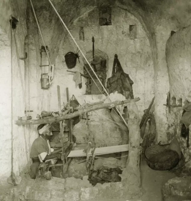
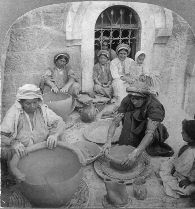
The area knew weaving, embroidery, pottery, building, smithing and carpentry; the gallery preserves a weaver at his loom around 1900 and pottery-making in 1905. [2][13]
Read also: Industry and crafts in Palestine before the Nakba.
Trade, the road and emigration
Closeness to Jerusalem and the Nablus road gave the towns a place in the movement of travellers and goods; a photograph of a caravan nearby shows pack animals carrying trade before the motor car. [1][13]
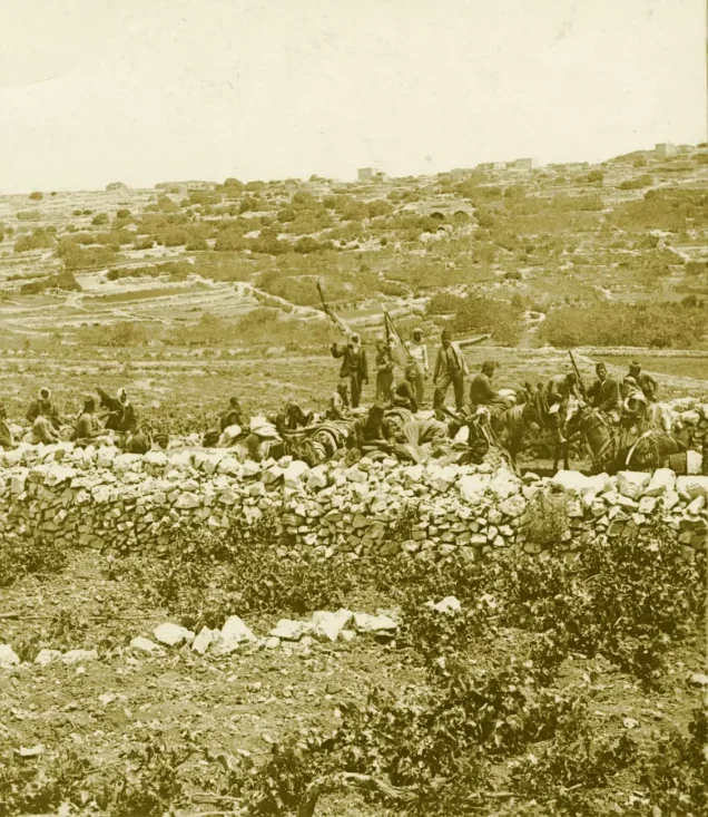
Ramallah Municipality records journeys from the town to Brazil and the United States in the late nineteenth and early twentieth centuries. In al-Bireh, emigrants’ remittances helped families build stone houses with gardens, and some returnees went into business, not always successfully. [14][2]
Read also: Trade before the Nakba; Palestinian banks and refugees’ frozen funds.
Ramallah as a summer resort
Ramallah’s altitude and mild summers made it a known summer resort. One pre-Nakba landmark is al-Hamra Palace, built in 1926 and leased in 1945 by the Ramallah Summer Resorts Company, which turned it into a hotel. [15]
Festivals and Arab summer tourism peaked in the decades after the Nakba. [16]
Read also: Tourism and summer resorts in Palestine before the Nakba.
Education: from the Friends schools to a teachers’ college
Friends educational work in Ramallah began in 1869; a girls’ boarding school opened in 1889 and a boys’ school in 1901, teaching science, health and sport alongside reading and writing. [8]
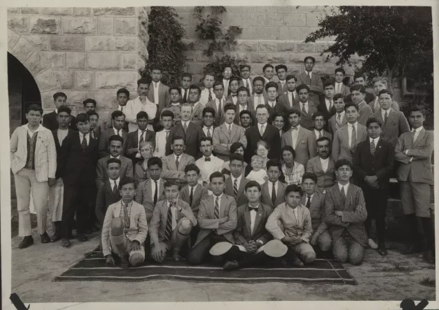
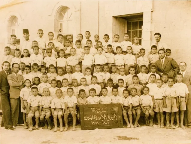
In al-Bireh, the government boys’ school completed its elementary grades in the 1930s and added its first secondary class in 1945/46, and a government girls’ school opened in 1935/36. In 1935 the Rural Women’s Teacher Training College opened in Ramallah to prepare young women to teach in the villages. [6]
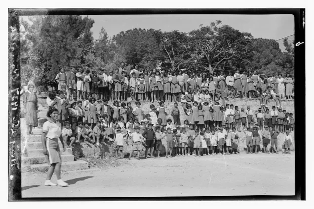
Nearby, the institution that became Birzeit University began as a girls’ elementary school in 1924, founded by Nabiha Nasir, and took the name Birzeit College in 1942. [17]
Read also: Palestinian education before 1948.
Health and medical care
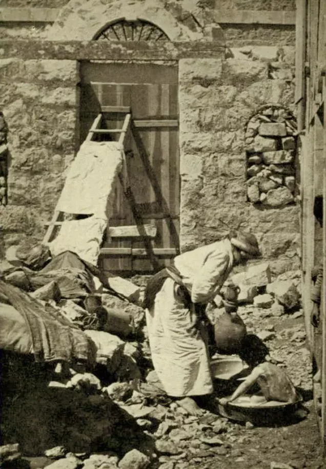
Ramallah had a clinic of the Sisters of St Joseph from 1873, a Friends clinic from 1883 and, from 1910, the clinic of Dr Nicola Shehadeh after his return from the United States. [18]
Under the Mandate a government department handled sanitation, prevention and treatment, and the study of al-Bireh’s history records Dr Suleiman Ghannam of Ramallah treating wounded fighters of the revolt. Ramallah Government Hospital was founded later, in 1963. [2][19]
Read also: Medicine and health in Palestine before the Nakba.
Women: work, learning and embroidery
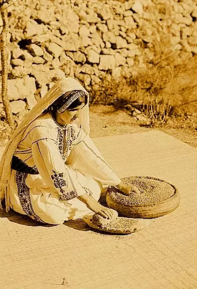
Women appear in the gallery preparing food, weaving, making pottery, caring for children and at school. The Palestinian Museum holds a white rumi dress from the Ramallah area, of linen embroidered in cross-stitch with silk threads, mostly red. [13][20]
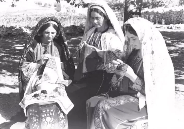
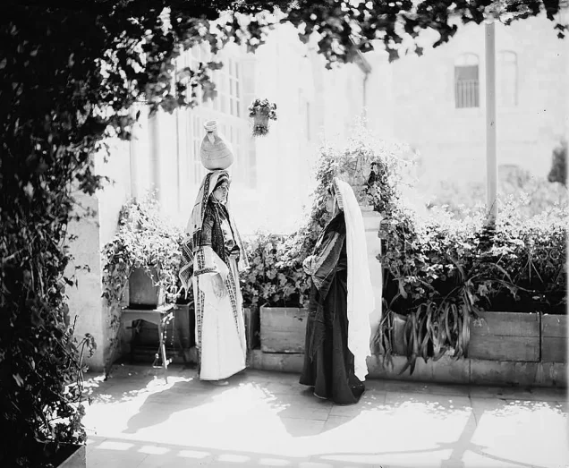
Girls’ schooling and teacher training opened new roles in education for women, alongside their work at home and on the land. [6][17]
Read also: Palestinian women before the Nakba.
Food and weddings
The gallery shows grain being ground and bread baked, and wedding photographs from around 1900 show women, the procession and food being carried, at an occasion shared by kin and neighbours. [13]
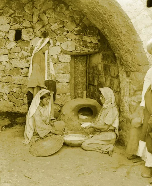
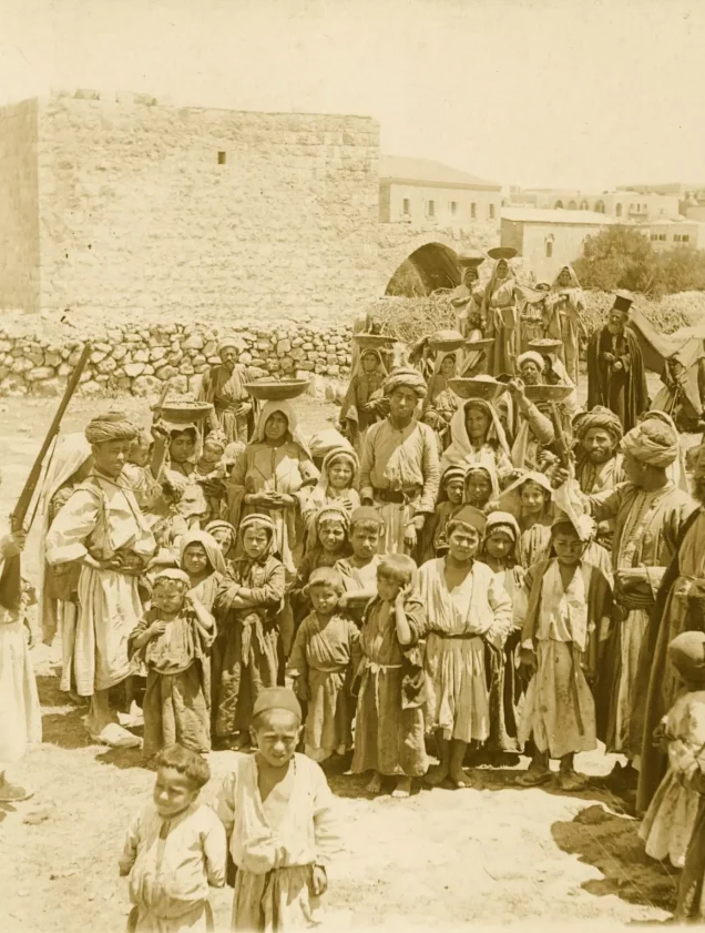
In houses with courtyards and guest rooms, receiving visitors and family gatherings had their place beside sleeping, storing provisions and work. [12]
Read also: Palestinian weddings before the Nakba; Palestinian seasonal festivals.
Under the British Mandate
The people of both towns lived under British rule that backed the Zionist project, and al-Bireh took part in the national movement while its civic institutions grew. [2]
During the 1936 strike, the difficulty of feeding boarding students forced the Friends schools to close for part of the school year. [8]
The Nakba: two towns receive the uprooted
Ramallah and al-Bireh stayed outside the control of Zionist forces in 1948, then came under Jordanian rule until Israel occupied them in 1967. [7][18]
In July 1948 Zionist forces committed a massacre in Lydda and expelled its people and those of Ramla and nearby villages such as Bayt Nabala; the expelled walked east, and many reached Ramallah and al-Bireh. [3]
The Friends School records school buildings in Ramallah being turned into medical facilities with the Red Cross, with wards, an operating room, a clinic and a maternity area. [8]
Read also: Lydda and Ramla before the Nakba.
Amari and Jalazone camps
Amari camp was set up in 1949 within al-Bireh’s municipal boundaries for refugees from Lydda, Jaffa, Ramla and other villages. Jalazone camp was set up the same year north of Ramallah. [4][5]
Read also: Depopulated Palestinian villages; Massacres.
From the Nakba to occupation: after 1967
Israel occupied Ramallah and al-Bireh in 1967 as part of its occupation of the West Bank. [7]
The occupation then built the Beit El settlement in 1977 inside a Jordanian army camp on the lands of Beitin, Dura al-Qar’ and al-Bireh, and the Psagot settlement in 1981 on Jabal al-Tawil, al-Bireh land. By 2022 it had built 29 settlements in Ramallah and al-Bireh governorate, plus some 55 outposts. [21]
The seizures go on: in August 2026 al-Bireh’s mayor, Muneef Tarish, said the occupation was taking between 300 and 400 dunams near Beit El by military order to serve the settlers, land registered in the land registry since the Jordanian period. [22]
The two towns thus carry two memories: of vineyards, schools and stone houses, and of the refugees who brought to them the names of towns they have never given up the right to return to.
Timeline
| Year | Event |
|---|---|
| Sixteenth century | Local tradition ties modern Ramallah’s founding to the Haddadin family |
| 1869 | Friends educational work begins in Ramallah |
| 1901 | The Friends Boys School opens |
| 1908 | Ramallah municipality formed |
| 1924 | Birzeit girls’ school founded |
| 1935 | Rural Women’s Teacher Training College opens in Ramallah |
| 1945 | About 5,080 people in Ramallah and 2,920 in al-Bireh |
| 1948 | Arrival of refugees expelled from Lydda, Ramla and their villages |
| 1949 | Amari and Jalazone camps set up |
| 1967 | Israel occupies Ramallah and al-Bireh |
| 1977 and 1981 | Beit El and Psagot settlements built on al-Bireh’s land and around it |
Sources: [7][8][17][6][3][4][5][21]
Frequently asked questions about Ramallah and al-Bireh before the Nakba
What does the name Ramallah mean?
“Ram” is an Aramaic word for a high place, with the word for God (Allah) added. [10]
What does the name al-Bireh mean?
It is linked to wells and water; some sources derive it from “Birta,” a fort. [9][11]
What was the population of Ramallah and al-Bireh in 1945?
About 5,080 in Ramallah and 2,920 in al-Bireh. [6]
Was there schooling for girls before 1948?
Yes: the Friends Girls School from 1889, al-Bireh’s government girls’ school and the Rural Women’s Teacher Training College from 1935. [8][6]
When did emigration from Ramallah to the Americas begin?
In the late nineteenth and early twentieth centuries. [14]
Were Ramallah and al-Bireh occupied in 1948?
No. They took in refugees in 1948 and were occupied by Israel in 1967. [18][7]
Which camps grew up in Ramallah and al-Bireh after the Nakba?
Amari camp within al-Bireh and Jalazone camp north of Ramallah, both set up in 1949. [4][5]
Read also on Palestinuna
- Ramallah and its photographs
- Amari camp
- Jalazone camp
- Lydda and Ramla before the Nakba
- The Lydda massacre
- Depopulated villages
- Palestine before the Nakba
Sources and references
- Palestinian National Information Center – WAFA, “Ramallah and al-Bireh: Location and History” (in Arabic).
- Samih Hammouda, Palestine Research Center, “Al-Bireh under the British Occupation and Mandate, 1917–1948” (in Arabic).
- Institute for Palestine Studies – PalQuest, “Bayt Nabala” (in Arabic).
- UNRWA, “Amari Camp”.
- UNRWA, “Jalazone Camp”.
- Palestinian National Information Center – WAFA, “Education under the British Mandate,” Ramallah district section (in Arabic).
- Ramallah Municipality, “History of the City” (in Arabic).
- Ramallah Friends School, “Pictorial Narrative”.
- Riwaq, “Register of Historic Buildings: al-Bireh”.
- Ramallah Municipality, “The Naming of Ramallah” (in Arabic).
- Ramallah Municipality Tourist Information Center, “Al-Bireh” (in Arabic).
- Ramallah Municipality, “Cultural Heritage and the Historic Fabric of the City” (in Arabic).
- Palestinuna, “Ramallah and its region photo gallery”.
- Ramallah Municipality, “Migration to and from Ramallah” (in Arabic).
- Palestinian Ministry of Tourism and Antiquities, “Al-Hamra Palace” (in Arabic).
- Ramallah Municipality, “Tourism in Ramallah” (in Arabic).
- Birzeit University, “Chronology” (in Arabic).
- Ramallah Municipality, “Milestones in the History of the City” (in Arabic).
- Palestinian Ministry of Health, “History of the Palestine Medical Complex and Ramallah Government Hospital” (in Arabic).
- The Palestinian Museum, “White Rumi Dress” (in Arabic).
- Palestinian National Information Center – WAFA, “Settlement in Ramallah and al-Bireh Governorate” (in Arabic).
- “The Occupation Strangles al-Bireh by Swallowing More of Its Land,” Al Jazeera Net, 2 August 2026 (in Arabic).
More from the archive
 Download Our Palestine App
The whole archive in the palm of your hand: depopulated villages, the Nakba, the massacres and Al-Aqsa — free, with no ads to erase the story.
Comments
No comments yet — be the first to write one.
Add your comment
Name and email are optional. Comments appear after review.